2/4 – 2/11/20
It had been a dreary winter. Not a cold one – I’ve never minded cold, clear weather – but a dreary one, a winter of slush and sleet and shrouded skies. And so, despite the fact that spring was nowhere in sight, I began to feel the familiar itch. I needed to go somewhere; and after some deliberation, I settled on the southern Appalachians.
The more I thought about it, the better the Appalachians sounded. The weather (as some quick googling confirmed) was usually, by Midwestern standards, fairly mild in February. Crowds would be light, hotels cheap. I would be able to hike trails in crisp solitude, and relax in the musty stillness of out-of-season resorts. So I planned, and booked, and went.
2-4
Around 6, I heaved my bags into the trunk and spurred my rental Sentra into the blustery dark. Dawn caught up with me in northern Indiana, revealing a panorama of gray fields and lowering clouds. Drizzle began to pimple my windshield as I approached the unprepossessing town of North Bend, Ohio, my first destination.
There is only one attraction in North Bend, Ohio: the tomb of William Henry Harrison. As dedicated readers (Hi Mom!) will recall, I have a habit of seeking the graves of obscure figures from American history. To one so motivated, the tomb of William Henry Harrison, remembered only as the president who died more or less immediately after taking office, was irresistible. The monument, when I finally reached it, proved to be a tall granite obelisk overlooking the Ohio River. I walked up the glistening steps, snapped a few pictures, and paused a moment to watch the colorless Ohio sweep past leafless hills and monumental smokestacks. Then, oddly satisfied, I returned to my car.
The drizzle developed into a steady rain as I wound with the Ohio into Cincinnati. After a traffic-dodging detour through a grimy industrial district overlooking the city, I stopped for a bowl of the city’s (justly) famous five-way chili. Then, pausing for a soggy self-guided architectural tour of downtown Cincinnati, I made my way to William Howard Taft’s boyhood home, now an excellent (and commendably free) museum. There, for the first of several times this trip, I was the only member of a guided tour. Having dutifully absorbed the prescribed dose of Taftiana, I returned to my car for the long drive to Virginia.
Over the next seven hours, as I steadily coursed eastward, the rain was continuous – sometimes a drizzle, sometimes a downpour, always cold. Despite the weather, a few sections of road were starkly beautiful: gaunt and rain-swept hills, wreathed with fog. Around sunset, I stopped in Nitro, West Virginia for gas (my car joined nine pickups at the pumps) and a very reasonably-priced dinner. After pausing in the restaurant parking lot to attend to my emails, I ventured out into the sodden night, and spent the next three hours coping with unpleasant combinations of hairpin turns, blinding fog, and torrential rain. Lexington at last, a mildew-scented hotel room, and sleep.
2-5
As a watery-looking sun labored to filter through the clouds, I rattled into downtown Lexington, home to Washington and Lee University, Virginia Military Institute, and more dead Confederates than you can wave a bloody shirt at. I encountered the first batch of these in the Stonewall Jackson Memorial Cemetery, the permanent address of – you guessed it – Stonewall Jackson. Like most of Lexington, the cemetery is picturesque: great oaks, ancient cast iron fences, and the Blue Ridge Mountains in the hazy distance.
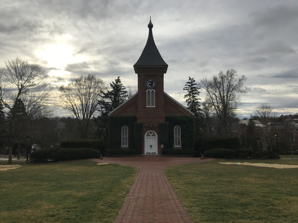
I continued to the pleasant and compact campus of Washington and Lee University, where I strolled up and down a charming row of early nineteenth-century buildings as I waited for the Lee Chapel to open. The Lee Chapel, final resting place of ol’ Robert E. himself, was the closest thing the Reconstruction-era South had to a national shine. The tomb, housed in a skylit rotunda and dominated by a life-size marble likeness of the general (right down to his size 4 ½ boots), has the look, and much of the feel, of a saint’s reliquary. I was guided around the tomb as the sole member of the day’s first tour group, and then directed downstairs to peer at Lee’s office, which has remained (more or less) untouched since the day of his death.
Onward, then, to Charlottesville. The overcast thickened as I headed east, where threatening masses of clouds pressed on the Blue Ridge Mountains. It began to drizzle again just as I parked my car and made my way to the Lawn, the heart of the University of Virginia campus. UVA was Thomas Jefferson’s baby. He arranged the charter, formulated the curriculum, and designed its buildings. The Lawn was ringed by what Jefferson intended to be an academic village – a place where students and professors would live side by side. To that end, he designed a series of pavilions (two-story buildings with both classrooms and professors’ quarters) connected by porticoes and one-story student dormitories. The centerpiece of Jefferson’s design was and is the rotunda, a scaled-down version of the Pantheon that originally housed the university library.
As the sole member of yet another tour, I was shown around this masterpiece of American architecture by a pleasant student guide. At the end of the tour, as we stood on the back porch of the rotunda, the president of the university suddenly emerged from the building. My star-struck guide asked me to take a picture of her with the president (who is apparently a big deal in the world of higher ed). As I obliged, the president peered at me through rain-spattered spectacles, said that he was pleased to meet me, and – mistaking the nature of the tour – asked if I was interested in attending the University of Virginia.
After lunch (a peanut butter sandwich in the back seat of my car), I drove up to Monticello. This, of course, was Jefferson’s mansion (the one on the back of the nickel), and remains one of the most interesting houses ever constructed in America. Jefferson was an inveterate tinkerer, and constantly refined both the architecture and the amenities of Monticello as suited his interests and needs. The result was a building that, to an unparalleled degree, reflects the personality of its owner. For me, the design of the famous exterior (inspired by the villas of the Renaissance architect Palladio) was much less intriguing than the rooms within, still filled with many of Jefferson’s possessions and inventions. It was easy to imagine him writing at that desk, or sleeping in that alcove bed (he had a real mania for alcove beds), or reading in that chair. After the main house walk, I took my third solo tour of the day, a very interesting walk exploring the complicated legacy of slavery at Monticello. Then, after braving the rain for a picture of Jefferson’s tomb, I returned to my car, and Charlottesville.
My hotel room, I discovered, had a cockroach. But it was only one cockroach, and it was mostly dead. So I finished it off, flushed the remains, and went out for dinner at a greasy little fried chicken place near the university.
2-6
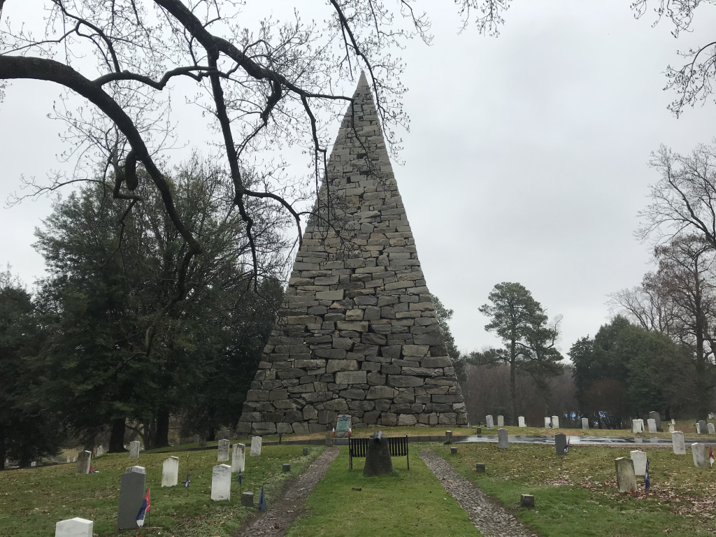
Rain, again. Torrential, unrelenting rain, descending from a malevolent sky. Since hiking was out of the question, I decided to devote the day to the Civil War sites so thick in this corner of Virginia. So I hydroplaned down the highway to Richmond, and pulled into Hollywood Cemetery, the final resting place of several key players in the War Between the States (as they like to call it down here). The most imposing monument in the cemetery is the Confederate Memorial, a 90-foot pyramid of rough-hewn granite blocks. Fringed with cypresses and streaked with rain, it loomed somberly in the background as I walked, umbrella in hand, past rows of tombs punctuated by sodden Confederate flags.
I drove by the tomb of Jefferson Davis, situated on a bluff overlooking the James River and rain-shrouded Richmond skyline, on the way to my real reason for visiting Hollywood cemetery: the tombs of James Monroe and John Tyler. As mentioned earlier, I have something of an obsession with the tombs of obscure figures from American history. The monuments to James Monroe and John Tyler – two of America’s least-remembered presidents – called me as molasses does a fly. I ventured out into the monsoon to take my pictures (Monroe’s tomb, surmounted by a great Gothic birdcage, was the more photogenic of the two), before returning to my car and heading downtown.
I wanted to see the Confederate White House (Jefferson Davis’ residence during the Civil War); but after squeezing into a parking space in the hospital complex that envelops the old mansion, I discovered that the only available tour would consist of twenty seventh graders and a single chaperone. Having no desire to board that flaming blimp, I went instead to the American Civil War Museum. This compact but impressive museum, built into the remains of the Tredegar Iron Works (“the Arsenal of the Confederacy”) occupied me for an hour.
The rest of the afternoon was spent among the battlefields of southeast Virginia. I stopped first at the Stonewall Jackson Death Site, a lonely little building with a tarp on its roof, surrounded by dripping trees. Then, after a brief detour to Fredericksburg, I continued to the day’s highlight: Spotsylvania. In the spring of 1864, Ulysses S. Grant, newly-appointed as Union General-in-Chief, fought a series of battles with Robert E. Lee in the corridor between Washington and Richmond. The Battle of Spotsylvania Courthouse was the bloodiest of these encounters, accounting for over 30,000 casualties between the two sides. Many of these occurred in the “Bloody Angle,” a section of earthworks that witnessed the most savage hand-to-hand combat of the entire war.
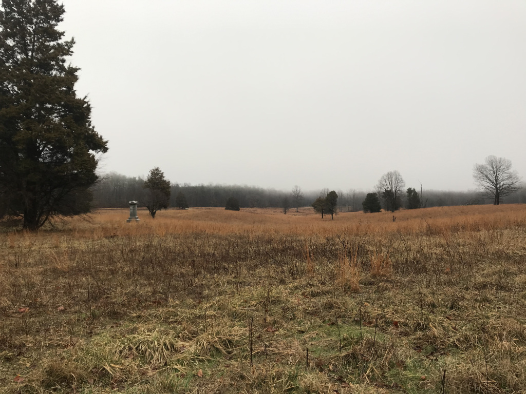
The Spotsylvania battlefield was never developed, and looks much as it did a century and a half ago. The trenches dug by both sides are still clearly visible, arcing off into the rolling hills and dense patches of woodland. I paced sections of these earthworks, mentally retracing the progress of the battle. When I came to the Bloody Angle, I paused. In the few hundred yards around me, now a gray meadow bounded by oak trees, thousands had died. Torrential rain had ruined most of their powder, so they fought with bayonets and knives, grappling and stabbing in blood-soaked mud until corpses were piled four or five deep. Strange, I thought, that it should seem so peaceful now, as rain tapped softly on my umbrella, and tendrils of mist stole among the listening trees.
2-7
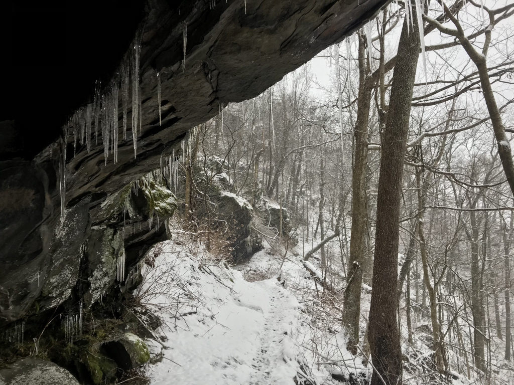
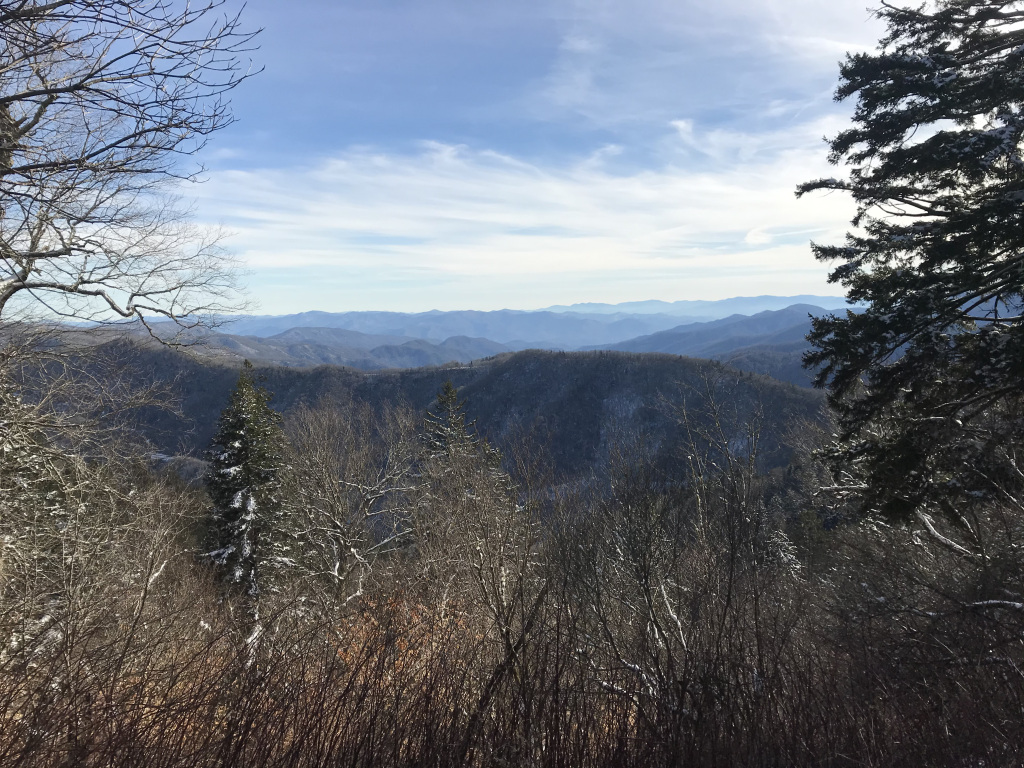
This morning – pacing, as I always do, during long phone calls – I watched as the raindrops pocking puddles on the hotel roof slowed and finally ceased. By the time I checked out, the clouds were scattering before a strong west wind, and the parking lot was bathed in wan but sincere sunlight. Squinting in the unaccustomed brightness, I followed an hour of winding roads up to Shenandoah National Park, a hundred-mile strip of protected land astride the crest of the Blue Ridge Mountains.
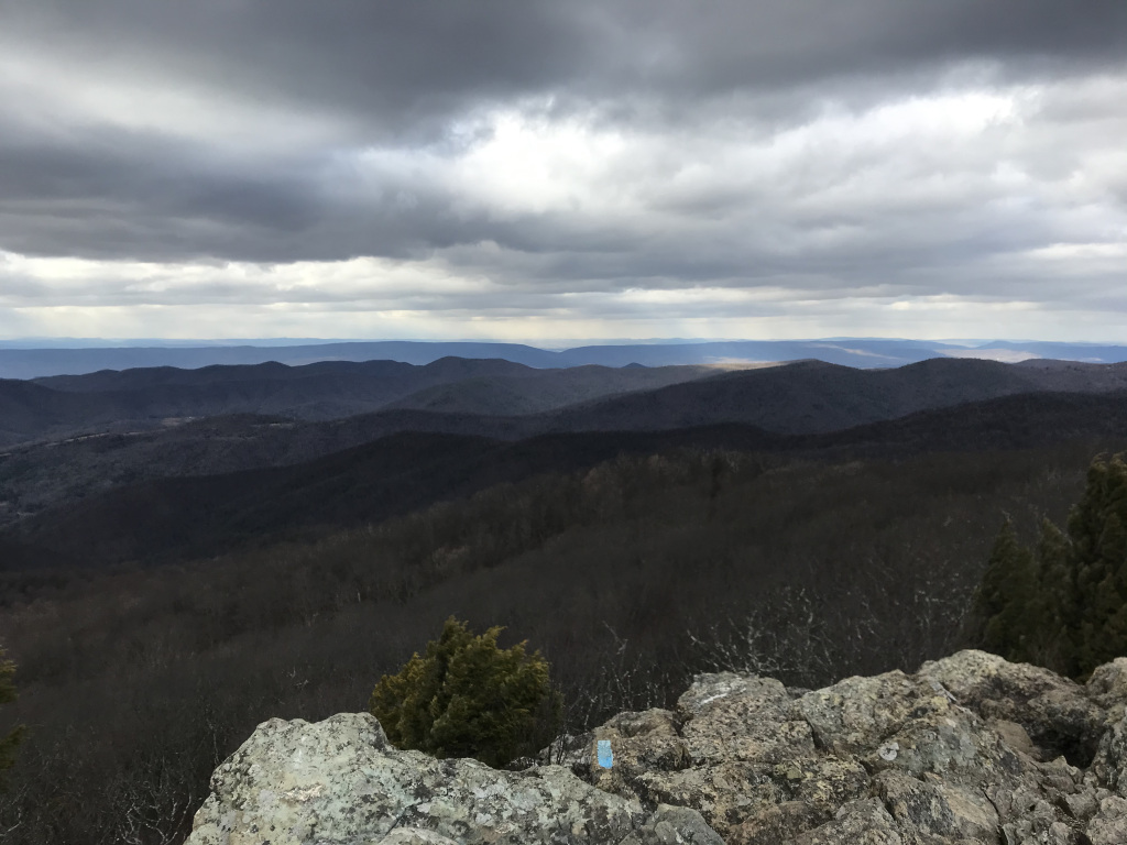
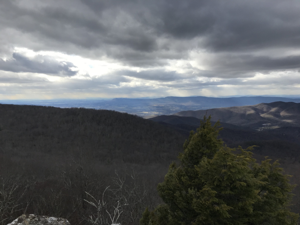
The park’s spine is the famously scenic Skyline Drive, which winds around and among the peaks. Stopping at the first of the Drive’s many scenic pullouts, I immediately noticed two things: the view and the wind. The view, as advertised, was stunning: lines of blue hills, stretching to the cloud-streaked horizon. The wind, less anticipated, was unavoidable: a steady surging stream of air howling over the ridges and through the barren trees. My Sentra wobbled furiously in the gale as I pressed forward.
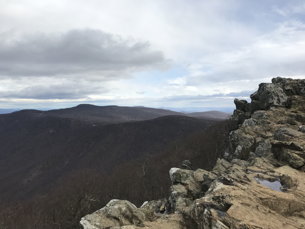
I had the first trail – a short climb up Hawksbill Mountain, the highest point in the park – to myself. Although the mountain shielded me from the worst of the wind for the first half-hour, stray gusts rippled through the trees, whipping flurries across the path. The view from the summit was magnificent: blue-gray mountains and leek-green valleys, dappled by clouds trailing streamers of snow. But the bitter wind, gusting to nearly 50 mph, quickly drove me back downslope.
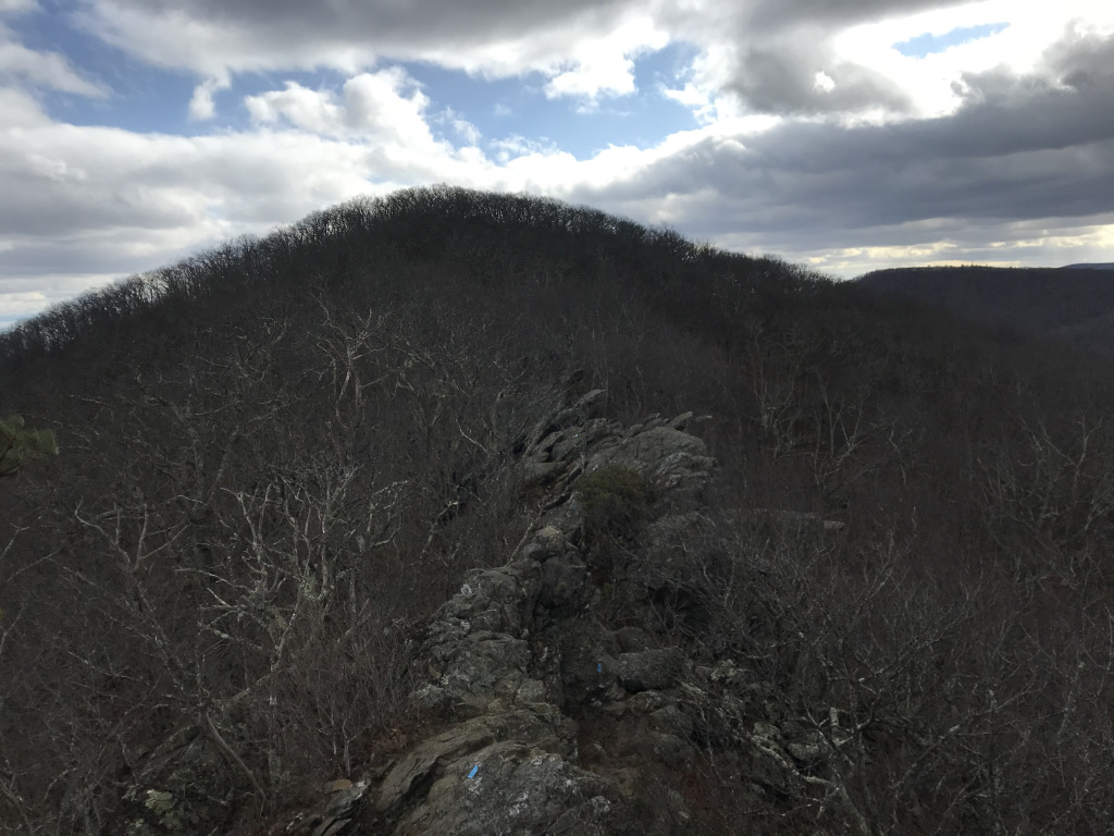
Next was a short but scenic hike to Dark Hollow Falls. Charged with rain, the falls were roaring over their rocky beds, sending up spray that sparkled in passing shafts of sunlight. My final hike, and the day’s scenic highlight, was a short scramble up Bearfence Mountain. The trail followed an exposed ridge high above Skyline Drive. The views were splendid, especially to the west, where snow cascaded over a shrouded range of hills. The wind added to the drama of the scene, whistling and keening among the boulders, and surging visibly through the rattling trees below.
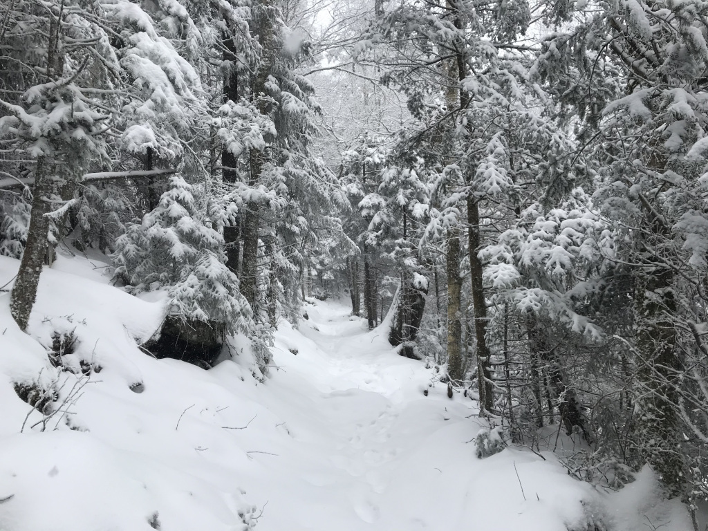
I returned to my car along the Appalachian Trail, and began the long drive to Tennessee. The wind continued to shove and jog my car, and periodic bursts of heavy snow blew over the highway. I stopped at the excellent (and excellently named) Dude’s Drive-In, and watched fat snowflakes fly past the restaurant lights as I absorbed my burger.
2-8
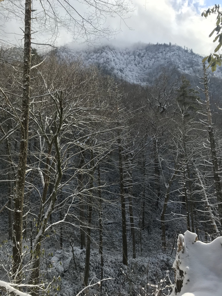
When I woke this morning, I ventured onto my frosty balcony for a first look at the Smoky Mountains. From my hotel, perched on the banks of the Little Pigeon River outside Gatlinburg, I could see a line of sparkling summits – overhung, ominously, by a spreading blanket of clouds. Driving to the visitor center, I discovered that the Newfound Gap road, the highway that cuts through the center of the park (and gives access to the hikes I’d planned) was closed due to ice and snow. With the help of a ranger at the information desk, I hastily planned an alternative hike, and drove off.
My new plan was to hike the Bullhead Trail up to Mount LeConte, the third-highest peak in the park. This trail, which runs through a forest burned by wildfire a few years ago, usually offers expansive views over the Tennessee Smokies. Almost as soon as I started the hike up, however, flurries began to sift through the trees; and by the time I reached the first overlooks, a steady, swift-accumulating snow shuttered the horizon and blurred the hills.
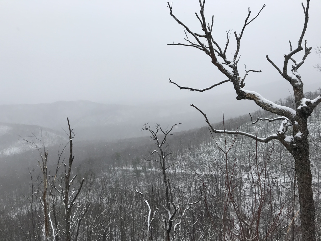
It was a memorable hike, but not an easy one. The howling wind dashed snowflakes against rocks, trees, and my face, forcing me to put on my sunglasses and rain gear. The burned-out forest that lined the first five miles of the trail provided little shelter from the storm. But I plodded on, the snow on the path steadily deepening, wrapped in walls of white. Finally, as I approached the summit, I entered the shelter of a dense pine forest, where branches heavy with snow arced overhead, and flakes cascaded gently through gaps in the canopy.
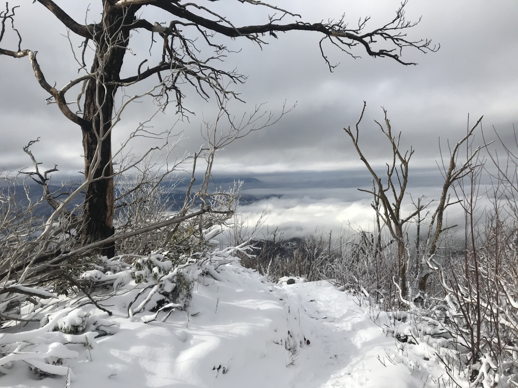
After pausing to eat my lunch among the snow-shrouded buildings of the LeConte Lodge (and wrestling with my backpack, which had somehow frozen shut), I headed back down along the Rainbow Falls trail. After about a half-hour, suddenly, splendidly, the sun came out. The heavens opened, the trees shone, and lines of mountains materialized below. A few minutes later, at a bend in the trail, I was treated to an awesome panorama of frosted trees and swirling clouds.
Descending through a shimmering forest, I paused for a few pictures of Rainbow Falls, squelched through the mud that caked the lowest sections of the path, and returned at last to my car. Then, after changing my shoes, I drove to a barbecue place outside Pigeon Forge. Finding myself the only customer, I sat facing a window, and watched the sun set over snow-dusted hills as I destroyed some brisket and smoked sausage. A golden moon hung overhead as I drove back to my hotel.
2-9
The park highway was still closed this morning. This time, however, I was prepared. The day before, I had learned from a fellow hiker of the Ramsey Cascades trail, an 8-mile hike that took in an impressive waterfall and some of the largest trees in the southeast. So I headed down the bumpy gravel track to the trailhead – where my car was the only one in the lot – and headed up toward the falls.
It was a splendid hike. The trail paralleled a rushing wilderness stream, which it crossed and re-crossed on bridges and snow-covered boulders. At first, the valley through which the stream ran was broad and cathedral-like. But it soon narrowed, and the trail narrowed with it, passing through tunnels of snow-shrouded rhododendrons and around the great flaring trunks of towering tulips and poplars. As the sun crested the mountain ridge overhead, the snowy landscape blazed to life, flashing and sparkling in the clean cold air. The real scenic highlight, however, was the trail-side stream, rushing over icicle-draped boulders beneath the drooping rhododendrons.
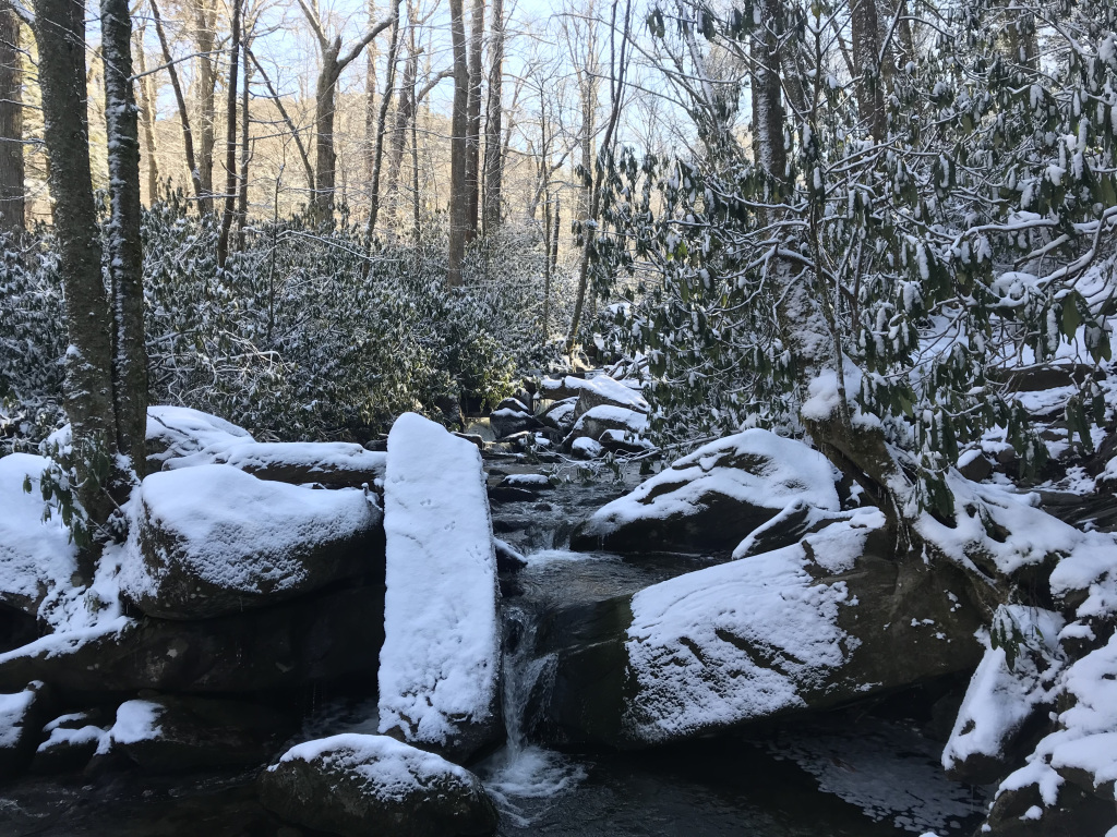
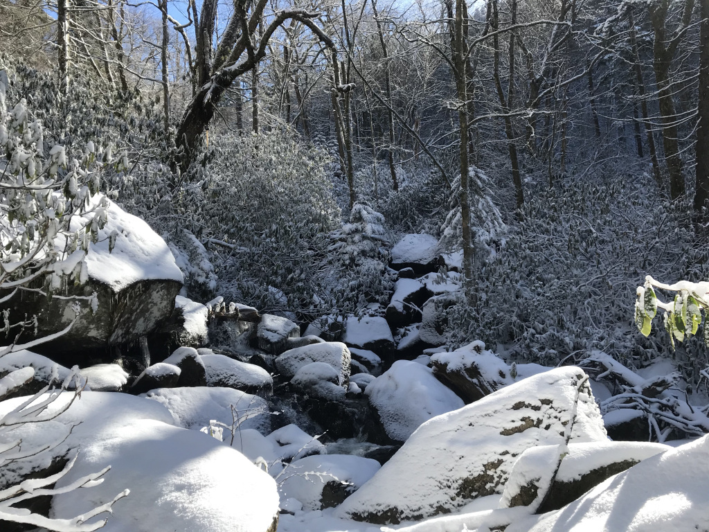
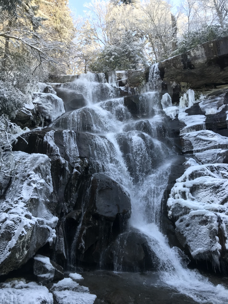
The last mile, beneath frosted pines, was especially beautiful. The snow on this part of the trail was unbroken; no other hiker had visited in at least three days. Upward, in the crystalline sunlight; onward, over a few slippery fords; and then I stood at the base of Ramsey Falls. Clambering onto a snow-covered boulder, I savored the moment. The falls, seventy feet tall, were fringed and framed with ice. On either side, frosted pines stirred gently in an unfelt breeze, tops glowing in the sun. Bathed in the frosty air streaming from the falls, I ate my lunch (peanut butter sandwich and an apple), watching water rush over the rocks below. Then, reluctantly, I began my descent.
The sun, now streaming directly on the valley, had begun to melt snow from the treetops. Putting on my rain jacket to escape a soaking, I was struck by how rapidly the air began to feel almost spring-like. The savor of sap hung in the humid air as I made my way back to the parking lot, and out along the gravel access road.
I was irritated to discover that the Newfound Gap road was still closed. After being told in the visitor center that it was unlikely to open until evening, I returned to my car and stared glumly at a park map. None of the few trails in the vicinity of the visitor center was appealing, and all were likely to be (by February standards) crowded. Then I realized that there was one scenic trail I was guaranteed to have to myself: the Newfound Gap road itself. So I grabbed my daypack, slipped on sunglasses, and strode confidently down the empty road. It was a remarkably peaceful walk: mountains in the background, a rushing creek alongside, wind whispering overhead. About a mile and a half down, as I stood in the middle of the road, trying to frame a picture of Mount LeConte, I heard the sound of a car approaching. A van passed – and then another, and another. The road was open! I turned and sprinted back to my car as fast as my heavy hiking boots would allow.
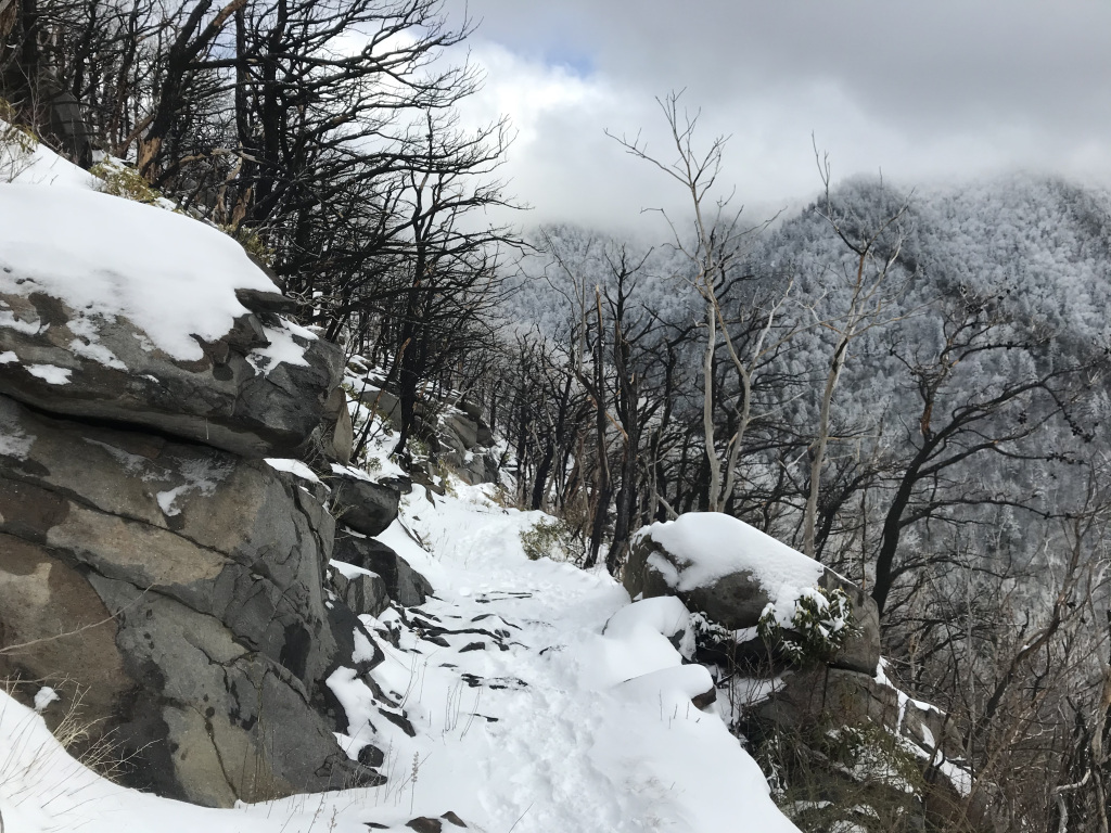
Leaping into my car, I sped up the road, knowing that I only had a few hours of daylight. A series of pullouts beckoned; galleries of icicles and frosted trees cried out to be photographed. But I refused to be diverted until I reached Newfound Gap, the high mountain pass marking the Tennessee / North Carolina border. This is where the Appalachian Trail crosses the highway – and where the section I planned to hike began.
I was pleased to see that there were no footprints on the trail; as at Ramsay Cascades, I was the first hiker in days. The path followed a high ridge along the state line, with awesome views on both sides. To my left was Mount LeConte, the goal of yesterday’s snowbound hike. To the right were the North Carolina Smokies, frosted and hazy.

The sun was already low to the horizon, and the snow-shrouded trailside pines cast long shadows down the slopes. Knowing that I didn’t have much daylight, I only went about two miles before turning. As I followed my tracks back to the road, I paused for pictures of the Carolina Smokies, now fading into the twilight. I stopped again in the parking lot for a last look over the darkening mountains. Then down to Pigeon Forge for a burger, and onward to my hotel beneath that golden full moon.
2-10
It began to rain almost the instant I checked out of my Gatlinburg hotel, and didn’t stop until evening. Fortunately, I was in the car most of the day. I started with a three-hour drive down to Chickamauga, Georgia, site of one of the bloodiest battles in the western theater of the Civil War. I listened to an informative phone tour as I drove the battlefield, passing over flooded creeks and beneath dripping trees. Occasionally, I braved the rain to walk stretches of the sodden battlefield, punctuated by late nineteenth-century monuments.
Crossing back into Tennessee, I headed into a run-down part of south Chattanooga for lunch at Zarzour’s Café, a tiny old-school diner famous for its burgers. I was one of three customers (the other two were sitting at the bar with the waitress), and watched as my (commendable) burger was grilled just behind the bar. Post-burger, as I worked my way through some homemade ice cream, I noticed two men who had just walked in looking at me curiously. One of them spoke up: “are you the Jeopardy guy?” Apparently, I look like James Holzhauer. I thought about playing along, but didn’t have the energy.
After lunch, I headed toward Lookout Mountain, half-hidden by trailing clouds. Sheets of water made driving the winding road up something of an adventure, and dense curtains of fog made the summit something of a disappointment. I dropped by the visitor center (which explored the famous Battle above the Clouds) and ventured into the rain and wind for a few pictures of Point Park, which normally offers panoramic views of Chattanooga.
Onward, then, toward Nashville. I stopped at one more battlefield – Murfreesboro / Stone River, site of a bloody clash in the winter of 1862 – and walked through the drizzly national cemetery next door. Three more hours of rain-spattered driving brought me through a gas station Subway, over the Ohio River, and into a reasonably-priced hotel in Metropolis, IL (the official home, according to the Illinois state legislature, of Superman).
2-11
Leaving my hotel early, I headed to Giant City State Park, southern Illinois’ answer to Starved Rock. I appeared to be the only visitor. Parking in a surprisingly large lot, I walked through the misty woods to the park’s namesake: a long ridge of moss-covered sandstone, pocked with caves and cut by narrow ravines. Water dripped and ravens called from the fog-shrouded trees as I clambered around the ridge, pausing to read the graffiti cut by dozens of nineteenth-century tourists.
Then I found myself back at the base of the trail. The sun had begun to peer through the fog, and a light breeze stirred the treetops. I took a deep breath of cool air, started the car, and headed home.