6/3 – 6/5/17
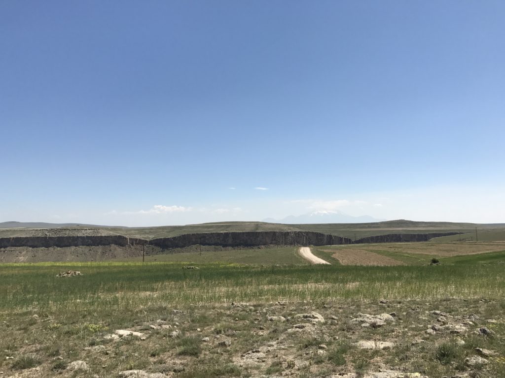
Most of the Anatolian plateau is about as exciting as North Dakota. Hills roll endlessly and unambitiously in every direction, devoid of anything as interesting as a shrub. Cappadocia, fortunately, provides more than enough visual stimulation to make up for the surrounding monotony. Red cliffs rear from the plain; blue mountains materialize on the horizons; and the arrow-straight highway begins to warp.
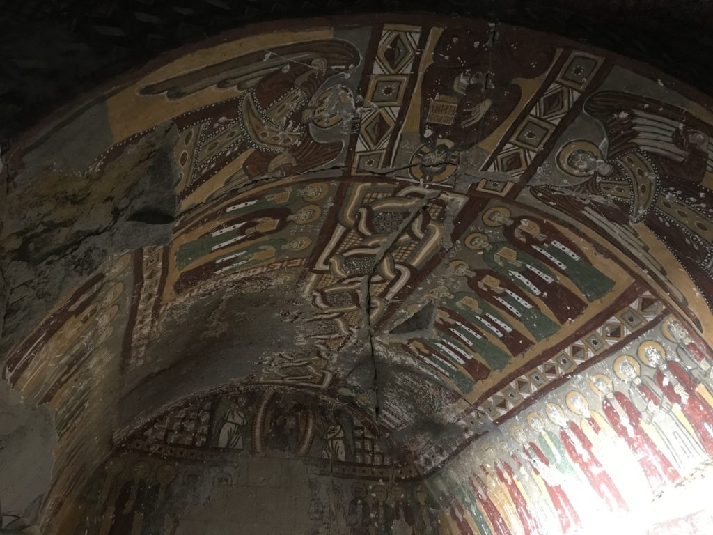
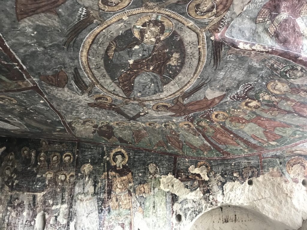
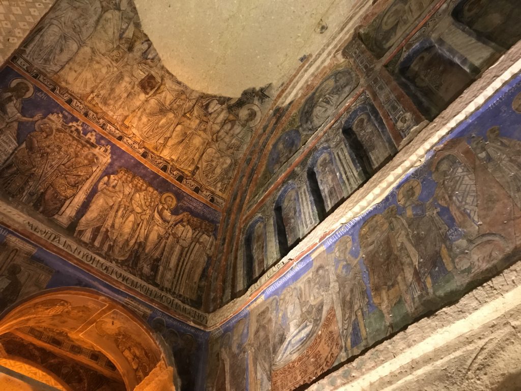
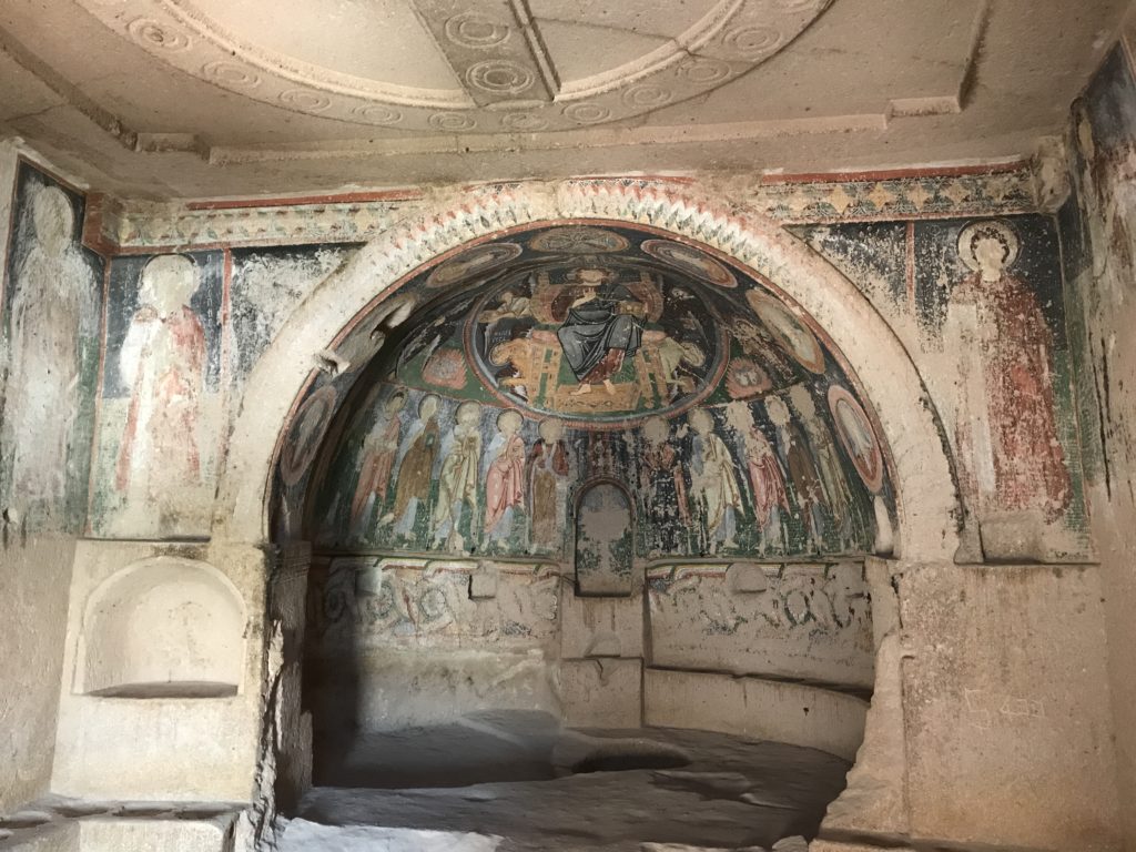
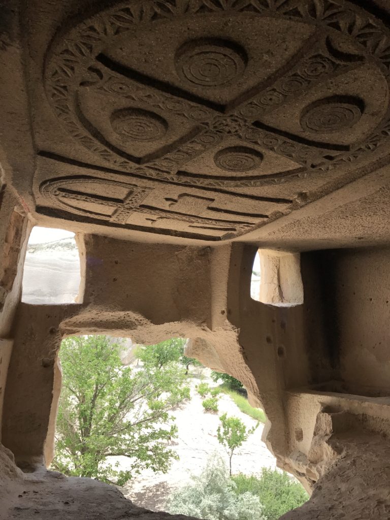
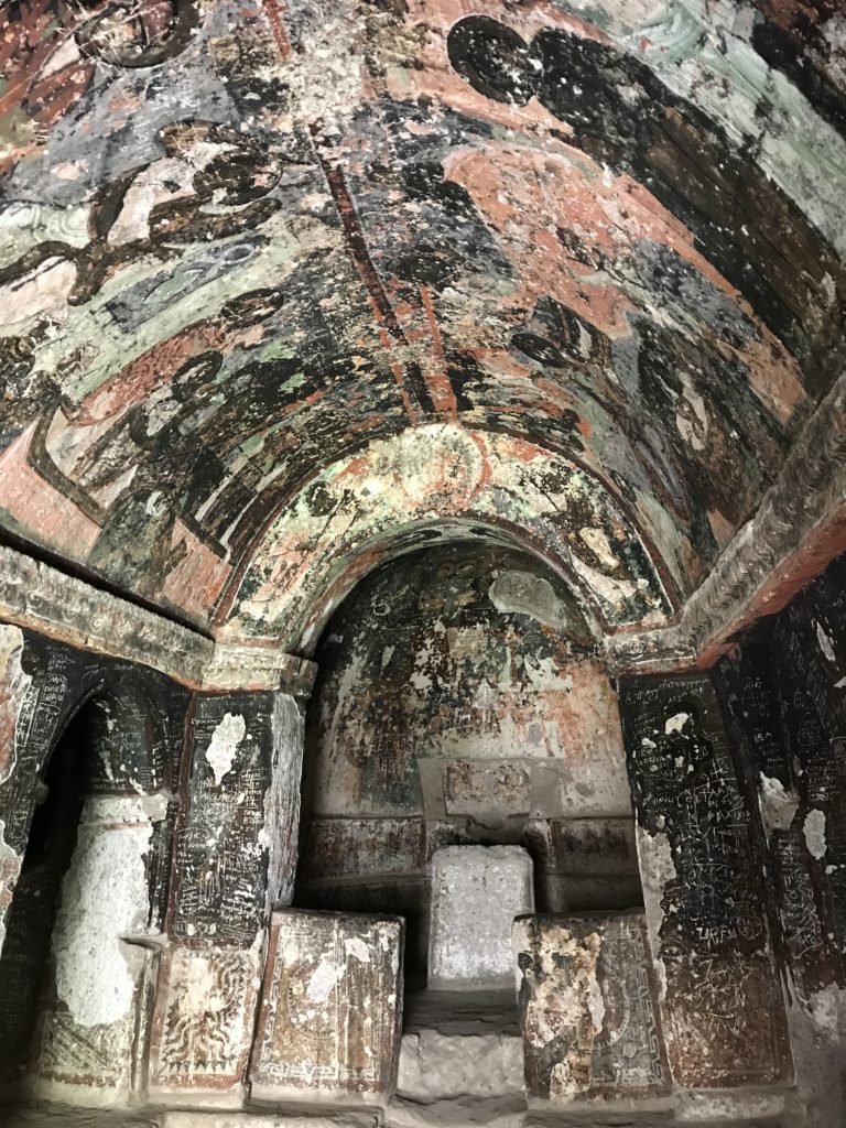
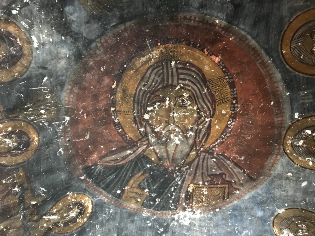
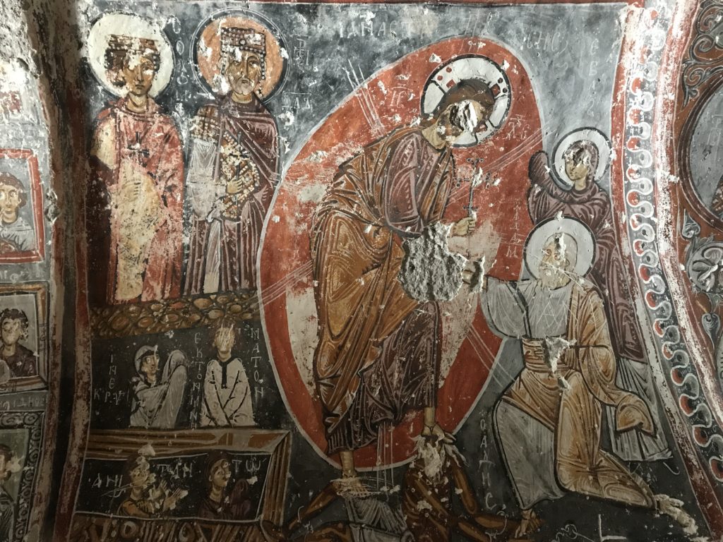
My first Cappadocian destination was the Ihlara Valley, a long canyon with rose-red walls and a forested bottom. Besides its beauty, the valley’s chief draw is the impressive crop of Byzantine churches and monasteries carved into its walls. Like the myriad other rupestrian churches in Cappadocia most date to the half-millennium between the sixth and twelfth centuries. Many feature impressive frescoes – virtually all sadly defaced by graffiti. Like the rural churches of southern Cyprus, which I visited two years ago, these remote outposts are almost the sole record of whole eras of Byzantine art. Some frescoes are splendidly executed; others are crude and awkward. All are fascinating glimpses into a vanished world.
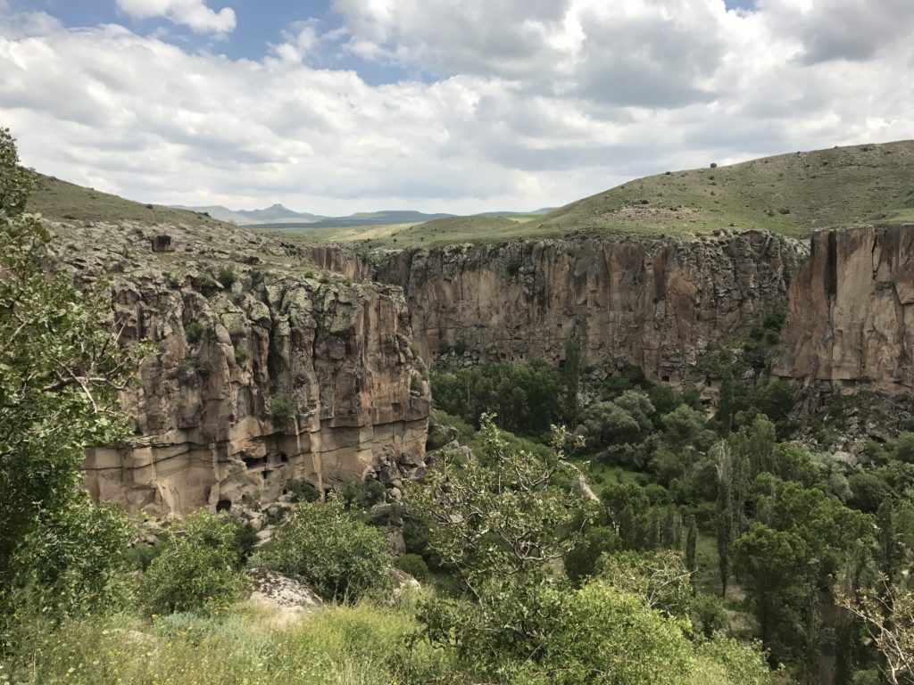
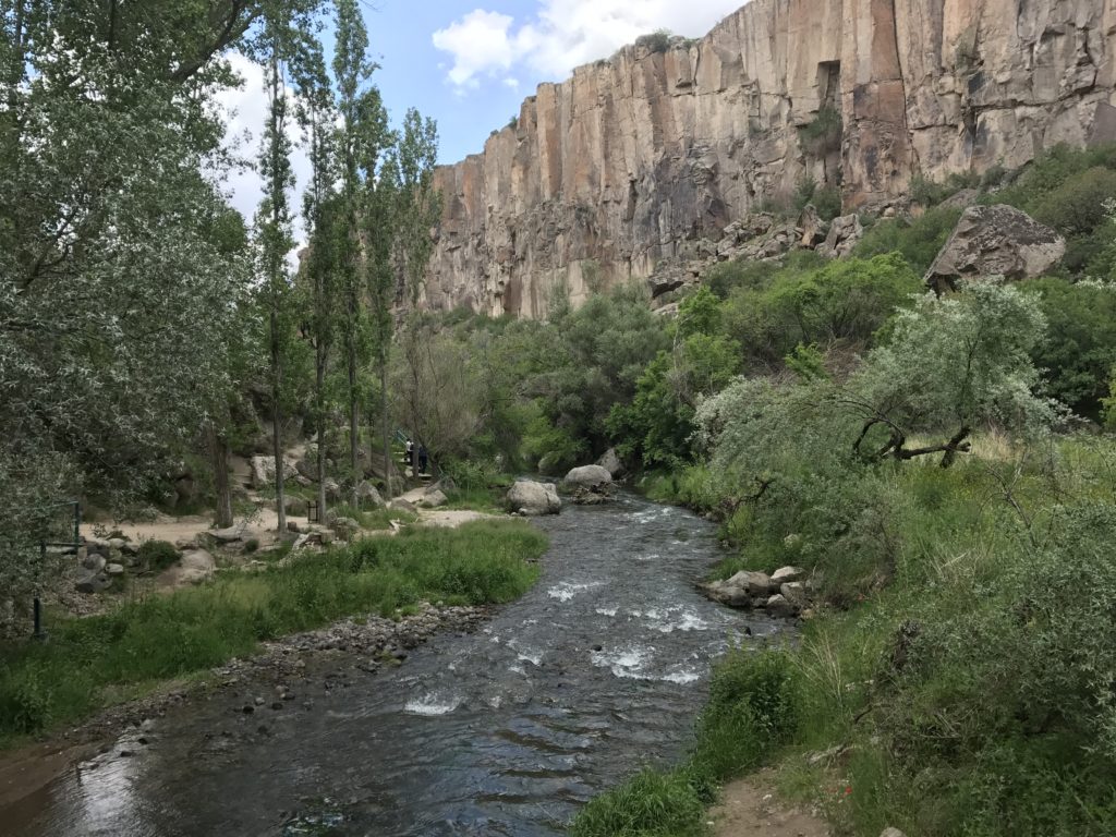
I spent a pleasant five hours hiking up and down the valley. Most of the time, I had the trail to myself. On two different occasions, however, I was forced to maneuver around Turkish tour groups. There is nothing quite like a Turkish tour group. They are invariably large – forty or fifty people seems about normal. At least half the members are invariably in their eighties; the rest tend to be families with small and unruly children. Everyone is chatting, laughing, and generally having far too good a time to give a fig for what the tour guide is saying. I got stuck behind a particularly slow and amorphous group along a stretch of trail hemmed in by cliffs on one side and a rushing river on the other. I tried everything to pass – crashing through reeds along the river, scaling ledges on the cliff – all to no avail. Just when I was beginning to seriously consider swimming the river, the group turned off on a side path, leaving me blessedly alone again. If I sin gravely in this life, I suspect that I will be reincarnated as a guide for Turkish tour groups.
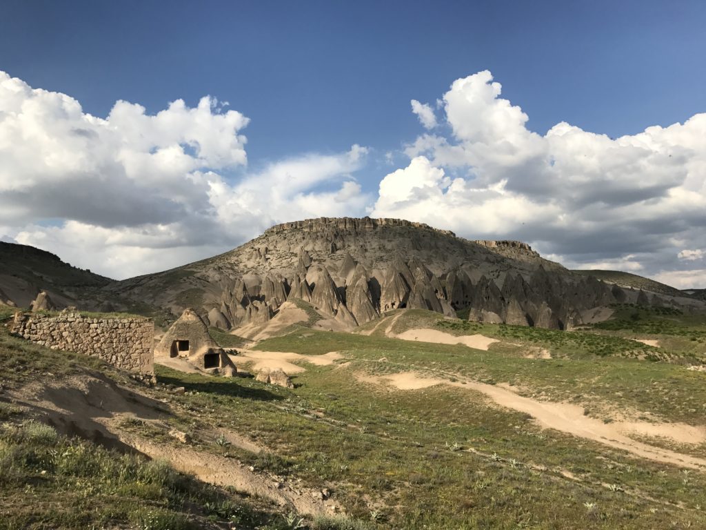
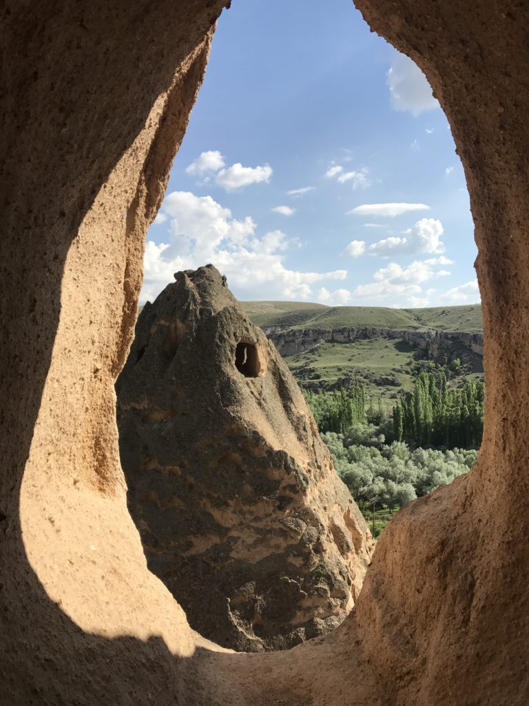
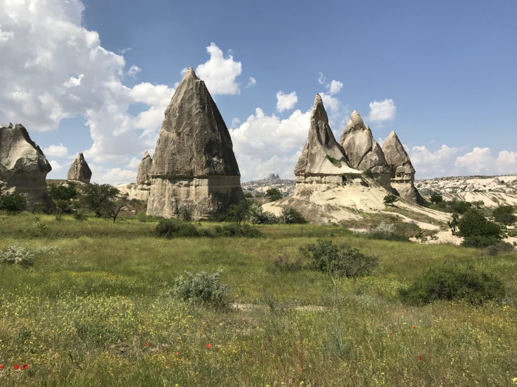
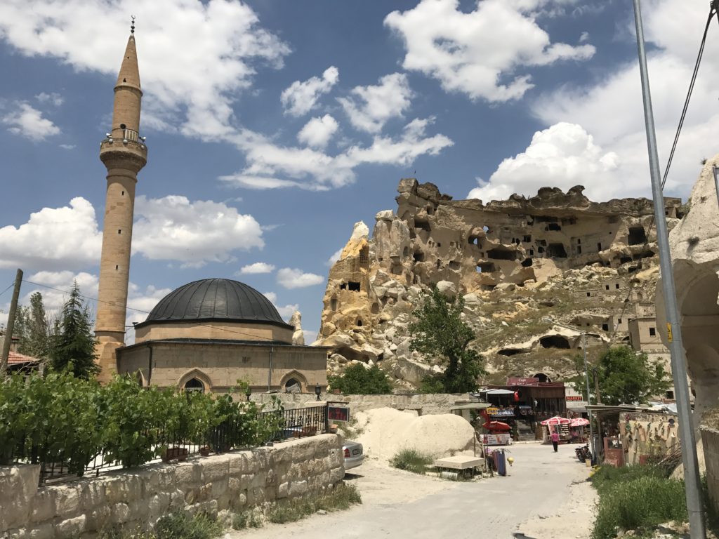
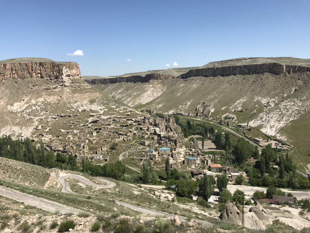
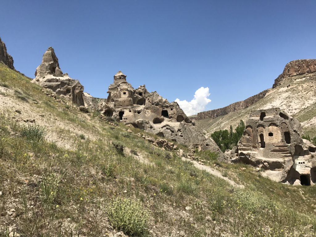
As I headed north from Ihlara, I stopped in the troglodyte village of Selime. This settlement, carved over the course of the late antique and Byzantine eras into the tower and buttresses of a massive tufa pinnacle, featured hundreds of homes and stables, a half-dozen substantial churches, and countless dovecotes (caves with grilled openings designed to entice pigeons and catch their droppings for fertilizer). The higher caves afforded spectacular views over a wildly-eroded landscape of canyons, cliffs, and “fairy chimneys” (conical tufa pinnacles).
6-4
I began by walking the mile or so to the Goreme open air museum, hoping to beat the tour groups. No such luck – several Turkish and Chinese groups were already blundering about, filling the cave churches and taking relay photos of one another. Fortunately, I had the Tokali and Karanlik churches – probably the best of the lot – to myself. Unusually for Cappadocia, many of the Tokali church’s frescoes predate the iconoclast controversy, an eighth- and ninth-century movement that opposed the use of religious images. As a result, they provide a rare and fascinating look at a period heavily influenced by ancient models but characterized by its own aesthetic. The frescoes of the Karanlik (Dark) Church are remarkable chiefly for their excellent state of preservation; the lack of windows kept light (and bored shepherd boys) away from the paintings.
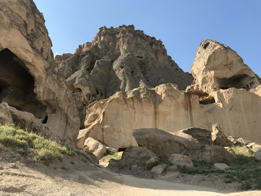
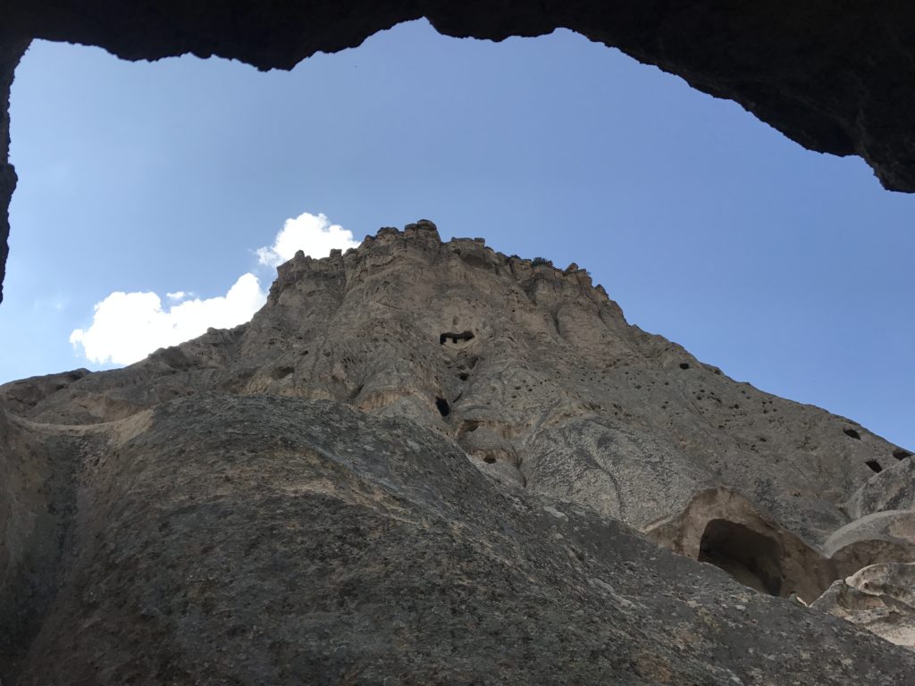
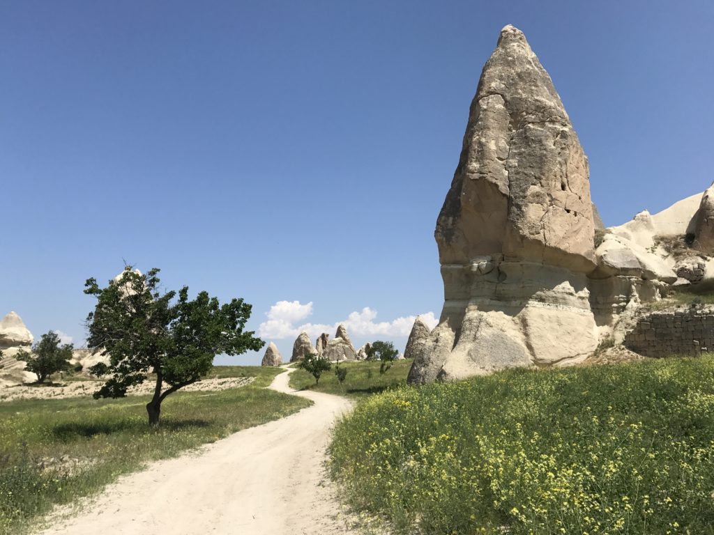
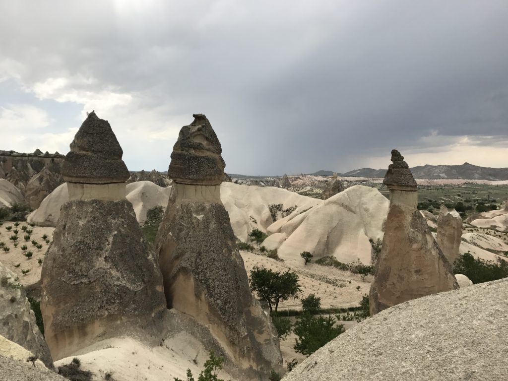
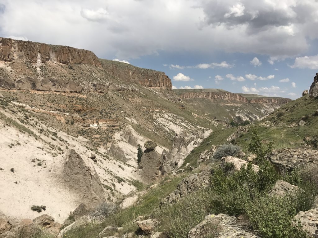
Having little taste for elbowing through tour groups, I left the museum and walked a short distance up the road to the start of a hiking trail leading down into the valleys north of Goreme. The trail led down through a narrow canyon that reminded me of Petra to a slope dotted with massive fairy chimneys, many pocked with the doors and windows of ancient cave dwellings.
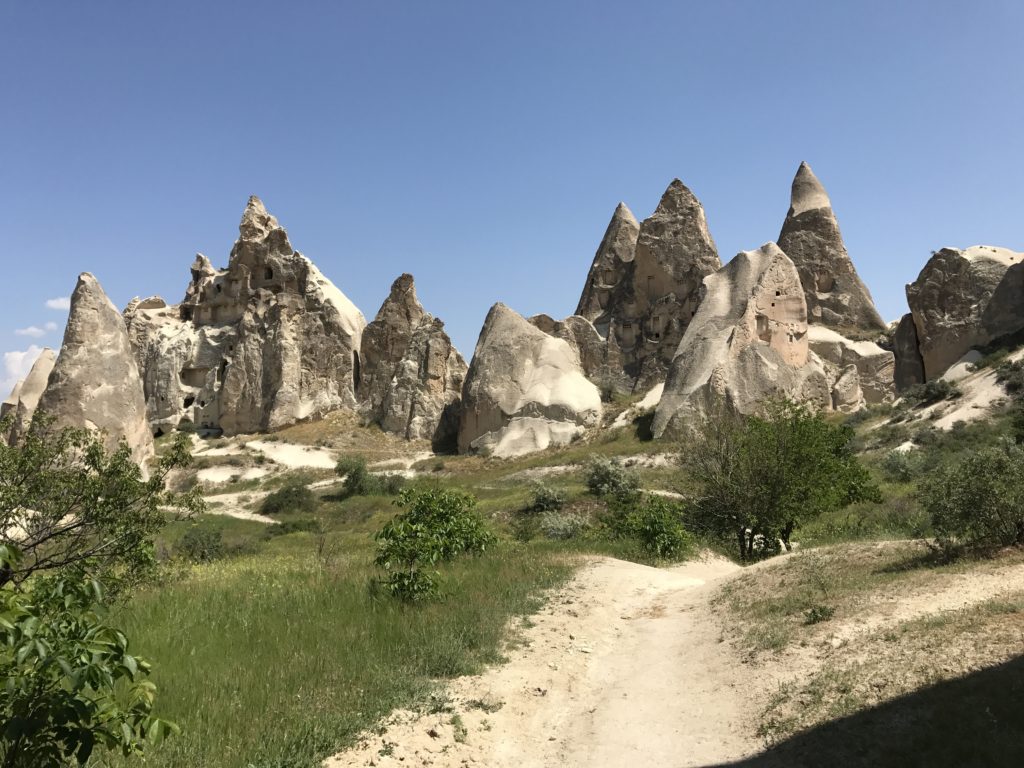
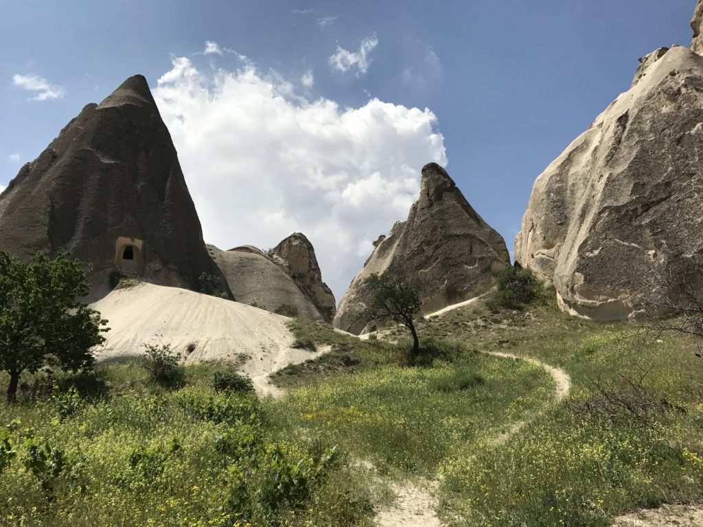
A number of painted churches were hidden among the pinnacles of the so-called Red and Rose Valleys – after climbing up into a troglodyte village to eat my lunch, I found one twenty feet from the ledge on which I was choking down a Nutella sandwich.
While walking through the village of Cavusin, I began looking for the trail to Zelve described in my guidebook…
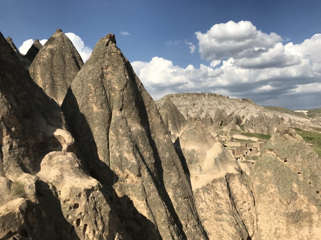
Following what seemed like a well-worn track in the right direction, I found myself in small wheat field ringed by cliffs. Frustrated, I backtracked and followed the only other track in the vicinity to another dead end. Deciding to make my own trail, I struck out in the general direction of Zelve, looking for a place to climb the line of cliffs that blocked my passage. When I finally found a slope that I could scramble up, I levered myself onto the clifftop – and, in a replay of my misadventure at Heracleia, immediately heard thunder. This time, fortunately, the storm passed by, leaving me to pick my way through a wild landscape of pinnacles and boulders and finally descend by treacherously steep slopes to the troglodyte village of Zelve.
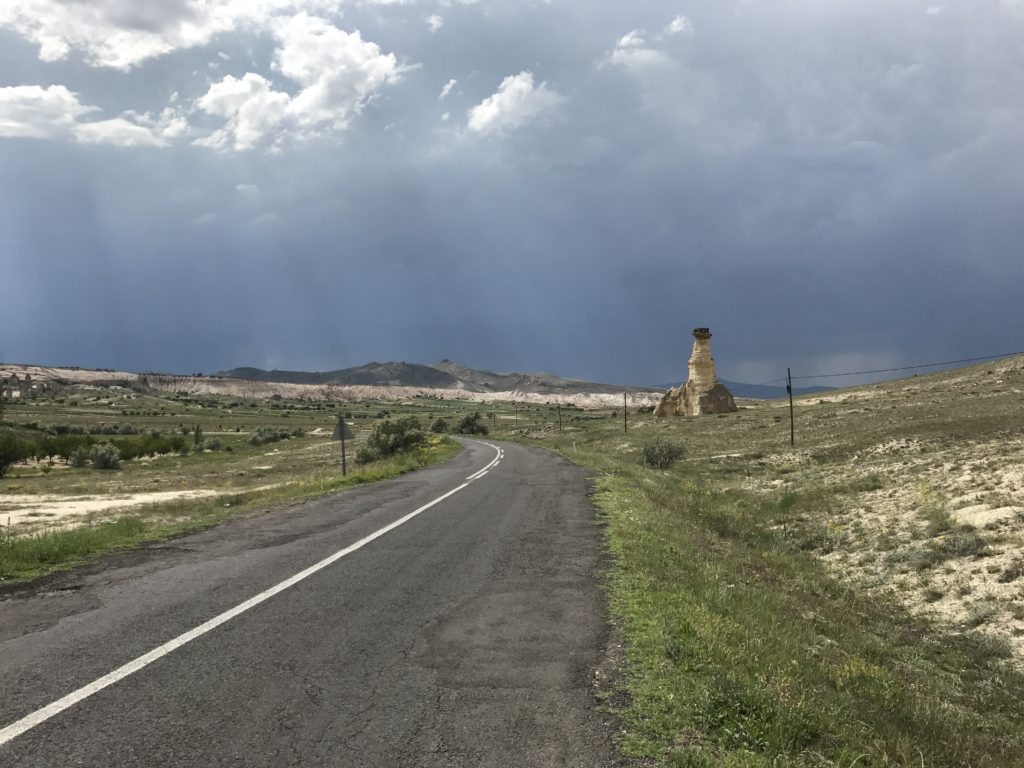
After poking around Zelve for a short while, I decided to make my way back to Goreme. I had been told that I could hail one of the Dolmuses (minibuses) that ran along the Zelve-Goreme highway at regular intervals. No bus, however, was forthcoming; and so I decided to walk along the road and try to flag down any public transportation heading in the right direction. I came to regret this decision; the road had no shoulder, and Turkish drivers are jealous of their lanes. As always, however, the Cappadocian countryside had a fascinating quality, especially against the dark clouds of the recently-passed storm.
When I finally managed to flag down a dolmus, the van made it a grand total of two hundred yards before being waved off the road at a military checkpoint. After another rehearsal of my smiling tourist routine, I finally made my way back to the hotel. Shortly thereafter, the storm that had threatened all day broke, wrapping the fairy chimneys in rain and sending volleys of hail upon my hapless rental car.
6-5
I started early to reach the underground city of Derinkuyu before the tour groups. I needn’t have hurried. The site was deserted when I arrived, and the handi-crap vendors arrayed around the parking lot were almost pathetically eager for a customer.
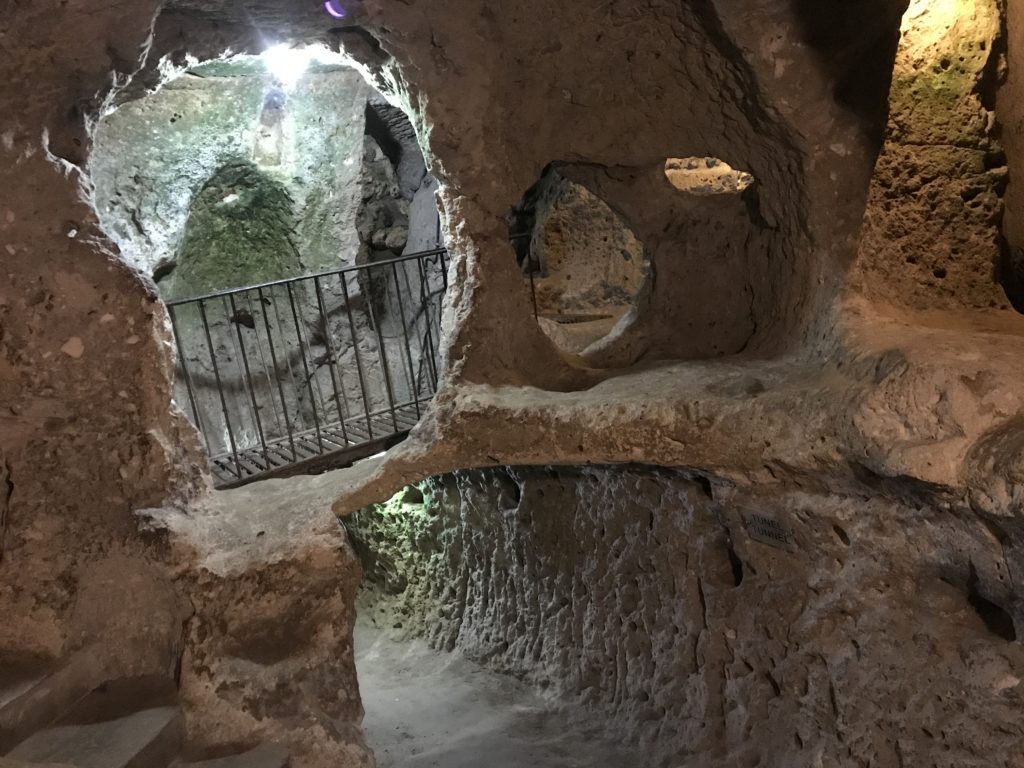
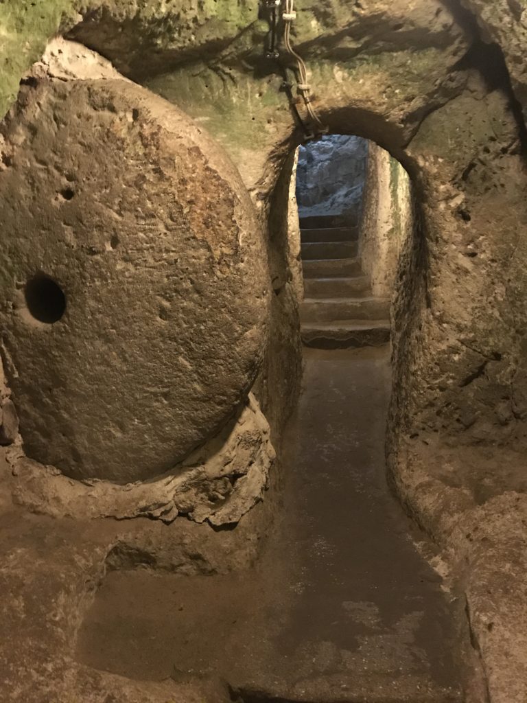
The underground city itself was about equal parts intriguing and claustrophobic. Arrayed on eight levels extending to nearly two hundred feet below the surface, Derinkuyu could support 10,000 people and their livestock through a six month siege. The tunnels seem to have been carved gradually: the oldest may long predate the Romans; the most recent are probably medieval.
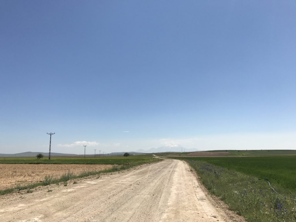
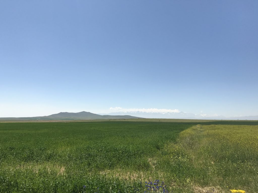
Having decided to spend the bulk of my day hiking in the remote and little-visited Soganli Valleys, I directed my GPS to find the village of Soganli. I should have checked the route it selected against my paper maps. Like all programs of its type, but to an exceptional degree, my GPS app is an idiot savant. It has the facts; but patterns and sense are quite beyond it. At first, the country highway it sent me down was quite beautiful, running through newly-planted fields toward a distant line of snowcapped mountains. Then it ceased to be a road. Rattling over gravel washouts, swerving to avoid basketball-sized rocks, cursing myself and the GPS profusely, I white-knuckled my way over ten miles of rutted track and down the mad switchbacks leading to Soganli.
The village itself was nearly empty. Three-quarters of the houses dug into the crimson wall of the canyon were windowless and decaying. Seemingly all the remaining villagers were hanging around the town square when I pulled up. After fending off various attempts to sell me the local craft specialty (some sort of doll-looking thing), I set off down a narrow road leading into the valleys behind the village.
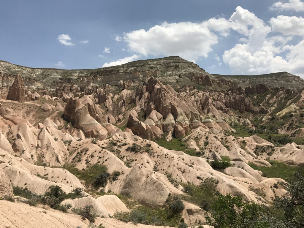
Both the upper and lower Soganli valleys are canyons about four hundred feet deep and perhaps a half-mile wide. Their walls are riddled with artificial caves ranging in size from cubby-like dovecotes to multi-story monasteries. Virtually all were carved in late antiquity, when the valleys were densely populated. I spent a pleasant five hours hiking along the walls of both valleys, pausing to admire the surprising number of frescoed churches. As around Goreme, the paintings were defaced by graffiti – but most of it was Greek and Armenian, a legacy of the time before the population exchange of 1922.
Highlights of the hike included lunch in a painted church, meandering through the deserted modern village, and exploring a large monastery that had been repurposed as a stable. The weather was perfect for a long hike: fair weather cumulus clouds drifted lazily over the crimson canyon, and a light breeze teased the leaves of the aspens along the canyon bottom. Best of all, I had the canyons completely to myself – a welcome relief after the mobs at Goreme.
After stopping to explore another large monastery complex carved into a forest of fairy chimneys, I made my way to my hotel. The only parking space available was beneath a mulberry tree that houses a large and incontinent population of birds. Hopefully the coating of dust will protect the paint…