Deep Freeze
2/17 – 2/22/21
For nearly twenty years, my family spent the week after Christmas in the North Woods of Wisconsin. We snowmobiled. We skied. We pretended to ice fish. When I think back to those vacations, however, it’s not the activities that I remember best, but the silences between – the majestic stillness of woods under heavy snow. In my mind, all those weeks seem to merge into a single day, played out against a backdrop of white and shimmering pines.
About a month ago, I decided to go north again. Starting, as usual, from Chicago, I would follow the Mississippi River to the Twin Cities, head north to Lake Superior, cross the Upper Peninsula of Michigan, and return home along the Wisconsin shore of Lake Michigan. I planned to leave in the second week of February, when both of the manuscripts I was working on would reach important milestones.
Everything was going according to schedule – until winter grew teeth. From late January to the middle of February, storm after storm swept over Chicagoland, blanketing my parents’ yard with thigh-deep snow. The worst arctic outbreak in years plunged down from Canada, sending parts of the Plains and Upper Midwest below zero for days on end. It was, in short, a bad time for a road trip. So I adjusted my schedule, shifted my reservations, and set my sights on the third week of February.
2-17
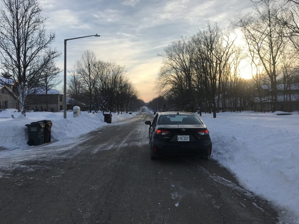
It was three below zero when I left home. Steam rose with infinite deliberation from smoke stacks. Drifts rolled endlessly over quiet fields. Sunlight filtered through the outriding clouds of a snowstorm.
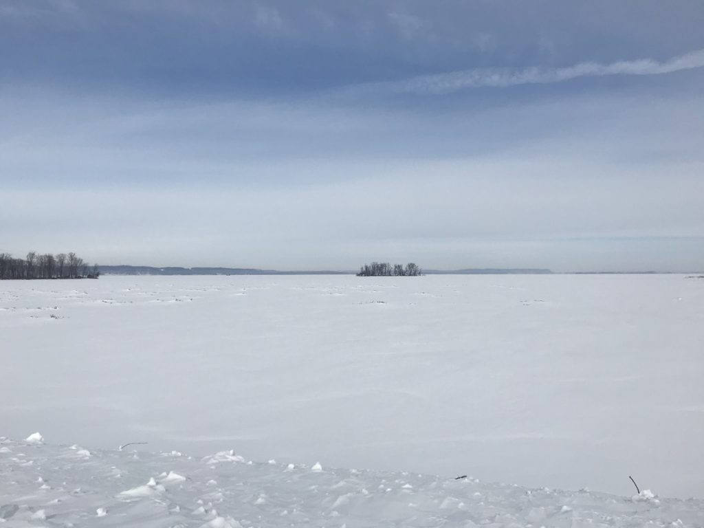
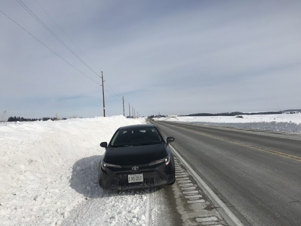
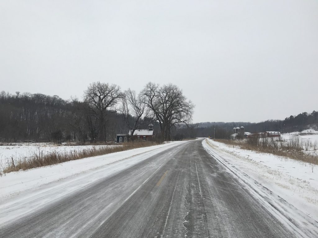
My first stop was Lock and Dam 13, the pride of Fulton, IL. There is nothing particularly remarkable about this structure. It just happens to be the thirteenth in the series of navigation dams that cross the Upper Mississippi River between Minneapolis and St. Louis. But since it was the first place where my path crossed the river’s, I felt compelled to see it. A partially-plowed road brought me to the dam’s maintenance yard. Pulling on my coat – it was still below zero – I stepped out into the wan sunlight and surveyed my surroundings. The river, completely frozen and covered with snow, looked little different from the fields I had just spent two hours driving through. On the Iowa shore, a line of forested bluffs provided a bit of relief. Stillness reigned. I took my pictures and beat a hasty retreat to my car, fingers stinging.
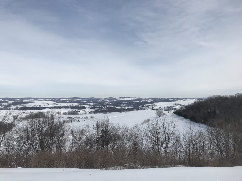
Lock and Dam 13 mark the southern edge of the Driftless Region, one of the more topographically adventurous corners of the Upper Midwest. Hills and valleys, valleys and hills – as I careened, ears popping, across the northwestern corner of Illinois, I was silently grateful that the roads were free of snow.
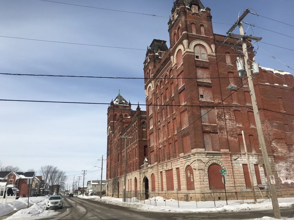
Having visited Galena before, I stopped there only long enough to take pictures of U. S. Grant’s House and a few other landmarks. Then, onward and over the river to Dubuque, IA. Since all the local overlooks were closed by snow, I contented myself with an impromptu architectural tour (I’ve always been a sucker for old commercial buildings), and continued north along a highway lined by huge drifts.
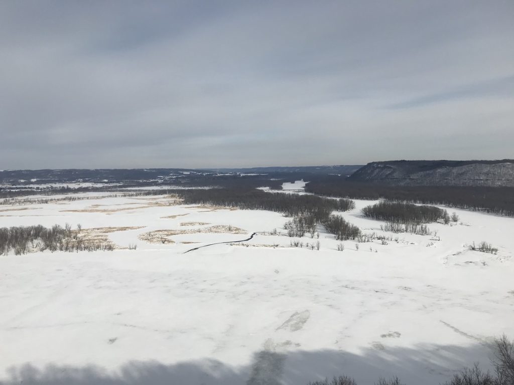
I stopped in the little town of Guttenberg, IA to take a walk along the river and see another icebound lock and dam (no. 10). Across the Mississippi, on the Wisconsin side, rocky bluffs stretched out of sight. From Guttenberg, a short drive brought me to Pike Peak State Park (as longtime readers will recall, I camped there a few years ago during an ill-fated kayak expedition). Pulling on my boots, I crunched my way to the overlook for a majestic bluff-top view of the river.
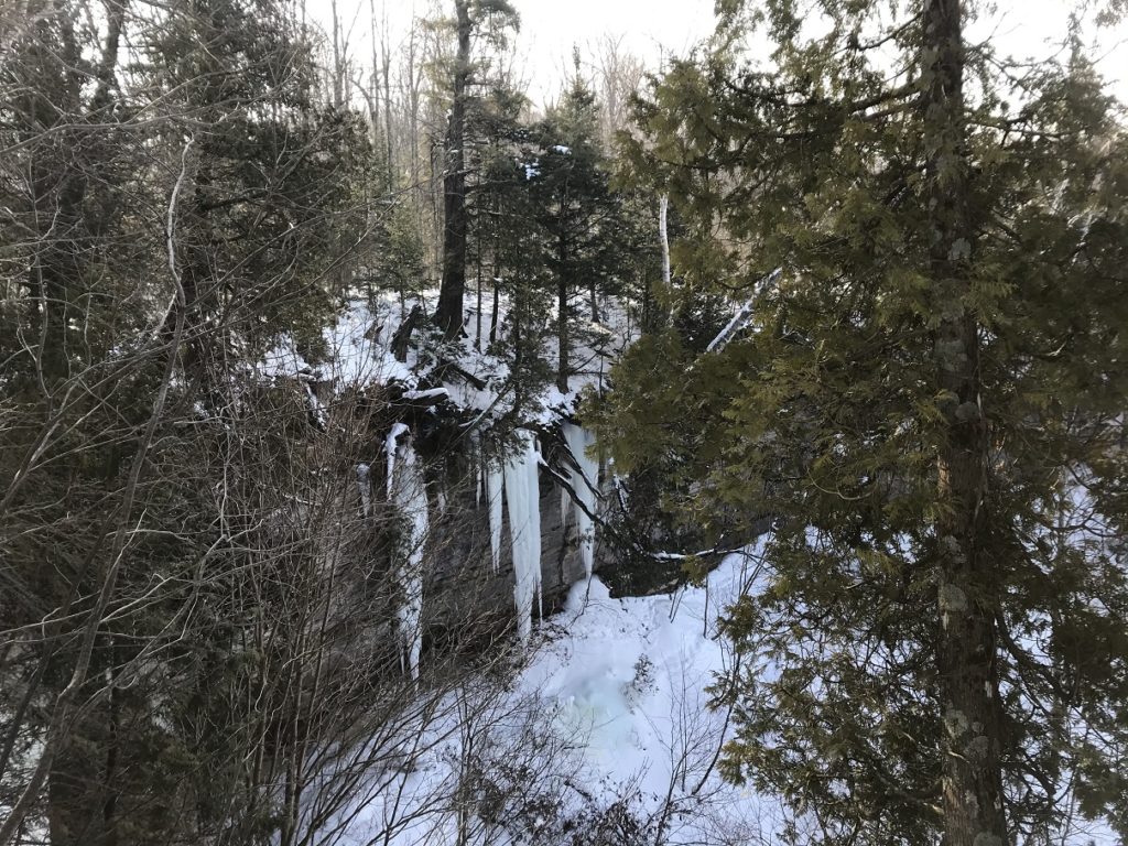
Emboldened by the weather (the temperature had risen to a balmy 12 degrees) and in the mood for a short hike, I walked a mile or so along the bluff tops. Although a narrow trail had been packed into the snow, any stray step plunged into well over a foot of powder. Whenever I ventured to glance up from my feet, I was treated to a series of bluff-top views and frozen waterfalls.
Returning to my car, I kicked the worst of the ice from the wheel wells, changed back into my gym shoes, and hit the road. I drove around the historic district of Prairie du Chien, across the river from Pikes Peak. Then I continued along the river on the Wisconsin side, pausing periodically for pictures of snowbound towns and bluffs fading into the dusk.
2-18
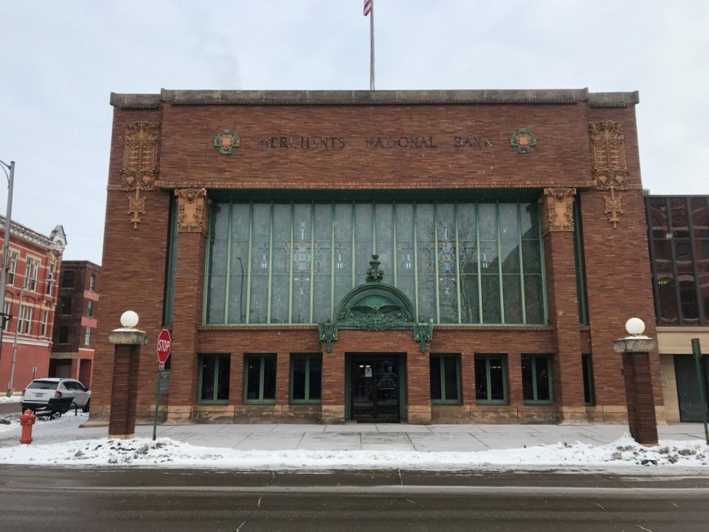
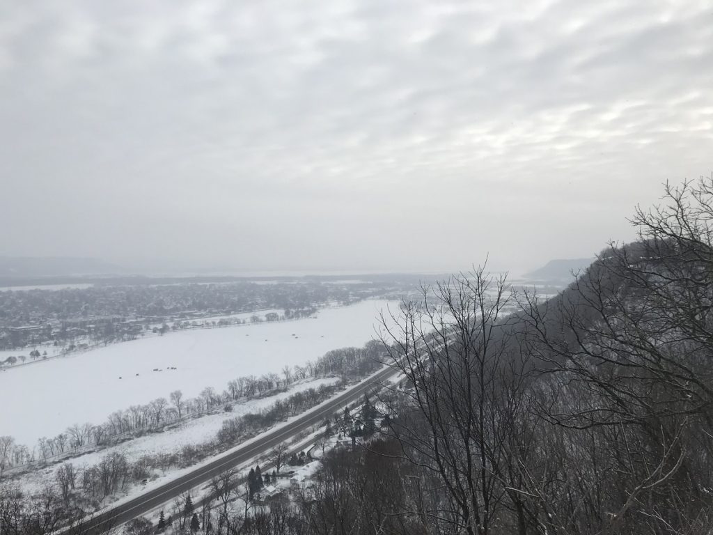
By the time I emerged from my hotel in La Crosse, the temperature had edged above zero – my car thermometer registered four above – and a light snow was falling. The snow intensified as I crossed the river into Minnesota, hiding the bluffs on the Wisconsin side. After stopping in downtown Winona to see a few gems of early twentieth-century commercial architecture, I drove to a bluff-top park for a sweeping overlook of the city and river, dreamlike behind millions of snowflakes.
Crossing back into Wisconsin, I continued north, trailing a wake of powdered snow. To my left was the white expanse of the river, punctuated here and there by the shanties and pickups of ice fishermen. On the right, a long line of bluffs gradually sank into forested hills. A half-hour or so from Winona, I followed a road deep into these hills to see the reconstructed cabin that marks the birthplace of Laura Ingalls Wilder. The cabin wasn’t much to look at – the wayside wasn’t even plowed – but there was something evocative about watching snow settle on the oaks that surrounded it.
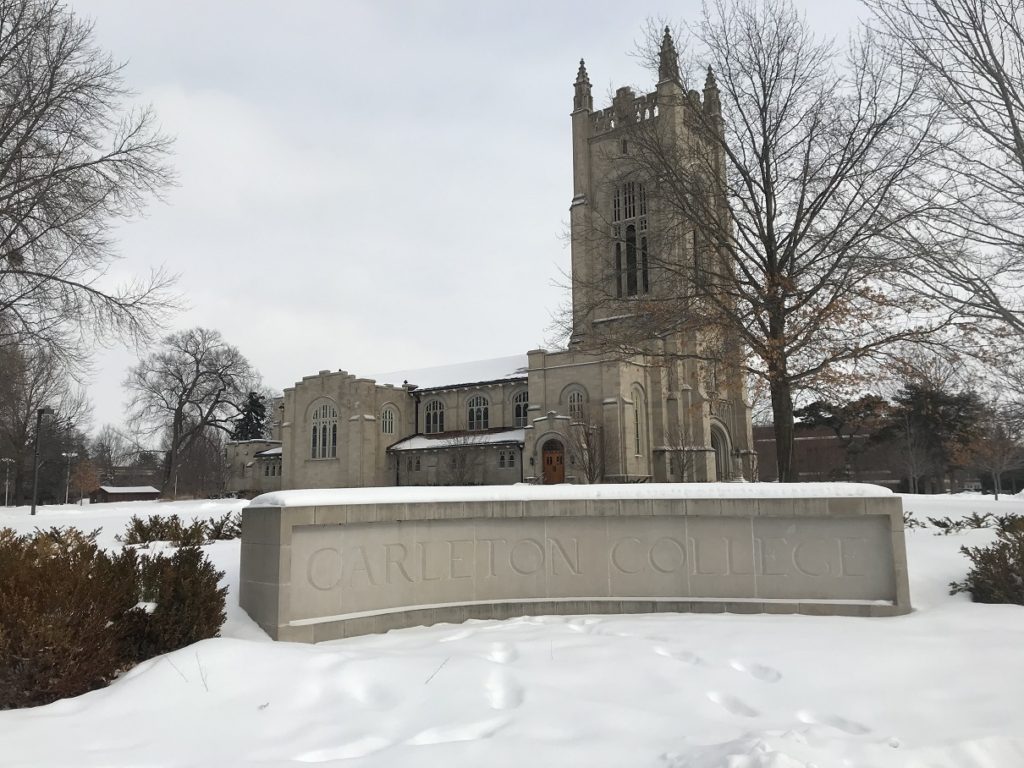
Crossing back into Minnesota at Red Wing, I drove through rolling hills to the town of Northfield, home of my alma mater Carleton College. Parking near the chapel, I pulled on my gloves and hat (the snow had stopped, but the temperature was still in the low teens) and walked around campus. Although I hadn’t visited since my graduation in 2009, almost everything was as I remembered it, down to the faint smell of baking cereal from the Malt-o-Meal plant in town. All that had changed, in fact, was yours truly – a ghost from another decade, wandering the haunts of its youth.
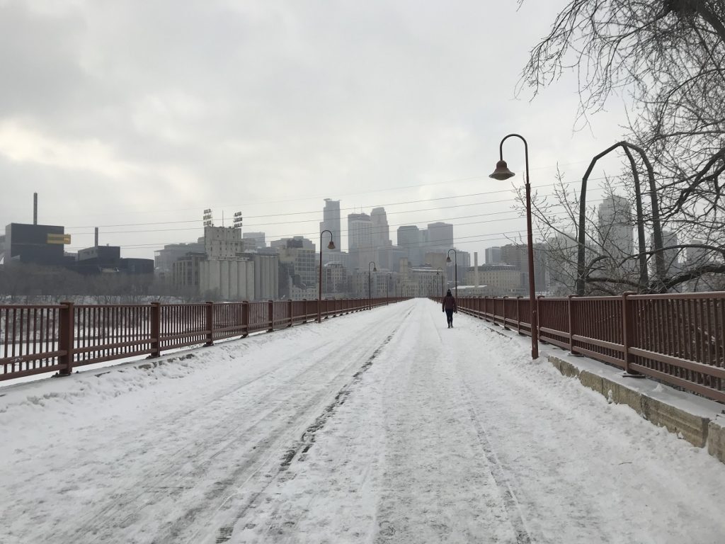
Fleeing the melancholy of middle age, I drove on to the Twin Cities. Although I’d spent a fair amount of time in Minneapolis and St. Paul during my years at Carleton (I used to moderate high school quizbowl matches there on weekends), I had never really explored them. So I started with a stroll down Stone Arch Bridge, the nineteenth-century railroad viaduct that crosses the Mississippi in the heart of downtown Minneapolis. A passing snow shower blurred the skyline and icy St. Anthony Falls. After a few pictures of Lock and Dam no. 1, I hurried back to my car (I’m fairly sure it was illegally parked) and headed over to St. Paul.
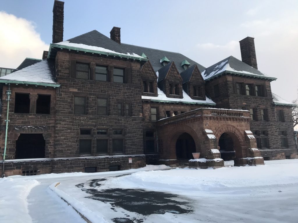
My first stop was The Nook, a great little bar / bowling alley famous for the “Juicy Lucy” – a hamburger with cheese backed into the patty. After savoring my burger (delicious but messy) at a table a few feet from the lanes, I headed back out into the snow for a trip to the Twin Cities’ largest used book store. Then, as sunset approached, I drove to Summit Avenue, the mansion-lined boulevard where Minnesota’s richest families lived a hundred years ago.
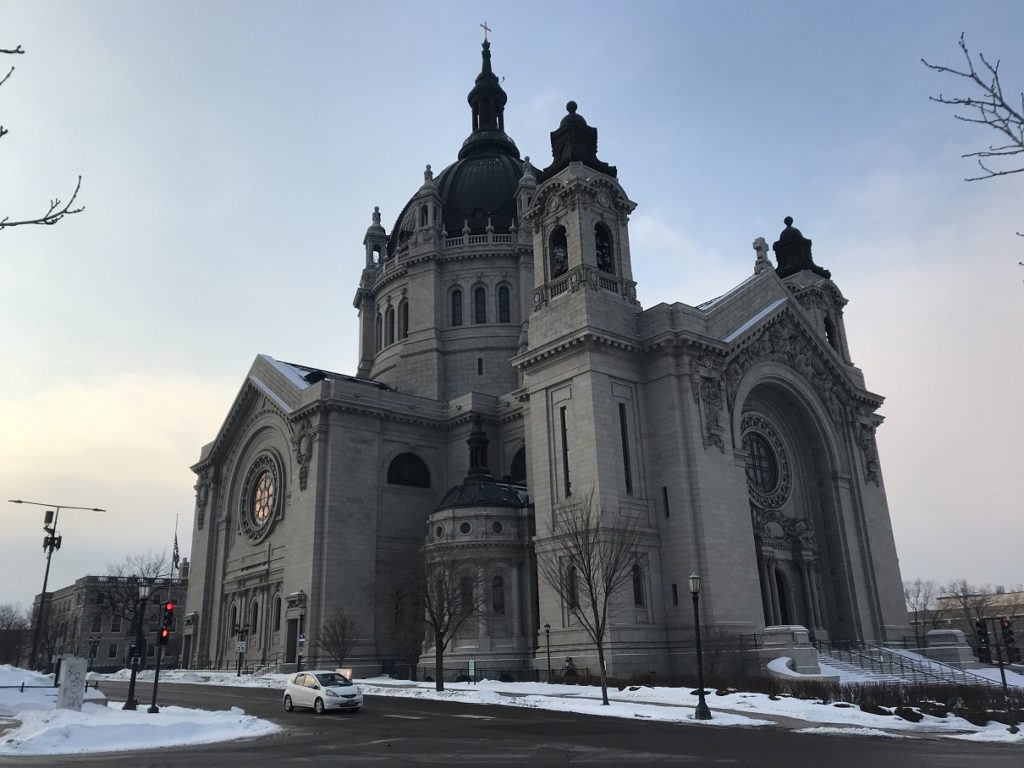
Parking in the vast Baroque shadow of the Cathedral of St. Paul, I stuck my hat and gloves back on and walked up the avenue, pausing occasionally for pictures of the vast old houses. The grandest of these, the gargantuan James J. Hill Mansion, was right next to my car. But dozens more were almost equally impressive, and I spent a pleasant hour and a half among them in the soft evening light, flurries dancing in the street lights.
2-19
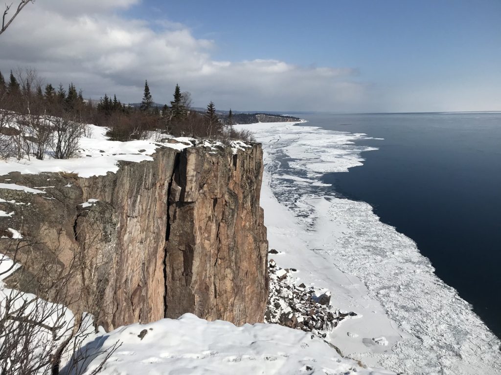
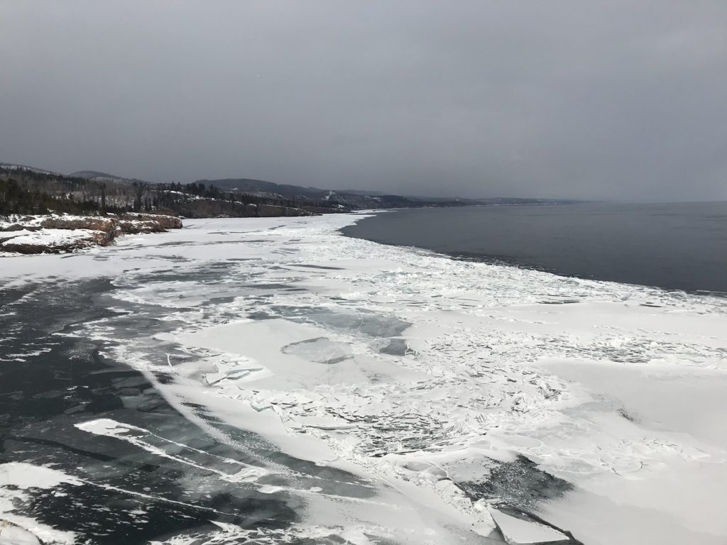
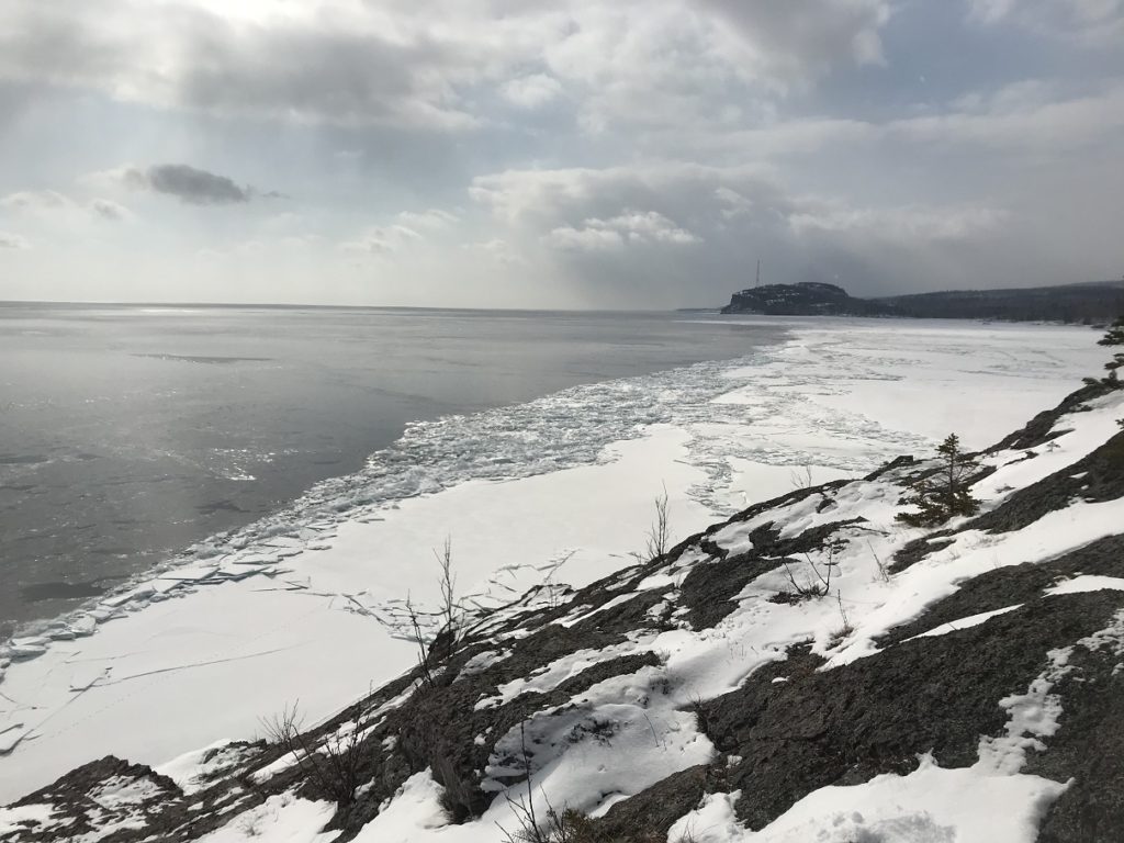
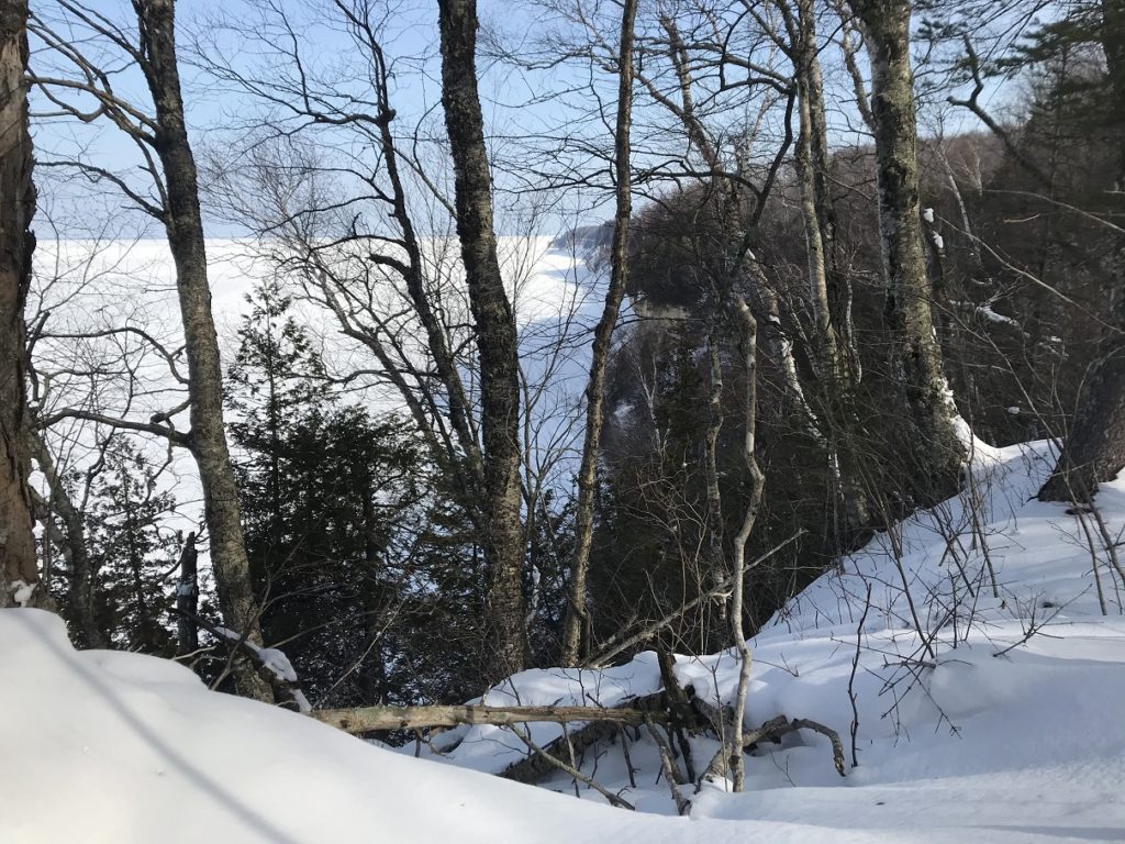
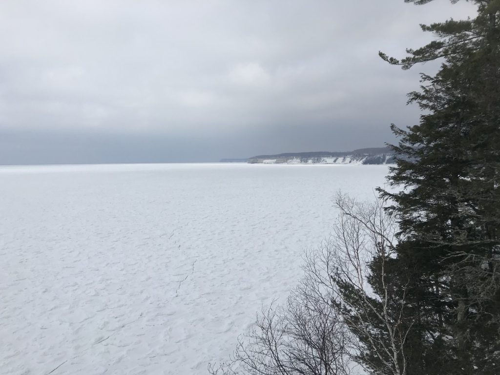
I started my car – according to the thermometer, it was one below zero – scraped the worst ice from the windows, and set out as the sun rose over the hazy Minneapolis skyline. Two hours or so later, I came into sight of Lake Superior, frozen as far as the eye could see. Passing through Duluth, I continued to Palisade Head, the most imposing roadside overlook on the North Shore. When I last stopped here, on an October day in 2019, the birches and maples on the hillsides had been in full fall color. Now the hills were shimmering with snow, and a galaxy of ice floes crowded the shore.
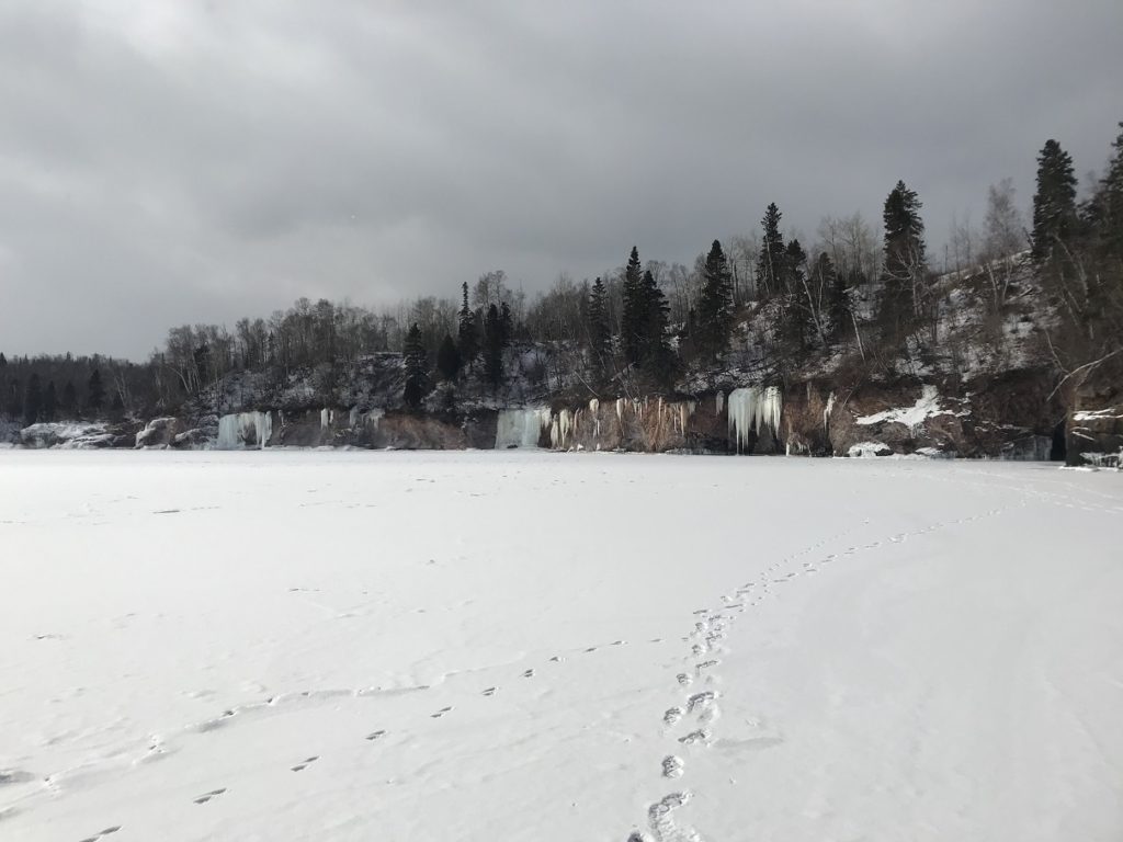
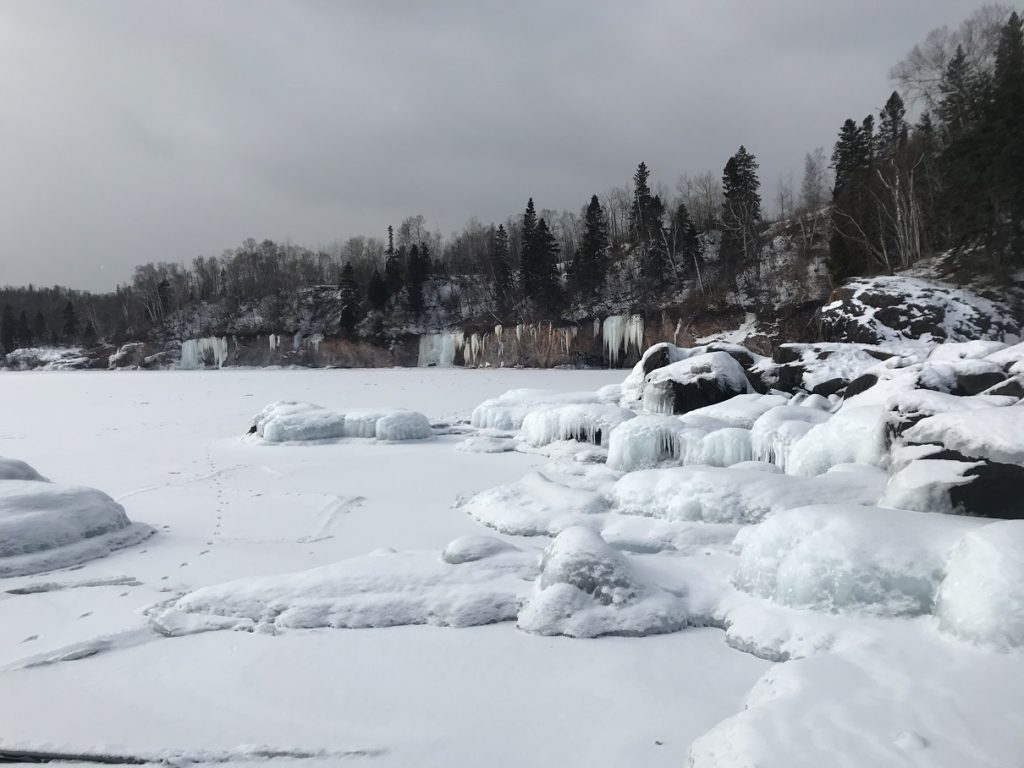
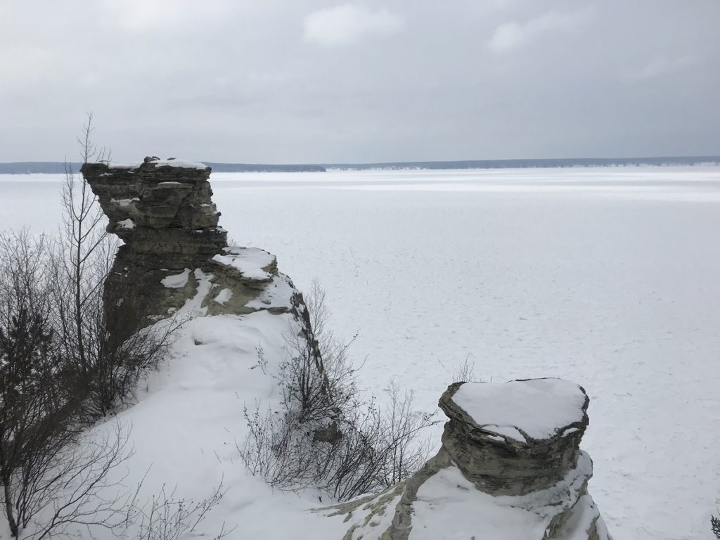
A few miles down the road, in Tettegouche State Park, I hiked out to Shovel Point, a long promontory that offers dramatic views of the Lake. Toward the beginning of the hike, I was startled by a series of booms and cracks – the familiar sound of ice expanding, amplified by the rocky cliffs. At Shovel Point itself, I was treated to a spectacular vista of glittering cliffs and piled ice, backlit by a tentative sun.
Following another trail down to the lakeshore, I ventured onto the smooth shore ice for a few pictures of glazed rocks and icicle-hung cliffs.
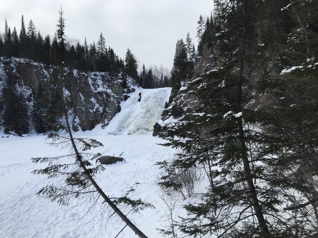
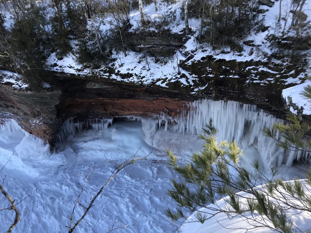
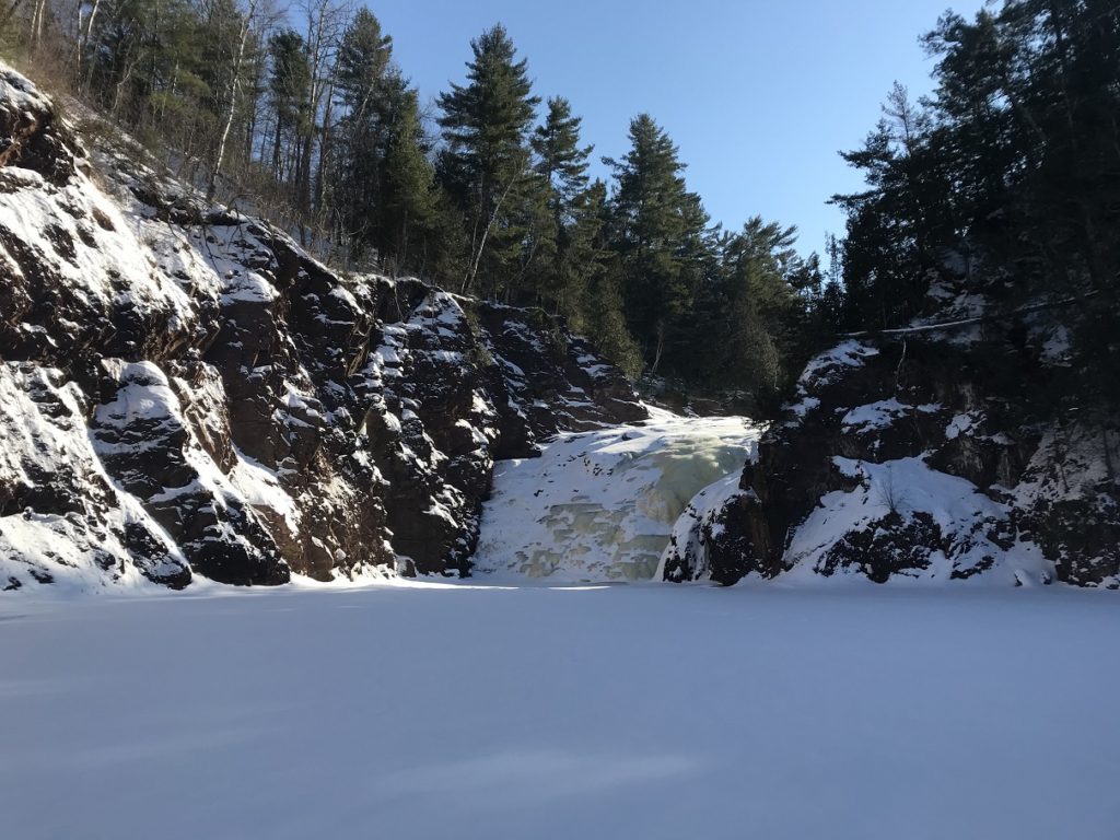
 Walking to the mouth of the frozen Baptism River, I ate my lunch (trail mix) while flurries drifted down over the ice. Then I hiked a mile and a half or so upstream. The main trail, overhung with snowy pines, was easy to navigate. The steps connecting the trail with the river, however, were icy to the point of impassability. I could only go down by “skiing” on my hiking boots, and could only get up by wading into the deep snow on the either side of the path and clinging to every convenient tree. The effort of getting down the final staircase, however, was justified by a spectacular frozen waterfall, dusted with fresh snow, at the head of an amphitheater-like canyon.
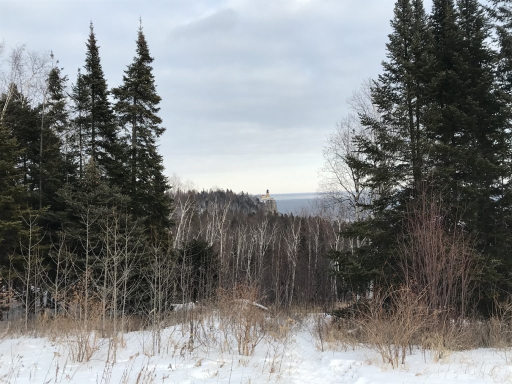
Returning to my car, I headed back to Duluth, stopping only for a few pictures of the Split Rock Lighthouse.
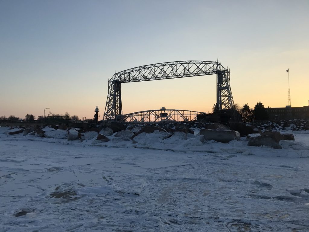
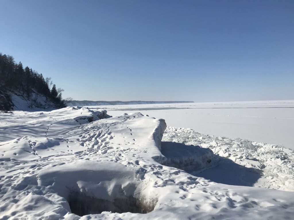
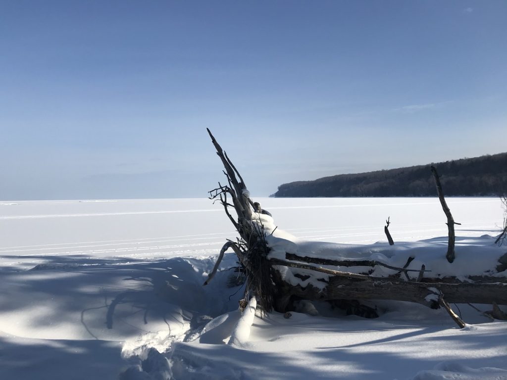
In Duluth, I parked beside the Aerial Lift Bridge. After a few pictures of the frozen harbor and ship channel, I walked out onto the lake ice (here, as I could see from cracks, at least two feet thick). The bridge and channel lighthouses were glowing in the sunset, and the snow-covered lake shone.
2-20
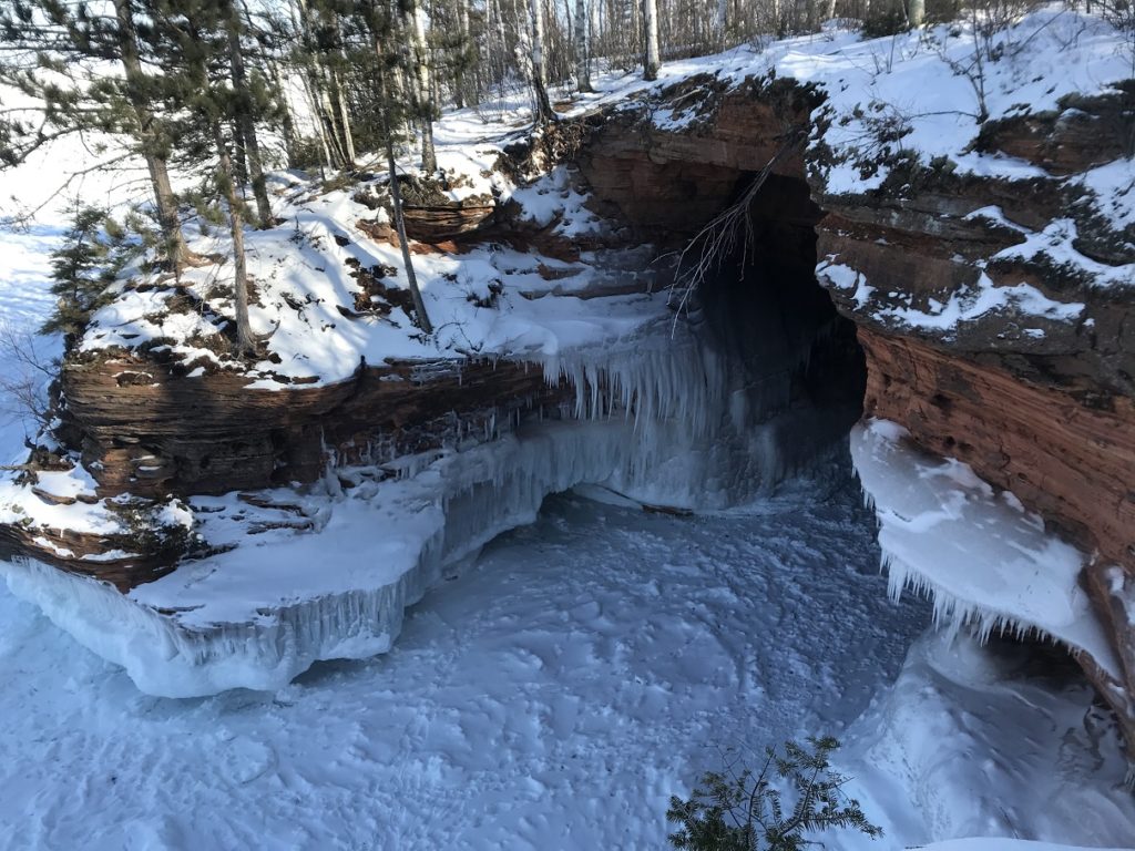
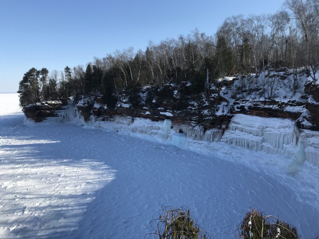
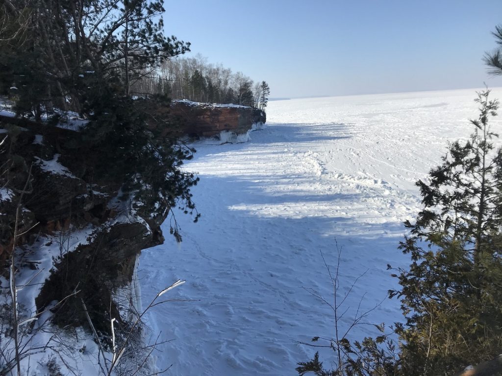
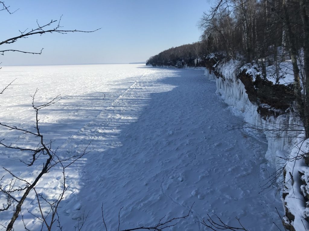
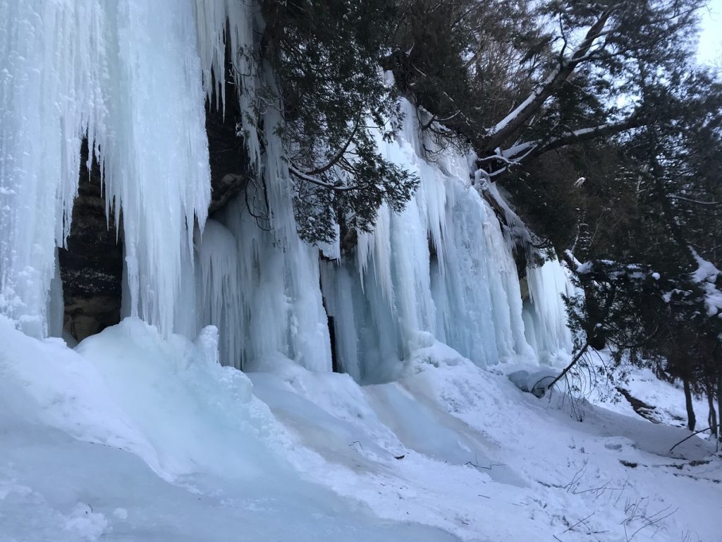
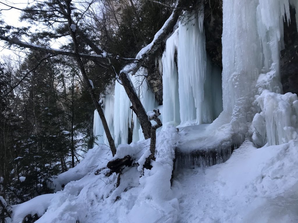
Sunny and three below this morning. Heading east, I passed fields of sculpted drifts, snow-covered pines, and – through gaps in the trees – moonscapes of lake ice. After about an hour, I entered the Apostle Islands National Lakeshore, famous for the ice caves that form along its lakeside cliffs in winter. Thanks to a combination of global warming and bad luck, the caves – once open almost every year – have been closed to the public since the winter of 2015. After the cold weather of the last two weeks, there was some hope that they would be opened again. Yesterday, however, the park announced that, thanks to rough ice and the general inadvisability of drawing crowds during a pandemic, the caves would remain closed.
Although I hadn’t expected the caves to open (and had no desire to cope with crowds), I was disappointed – and frankly tempted to venture out onto the ice anyway. But in the end, common sense (and the knowledge that I would probably be reported to a ranger) kept me on the Lakeshore Path, which runs atop the bluffs overlooking the caves.
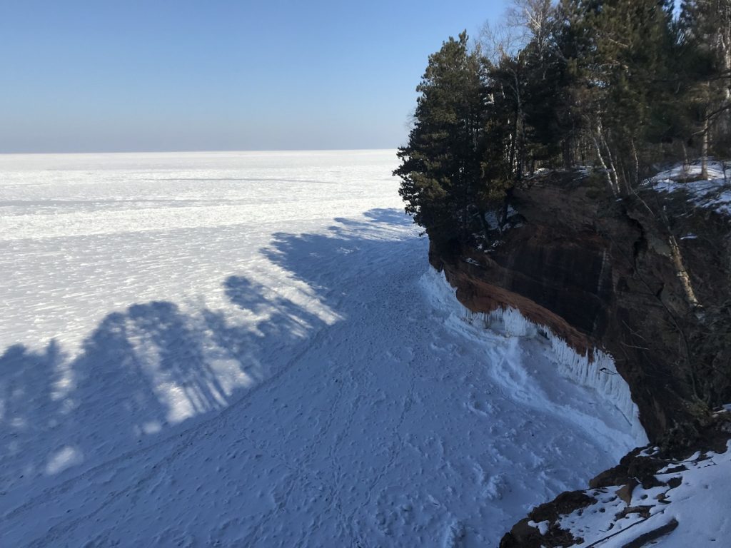
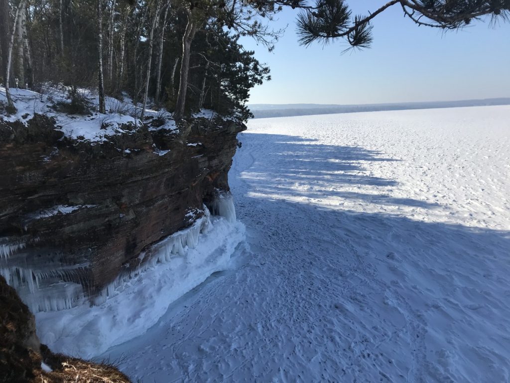
After about a mile beneath snowy pines, Lake Superior came into view, frozen as far as the eye could see. Soon, the first ice caves came into view. As caves go, they aren’t very impressive. Most, in fact, aren’t really caves at all – just shallow alcoves in the sandstone. In winter, however, pounding waves and seeping springs transfigure these unprepossessing hollows into spectacular walls and columns and castles of ice.
After a few miles, I retraced my steps to the now-crowded parking lot and headed east on US-2. Although the highway was almost deserted, the snowy shoulders were buzzing with snowmobilers. An hour or so from the Apostle Islands, I followed a series of ill-plowed roads to Superior Falls, a remote lakeside waterfall that I’d encountered in a guidebook. As at the Apostles, the lake was frozen as far as the eye could see. Here, however, the shore was fenced by jagged bouquets of ice.
The waterfall, a few hundred yards inland, was even more spectacular: a cobalt blaze slashing across an amphitheater of red stone.
Continuing eastward, I stopped in Hurley, WI – buried beneath at least three feet of snow – and neighboring Ironwood before settling in for the long drive to Marquette.
2-21
It was warmer this morning – well into the teens – but breezy; snow from the hotel roof showered my car as I loaded the trunk. I drove straight to the day’s main destination: Pictured Rocks National Lakeshore. I began by exploring a series of ice formations produced by springs spilling over a low sandstone cliff. The central formation – “The Curtain” – was as impressive as anything in the Apostle Islands.
Since my favorite part of the park – the area around Chapel Beach – was inaccessible, I settled for a ten-mile hike up and down the North Country Trail. Here, as for most of its length, the trail runs along bluffs overlooking Lake Superior. The woods – maple and birch, punctuated here and there by groves of huge cedars – were quiet and shrouded with snow. Waterfalls shimmered at the heads of plunging gorges. Across a frozen bay, forty-foot icicles shone on the cliffs of Grand Island.
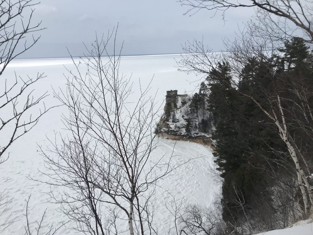
I finally emerged at Miners Castle, the most famous of Pictured Rocks’ sandstone formations. In the distance, around Grand Portal Point, ice-sheathed cliffs gleamed.
The hike back, like all return hikes, seemed much longer than the hike out. It was made even more unpleasant by a strong south wind that knocked snow from the treetops and opened a huge crack in the ice of the bay below.
When, at long last, I returned to my car, I performed my usual post-hike ritual – change shoes, restock trail mix, plug in ipod – and set out on the long drive south. At first, the trip was uneventful – woods, more woods, and the northern end of Lake Michigan, dotted with ice shanties. Then the snow started to fall. Light at first, it soon became steady enough to cover the road. It took me two hours of white-knuckle driving to get to Green Bay.
2-22
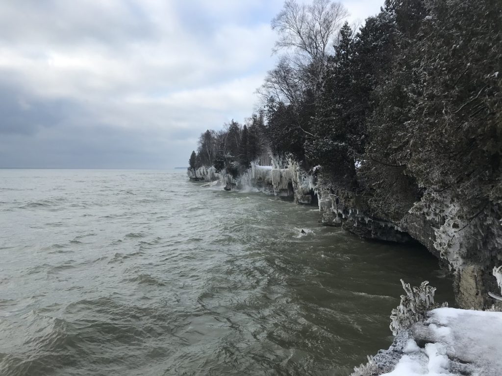
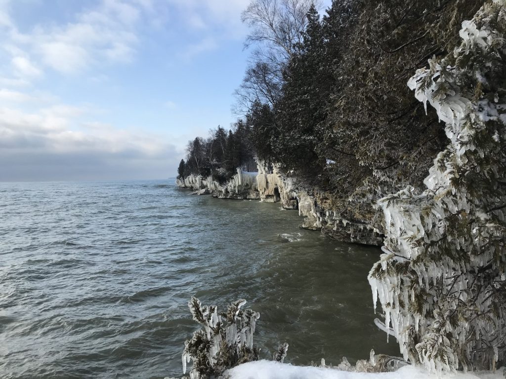
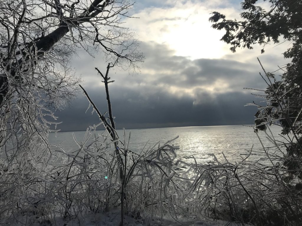
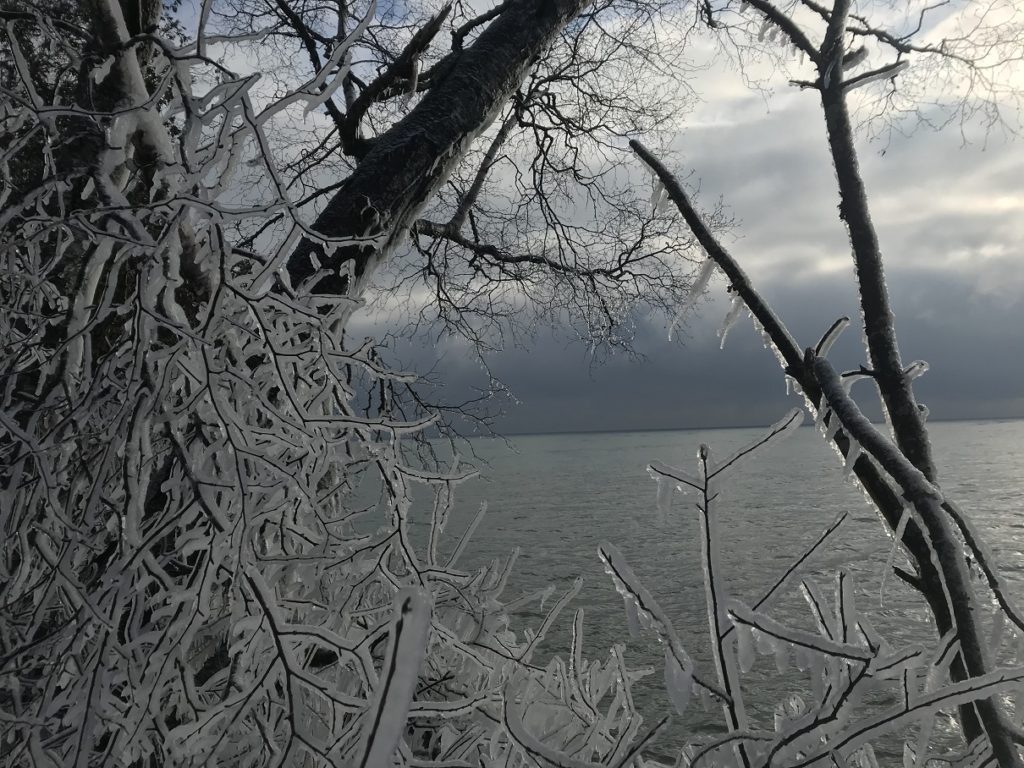
Brushing two inches of fresh snow off my car, I set off into Door County. During summer, this is vacationland, overrun by antiquing retirees and RVs with Illinois plates. In late February, however, even Door County is quiet. I was the only visitor at Cave Point County Park, famous – among people who visit Door County, that is – for its limestone sea caves, which waves strike with a roar that can be heard for a half mile. Thanks to a stiff south wind, the waves were in fine form during my visit, surging and booming over the rocks.
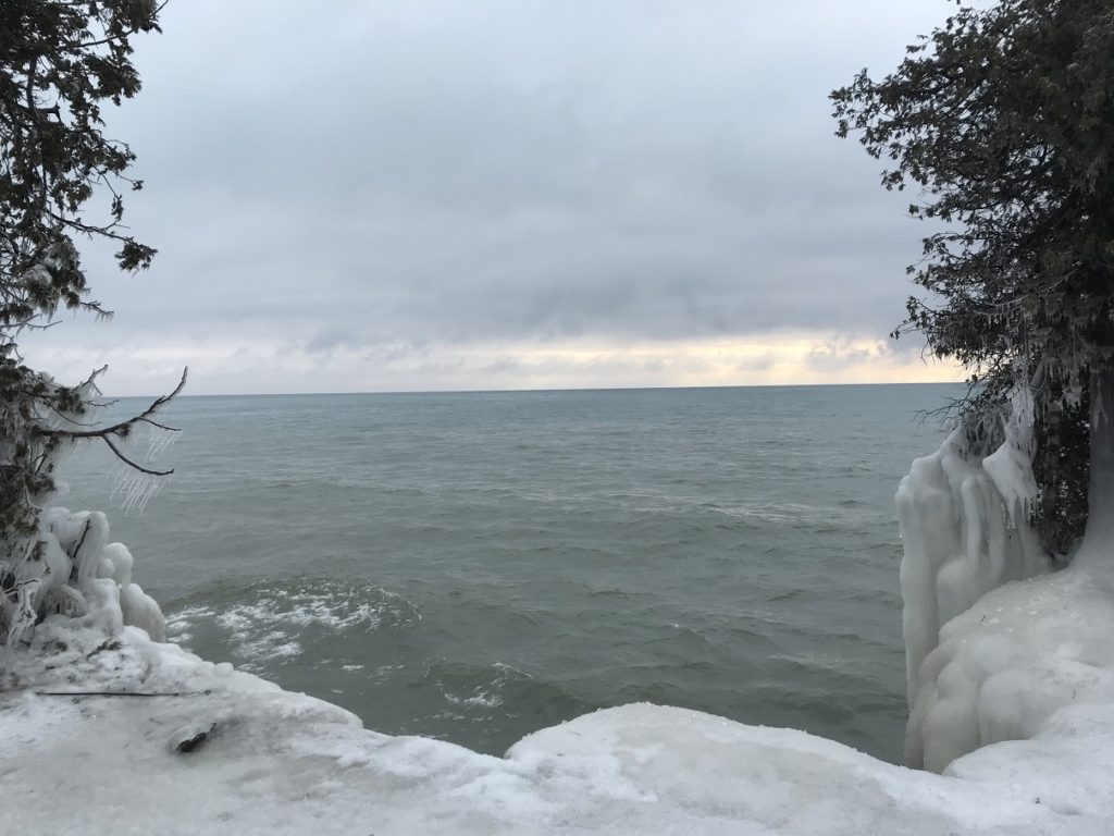
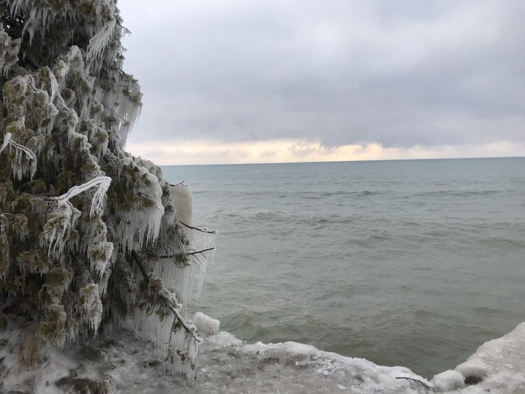
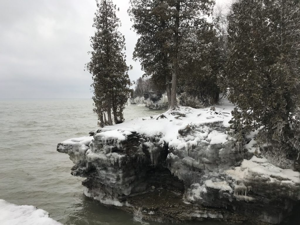
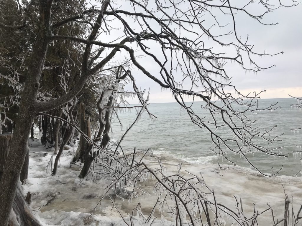
In winter, the spray flung by the waves sheathes every rock and tree along the shore in thick layers of ice. During my visit, the dramatic ice formations were counterpointed by the sky –brooding clouds at first, then brilliant shafts of sunlight. Far out over the lake, beyond the glittering trees, snow slanted down on the gray lake.
After Cave Point, the rest was anticlimax. I detoured to visit a house and factory designed by Frank Lloyd Wright in snowbound Racine. Otherwise, I let the salt-streaked interstates carry me home.