9-11-13. Asarkoy & Kovanlik, Turkey
I decided to round off my exploration of Lycia and Pamphylia with two remote sites. The first was actually within sight of my hotel balcony in Belkis. Looking north towards the brown hills of Pisidia, I could make out an isolated mesa, seperated from the main range by some geological freak. This was the site of Sillyon, the fortress-city which dominated western Pamphylia at the time of Alexander’s conquest. Though never as wealthy as nearby Aspendos, Sillyon enjoyed several periods of prosperity. The extant ruins mostly belong to two such periods, separated by more than a millennium: the Hellenistic era and the early years of Seljuk rule.
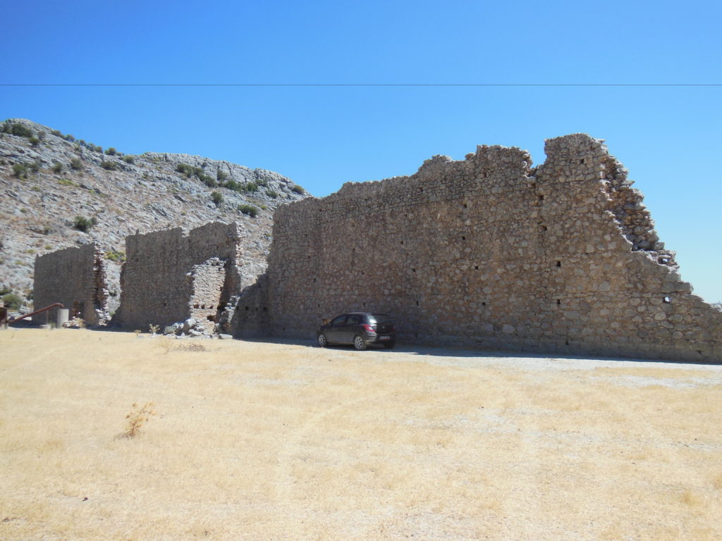
Sillyon is approached from Asarkoy, a hamlet populated by a few dozen houses, a hundred or so inhabitants, several thousand sheep, and dogs uncountable. After narrowly evading several vicious curs, I made it up the path to the ruins, and soon reaching the two most distinctive Roman ruins: a badly ruined stadium (now used to pasture cattle), and the so-called “palace,” actually a large bath.
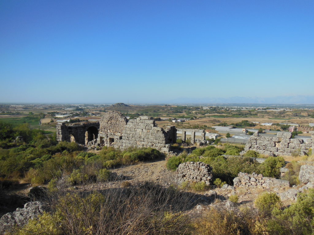
Just upslope stood the buttressed Hellenistic walls, expanded and modified over fifteen centuries of use. When I finally scrambled up to the top of the mesa, I could see little over the thick brush besides the shattered tops of a few stone facades. Navigating towards the nearest of these, I found myself before a well-preserved late Byzantine or Seljuk building, perhaps the palace of some commandant or princeling.
The rest of the area was too overgrown to explore and – much as I hated to admit it – too dangerous. Like most mountaintop cities, Sillyum stored its drinking water in deep cisterns. Most of these remain open, their openings concealed by brush. On several occasions, I found myself suddenly poised over a pit twenty or thirty feet deep. The bottoms of many cisterns were littered with sheep bones. Having no desire to end my vacation in like manner, I made my way to the other end of the mesa.
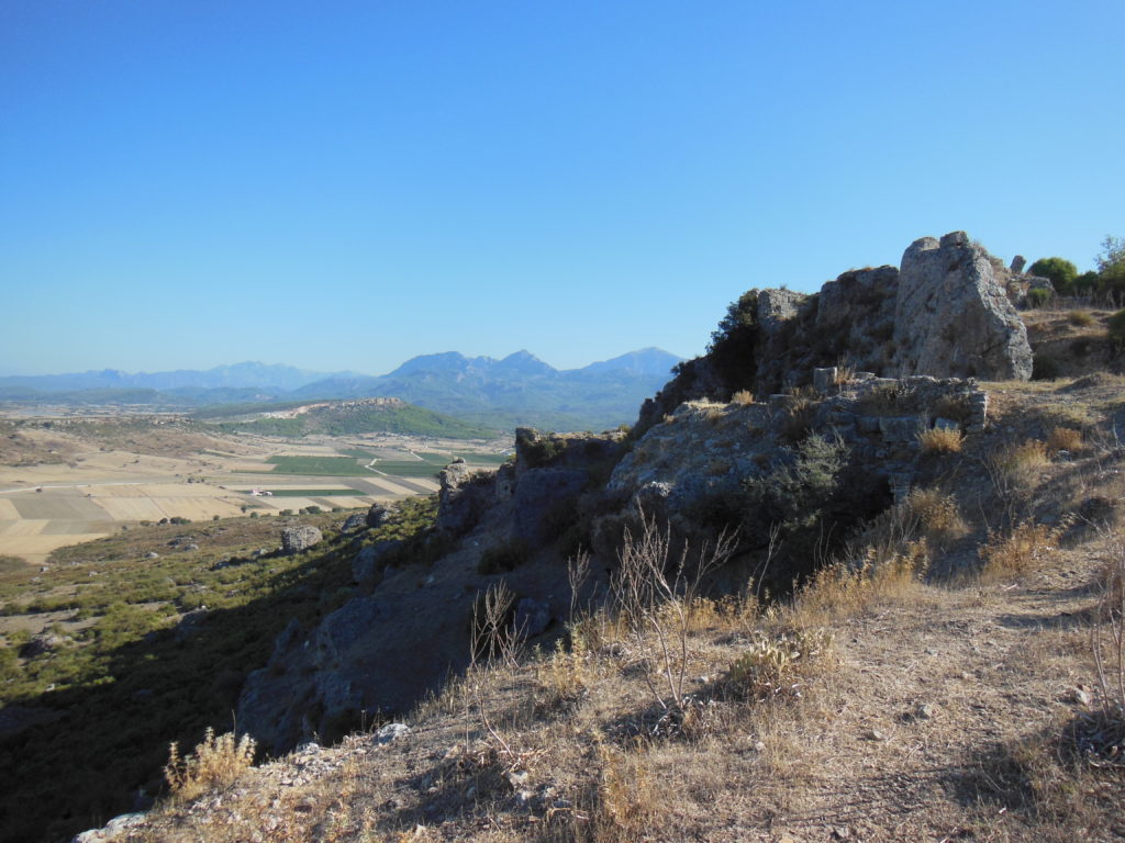
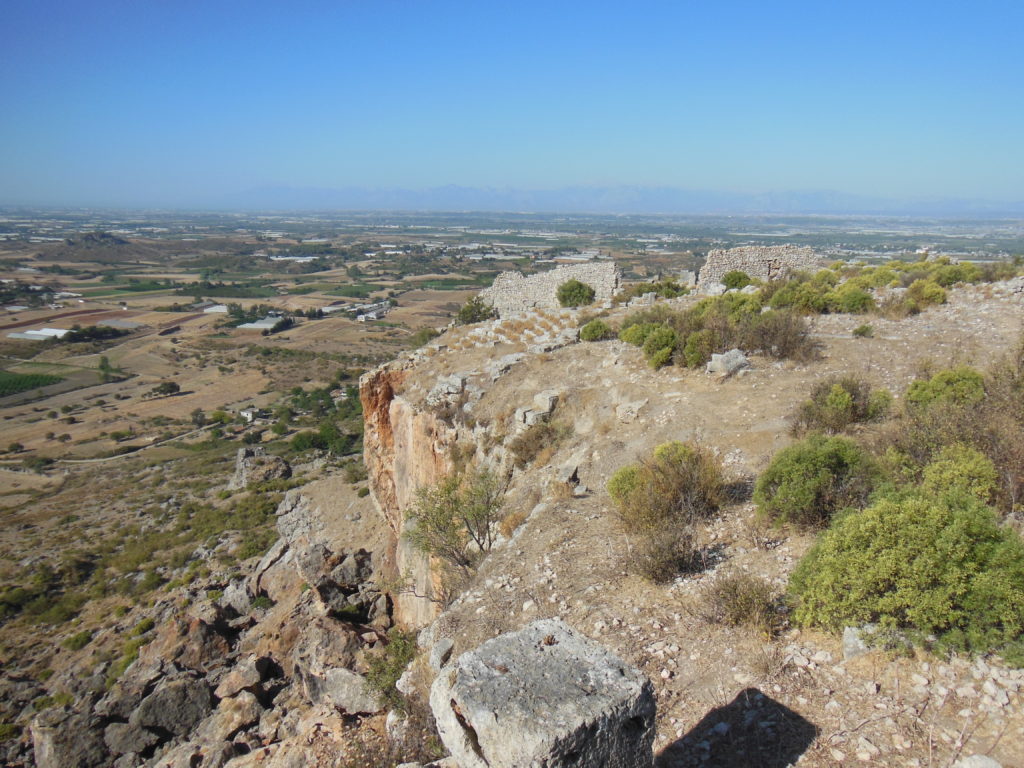
Here, where the butte walls rise two hundred feet sheer from the plain, periodic rockslides have carried away much of the ancient city center. The theater has almost disappeared, along with half of the adjoining Odeion, long stretches of wall, and a few of the ubiquitous cisterns. Though the cliffs further north seem to be more stable, great cracks are everywhere opening twenty to thirty feet back from the present face. The next big earthquake will likely bring most of the wall circuit down. For the present, however, one can walk the original rock-cut stairs and streets behind the defenses, pausing occasionally to admire the view over the surrounding mountains and plain.
On the climb back down to the village, I took an unplanned detour (having missed the path) down a thirty-foot slope composed entirely of ancient pottery washed down from the plateau. The experience was of being knee-deep in potsherds was novel, but extremely uncomfortable.
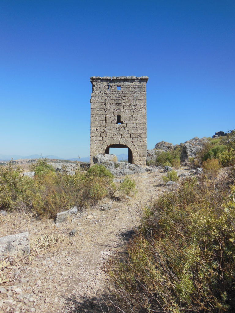
I finished my tour of Sillyum with the city’s best-preserved ancient monument, a three-story Hellenistic watchtower preserved to its full height. As I stood inside the building, I couldn’t help noticing the enormous cracks that fissured every wall. Like the rest of Sillyon, this will not be a congenial place during the next earthquake.
From Asarkoy, I set my GPS to find a village near my next destination, a well-preserved stretch of the Roman Via Sebaste. Laid out around the birth of Christ and repaired through the Ottoman period, this was the main north-south highway between Lycia and Pamphylia and central Anatolia for well over a millennium. The section I wanted to visit was the famous Climax pass, crossed by both Alexander the Great and St. Paul.
The pass is now about five kilometers northeast of the little village of Kovanlik. My GPS decided to have its way with me one last time, directing me over two unpaved mountain tracks. When I finally reached Kovanlik, I discovered that – in good Turkish fashion – the turn from the highway was marked, but none of the subsequent six intersections were. Only a combination of intuition and luck brought me to the gray ruins beneath the pass.
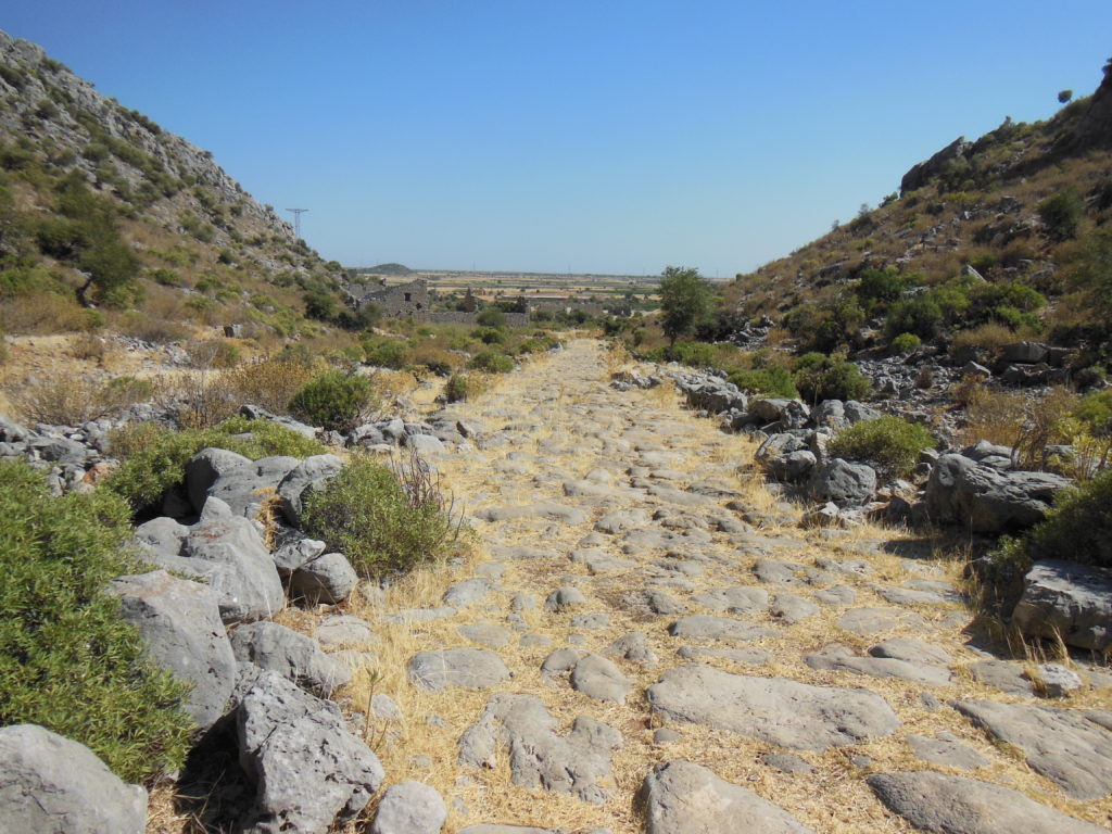
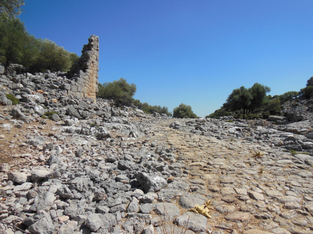
I parked in the shadow of an Ottoman caravansary, and walked along the paving stones of the highway through the ruins of a Roman town. Though the street grid was still readily discernible, only a few buildings stood higher than three or four feet, making it difficult to identify the main public spaces. The Via Sebaste itself, however, still ran through the middle of town. The best-preserved building, apparently an official inn or staging post, stood two stories high just beside the road.
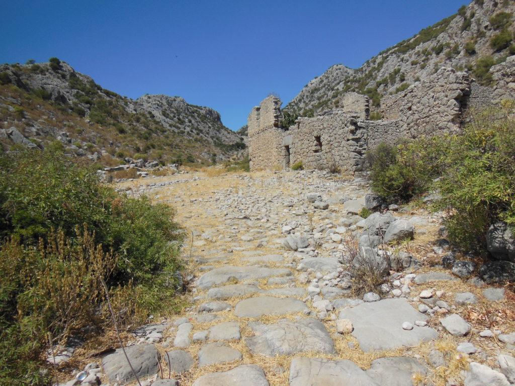
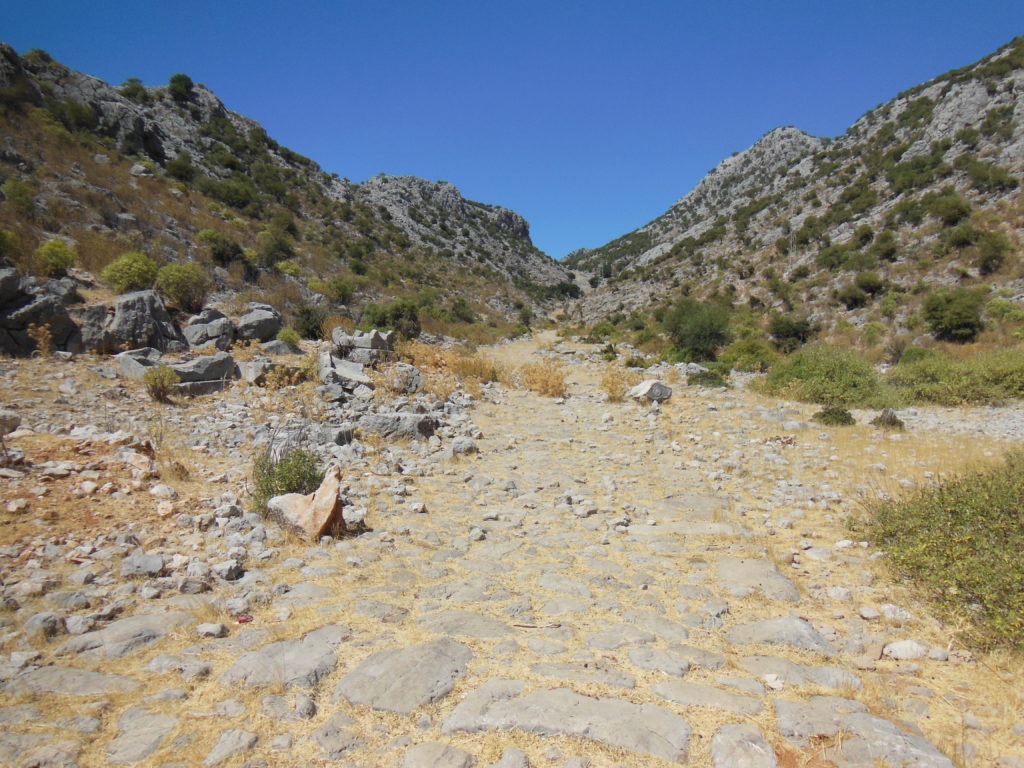
Past the few tumbled sarcophagi that marked the location of the town necropolis, the Via Sebaste climbed five kilometers to the top of the pass. Two distinct roadways were visible: on the left, the first-century Roman road drove arrow-straight between the peaks; on the right, a more recent (fifth- or sixth-century) Byzantine highway handled the slope more accommodatingly, taking the steeper sections with switchbacks and steps. For the long sections, the original paving stones of both roads were visible; a few parts, however, were completely covered with scree fallen from the slopes on both sides.
As I neared the head of the pass, I began to see the gray ruins of another Roman/Byzantine town about the same size as the settlement at the foot. Among the more notable buildings were a Late Antique chapel and ruined temple-tomb, the latter sadly damaged by looters.
After stopping to photograph these and a few inscribed sarcophagi, I turned and picked my way back to the car.