4/4 – 4/5/19
4-4
Rattled out of bed by a peal of thunder, I drew back the curtain to see sheets of rain whipping the motel lawn into a muddy froth. I pulled on my rain jacket and ran over to the hotel office to eat breakfast and recalibrate my itinerary. I had intended to occupy most of the day kayaking in northern Louisiana; but since the river I wanted to paddle was now in major flood, it made more sense to remain on terra firma, and spend the morning exploring Hot Springs National Park.
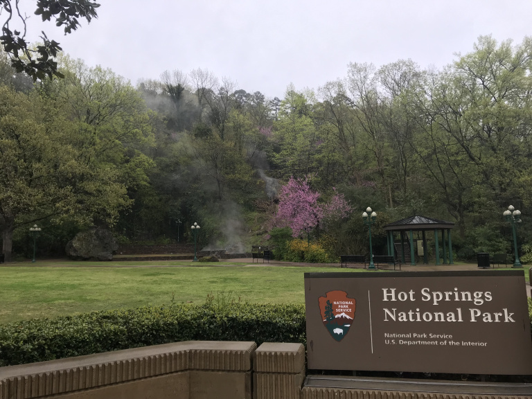
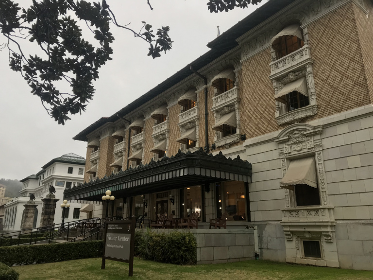
Hot Springs has always been something of an oddball in the National Parks system. It is located entirely within the city of Hot Springs, and actually fronts the busy main street. The naturally-heated pools and seeps after which both park and city are named were channeled and covered long ago, leaving only a few smoking fountains. The rest of the water is pumped through the buildings of Bathhouse Row, the center of the national park. From the late nineteenth to mid-twentieth century, thousands of well-heeled bathers visited this line of bath buildings for real or imaginary cures to a wide variety of ailments. I toured the facilities of the most imposing bathhouse, now the headquarters of the national park, and then ventured out into the pelting rain to peer at the others.
During a brief lull in the storm, I explored the streets around the bathhouses, dominated by towering art deco hotels – several obviously empty and decaying. Fresh peals of thunder and a renewed downpour, however, sent me scurrying back to the car. After visiting a bike shop to have my pedals fixed, I rounded off my stay in Hot Springs with lunch at another barbeque joint, where I tore into a pulled pork sandwich and the best baked beans I have ever tasted. Then, back on the road, and down another series of twisting two-laners in pouring rain and dense fog.
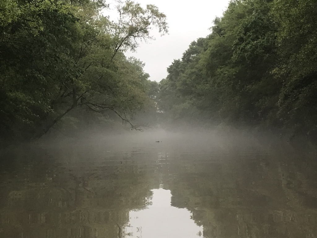
After splashing through the scrubby fields of southern Arkansas and northwest Louisiana, I reached Shreveport, where I spent a pleasant hour strolling through the Fairfield Avenue historical district. This neighborhood, built by the city’s oil-flush elite in the roaring twenties, featured an impressive array of mansions in various revival styles. To my Midwestern sensibilities, however, the real highlight was the lush landscaping. The spreading oaks, glossy-leaved catalpas, and flowering shrubs (and, of course, the swarming mosquitos) made me feel that I had finally entered the south.
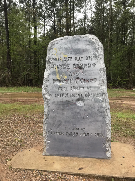
After stopping briefly at a Shreveport restaurant famous for its pie, I pushed eastward across northern Louisiana on old route 80, passing a series of collapsing gas stations and gutted small towns in a spitting drizzle. About an hour along, I turned down a lonely rainswept road to see the monument marking the place where Bonnie and Clyde were gunned down in 1934.
My taste for obscure Americana momentarily sated, I continued eastward to Monroe, and my next motel.
4-5
As I drove south, flat cornfields gave way to pine forest, and then to lusher vegetation as I approached Lafayette. After stopping for a bowl of gumbo, I continued through Cajun country, where live oaks draped with Spanish moss shaded the narrow roads, and every little town had its lines of tin-roofed bungalows and cemetery of whitewashed mausoleums.
To judge from the dozens of signs along the highway, the local imagination seemed to have been captured by an upcoming election for county – or rather, parish – sheriff. The chief contenders appeared to be two men named Breaux and Theriaux. Breaux had much better posters: one showed him with a cowboy hat, another with a jacket draped casually over his shoulder. All Theriaux’s posters, by contrast, showed him standing uncomfortably in an ill-fitted suit.
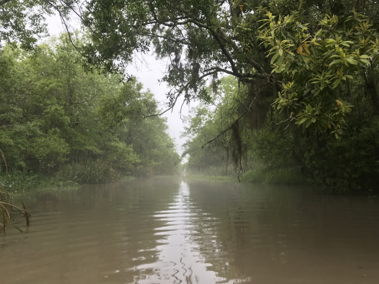
The morning’s drizzle resumed as I approached the Gulf coast and the town of Franklin, near which I planned to kayak in the Bayou Teche National Wildlife Refuge. Changing into my swimsuit in a rather grim gas station / casino, I launched just beneath the US-90 bridge in a driving rain. This soon slackened, and was replaced by a clinging mist that cut visibility to a few hundred feet.
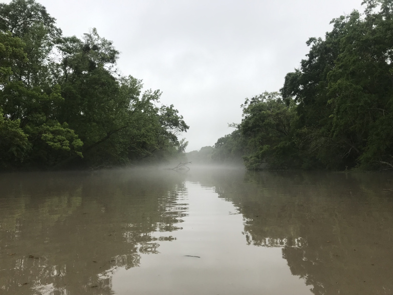
I began along the Franklin canal, used by fishermen and the occasional barge heading to the Gulf or the Intracoastal Waterway, both about five miles from where I started. Well before I reached either, however, I turned down a much narrower channel into the wildlife refuge.
The mist was even thicker here, making it difficult to see more than thirty or forty feet. Trees formed a tunnel overhead, and the banks bristled with jungle-like overgrowth. An alligator crossed the channel about fifteen feet in front of my kayak before sinking, silently and unnervingly, into the still water. As I continued, the fog and vegetation grew even denser. Tendrils of Spanish moss brushed my arms, and clouds of insects danced around my head, blissfully indifferent to the repellent.
After about an hour, fed up with the bugs and worrying about time, I turned around, and made my way back against the surprisingly strong current on the Franklin canal. Upon returning to my car, I discovered that I had parked my bike beside a colossal nest of fire ants, which attacked me as I attempted to recover it. Once I finally succeeded, I merged, welted, back onto US-90, and sped through the bayous and cypress swamps toward New Orleans. A massive thunderstorm was parked over the city; and once night fell, regular flashes of lightning lent a curious sense of drama to the drive. The towering bridge over the Mississippi, flanked by galaxies of refinery lights and backlit by the storm, had an especially lurid feel. Then out into the humid night, and my New Orleans hotel.