12/31/18 – 1/7/19
A few months ago, some of my friends from Carleton College began to plan a New Year’s reunion in Austin, Texas. After dragging my feet for the usual reasons – flights were expensive, and I would have to wear something besides sweat pants – I finally decided to go, and to make the trip an occasion for visiting Big Bend National Park.
12-31
After an uneventful flight, I picked up my rental car at the Austin airport, and met my friends for dinner at a Thai place in one of Austin’s rapidly-developing shopping centers. Afterward, we took a (conveniently free) bus downtown, where a walk past the bars on Sixth Street made me feel very old – but not too old, fortunately, to appreciate the firework display on the river.
1-1
I was woken by my friend’s cat head-butting my face. The rest of the morning was comparatively subdued. We visited the Harry Ransom Center (where we duly admired a Gutenberg Bible and the first photograph ever taken), had a leisurely lunch at a pizza place, and speculated about the animals most likely to attack me on my upcoming trip. Then, with a round of hugs and an armload of borrowed fruit, I set out on the long drive to West Texas.
As I drove northwest, the temperature plunged through the thirties beneath a low ceiling of scudding clouds. The topography, fortunately, was more varied. For the first hour or so, I followed a series of two-lane roads up and down the Hill Country. As the landscape leveled and the scrub oaks dwindled to scrub proper, the regular small towns of the Hill Country gave way to an endless series of cattle fences, punctuated by the occasional gate for an unseen ranch. Finally, after a long stretch between fields of dead and rustling cotton, roadside oil jacks advertised my arrival in the Permian Basin. The jacks thickened as I approached Odessa, where the darkening sky was splotched by gas flares.
1-2
Up hours before dawn, I stepped out of my room to discover that a freezing fog had slicked every surface with thin layer of ice. I picked my way over to the office, where I watched a news broadcast warning about hazardous driving conditions as I wolfed down my waffle. The next few hours were marked by a series of unpleasant surprises. As I gingerly turned onto the highway, a warning message about low tire pressure (doubtless from the cold) flashed on my dashboard. So I had to slide into a gas station, buy a tire gauge, and top off my air with numb fingers. When I finally got on the interstate, I made it only a few miles before being stopped for more than an hour by a nasty accident just ahead.
Once I escaped Odessa, I sped as fast as I dared through the gray heart of the Permian Basin. Low clouds streamed over a landscape of whistling grass and endless ranks of oil jacks and gas flares. Past a string of dead little towns surrounded by drilling debris, I turned down a long two-lane highway roaring with tankers.
As I approached the New Mexico border, the traffic thinned, and the grass and shrubs along the road began to be coated with ice, which grew thicker as I approached the Guadalupe Mountains. Shortly before the entrance to the national park, the freezing fog responsible for the icing reappeared, reducing visibility to a hundred feet. Squinting through the fog, I found that the park gates were chained shut, apparently because conditions were too hazardous for hiking. Deliberating what to do, I drove just past the park, and stopped by an ice-coated picnic shelter. The surreal beauty of the frozen meadow beside it convinced me that I had to try to get in.
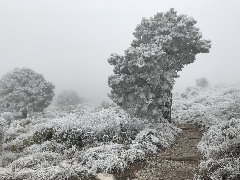
In the end, I found that I could simply walk into the park along a path not far from the main entrance. My original agenda for the day had been to ascend Guadalupe Peak, the park’s centerpiece and the highest point in Texas. As I walked past the deserted visitor center and empty parking lots, I decided – despite some misgivings about the time – to stick with this plan, and made my way to the trailhead.
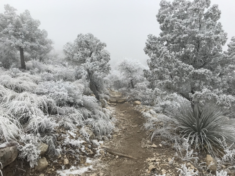
The first hour was magical. I climbed steadily through a landscape transfigured by ice. Huddled cacti, spindly-stalked agave plants, and nodding junipers glittered beneath inch-thick crystal coats. Curtains of fog swept over the trail, now hiding, now framing, a world of silver and glass.
Then, slowly, the quality of the light changed. Crystalline branches began to sparkle; cobalt sky poured through rents in the gray; and suddenly, incredibly, I was above the fog.
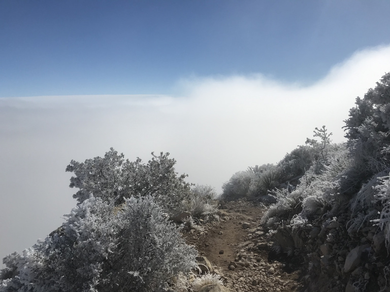
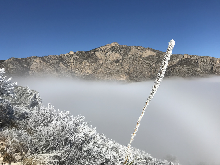
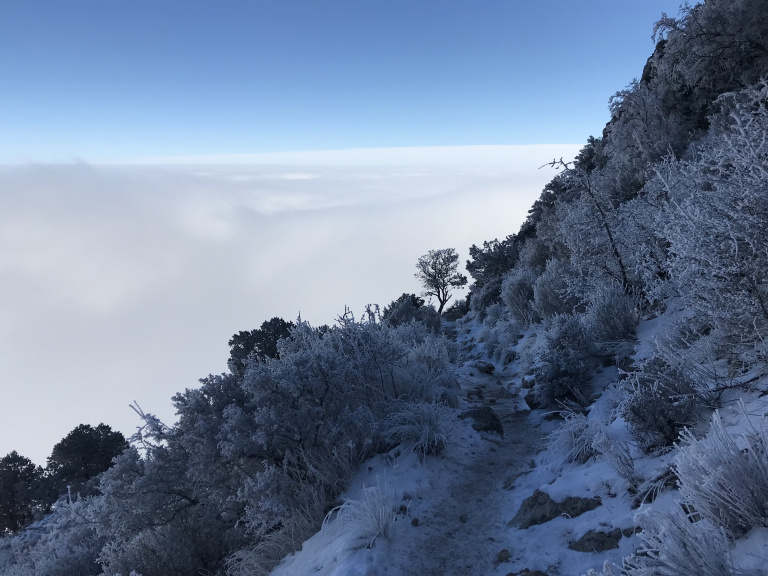
Exposed to the sun, the frosted plants on either side glittered with painful intensity. To my left, cascades of ice crystals, loosened by the warmth, shimmered down from the junipers along the cliff overhead. And to the right, across an opalescent sea of cloud, shone the summits of the Guadalupe Mountains.
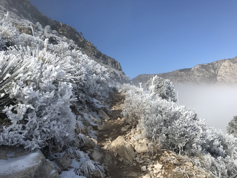
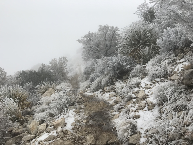
As I climbed, the views continued to be sublime. The condition of the trail, however, forced me to spend most of my time looking down. Snow had fallen a few days before, partially melted, and then frozen, creating treacherous walking conditions. Though I usually managed to avoid slipping with the aid of a walking stick improvised from a fire-killed pine sapling, there was no way to guard against the rising wind, which rose to gale force as I approached the summit.
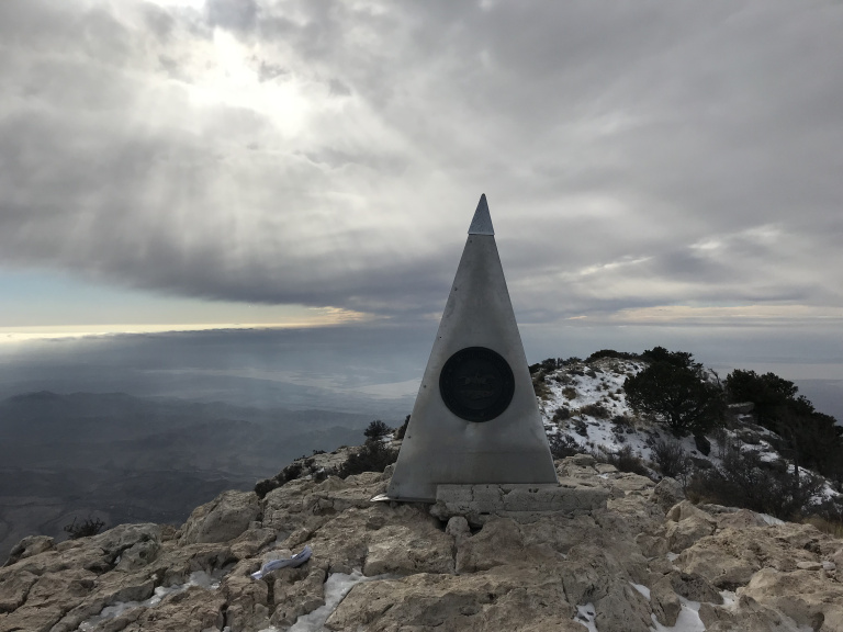
After a final half-mile of ice-slicked rock, I reached the peak. To the north and east, the fog had opened, revealing a tan desert fissured by countless ravines. South and west, distant mountain tops towered over lingering cloud banks. Overhead, the sun filtered through a thickening haze.
As usual, the way down was considerably more dangerous than the climb up. Despite my walking stick, I slipped constantly on the ice, pushed along by the screaming wind. A few minutes after I left the summit, clouds washed over Guadalupe Peak, drowning the sun. As the sky darkened and the wind on the peaks rose, the mist that still shrouded the lower third of the path took on a less enchanting feel. The last mile, hung with heavy fog that swirled at the touch of the wind above, was little short of eerie.
I reached my car a few minutes before sunset. After pausing for a moment to admire the darkening ice-wrapped landscape a final time, I cranked up the heat and drove through a flurrying snow to Roswell.
1-3
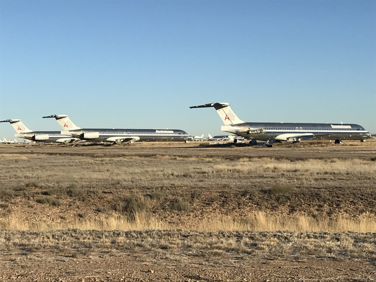
Having passed the night in the best bed $38 could buy, I drove a few miles south to the Roswell International Air Center, a small airport that occupies part of the old Walker Air Force Base. Conspiracy theorists and other foil-hatted types know Walker as the place where the remains of the supposed UFO were taken after the Roswell Incident. I was more interested in the dozens of airplanes parked on the former base’s disused runways. The Roswell International Air Center is the site of one of America’s largest boneyards – places where defunct aircraft are gradually disassembled for parts and/or scrap. I snapped a few pictures of 747s rusting on the frozen desert, and then sped off west.
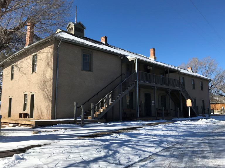
An hour winding through snow-dusted hills brought me to the small town of Lincoln, best known as the base of Billy the Kid and epicenter of the Lincoln County War. As at Guadalupe Mountains, I had the place more or less to myself. After a leisurely perusal of the excellent little museum, I made my way along the snowy main (and only) street, past a series of buildings unchanged since Billy’s career in the 1880’s. The most picturesque building was the adobe church, whose doors and windows rattled and whistled in the wind. The highlight, however, was the Courthouse, famous as the place where Billy killed two deputies and escaped the custody of Sheriff Pat Garrett. A hole in the stucco (enlarged by the fingers of curious tourists) marks the place where one of Billy’s bullets struck the wall.
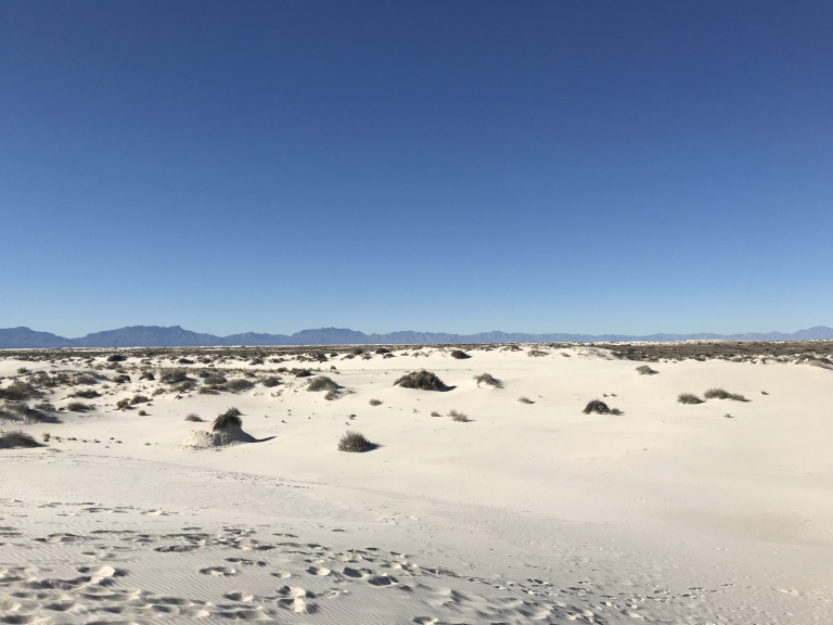
Snow was piled deep along the road to Alamogordo. After an hour or so, however, the highway plunged into a broad and dusty valley, the snow vanished, and the car thermometer rose fifteen degrees. I stopped for lunch at the Hi-D-Ho Drive-in, where I enjoyed the house specialty, the colossal Tiger Burger, while looking toward the snowy hills. Then I continued to White Sands National Monument. Thanks to the ongoing government shutdown, the park was closed; but I had read that the dunes were accessible farther down the highway, at a spot where sand had swallowed the boundary fence. Sure enough, I found a dozen cars already parked at accessible spot. Tingling with the familiar thrill of low-grade trespassing, I spend the next half-hour or so strolling through a surreal landscape dominated by pearly dunes and distant jagged peaks.
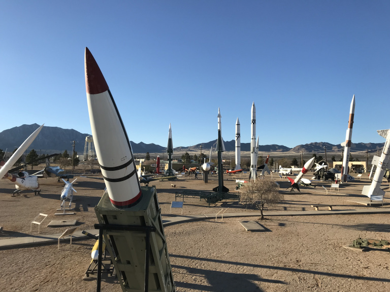
Thirty miles down the road, toward the edge of the same dusty valley, I pulled into the White Sands Bombing Range, the largest military installation in the country and site of the first atomic bomb test. After waiting at the gate for a half-hour, I was issued a visitor pass and directed to the small museum, which describes some of the many thousands of weapons and munitions tests carried out on the range. More interesting than any of the exhibits, however, was the rocket park outside: a display of nearly 100 missiles and military vehicles, dating from the end of the Second World War to the present, silhouetted against the jagged Organ Mountains.
Once I was done traipsing among the missiles, I drove through a gap in the snow-dusted mountains, and down toward El Paso. I stopped for dinner at the aptly-named Little Diner, a Mexican Restaurant in the dusty town of Canutillo. As I ate, I listened to my fellow diners switching casually between Spanish and English, and was reminded that the Mexican border was only a few miles away.
The drive through El Paso was nerve-wracking – I missed a turn in the dark, and ended up being directed over the hills behind the city before rejoining I-10. The high bridge leading onto the interstate afforded a panoramic, if fleeing, view of El Paso and Ciudad Juarez, with the floodlit trench of the Rio Grande between them. Then it was on to the interstate, and a long drive southeast.
1-4
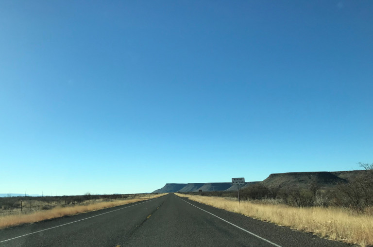
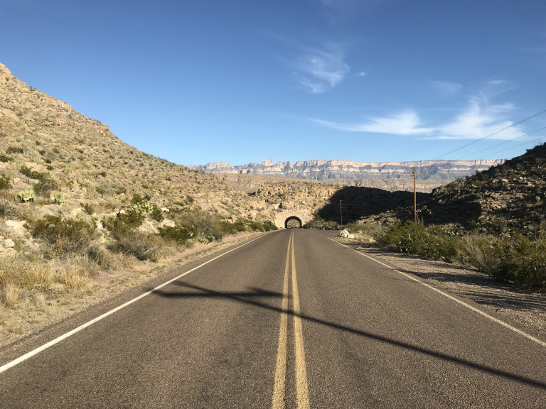
I left frosty Van Horn early, and met the dawn in a rocky desert punctuated by jagged hills. Past the charmless town of Valentine, the landscape briefly became greener, and patches of snow glittered beneath thick pine groves. Then the road veered back into desert. Lines of rusty buttes rimmed the horizon, and the hazy blue outline of the Chisos Mountains gradually filled the southern horizon. And so, finally, I reached Big Bend National Park.
The scale of the park, like everything in this part of Texas, seemed to bear little relation to its size on the map. After I passed the gate, it took nearly forty minutes to reach the Chisos Basin, site of the lodge and main trailhead. I parked, checked my water bottles, and strode off to the Window trail as fast as my stiff legs would take me. I was surprised to encounter several groups of hikers in the first mile – remote as Big Bend is, it still draws respectable numbers of visitors, especially (as now) during the college winter break.
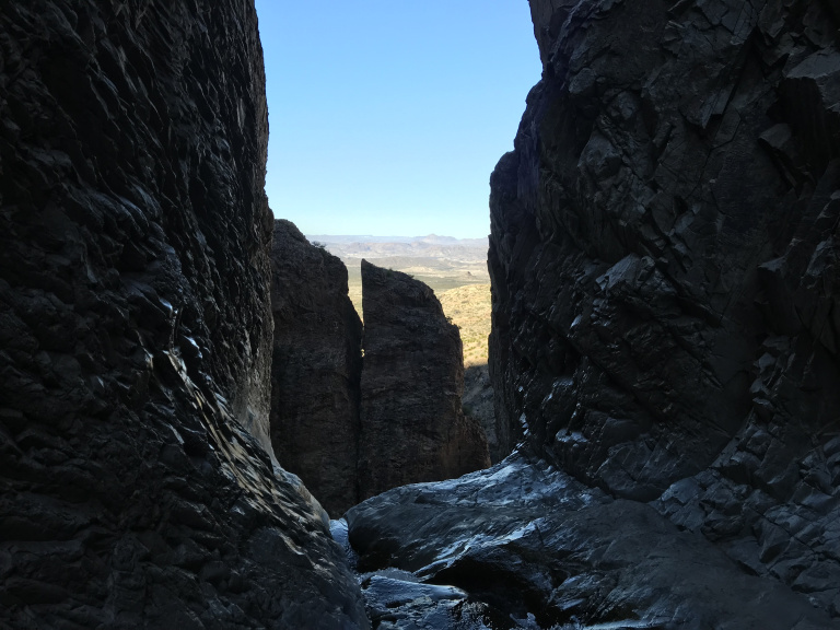
After crossing and re-crossing a small creek, the trail ended at the window, a notch through which the creek cascaded a thousand feet to the desert below. The view over the sagebrush-covered plain and broken mountains beyond was awesome. My footing on the slippery rock, however, was less ideal, and I kept well back from the “sill.”
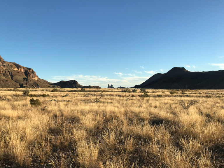
Returning to the trailhead, I explored Ross Maxwell Drive, a 30-mile scenic route on the park’s west end. Santa Elena Canyon, the usual end and highlight of the drive, was closed; but the overlooks along the way provided impressive views of the canyon and the mountains beyond. On the return trip, I stopped to hike the Chimneys trail, which strikes off through the desert toward the eponymous rock formation. The weather was perfect – in the mid-sixties and sunny – and the tan grass along the trail rustled in a light breeze. Mesas and crags, glowing in the late afternoon light, loomed on all sides, and twin spires of rock (the Mule Ears) hovered like the towers of a cathedral on the southern horizon.
After dinner at Terlingua’s Mexican restaurant, I drove to my room, which I found to have a finicky septic system and alarmingly buckled floor. While retrieving some items from my car, I happened to look up, and felt my jaw drop. Never, in any of the desolate places I’ve visited over the years, have I seen so many stars.
1-5
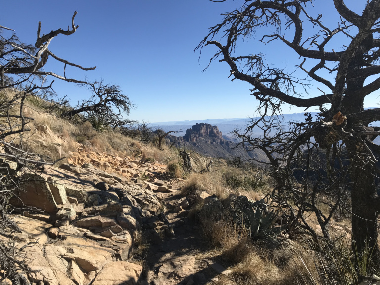
I started the long climb to Emory Peak, the highest point in the park, just before dawn. Though not especially steep, the endless series of switchbacks up to the summit were generously seeded with loose rock. I found myself glad I’d invested in decent hiking boots – particularly on the final half-mile of trail, which consisted largely of slickrock. The final thirty feet or so required actual climbing. I’ve never liked heights – but having come so far, I forced myself up, and emerged on the windswept summit, where I was joined by two pairs of college-age guys who had started the trail even earlier than I had. I swapped trail mix for an orange with one pair, and declined a beer from the other. The views from the summit were worth the vertigo of the climb back down.
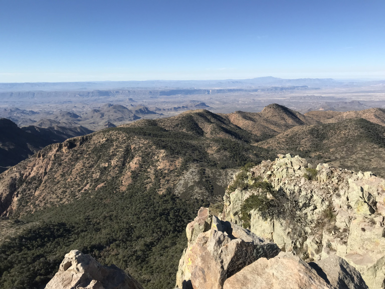
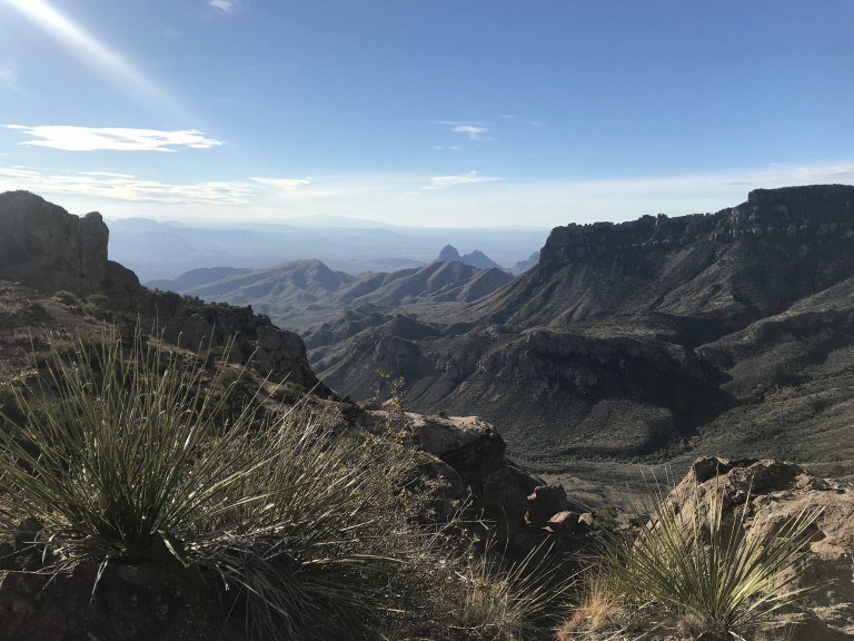
On the way back down to the trail junction, I paused repeatedly for pictures of the hazy desert and mountains below, framed by gnarled junipers. Instead of descending to the trail head, I decided to make a long loop to the South Rim trail, and so continued down Boot Canyon, along a stream that still crackled with last night’s ice.
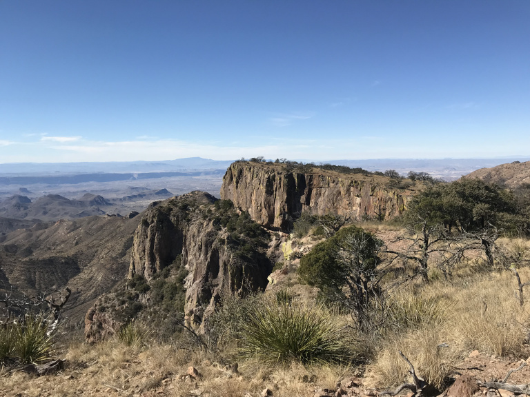
The South Rim trail afforded another series of awesome panoramas over the desert. I especially admired the view to the south, toward the ruddy cliffs along the Rio Grande and the hazy Sierra del Carmen beyond.
By the time I returned to my car, I had hiked about 16 miles, with a calf-burning 3,000 feet of elevation gain. But I still had a few hours of sunlight, and so drove over to the eastern end of the park, and the thousand-foot cliffs of Boquillos Canyon.
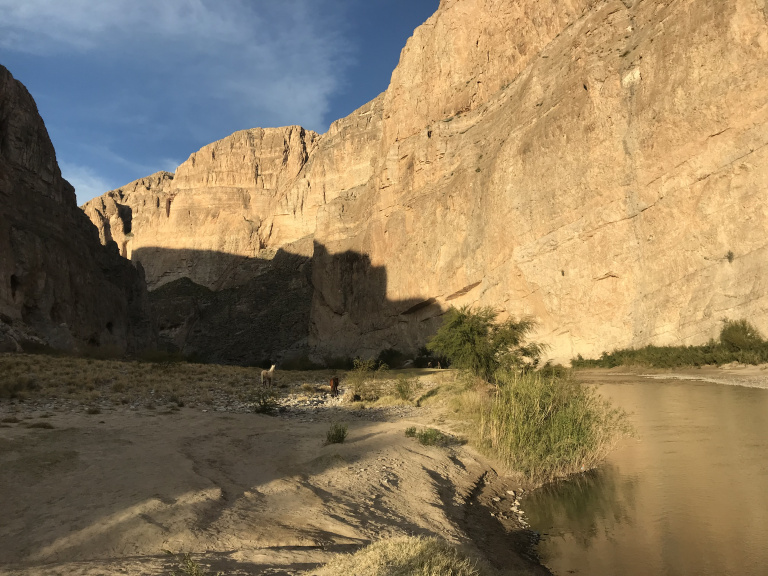
At Boquillos Canyon, the Rio Grande is not all that Grande – maybe sixty or seventy feet wide, and a few feet deep. In light of all the recent uproar about a border wall, it was amusing to see Mexico across a shallow and unguarded stream, and to watch villagers from the Mexican town of Boquillos casually cross to graze their horses on the American side. The canyon itself was splendidly backlit by the sunset. As I watched, a few unattended horses from Boquillos wandered along the river bank, pausing every few moments to pose picturesquely.
1-6
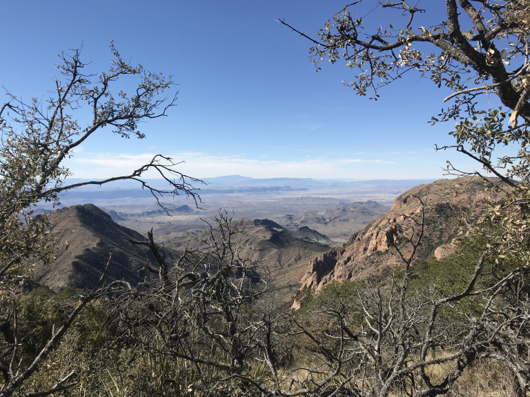
To round off my Big Bend trip in style, I hiked up the popular Lost Mine Trail, which terminates at a ridge with splendid views. When I reached the top, I sat for a few minutes on a boulder, gazing wistfully over a hazy infinity of mountain and desert. Then, with a silent promise to come back someday, I made my way back down for the long drive to Austin.
Along the lonely two lane highway from the east gate, while admiring yet another picturesque desert valley, I came within a few feet of pulverizing a peccary that bolted across the highway.
After several hours of desert and scrub along I-10, I exited onto a local highway, and into Hill Country. Passing through Fredericksburg (home of Chester Nimitz) and Johnson City (home of LBJ), I stopped for dinner at the (apparently famous) Salt Lick BBQ, where I tore into the best, and most filling, slab of ribs I’ve ever had. Then, having replaced all calories lost over a week of hiking, I made my way to my Austin hotel. Tomorrow, back to Chicago…