10/18 – 10/20/18
During the last Ice Age, most of the American Midwest was buried beneath the colossal Laurentide Ice Sheet. For tens of thousands of years, lobes of ice two miles thick advanced and retreated, gouging out the basins of the Great Lakes and depositing layers of till – also called “drift” – over the ravaged landscape. In what is now southwest Wisconsin, northeast Iowa, and far southeast Minnesota, however, a range of hills deflected the glaciers, leaving the narrow strip now known as the Driftless Area free of ice.
The topography of this region, never bulldozed or buried by the ice, is strikingly different from the level “drifted” (till-covered) plains of the upper Midwest. Millennia of erosion have sculpted the landscape into rolling hills, and cut valleys hundreds of feet into the limestone bedrock. The rivers of the Driftless are the most beautiful – and fastest-moving – in the Midwest. Blue with pulverized limestone, chilled by the waters of rushing springs, they twist and purl with the perversity of old age, rushing over murmuring beds to the Mississippi.
10/18
Finding a window when high levels on the rivers coincided with peak color in the hills, I decided to spend a long weekend kayaking in the heart of the Driftless.
I left at 4:30 on one of those cold mornings when frost flashes on the grass and smoke trails forever from the chimneys, and drove to southwestern Wisconsin through a haze of fatigue. All weariness lifted, however, on my first glimpse of the Blue River, meandering through a frosty meadow across a backdrop of wooded bluffs. Kayaker’s heart racing, I locked my bike at the take-out point, and drove twelve miles upstream to launch.
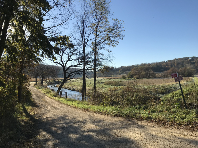
The Blue is a small river, seldom more than thirty feet wide or four deep. But thanks to heavy rains the week before, it was flowing high and fast, nearly overspilling its banks. Though conducive to a swift paddle, the strong current made it difficult to avoid obstacles, especially around turns. I discovered this almost immediately when I came upon an old cattle fence, festooned with flood debris, blocking the river. Since the top was only a few inches above the surface, I attempted to ramp over it. Unfortunately, the fence was a little too high, and my kayak got pinned against it. While trying to extricate myself, I lost first my paddle and then my balance, and pitched into the water.
After draining the kayak on the frosty shore, I continued more cautiously, expecting new obstacles around every bend. In the event, the only hazards were the barbed and/or electrified wires farmers draped across the river (often, irritatingly, in the middle of rapids) to corral their cows. If I hadn’t brought a Y-shaped stick to lift these over my head, I would ended the trip rather worse for wear.
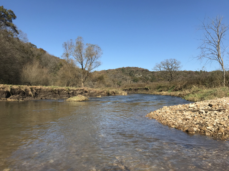
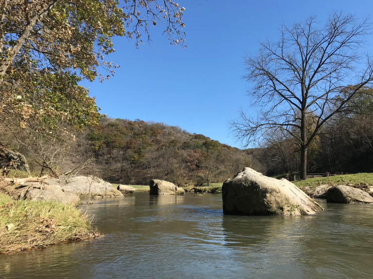
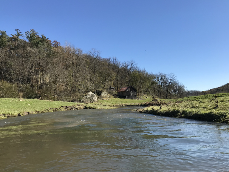
But once I learned to cope with the wires, I began to appreciate the beauty of my surroundings. The Blue River runs between lines of wooded bluffs, typically separated from the water by a narrow strip of floodplain forest. Once the sun cleared the bluffs, the valley was filled with the colors of fall, the yellows and reds of the deciduous trees contrasting dramatically with the pines on the bluffs. Here and there, massive chunks of limestone – some ten feet tall – had tumbled into the river, forming picturesque boulder gardens.
Although about half the land along the riverbanks was undeveloped, the rest belonged to dairy farms. I encountered (encowntered?) four herds of cattle, each more astonished than the last to see a strange creature in a green kayak appear on their river. To a cow, they stopped grazing and watched in unison as I passed, mild interest cohabiting with equally mild alarm in their eyes.
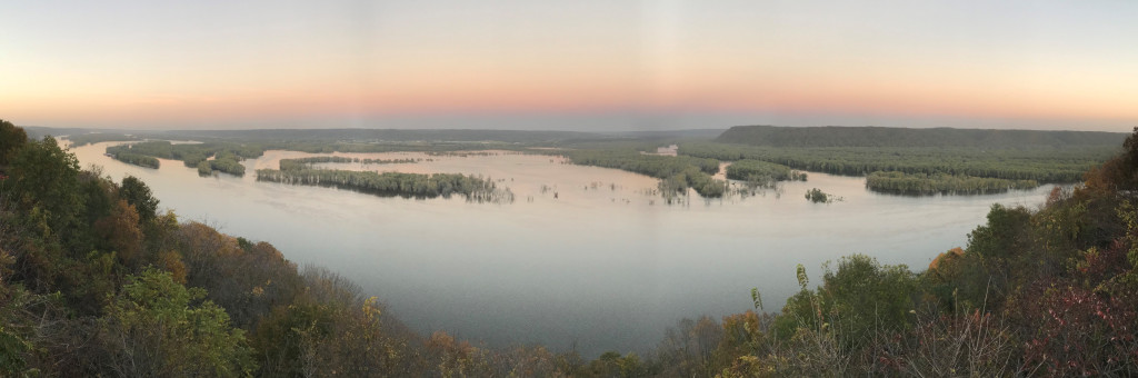
And then it was over. I pulled my kayak up on the shore at the take out, hopped on my bike, and spent the next hour laboring over the hills between me and the car. After recovering my kayak, I continued west, crossed into Iowa at Prairie du Chien, and made my way to Pikes Peak State Park (the 500-foot bluff for which the park is named, incidentally, commemorates the same Zebulon Pike who later lent his name to Pikes Peak in Colorado – impress your friends). After setting up my battered tent and attempting to inflate my perpetually leaky air mattress, I walked a few hundred feet to the Pikes Peak overlook, which afforded sweeping views over the flooded Mississippi.
10/19
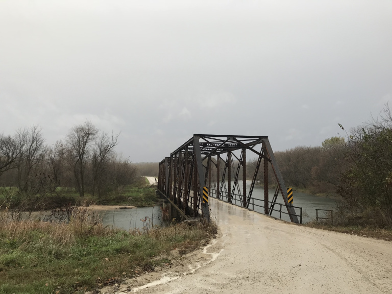
I woke to find my air mattress flat and a heavy rain falling. The rain persisted throughout the hour-long drive to the hamlet of Bluffton, Iowa, where I left my bike (and nearly my car) in a muddy parking lot. Seventeen miles upstream, in Kendallville, I launched into the pale blue Upper Iowa River.
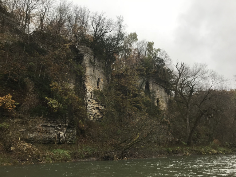
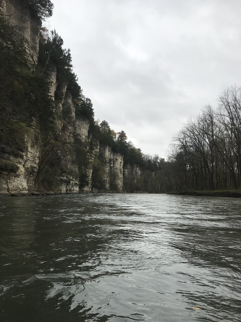
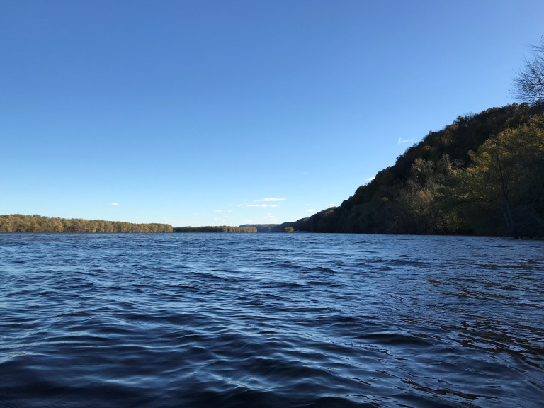
If Iowa has a paddling mecca, the Upper Iowa River is it. A mid-size river with a swift current but no real rapids, it flows beneath towering limestone bluffs up to three hundred feet high.
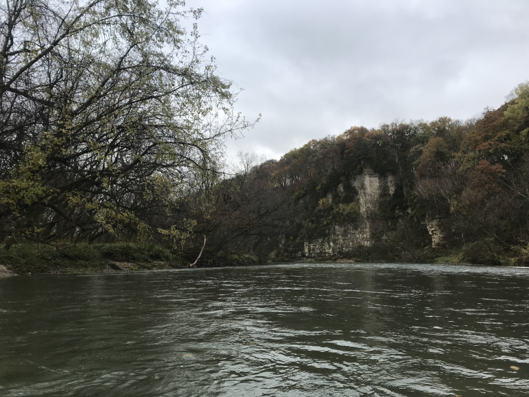
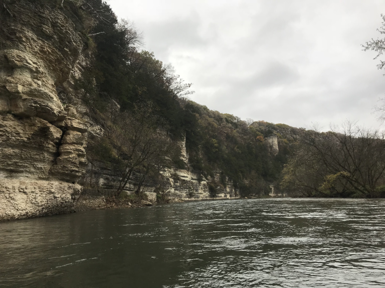
The miserable weather actually contributed to the experience. I had the river entirely to myself, and heard nothing but rushing water and pattering rain for the four hours I paddled. Huge cliffs reared suddenly through curtains of rain, tops seeming to scrape the livid clouds.
All too soon, I reached the takeout point, and commenced an exhausting fifteen-mile bike ride over a series of hilly gravel roads. My progress up one of these roads was expedited by two farm dogs, who chased me for nearly a half-mile. The sun finally emerged around the middle of this ordeal, lighting endless ranks of gaunt dead corn, leaves rasping in the wind.
That evening, having invested eight dollars in a new air mattress, I celebrated a successful paddle by making a fire and reading hours into the windy night.
10/20
Wakened just before dawn by roaring in the trees overhead, I emerged from my tent to find that the evening’s breeze had turned to the north and strengthened to gale force. Mentally cursing the weather of the Upper Midwest, I broke camp and drove to the mouth of the Yellow River, my final kayaking route. After locking my bike to one of the few trees at the landing still above the Mississippi floodwaters, I entered the address of the launch point in my phone, and frowned to see that Google Maps had assigned it to a rural town far west of my route.
The length of the drive – 25 miles – should have warned me that something was wrong. But when I reached the launch address and saw the Yellow River, I assumed that my phone had made a simple error, and thought nothing more of it. Not until I was well past the point of no return would I realize what had happened: the night before, working by firelight and an old brochure, I had accidentally written down a launch thirteen miles upstream of my intending starting point. As a result, what should have been a long but manageable 17 mile paddle became a 30 mile ordeal.
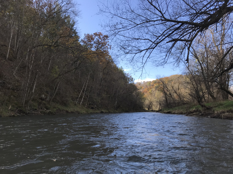
So, I saw a great deal of Yellow River. Like the Upper Iowa, it was characterized by a series of tall bluffs, crowned by the russets and golds of oaks and maples. In places, the river ran at the foot of the bluffs; elsewhere, it was lined by floodplain forest or rustling corn.
The wind intensified. Although the bluffs and high banks sheltered me from the worst of it, gusts tore across the landscape, whirling leaves and sometimes whole cornstalks into the water. At intervals, horizontal show showers whipped across the river. Cold crept steadily into my hands and feet.
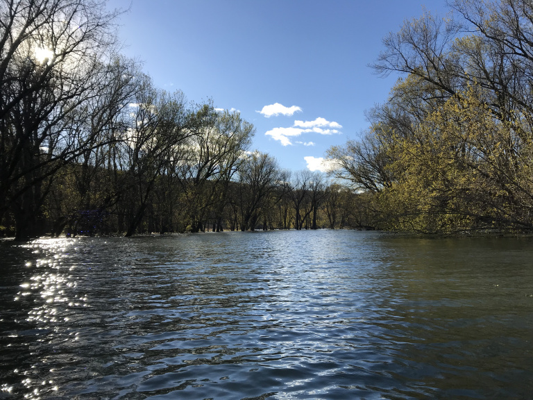
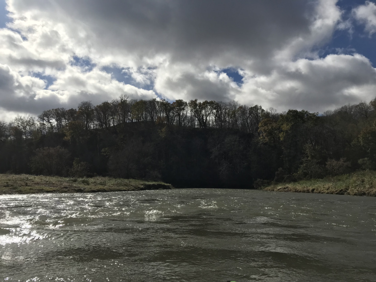
The last ten miles, where the river wound through a state park, were the most scenic, though the howling wind and surprisingly substantial rapids (the river was running high) sometimes made it difficult to be properly appreciative. As I approached the Mississippi, the current, backed up by the floodwaters of the big river, slowed and stopped. I paddled the last two miles through a submerged floodplain forest, bumping through islands of floating debris.
Finally, after passing beneath a railroad bridge, I emerged onto the Mississippi. Rolling alarmingly in the chop whipped up by the wind, I paused only to take a few pictures of the bluffs before turning and winding through the flooded trees to my bike.
The 25 miles back to my car constituted the most unpleasant bike ride of my life – which is saying something. I have ridden farther in colder weather; but a loose gravel shoulder, constant hills, freezing temperatures, and steady headwind combined to make this trip uniquely wretched. Usually, I manage about 12-14 MPH on my mountain bike. Thanks to the hills and wind, however, it took me nearly three hours to reach my car.
I rode the final hour in the dark down a series of isolated gravel highways. A three-quarter moon lit the way, silvering the endless corn fields, the faintly glowing road, and – for a few terrifying moments – three very dedicated farm dogs. When I finally reached the car, I slid stiffly into the driver’s seat, turned up the heat, and spent the next ten minutes grating my teeth as blood worked its way back into my fingers. When the pain subsided, I took a last look at the Yellow River, flowing placidly toward a line of silvered bluffs, and turned back toward the Mississippi, and home.