5/20/15. Western Jordan
I spent the day on and around the King’s Highway, the grandiosely named and badly paved highway that runs from Amman to Petra. Since it roughly follows the course of the Via Traiana, backbone of the Roman province of Arabia, and parallels an even older Edomite road, ruins are thick in the vicinity; both Machareus and Umm ar-Rasas lay on spurs from the road, and many more ancient cities, most surviving only as unexcavated tells, dot the countryside around it. In addition to its historical associations, the King’s Highway is remarkable for the variety and beauty of the landscapes it traverses. For about thirty kilometers south of Madaba, it passes through rolling wheat fields, and is shaded by brakes of pines bent by constant westerly winds.
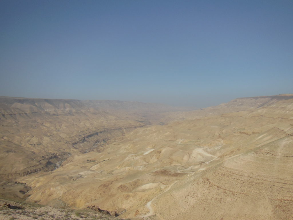
Then, abruptly, the bottom falls out, and the road twists in a series of switchbacks down the majestic Wadi Mujib, justly called “Jordan’s Grand Canyon.” I stopped at a scenic overlook to admire the thousand-meter gorge, cut through sandstone of every hue. (My enjoyment was only slightly blunted by the arrival of a chattering Korean church group, who parked their enormous tour bus directly behind my car and formed a chattering knot around my perch.) It took nearly an hour to drive back of the canyon, as I shared the writhing switchbacks with a series of dump trucks grinding along in second gear. Passing these in my Nissan, whose four cylinders whined and protested the whole way up, was rather nerve-wracking. When I finally crested the south lip of the canyon, I found myself in a drier and hillier country, over which the highway pitched and rolled to Karak, my first stop.
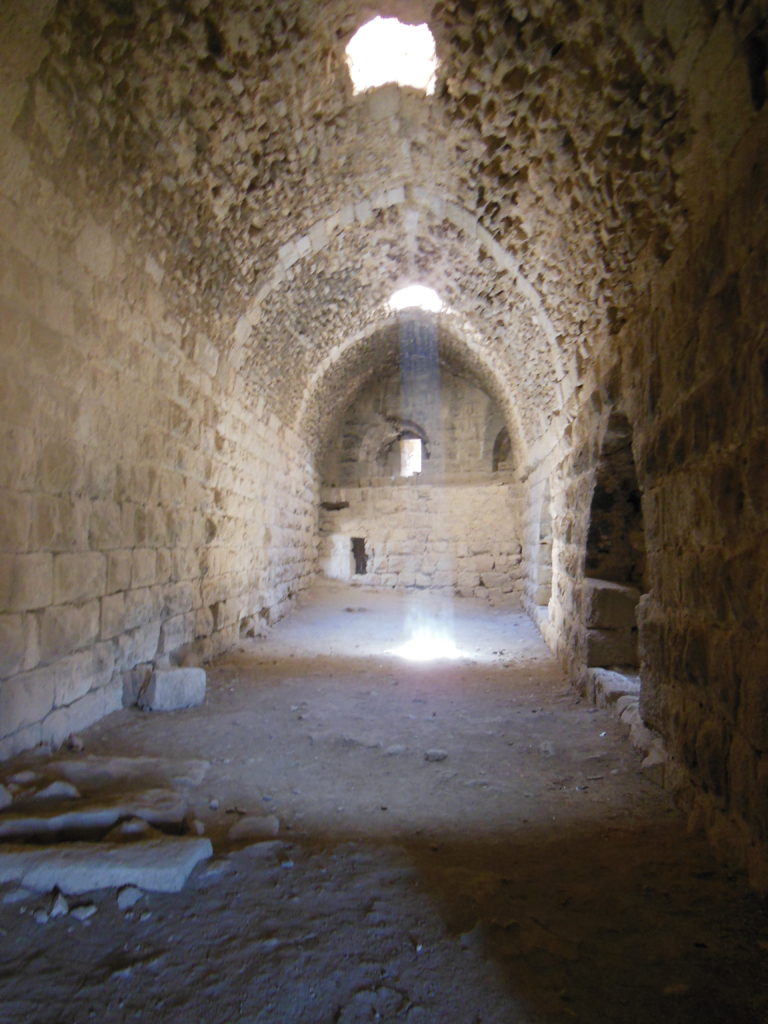
Karak is remarkable only for the poor quality of its roads. The castle that dominates the city, however, is the greatest monument of the Crusader era in Jordan, and one of the finest medieval fortresses in the Near East. First constructed by a French knight in the mid-twelfth century, captured by Saladin a few decades later, and used subsequently by the Mamluks and Ottomans, it is now something of an architectural chimera; without a whirlwind tour from one of the site guards, I would have had a hard time making sense of the general layout. The most interesting components proved to be the Mamluk-era palace, which featured a grand banqueting hall; and the Crusader stables, whose superimposed vaults could hold five hundred horses. I had the most fun, however, exploring a row of subterranean barracks and the inevitable dungeons with my flashlight. Before leaving, I walked to the west battlements and admired the view over the broad valley beneath the castle, which plunged toward the invisible Dead Sea.
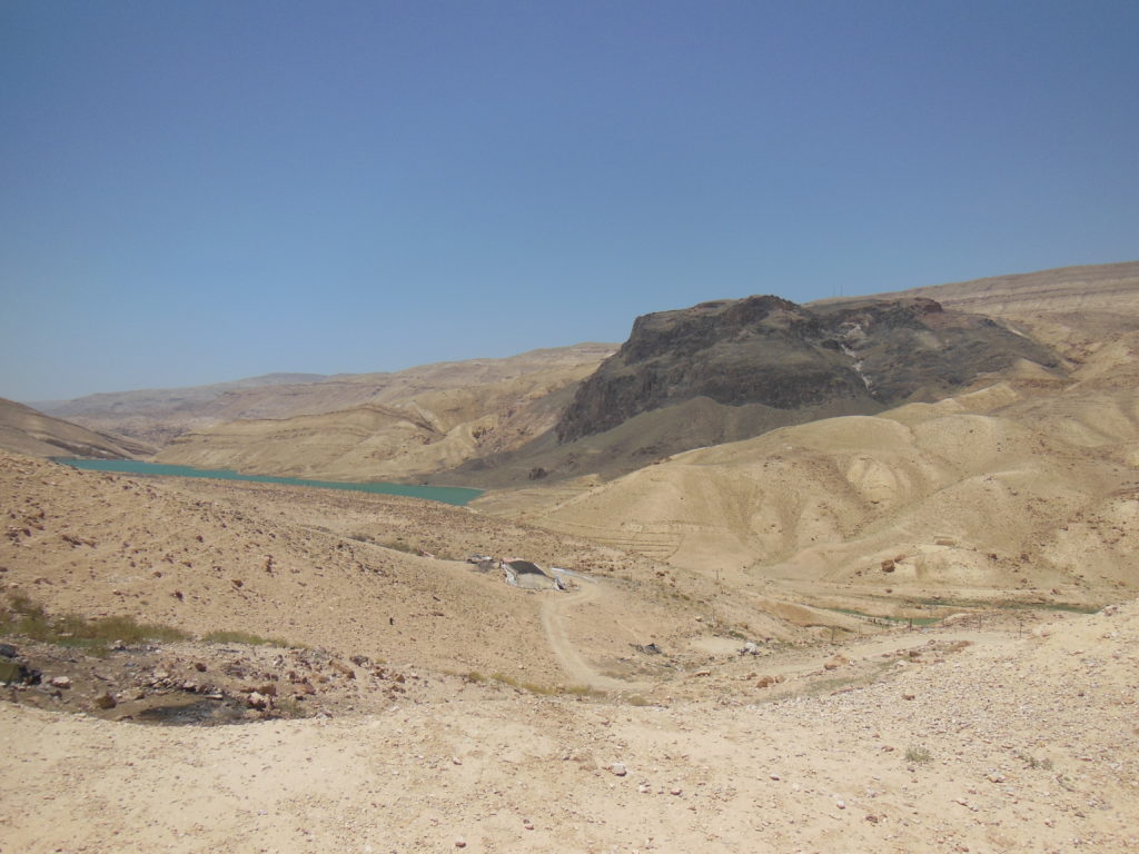
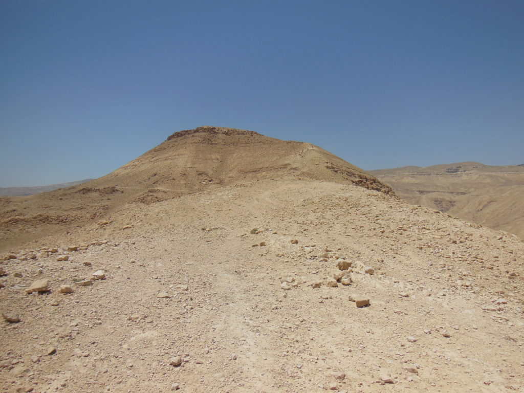
Some thirty kilometers past Karak, the highway threaded its way into another immense canyon, the Wadi Hasa. I crossed the valley, picked my way up the facing slope, and had progressed nearly kilometers into the gullied landscape beyond before realizing that I had missed the turn for my next destination. I was looking for Khirbet Tannur, a Nabatean sanctuary overlooking the Wadi Hasa. As so often in Jordan, however, there were no signs, and no obvious turnoffs. I worked my way gradually back down toward the Wadi, turning down any promising- looking gravel road. One particularly enticing turn-off left me stranded on a narrow gravel track amid the ruins of some ancient hill fort, unable to go forward or turn around; I had to back down the track, boulders and precipitous drops on either side, half the way to the highway. I was getting dispirited by the time I reached the last road south of the wadi, a twisting track so rough that I parked my car on the highway shoulder and walked along it. My hopes rose as I gained my bearings. According to my guidebook, the sanctuary at Khirbet Tannur was built across the wadi from an immense black cliff sacred to the Nabateans; and sure enough, five miles away, a thousand-foot high block of basalt was embedded in the canyon face, contrasting dramatically with the red sandstone on either side. On my side of the wadi, perhaps a mile and a half away, a conical hill about five hundred feet high loomed from the rocky landscape. This, I decided, must be the location of my temple.
First, however, I had to reach the hill. A half-dozen Bedouin families had camped in the plain below, each equipped with flocks of sheep, goats, camels – and, inevitably, aggressive guard dogs. I managed to get the attention of a boy in one of the first tents, who obligingly called off his family’s curs. Another boy, obviously curious about an unexpected foreigner, walked along with me past the next batch of tents, and called off the next pack. Mustering my best Arabic, I asked: “I want to go Tannur; there?” (pointing toward the hill). After consulting with his sisters, who appeared shyly at the tent door, he nodded. Thanking him, I hiked the last half-mile alone.
As I drew closer, brown and white specks atop the hill resolved into a herd of camels, which happened to be descending the only path to the summit just as I began to climb up. We met halfway. The lead camel, an awkwardly majestic beast at least eight feet tall, gazed incuriously at me as he shambled past, and his herd followed, pausing to nibble at thorny delicacies along the way. A particularly unenergetic specimen paused for a long minute right in front of me, providing a nice foreground for the desert scenery below.
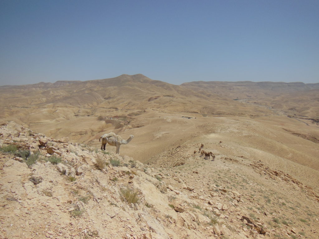
Having finally passed the camels, I clambered up to the summit, where I found the scattered ruins of a Nabatean sanctuary dedicated to the fertility goddess Attargatis and her consort Zeus-Haddad. The sanctuary’s rich sculpture was stripped away by archaeologists in the early twentieth century, leaving only a few stones inscribed in the cursive Nabatean script (the precursor of Arabic) for me to puzzle over. Far more impressive were the views in every direction. Across the wadi, the awesome black cliff was framed by an amphitheater of rosy sandstone, which fell 1500 feet to the green waters of a reservoir. Ahead, the wadi broadened in dampening waves of stone, its mouth lost to the salt haze over the Dead Sea. To the side, the infinitesimal ribbon of the King’s Highway wove itself into a lattice of hills and canyons, mounting toward a gray plateau. I sat for nearly a half-hour on a broken architrave block, as the camels became specks again and trucks glimmered along the highway. Finally, warned by the lengthening shadows of the mesas below, I stirred myself and clambered back down.

Seventy kilometers of desert, then twenty of peacefully rolling fields, and then the turning to Shobak castle, my last stop of the day. Yet again, my GPS contrived to send me the wrong direction down a narrow one-way street, resulting in an uncomfortably close encounter with a passing bus. I finally found the access road, however, and made my way up to the ruins. Like its northern counterpart at Karak, Shobak castle (which its builders called Montreal) was intended to guard the eastern frontiers of Outremer. Again like Karak, it filled this function for only a few decades; when the Kingdom of Jerusalem dissolved after Saladin’s victory at the Horns of Hattin, the isolated fortresses of the frontiers became administrative centers for a series of Muslim dynasties. Shobak eventually became a village, cottages budding from its tumbled towers and keep. Although these accretions were cleared away a few decades ago, the castle has yet to be adequately excavated. I wandered a while in the jumble of blocks within the walls, noting the fine Mamluk stonework of several towers. Showing restraint for once, however, I did not explore the castle’s most famous feature: a staircase that plunges three hundred feet to a pool of pitchy water. Going partway down, and feeling the steps growing increasingly treacherous, I contented myself with a picture. As I left the castle, I found myself more impressed by the views from the walls than by anything within them. My shadow, cast impossibly far by the setting sun, joined the dusk welling up in the canyons below the castle as I walked to my car.

It was nearly nightfall by the time I wound my way into Wadi Musa, the untidy little town that sprawls before the gate of Petra. Within ten minutes of my arrival, I was on the rooftop terrace of my posh hotel (a rare splurge), sipping a drink and looking out over the dreamlike spires of the Petra Mountains. A crescent moon rose through a cleft, lending unreal tones to the blood red rock. A satisfying close to a very full day.
Blog Home