2/7 – 2/12/23
2-7
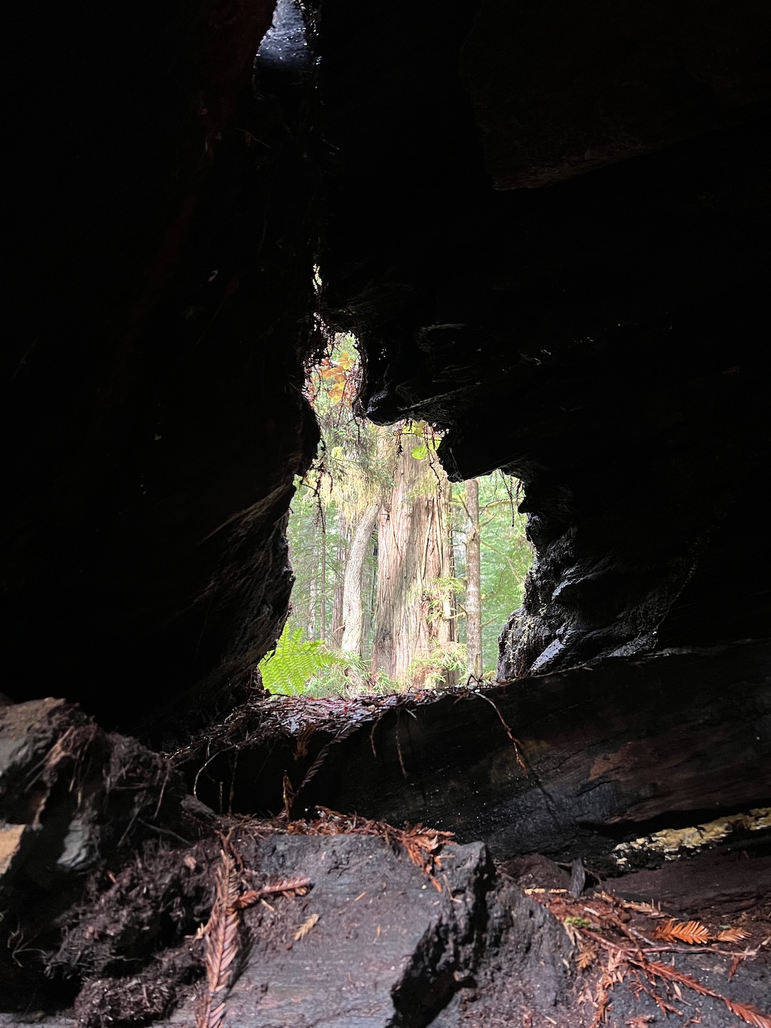
There were redwoods along the highway from Arcata, their distinctive ridged bark glowing through the fog. But it was only after I started up the trail to the Lady Bird Johnson grove in Redwood National Park that I encountered the first old growth giants. I had the trail to myself; and as I peered up at the invisible treetops, only water dripping from branches broke the silence.
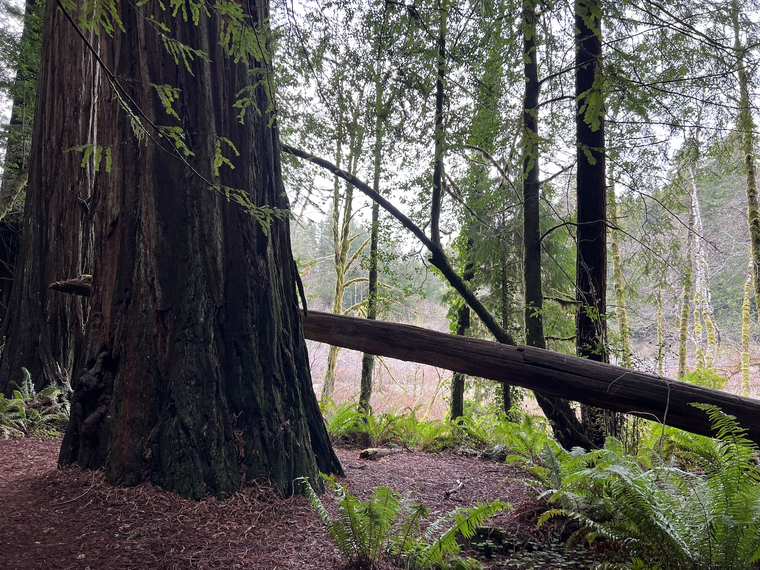
The highlight of the day was Prairie Creek State Park. Along the park’s namesake stream, grand galleries of redwoods, their bases enveloped in a tropical profusion of mosses and ferns, loomed gigantically. Many were so-called cathedral trees, sprouting from a shared root system. Occasional tears in the ceiling of fog splashed sunlight over groves and stream.
I was so enchanted that I took a wrong turn, and ended up hiking five miles farther than I had intended. Though unappreciated at the time, the detour proved to be picturesque, especially the section along the Cal Barrel Road, an old logging track.
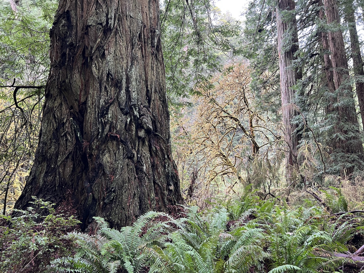
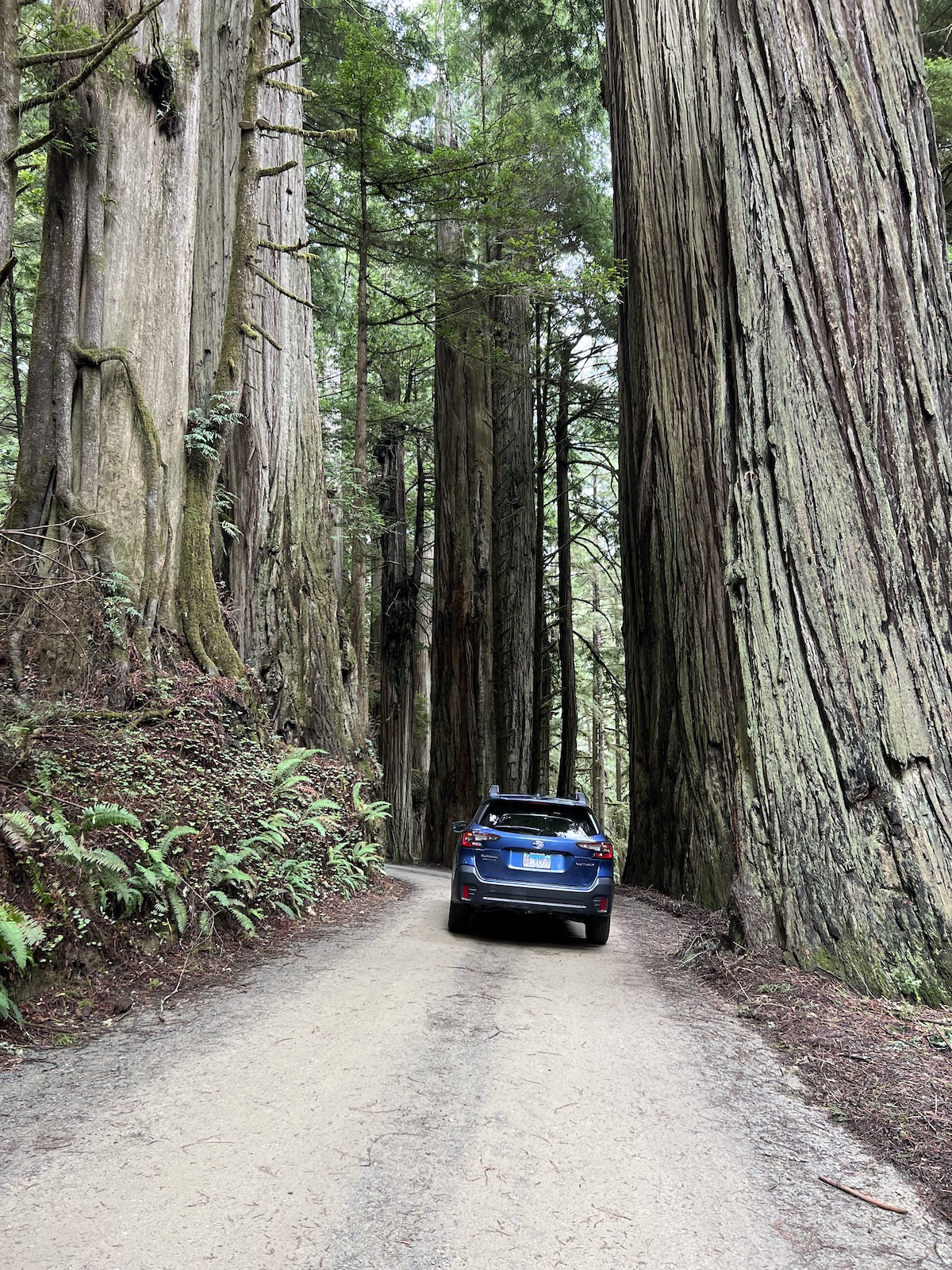
But the best drive in Redwood country – or, for that matter, anywhere in California – is Howland Hill Road, which winds through Jedediah Smith Redwoods State Park. I followed this gravel track, only one lane wide, between looming redwoods to the trailhead for the Stout Memorial Grove, the park’s signature hike.
In a light drizzle, I strolled awestruck through the grove, arrayed along a pale blue stream. The Stout Grove has been called the picturesque of all Redwood stands, and I can see why – nowhere else have I felt so dwarfed by the big trees.
As I headed up the Pacific Coast Highway into Oregon, the drizzle became a steady rain. I stopped along the road a few times to peer through the mist and rain at the sea stacks and pounding surf. Then darkness fell, and there was nothing to watch but my wipers.
2-8
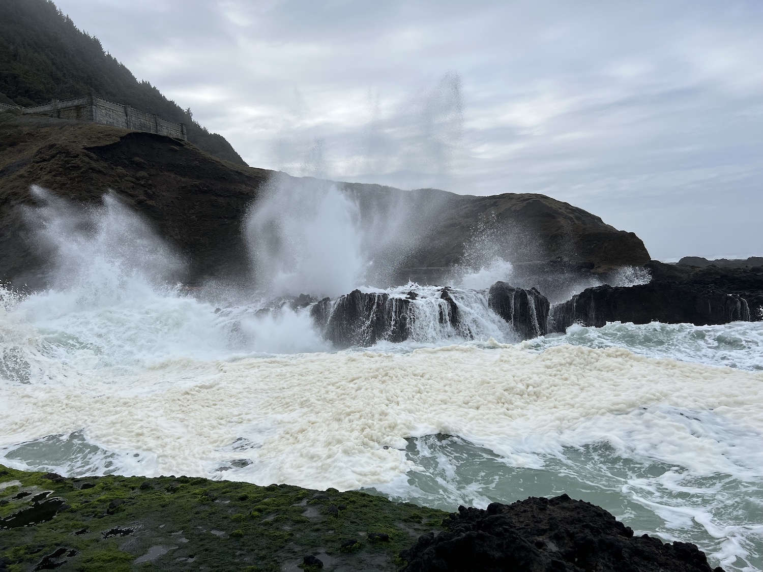
My motel in Coos Bay was located a few feet from Highway 101, so I counted trucks all night instead of sheep. Bleary-eyed, I left around dawn and continued north to Cape Perpetua, the most majestic headland along the Oregon coast. As soon as I left my car, I could hear the thunder of the waves, churned up by a storm far out to sea. I clambered down to the tidepools, where huge foam-flecked swells were slamming into the rocks with eardrum-rattling booms.
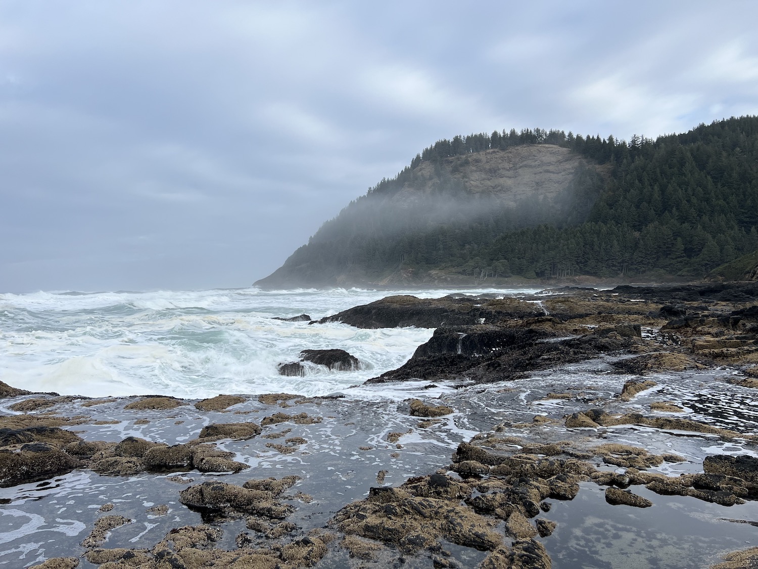
Irresistibly drawn to the water’s edge, I stood on a boulder that projected three or four feet above the highest waves, and watched the awesome power of the sea in action. Within a few minutes, predictably, a rogue wave splashed up against my perch, soaking my pants to the knees.
After pausing to watch the spouting horn – a rock formation that funnels geyser-like plumes of spray when struck by large waves – I walked back to the overlooks, poked my head into the visitor center, and resumed my northward trek.
After lunch at a breezy wayside overlooking the sea, I followed the coastal highway through a decidedly non-marine stretch of Oregon farm country. Then, Ecola State Park, the most famous beauty spot on the Oregon coast. It lived up to the hype: a long and lonely beach, facing a gray sea speckled with sea stacks.
I hiked up to a tall headland overlooking the beach, following – for the first time this trip – in the steps of Lewis and Clark, who came here from Fort Clatsop in search of a beached whale. From the top, I was rewarded by a vista of forlorn Tillamook Rock Light, marooned on a tiny islet more than a mile offshore.
In an ultimately futile effort to reach Fort Clatsop – a replica of the place where Lewis and Clark camped over the winter of 1805-6 – I sped north to Astoria. Finding the fort closed, I drove up to the Astoria Column, poised on a hill overlooking the town and the mouth of the Columbia River.
I crossed the Columbia twice on my way to Portland, where I parked illegally during a short visit to Powell’s City of Books, America’s largest bookseller. It was an impressive place, though I was slightly disappointed that they didn’t have Naked Statues in stock.
2-9
The morning was sunny and warm. After leaving my hotel, a short drive brought me to the (original) Original Pancake House, where I was the only patron under the age of 70. Having been defeated by the mighty apple pancake, I continued north, Mount Hood shining in the distance. Along the way, I stopped at the public library of Longview, Washington – an imposing Georgian structure patrolled by little old ladies with iron-gray hair – to upload a video.
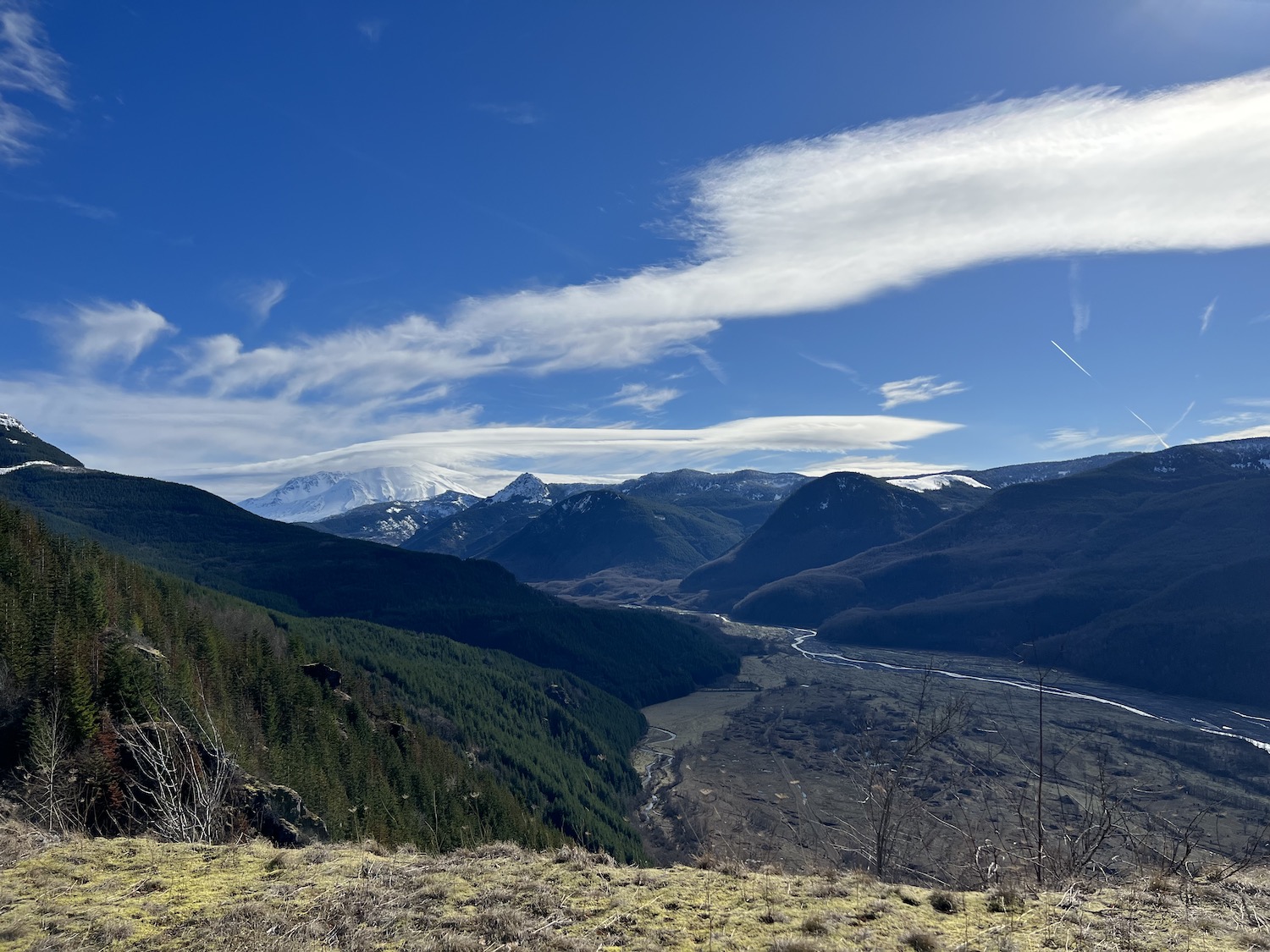
I spent an hour following a winding highway toward Mt. St. Helens. Although I didn’t have the time to drive all the way to the mountain, I got close enough for a picture of the gleaming summit, capped by a lenticular cloud.
2-12
I spent a very pleasant weekend in Seattle with my girlfriend, who flew in from Chicago for the occasion. Over a few whirlwind days, we saw Snoqualmie Falls, explored downtown (in particular, the Pike Place market and an excellent sushi place), took the ferry to Bainbridge Island, and trekked up to North Cascades National Park. Then, all too soon, it was over; I dropped my girlfriend off at the airport at 4 AM on Sunday, and resumed my lonely pilgrimage.
Since I had hours to kill before the sun rose, I decided to loop the highway around Olympic National Park. Rattling over the Tacoma Narrows Bridge, I made my way to Hurricane Ridge – the high-altitude section of the park – and was irritated to discover that it only opened mid-morning. After a few pictures of the moon shining over the snowy mountain wall, I continued my counter-clockwise circuit. As I rounded the western coast of the Olympic Peninsula, one of the wettest places in North America, a steady rain began to drum on the Subaru’s roof.
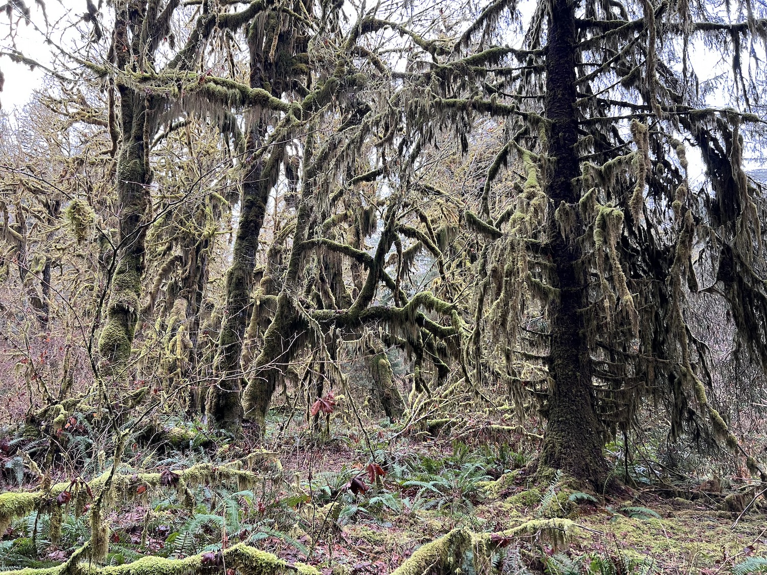
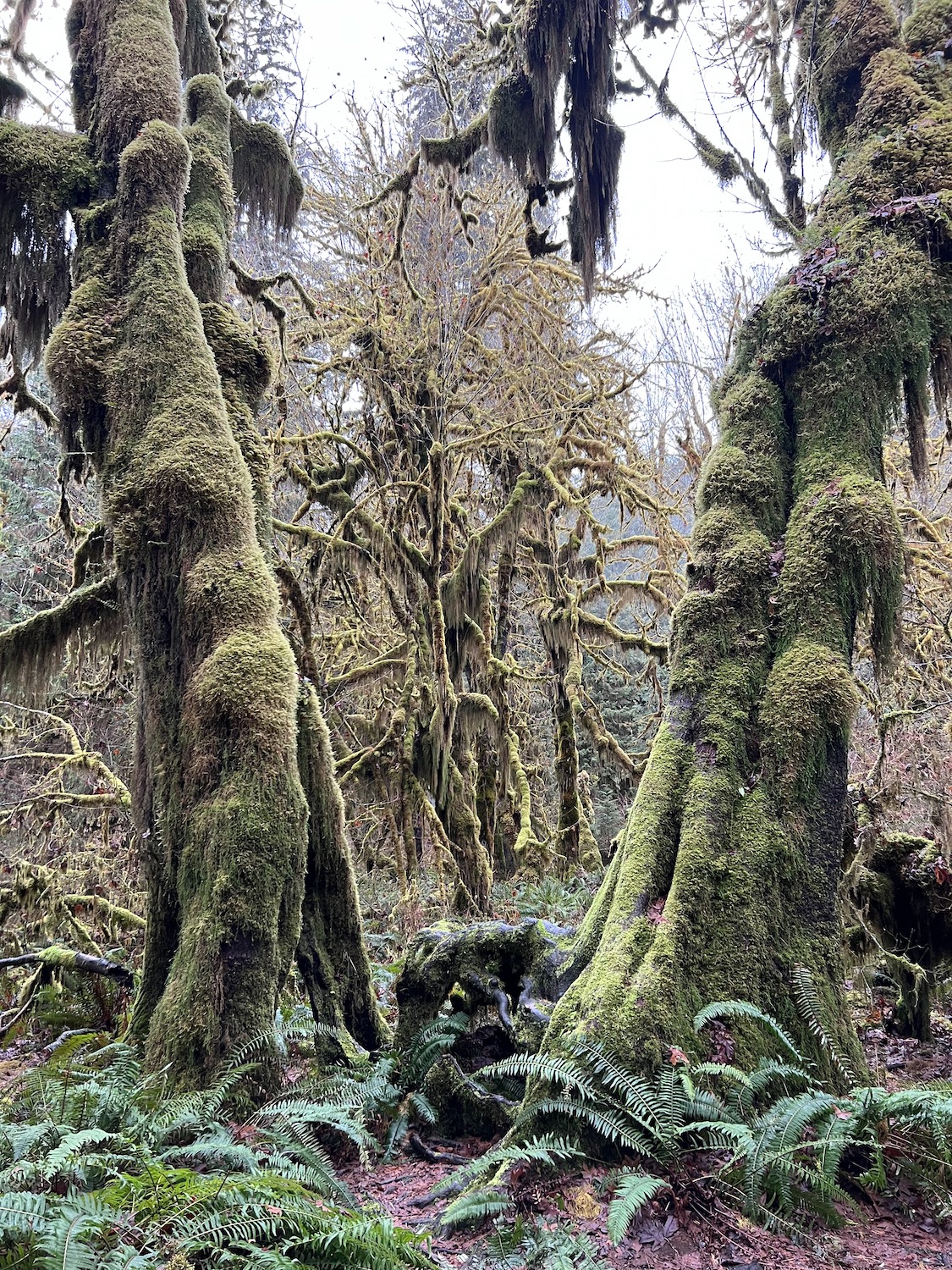
The rain had turned into a drizzle by the time I reached Hoh Rainforest. I walked the Hall of Mosses trail, which winds between huge firs and spruces, their bark and branches draped with clubmoss. It was the forest primeval – shadowy and damp, rising from fathomless marshes through layered mists.
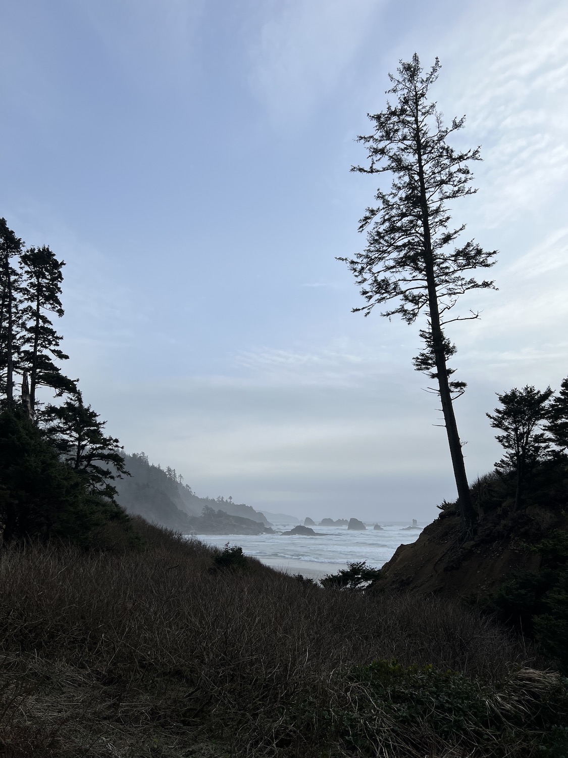
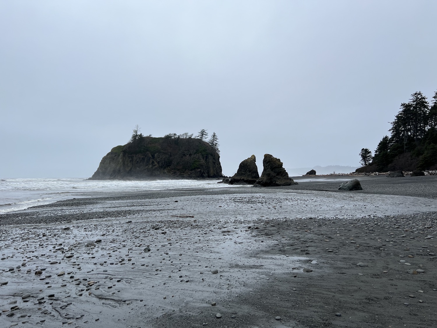
After narrowly avoiding a herd of Roosevelt elk, I headed to Ruby Beach, where windrows of logs – thrown up by winter storms – littered the pebbly sand, and sea stacks hovered between gray sea and gray sky.
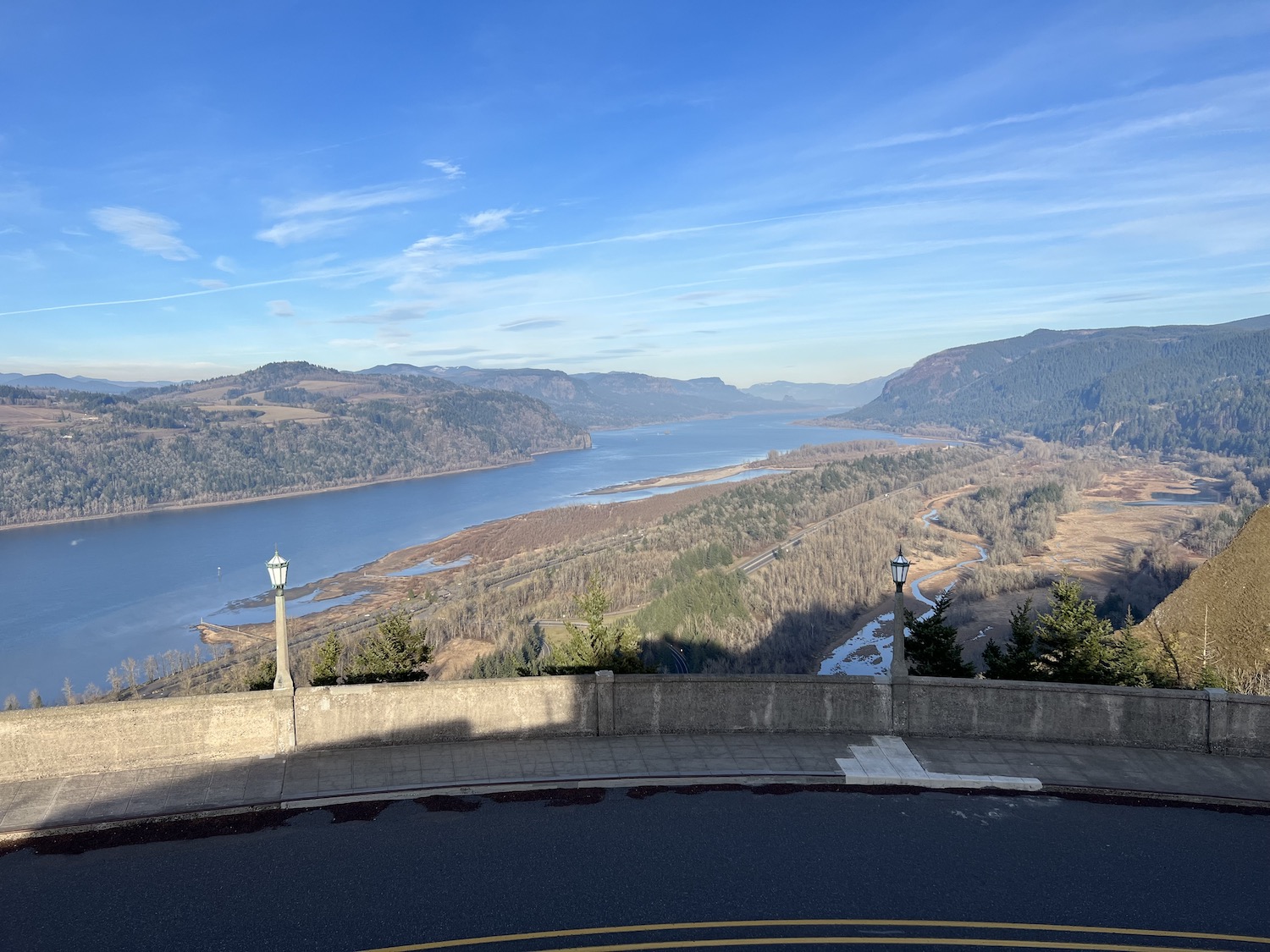
A long drive carried me south to the Columbia River. It was a perfect winter afternoon – sunny, windless, and crisp – and I couldn’t resist the old Columbia highway, a two-lane road that winds along the bluff tops overlooking the river. I especially liked the Vista House overlook, where the elegant lampposts and railings of the highway framed the shining river.
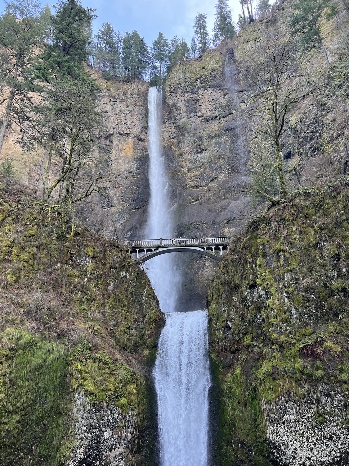
Another highlight was majestic Multnomah Falls, its silver ribbon bisected by a footbridge.
It was now almost sunset; and thanks to poor planning, I still had eight hours to drive. I followed the Columbia upstream, the sun setting at my back. As the light faded, the landscape changed, coastal forest sinking into steppe. Then, only the lights of ill-distinguished cities: Kennewick, Spokane, Coeur d’Alene… Between, semis sailed like lighted clippers through the dark. I crossed two snowy mountain passes, windows open to keep myself awake, and arrived in Missoula, Montana around 1:30 AM, having driven nearly 1,000 miles over the past 20 hours.