The Mail Plane to McCarthy
8/25 – 8/27/22
A long flight beside a ridiculous little dog; turbulence; a brief, magical moment of glaciers and mountains glowing in the sunset – and then Anchorage, for the first time since 2020. A cab carried me to an overpriced hotel, where I was warned to turn the fan on before using the shower down the hall (“if you don’t, the alarms go off – and that’s a $500 fine.”) Welcome to Alaska.
8-25
The first of this trip’s many logistical problems had been figuring out how to get from Anchorage to McCarthy. The cheapest way was by van, which would have taken about ten hours and involved an overnight stay in the Glenallen, Alaska’s least favorite truck stop. Instead – I decided – I would take the mail plane. It flew only on Monday and Thursday, and only had a few seats. But anything, I told myself, would be better than Glenallen. So I booked a flight – or rather, two flights, one from Anchorage to the Glenallen airport, the other to McCarthy.
The hangar address on the confirmation email for the first flight turned out to be wrong; Reeve Air, I discovered, had moved to the other side of the Anchorage Airport, and my hapless Uber driver and I spent a half-hour trying to find the correct location. Once we did, I was directed to a six-passenger prop plane, which sputtered, thrummed, and sprang into the hazy morning.
Cruising just above a pearly sea of clouds, we paralleled the Chugach Range, whose highest peaks peered majestically into sunlight. The clouds parted as we approached Glenallen, a grayish smudge in the leek green wilderness, the Wrangell Mountains gleaming behind. At the sunny Glenallen hangar, I chatted with one of my fellow passengers, a tourist from Germany, as the planes that would bring us to McCarthy were prepared.
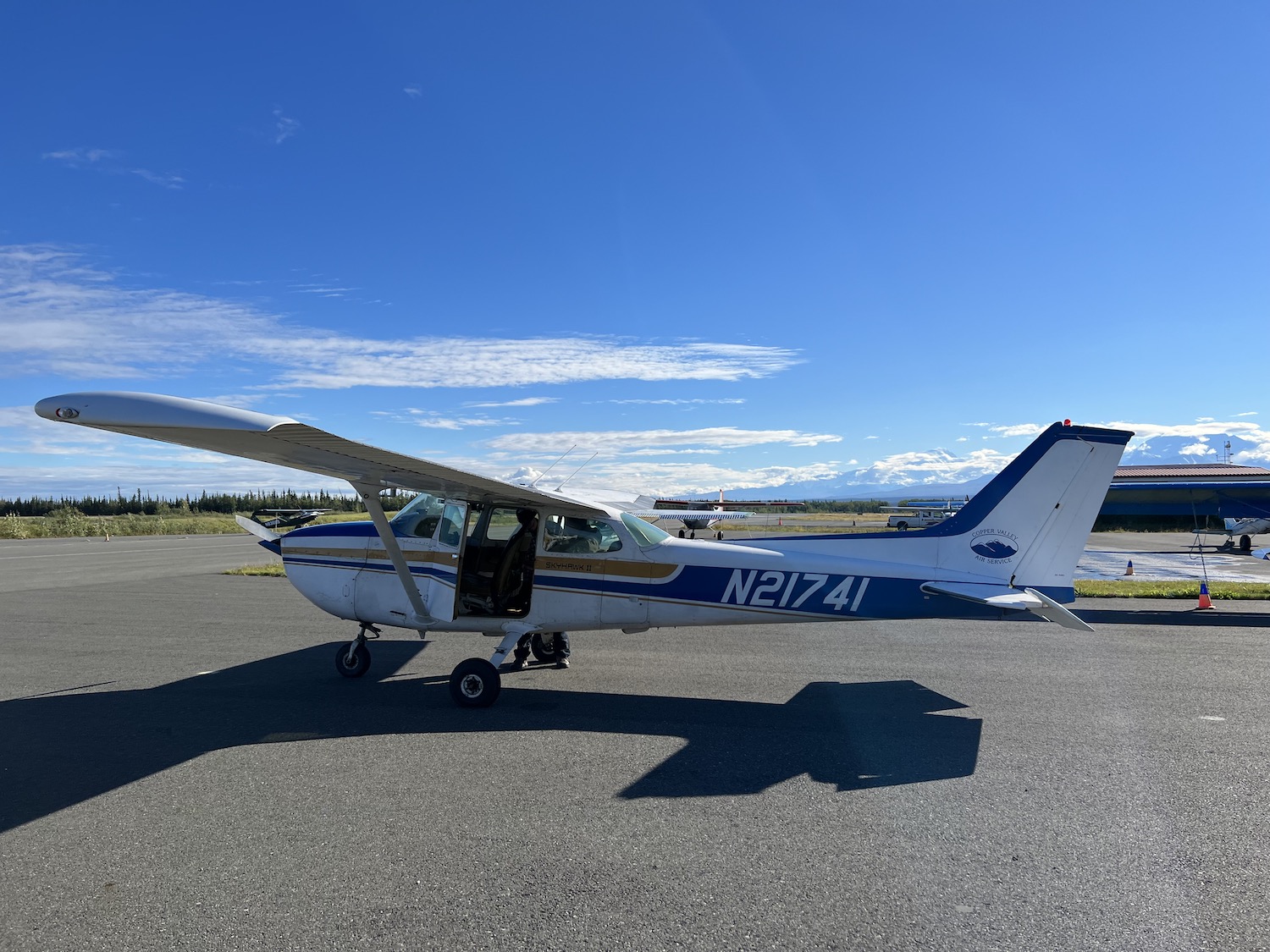
Planes in the plural – the only aircraft at Glenallen were three-seat bush planes, and three were sent on to McCarthy: two with passengers, one for the mail. The plane to which my German friend and I were directed was about 60 years old. The pilot, for contrast, was about 20.
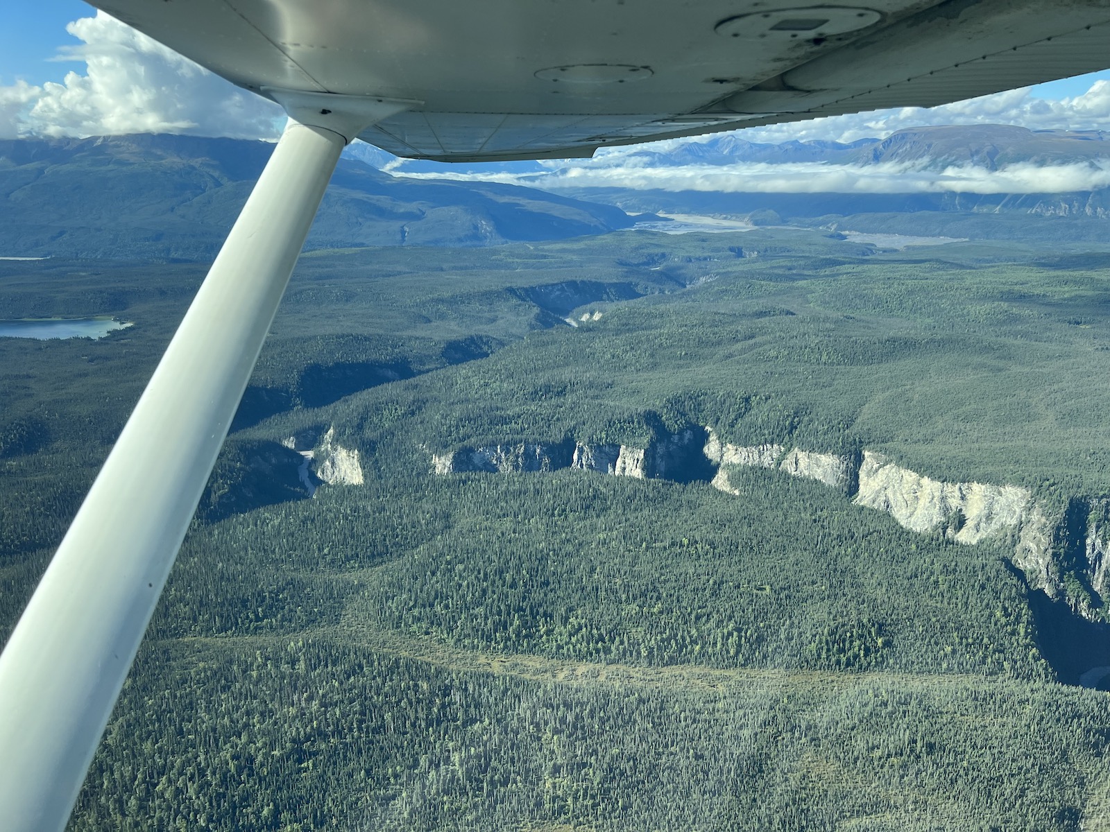
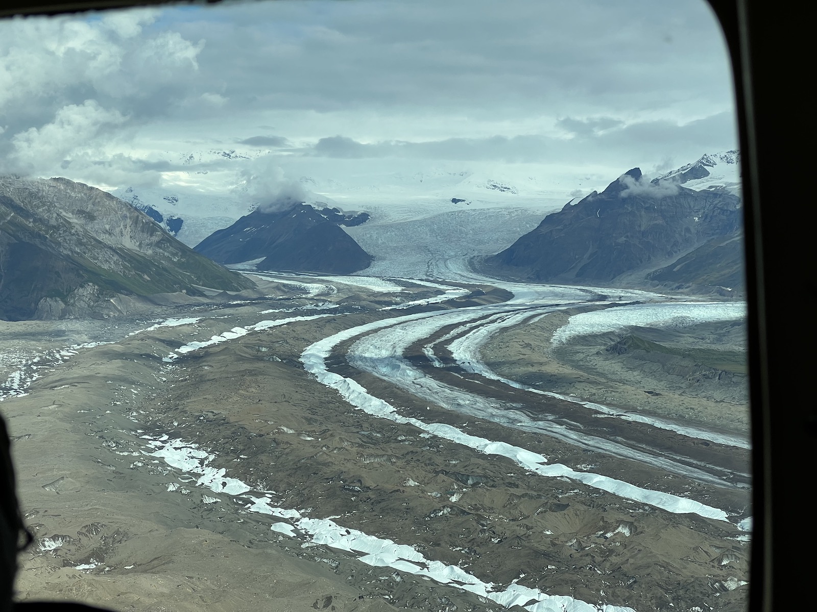
The skies were almost totally clear. The upper Copper River coursed through the taiga below, gnawing at tall cut banks. The glaciers of the Wrangells sparkled to the east. At my request, the pilot dipped low over the bridge and trestle on the McCarthy Road. The highlight of the flight, however, was the approach to the McCarthy Airport over the vastness of Kennecott Glacier.
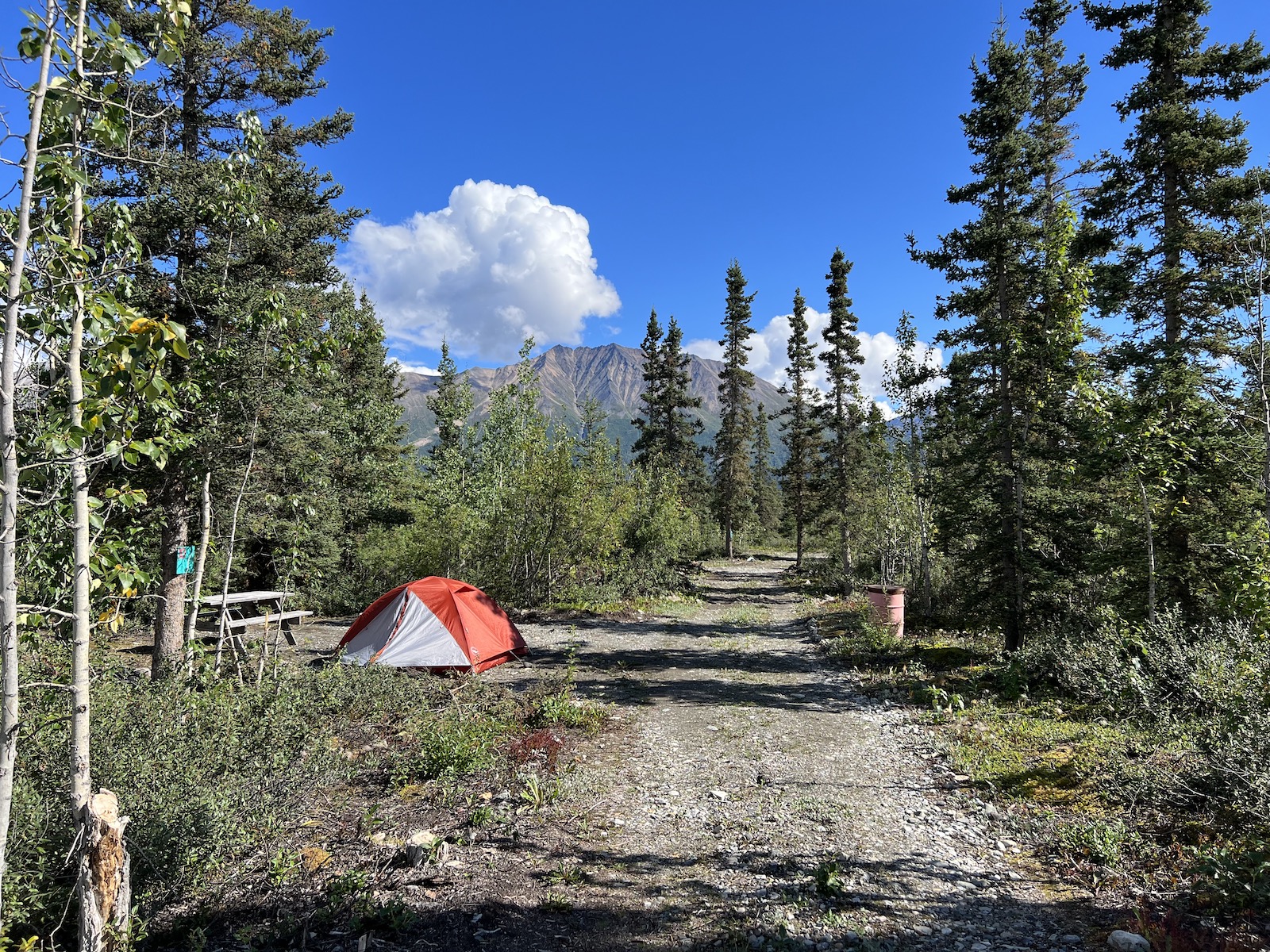
I walked with my German friend to McCarthy, and then continued a mile to the lodge run by MRTO – my rafting company – where I picked up the tent and sleeping bag I would be using during my trip. With these balanced precariously atop my duffel, I was sent a half-mile up to the road to the campground. I contrived to pick the rockiest site.
Onward to Kennecott via shuttle. I took a tour of the huge ramshackle concentration mill, where I distinguished myself by carrying a notebook and scribbling notes like a grade schooler on a field trip. During its heyday, when the building rattled and groaned with crushers, sifters, and shakers of every description, the timber walls reverberated so much that they had to be tied together with huge steel cables that were tightened daily.
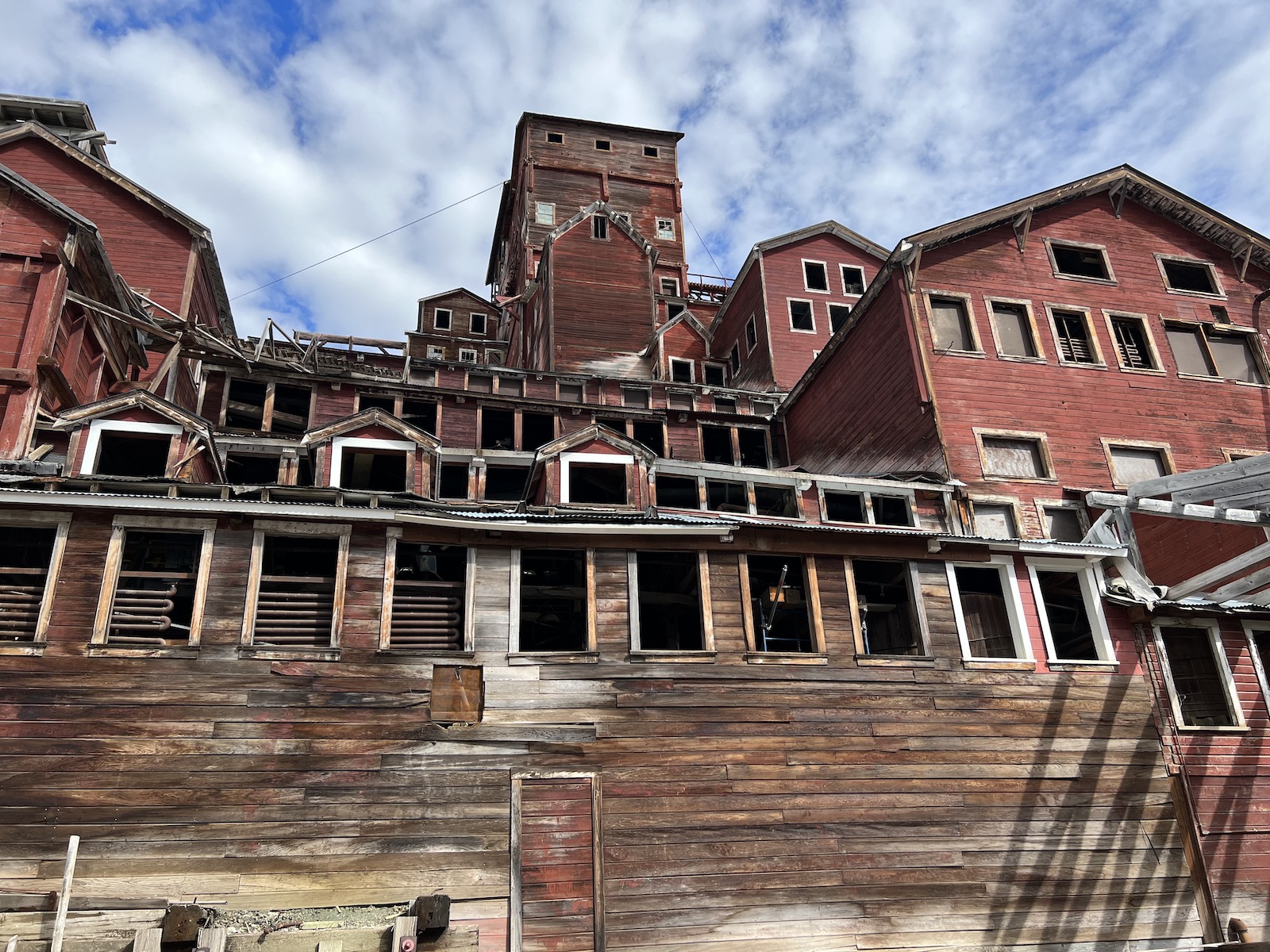
After a walk around Kennecott, bathed in the golden light of late afternoon, I took the shuttle back to McCarthy. I dined at The Potato (famous hereabouts for burritos and pizzas), where I stumbled into my German friend again. We talked about our travels; I worked my way through a pizza, fries, and cobbler. Then a cold dark walk to a cold dark tent.
8-26
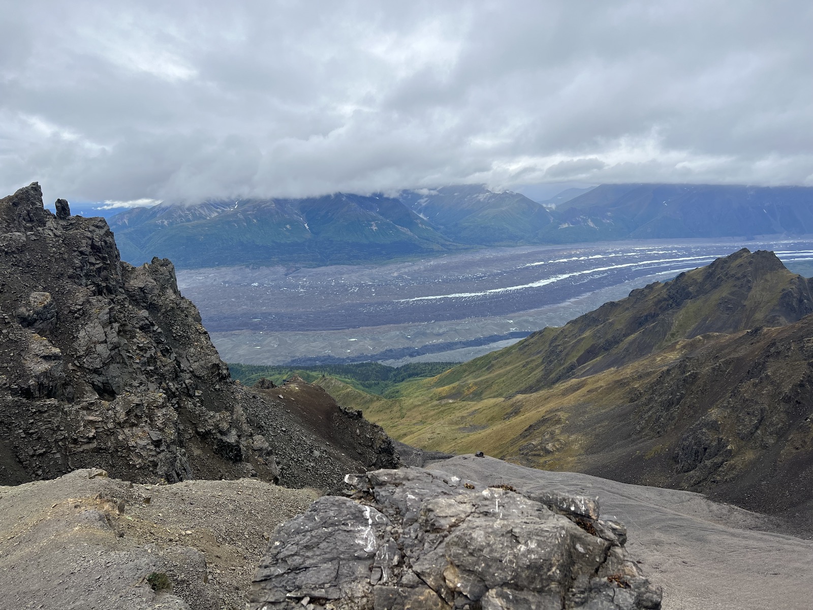
I woke to the sound of rain on the tent fabric. I pulled on my rain gear, wrapped plastic bags around everything in my daypack, and made my way to the footbridge. There I encountered the van from St. Elias Mountain Guides, and met the guide I had hired to lead me up to Erie Mine, perched on a not-quite-inaccessible pinnacle 3,000 feet above the glacier.
With the guide and one other hiker, I walked along the edge of Root Glacier, which was almost invisible in the downpour. As we started up the slope toward Erie Mine, the guide took a long look at the slope and announced that it was too dangerous to continue. I asked the guide to head instead to Bonanza Mine; and so, after backtracking six miles, we splashed our way in that direction.
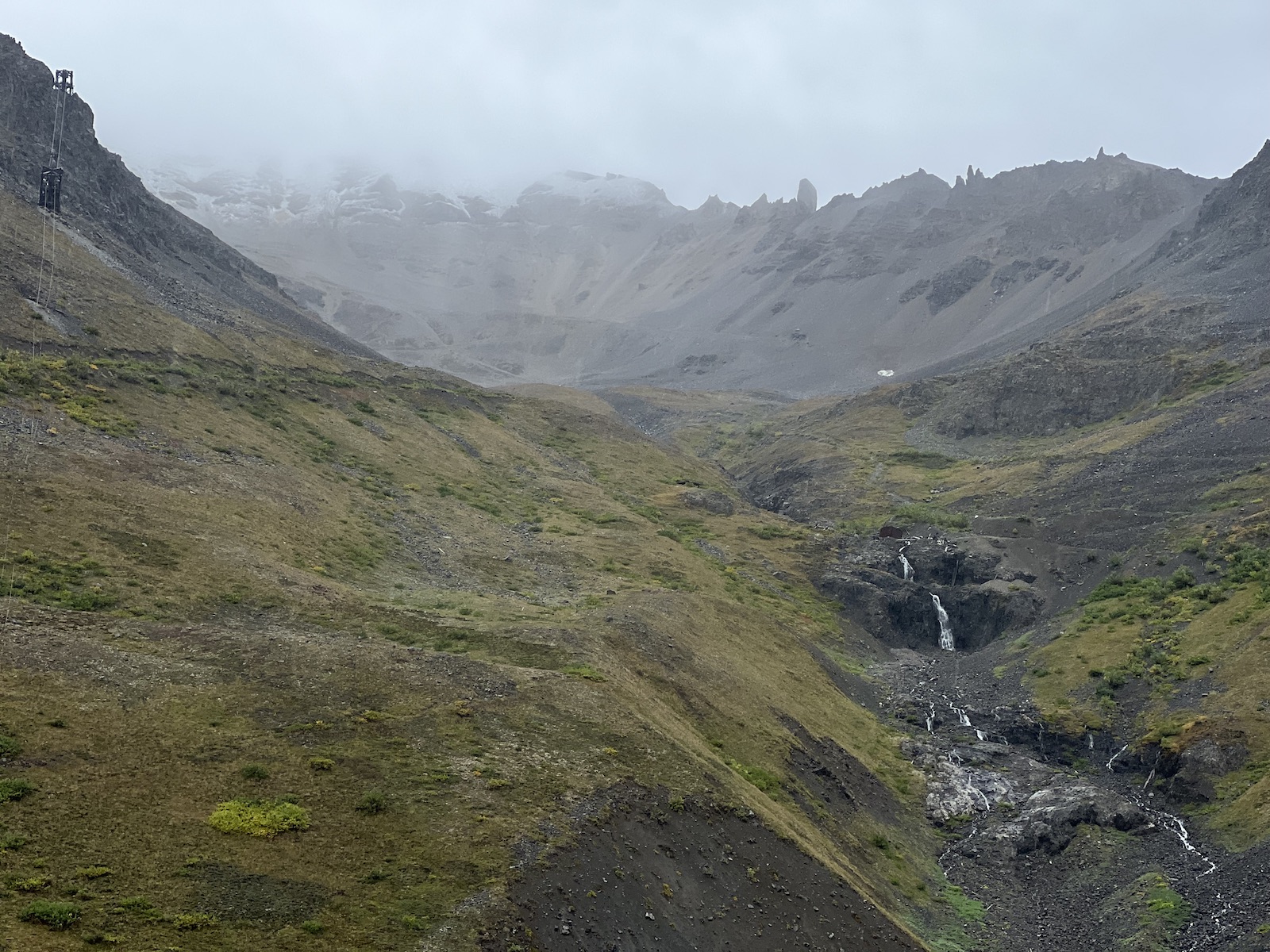
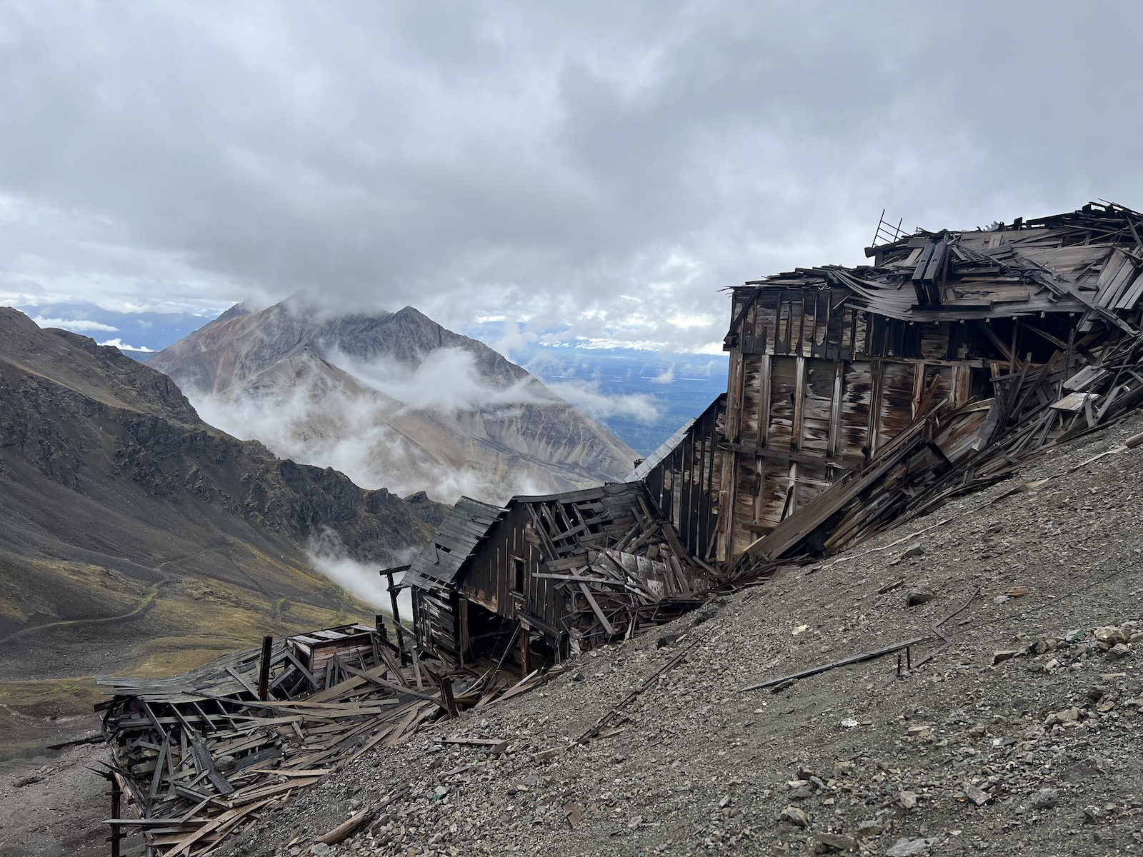
By some quirk of the weather, the clouds that wrapped every surrounding mountain had withdrawn from Bonanza Peak, haloing the black valley and its rushing brook. Up we went, the rain changing to snow as we approached the bunkhouse. A howling wind tore a gap in the clouds, exposing Kennecott Glacier.
As new fleets of clouds sailed up the valley to close the horizon, I fumbled with numb fingers, trying to shoot panoramic videos. Back at the mine, I took a series of videos in the half-collapsed bunkhouse, hands stiff and twitching with the cold.
After a few last shots amid flurrying snow, we began the knee-popping descent. It was still raining when we reached Kennecott, where I demolished a meatball sub under the dripping eaves of the Meatza Wagon food truck.
I returned to a large canvas tent behind the MRTO lodge in time to meet with Sam and Jake, the guides for my upcoming rafting trip. As rain drummed on the roof of the tent, I tried on the dry suit that I would be wearing for the next week. Then, after charging my phone at the lodge, I slogged back to my sodden tent.
8-27
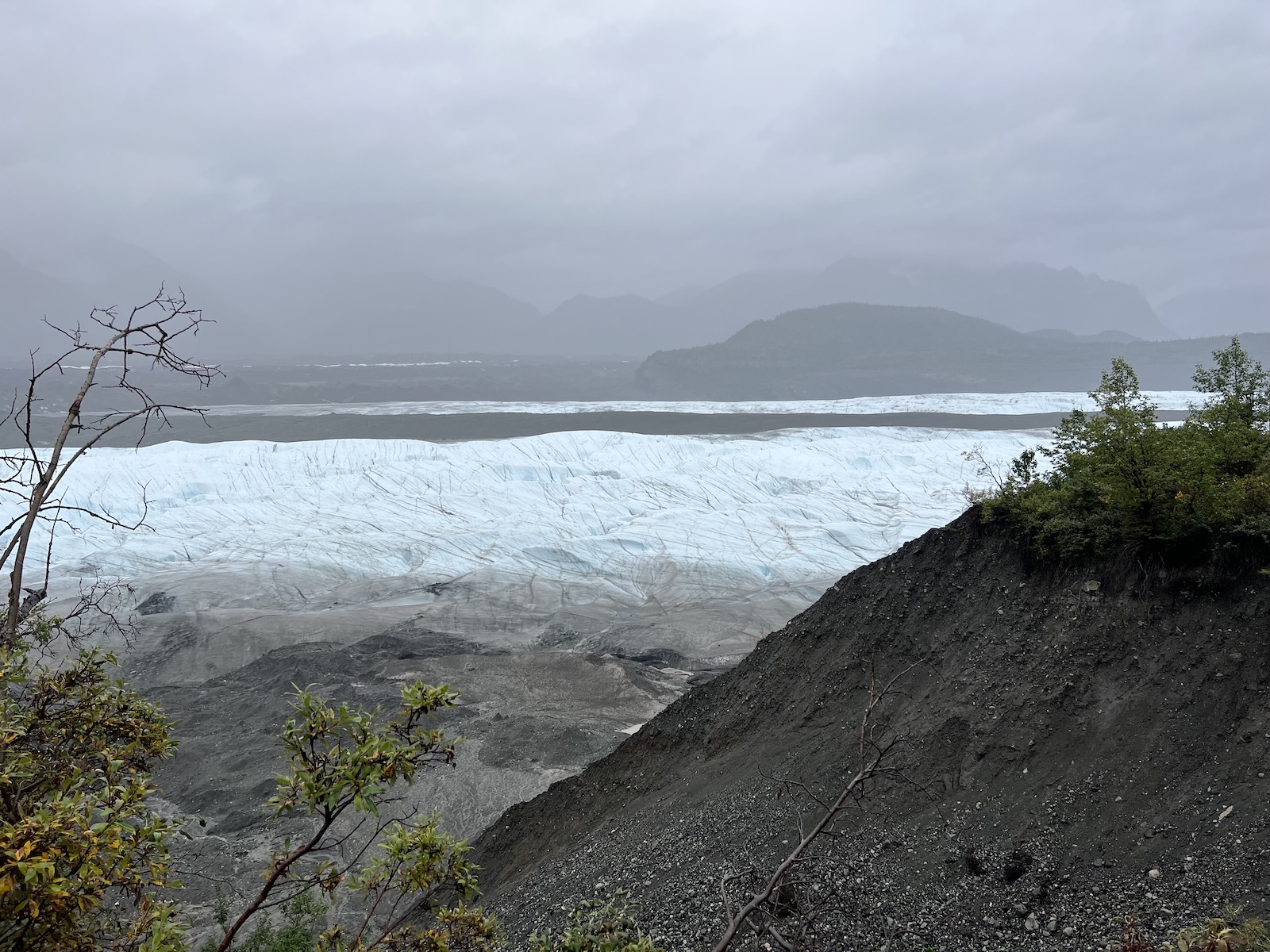
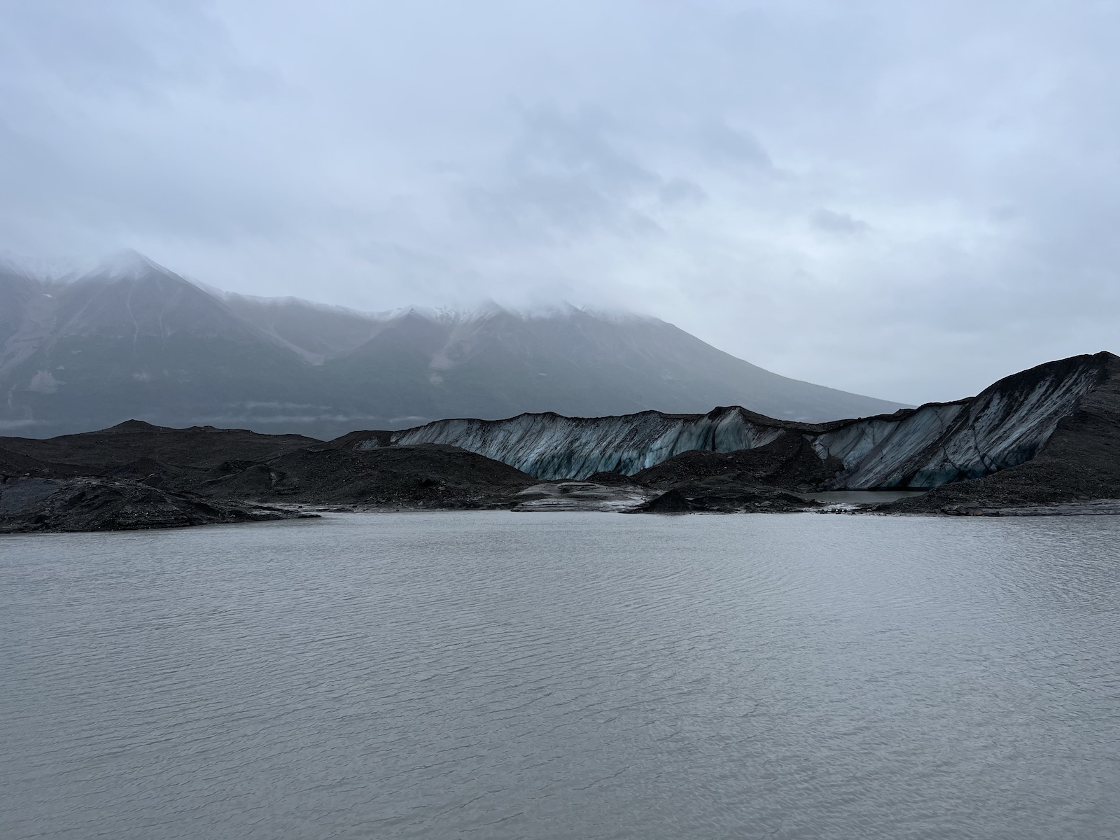
The rain continued all night, hammering at the rain fly with numb ferocity. Dawn succeeded only in illuminating the innumerable puddles surrounding my tent. Deciding that the downpour was not likely to stop anytime soon, I set off through the dripping woods on the west glacier trail, which follows the ragged lateral moraine of the Kennecott Glacier.
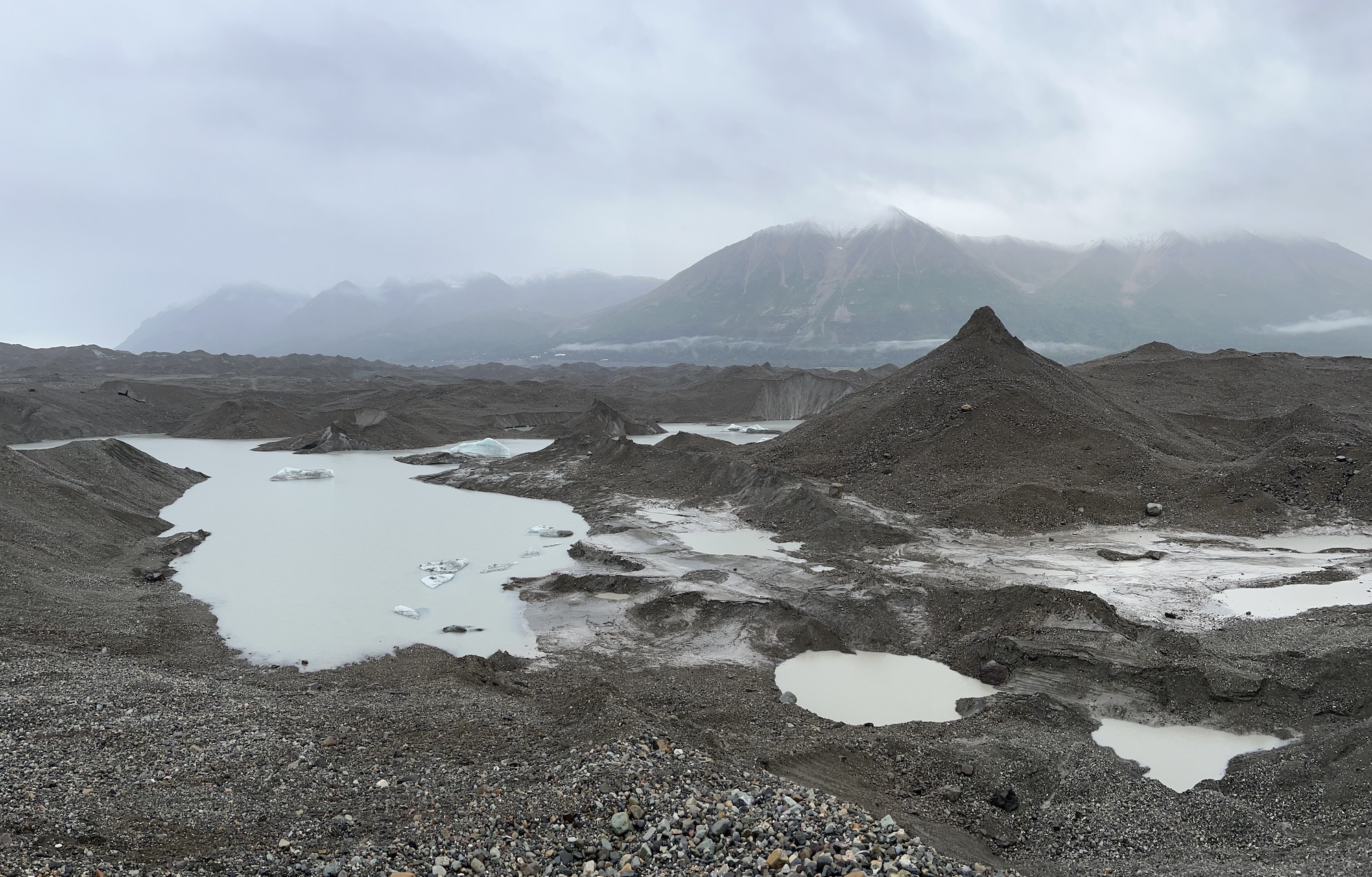
Although the glacier has not retreated much in the past century, it has lost nearly 300 feet of thickness, and its last few miles have decayed into a stagnant ice field, where huge rock-shrouded pinnacles rear up from muddy ponds of meltwater. As the rain plummeted and blew, I plunged through thickets of alders and forded swollen streams, working my way toward the distant point at which the glacier was accessible.
When I finally reached a low shelf that spanned the meltwater, I found myself among razorback ridges and pinnacles of ice. Deciding that a hundred-foot ridge in the middle distance would be the best vantage point, I scrambled over the tortured surface, slipping and skating over the thin blanket of debris. When I finally clambered up, I was treated to a somber panorama of ice and stone, hazed by the relentless rain.
Four muddy miles later, I ordered hot chocolate at the Potato in McCarthy, destroyed a burger, and finally worked up the will to return to my tent. The rain redoubled in intensity the moment I had the fly off, and I scrambled to jam the swollen fabric into the stuff sack before more damage was done. At length, awkwardly hauling duffel, backpack, and dry bag, I staggered back down the road.
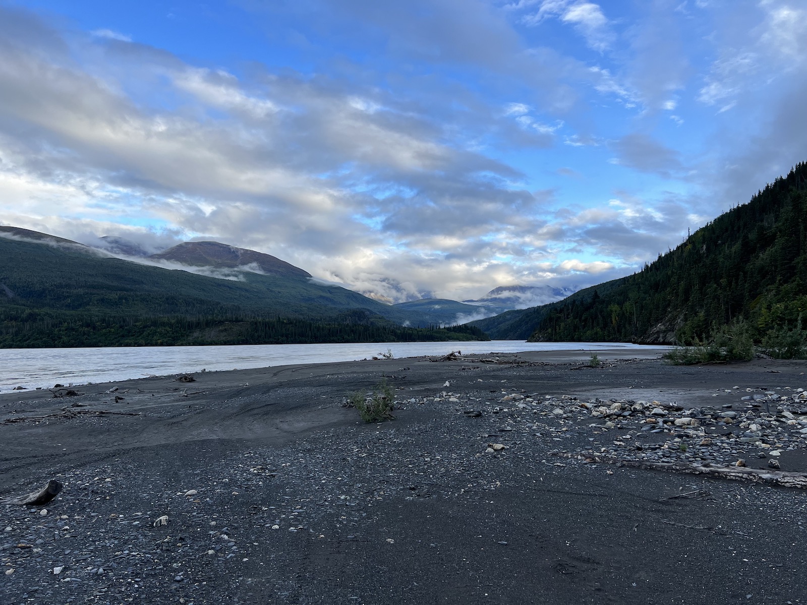
After stopping at the lodge to charge my phone for the last time, I made my way to the McCarthy footbridge, where I met the shuttle van that would take me to Chitina. The driver – a man with a thick Boston accent – regaled me and the other passengers with stories of bow hunting grizzlies. He detoured a few miles off the road (passing a cow moose and her calf) to bring me to O’Brien Creek, where I would meet the rest of the rafting group the following morning.
The weather had cleared, and the evening sun glimmered on a spectacular sweep of snowcapped peaks, bisected by the mile-wide Copper River. Once I had my tent up, I walked over the river’s edge. The current was surprisingly swift for such a big river – I watched a tree hurling downstream faster than I could run – and the water was bitterly cold. A chilly breeze blew upstream, rustling the alders along the bank.