Canadian Rockies
1/26 – 1/29/26
For a decade, ever since my National Parks road trip, Banff has been on my bucket list. I especially wanted to see Banff in winter, when the hordes of July and August were a distant memory, and silence reigned over the snowy peaks. So, when my wife went away for a week to visit her mother, I decided to take a brief trip to the Canadian Rockies.
1-26
I hadn’t expected to find many people at O’Hare two hours before dawn on a frigid Monday morning. I should have. Thousands of travelers had been stranded in Chicago by the blizzard that had buried half the country over the weekend, and everyone seemed to be trying to leave simultaneously. My own flight to Calgary, fortunately, was only delayed by an hour.
We flew over the frozen Mississippi, frozen Fort Peck Lake, and the endless white plains of Saskatchewan. Then, as the Rockies appeared on the horizon, the plane descended into Calgary. I picked up a rental car with a windshield starred by thrown gravel – a constant hazard, as I was to discover, in Alberta winters. I headed west along the Trans-Canada Highway, fresh snow gleaming on the rolling prairie. Ahead was the hazy line of the mountains.
I had decided to stay in Canmore, the poor man’s Banff. My hotel was the best Super 8 in my experience. The room was clean, the bed was comfortable; mountains gleamed in the window. Less appealingly, Canada’s busiest train line was a few yards away.
Dropping my gear in the room, I returned to my car and drove into Banff National Park. The snow deepened as the highway climbed toward the Continental Divide. At least five feet blanketed the landscape around Lake Louise, where I stopped for a short hike. The famous pale blue water was hidden under ice. But the surrounding mountains, every crag and fissure outlined by snow, were as majestic as ever.
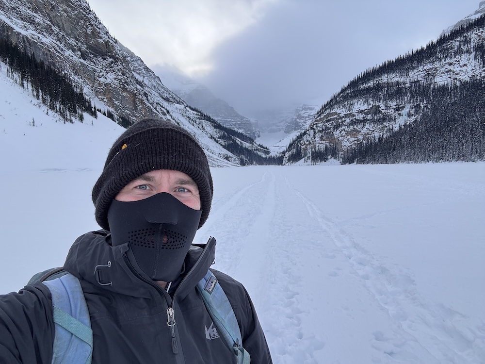
I followed a cross-country trail to the far side of the lake. Once past the hotel, where a section of ice had been cleared for a hockey rink, I found myself alone on the ice. Although the sky overhead was clear, flurries drifted from clouds massed over the glacier on the lake’s far side. I stopped at the base of a waterfall, frozen into a ribbon of pale blue ice. Then, face stinging in the evening chill, I retraced my steps to the car.
1-27
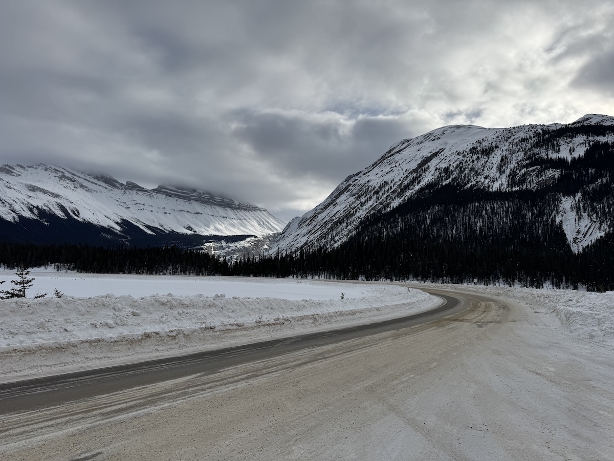
Leaving the cozy confines of the Super 8 in the predawn chill, I followed the Trans-Canada Highway west, past Banff and Lake Louise, to the entrance of the Icefields Parkway, Canada’s most iconic scenic drive. The sign at the entrance booths announced POOR road conditions. The pavement, I quickly discovered, was almost completely covered with ice and packed snow. But it was only treacherous if you weren’t paying attention.
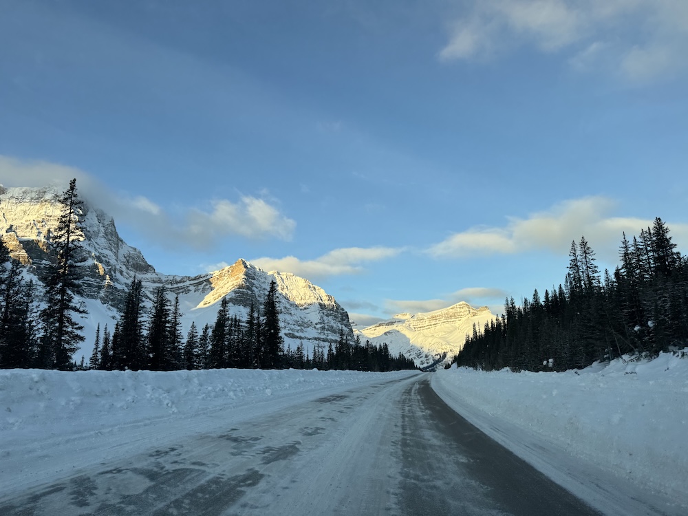
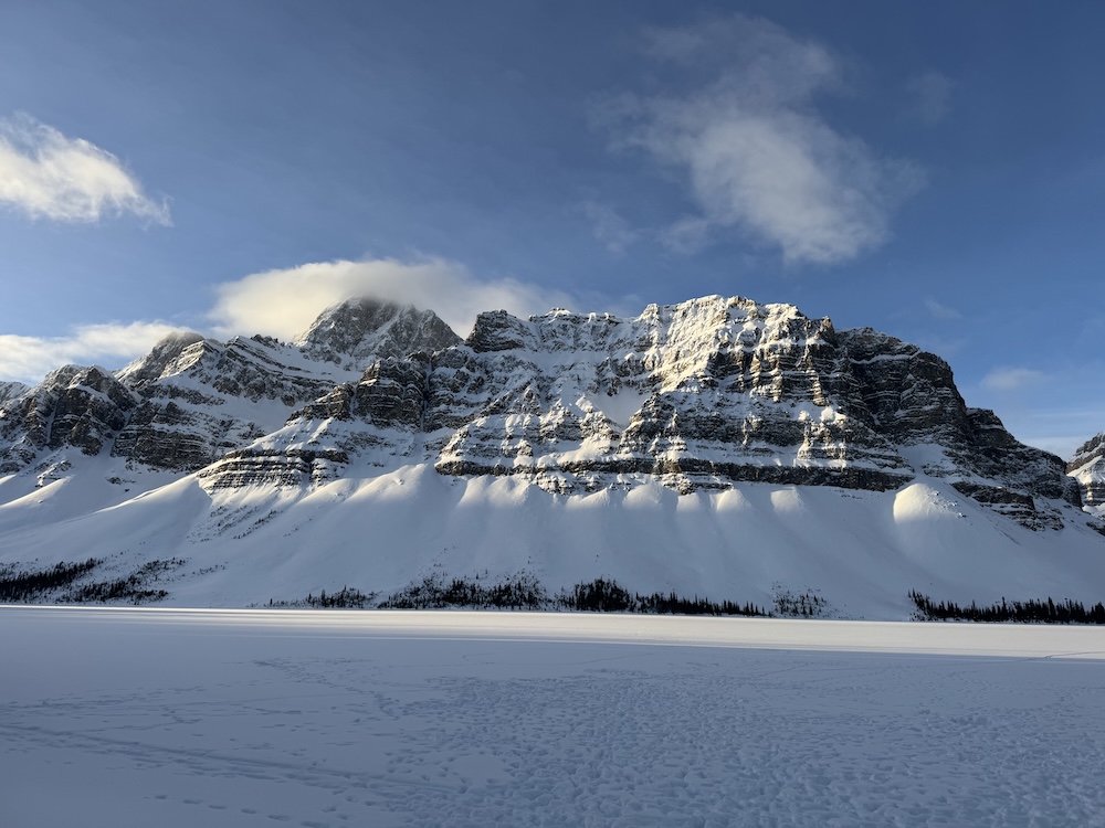
I wasn’t paying attention, because the landscape opening on either side of the road was staggeringly beautiful. Under a clear and brightening sky, mountains reared – jagged, sheer, shining with snow. As the sun crested the peaks, with the temperature just above zero, I stopped at Bow Lake. Pines rose on every side, limbs freighted with snow. High on the mountain wall across the lake, the cobalt ice of a glacier gleamed.
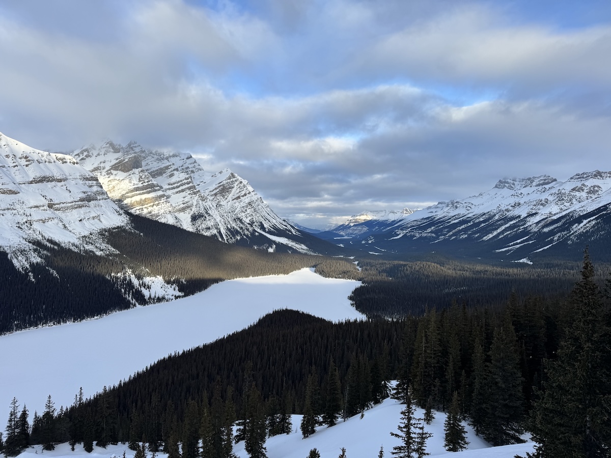
My next stop was Peyto Lake, probably the most famous beauty spot on a highway packed with them. The trail was deserted. When I reached the snow-shrouded viewing platform, I found myself overlooking a vast and lonely valley, with a glacier on one side and the frozen lake below. I stood there a while, listening to the wind.
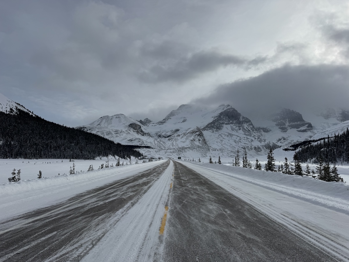
Beyond Saskatchewan Junction, the parkway climbed steeply, the mountains crowding ever closer to the road. I stopped to marvel at a spectacular alpine amphitheater, where the road made an S-bend beneath beetling cliffs. At Parker Ridge, just beyond, I watched clouds sagging with snow cascade over the mountain wall.
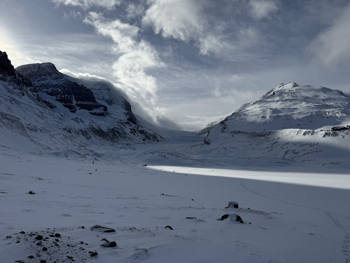
Near the place where the Banff and Jasper parks met, I reached the Columbia Icefield, namesake and centerpiece of the parkway. I hiked to the foot of Athabasca Glacier, passing huge lateral moraines made during the Little Ice Age, when the glacier was more than twice its current size. Even in its diminished state, it was still impressive, its ice gleaming gem-like through gaps in the snow.
After driving to the north side of the Icefield, I backtracked to Wilcox Pass, just beyond Athabasca Glacier. The trail overlooking the pass is one of the finest in the park. Unfortunately, it was buried beneath four feet of snow – and I had neglected to bring snowshoes. I was forced to struggle up, post-holing to my knees at every other step, sometimes almost swimming in snow. When I finally made it to the ridge, legs aching and will fading, I was treated to a view of Athabasca Glacier, crowned by a boiling mass of clouds. To the west, the sun was just setting behind a jagged rampart of peaks. Beneath, almost lost in the sea of white, was the black ribbon of the parkway.
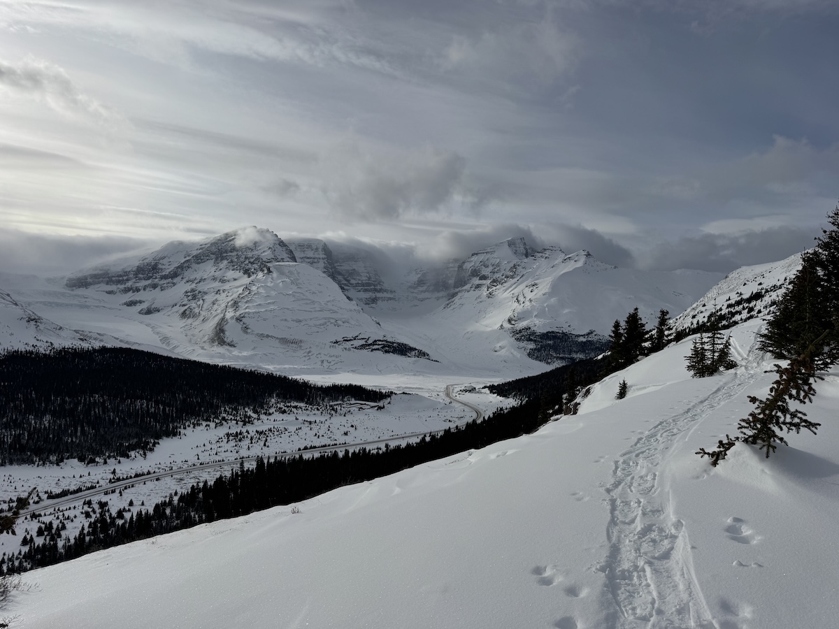
Parks Canada had set up a pair of red chairs at the highest point of the ridge. Settling into one of these, I sipped my icy water, devoured a few handfuls of peanut M&M-infused trail mix, and counted myself very lucky to be where I was.
1-28
Leaving the hotel before dawn again, I drove in the twilight down the winding Bow Valley Parkway. Trees crowded close to the narrow road, occasionally parting to reveal snowy peaks that shaded almost indistinguishably into gray sky.
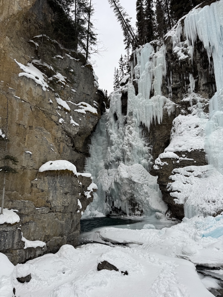
I was one of the first cars in the large parking lot – very crowded in summer – for the Johnston Creek Trail. Strapping on my cleats, I followed the ravine, the babbling creek at its base just audible through pockets in the ice. In places, the trail was cantilevered over the canyon, and the rockface on the other side, draped with pale blue icicles, was almost close enough to touch. Although the lower falls were completely sheathed in ice, water was still tumbling beneath and boiling in the open pool blow.
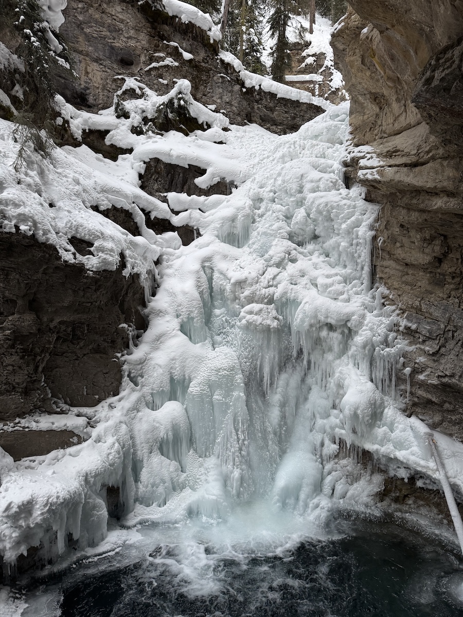
The Upper Falls, another half-mile up the trail, were even more impressive – a looming tower of ice, haloed by cascades of sky-colored icicles.
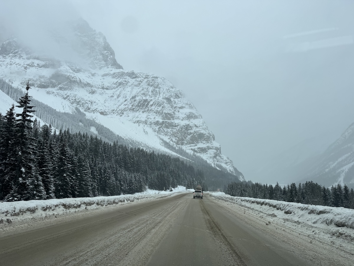
After returning to my car, I followed the Trans-Canada Highway over the Continental Divide and into British Columbia. It was snowing in the pass, covering the pavement and reducing the looming mountains to ghostly outlines. Every truck sent snow devils whirling along the road.
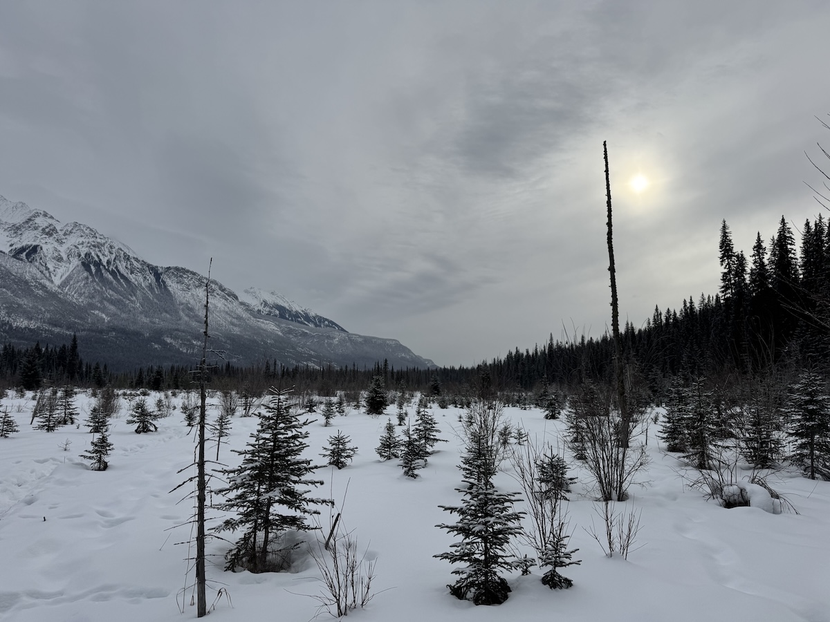
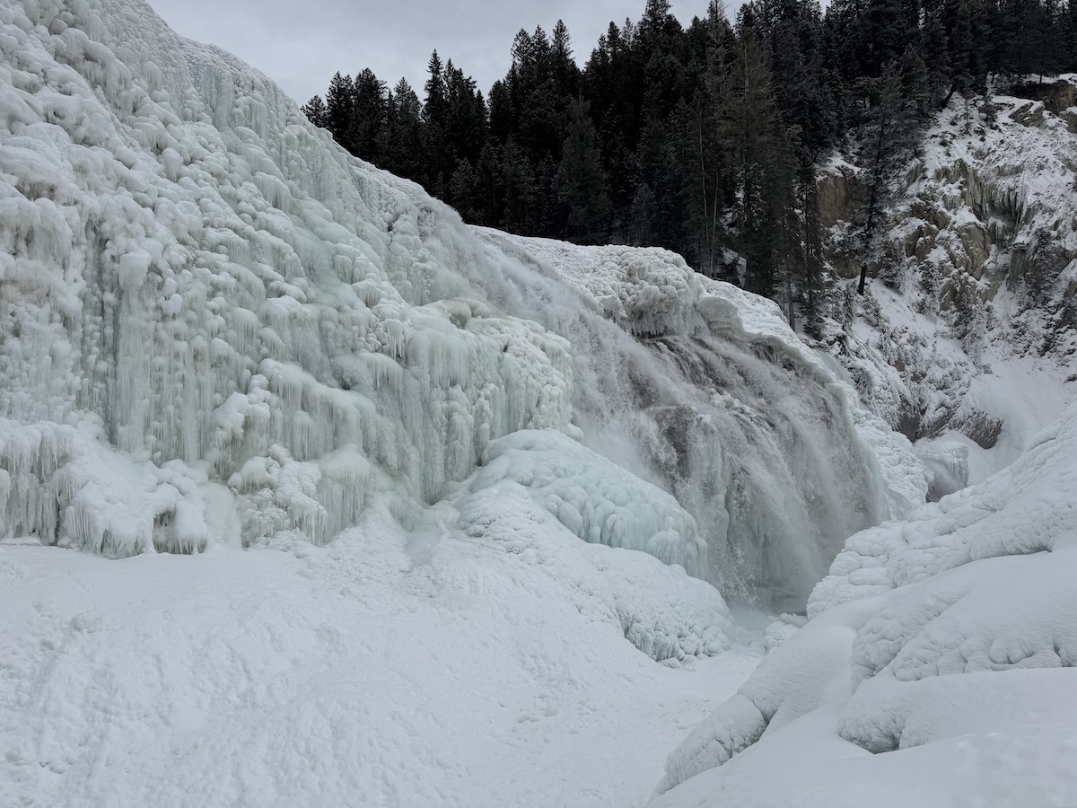
The snow had dwindled to flurries by the time I reached Yoho National Park on the far side of the divide. Parking in a small and icy lot, I followed the snow-covered access road to the trail for Wapta Falls, one of the largest cascades in the Rockies. Along the way, I detoured to a snowy meadow, where a hazy sun presided over a dramatic mountain vista.
There were only a few other hikers on the trail, and the surrounding woods were filled with the silence that follows snow. I had to put my cleats back on as I clambered down the treacherous slope to the falls. But they were worth the effort – a spectacular wall of ice against a backdrop of mountains. Trusting to my cleats, I climbed a high ridge of ice-covered rock in front of the falls, and took in the sublimity of it all. Although ice covered most of the falls, two sections were open, and their spray rose in clouds that slapped my face. The roar of the water filled the landscape. No other people were in sight. It was one of those moments you hope for in every trip. I broke the ice in my water bottle, balanced myself on the ridge, and drank it in.
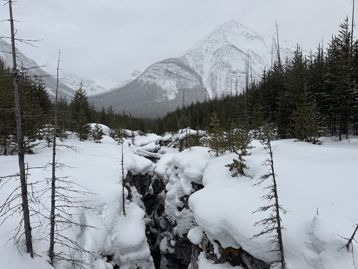
Crossing back over the Divide, I made my way to Kootenay National Park, just west of Banff. It was snowing again, and fat flakes drifted over mountains scarred by fire. With time for only a single short hike, I stopped at Marble Canyon. It was a magical place. Snow was falling heavily, drifting through the pines and over the trail. The canyon was a deep gorge, almost narrow enough to leap over, cut by a pale blue creek. Over the ravine loomed a conical mountain, hazed by the snow. The only sound was the rasp of flakes on my hood.
Then it was time to go. A gap opened in the clouds as I returned to the Trans-Canada Highway, and sunset gilded the mountain tops.