Lake Van Region, Turkey. 6/9 – 6/11/17
6-9
As usual, I chose the wrong road. A malicious GPS aided and abetted; but the decision was mine. I had to get from Erzurum to Van – a substantial drive, but not an inordinately long one by the main highways. Along the way, however, I wanted to see Ahlat. The shortest route incorporating that city was a road cutting through the steppe to the north shore of Lake Van. What appeared on my map as a major highway proved to be winding, potholed, not quite two lanes wide, and irresistibly attractive to farm animals. At one point, I had to crawl on the shoulder around a mule who steadfastly refused to leave the middle of the road.
When I dared to look up, the steppe had all the beauty of late spring: every shade of green, slashed with mile-long streaks of wildflowers. Where the road rose above the lip of the river valley it paralleled, the snowcapped peak of Suphan Dag hovered on the southern horizon. The weatherbeaten houses of the few straggling villages seemed a part of the elemental landscape.
One of these villages nearly destroyed my car. In a place with the uncouth name of Tutak, I found the highway – apparently the only road that crossed town – blocked by a ditch for a new culvert. There were no detour signs. I tried the only other paved street in Tutak – and found this obstructed by a heap of gravel. My GPS registered no other roads. Parking in somebody’s backyard, I walked up and down the rutted dirt lanes, scattering geese left and right, until I finally found a rutted track leading around the construction zone and across the only bridge for seventy miles.
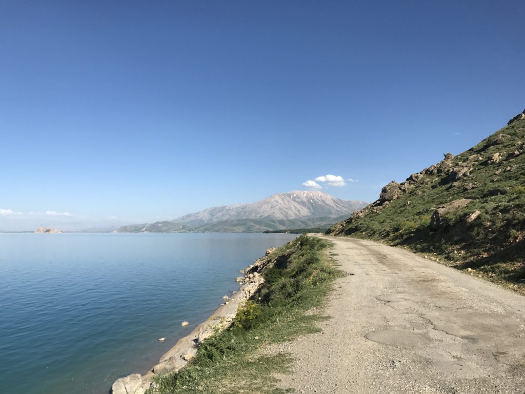
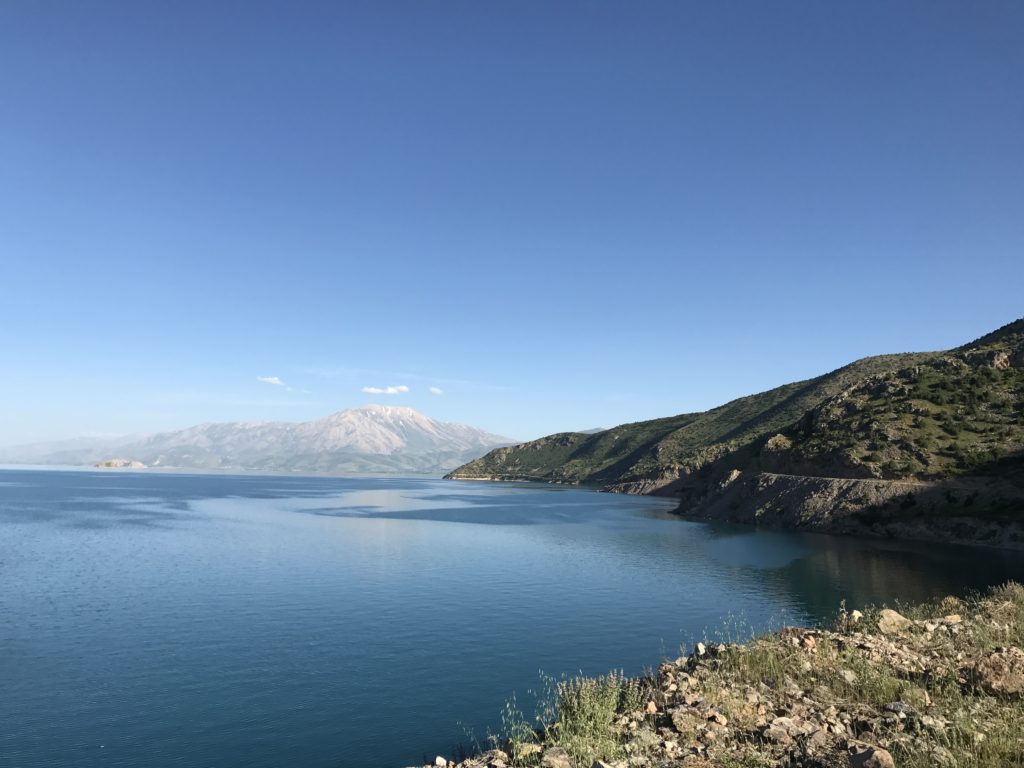
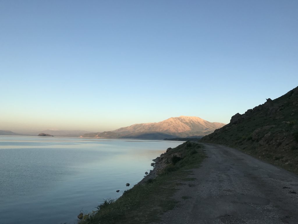
Suphan Dag mounted higher as I continued south, filling the horizon by the time I came into sight of Lake Van, Turkey’s inland sea. The first glimpse was arresting. Turquoise water, swept and untroubled by a light breeze, stretched to cobalt mountains hazy with distance. Seabirds cried over the leek green grass of the shore.
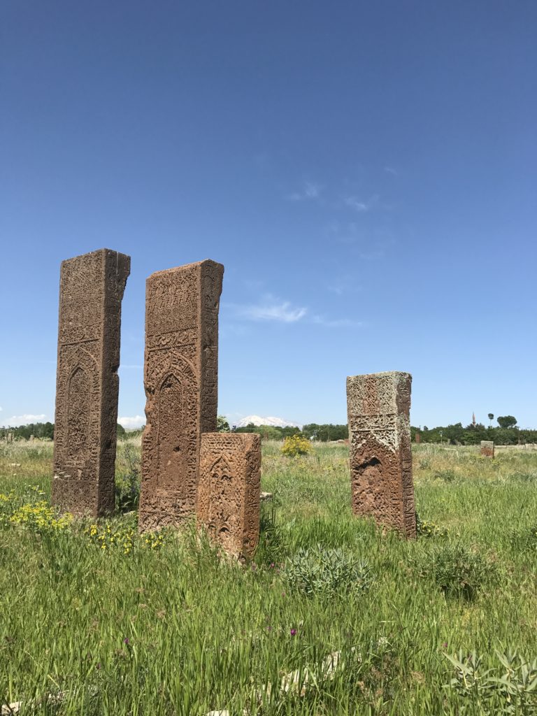
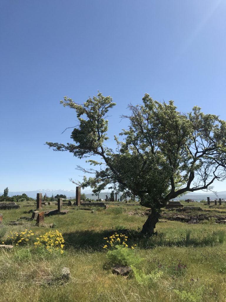
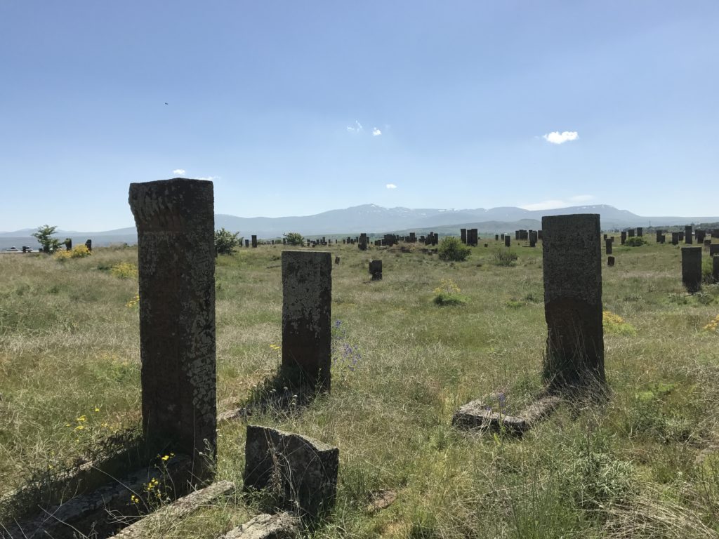
Besides the lake itself, there was little to see until I reached Ahlat, an unimpressive city endowed with a supremely evocative medieval Muslim cemetery. I wandered for more than an hour among the thousands of elaborately carved tomb markers that stand among the tall grass and wildflowers there, pausing occasionally for inadequate photos.
After forcing my way through Tatvan, I turned down a rutted track for what I thought would be a quick and painless excursion to the medieval Armenian monastery of St. Thomas. The ride proved both longer and more memorable than I had anticipated. For nearly 15 miles, the track wrapped along the lakeshore, each turn revealing fresh vistas and potholes new.
About halfway, I rounded a bend to find a large herd of cows advancing toward me. Parking on the roadside, I waited for the bovine procession to pass. Cows brushed both sides of my car, bending the mirrors forward. For reasons best known to herself, one stopped to lick my hood. Finally, an adolescent cowherd passed with a nod, and I was free to continue down the manure-slicked road.
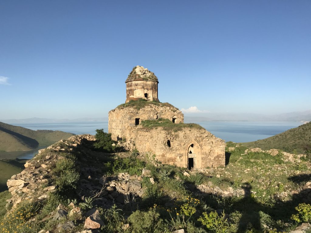
After nearly forty minutes, my destination finally came into view: a circular church atop a steep and distant mountain spur. Pulling down a wretched dirt track, I soon came to an intersection. Naturally, I chose the wrong fork. My error became apparent almost immediately from the jutting rocks and tall grass in the middle of the sunken road – but there was no place to turn around. Inching forward, straining for any place level enough for a fifteen-point turn, I rounded a bend to find, yet again, a herd of cows bearing down on me. I had no choice; throwing the car into reverse, I drove backward for nearly a half-mile, juddering over rocks and careening into grassy banks rendered invisible by the downward slope of the road.
By the time I made it back to the fork, I was extremely frustrated. Fortunately, a means for working off that anger was close at hand, in the form of the mountain spur I now had to climb to reach the church. If there was ever a path, it had long since vanished from disuse; and so, powered by rage, I charged straight up the 800 foot slope. Twenty minutes later, soaked in sweat and raked by thorns, I emerged on the summit. The sun was just receding behind the western mountain wall. Raking light crimsoned the creamy stone of the monastery walls, casting the shadow of the broken tower into the lake a thousand feet below.
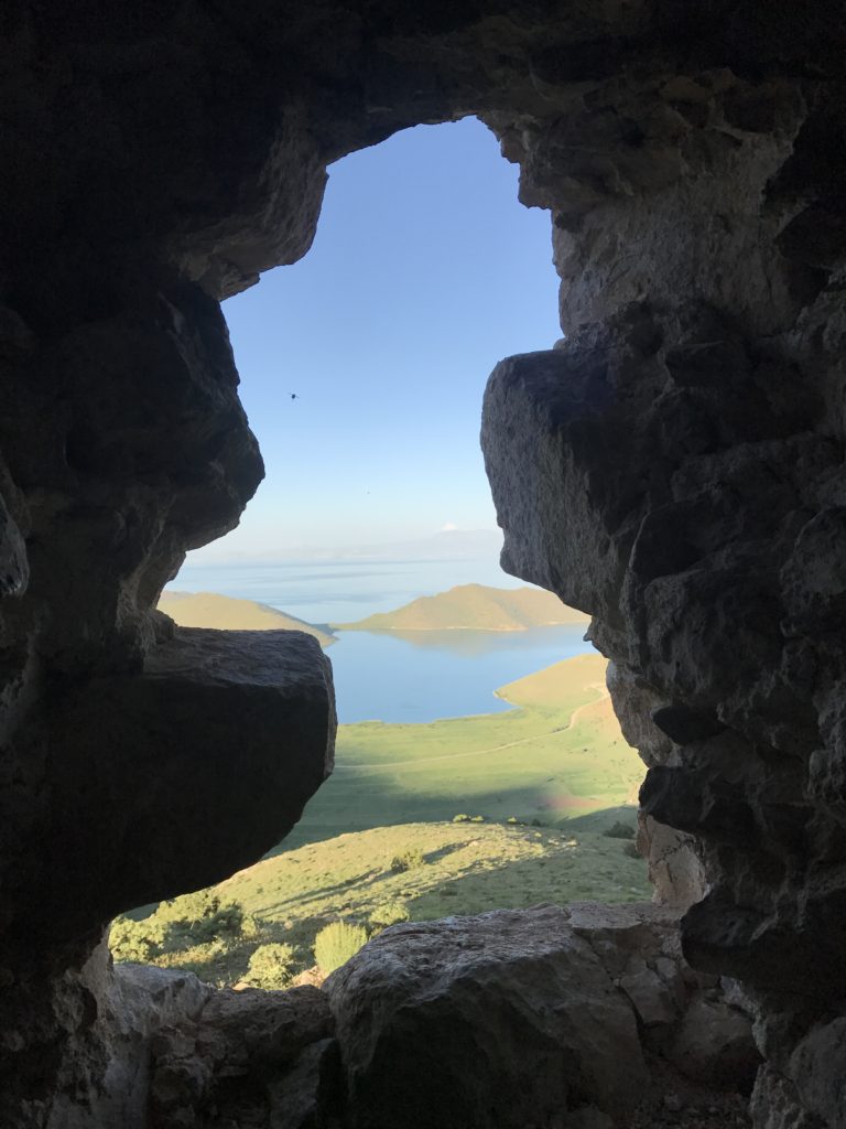
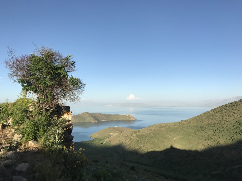
Ravens perched among the smashed tiles of the roof cried out at my approach. The interior, as usual, was dark and smelled faintly of cow manure. Climbing over pits dug by treasure hunters, I made my way to a window that overlooked the glassy lake. My car, nearly two miles away, shimmered among the grass. By the time I started back down the access road, a golden moon was rising over the eastern mountains.
6-10
The boat ride to Akdamar Island is probably the most popular tourist activity in the Lake Van region. However, since I appear to be the only western tourist in town, and since the Turks are not early risers on weekends, I found myself the only person on the dock at 10 AM. By the time I finally convinced the captain to leave a half-hour later, a stiff wind had risen, kicking up whitecaps over the lake.
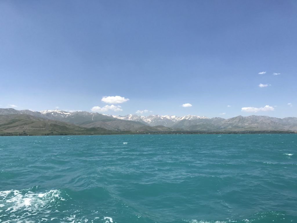
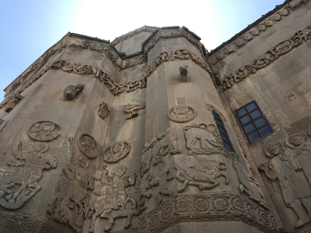
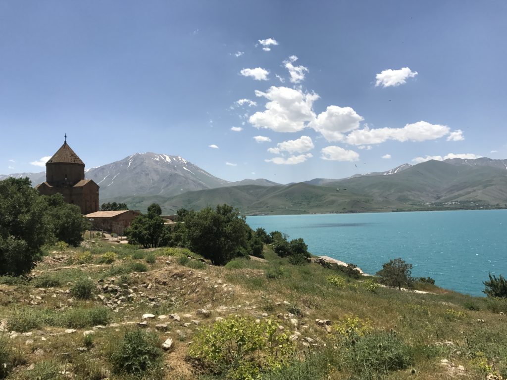
Akdamar island is famous for the Armenian monastery picturesquely perched above its tawny cliffs and against the distant profile of Suphan Dag. Recently restored, the monastery features fragmentary frescoes and impressive stone reliefs. The real highlight, however, is the setting. In the mottled shadow of passing clouds, the surface of the lake – now streaked with whitecaps – contrasted brilliantly with the darker shore. Late morning haze blurred these masses of color, lending an impressionistic feel to the scene.
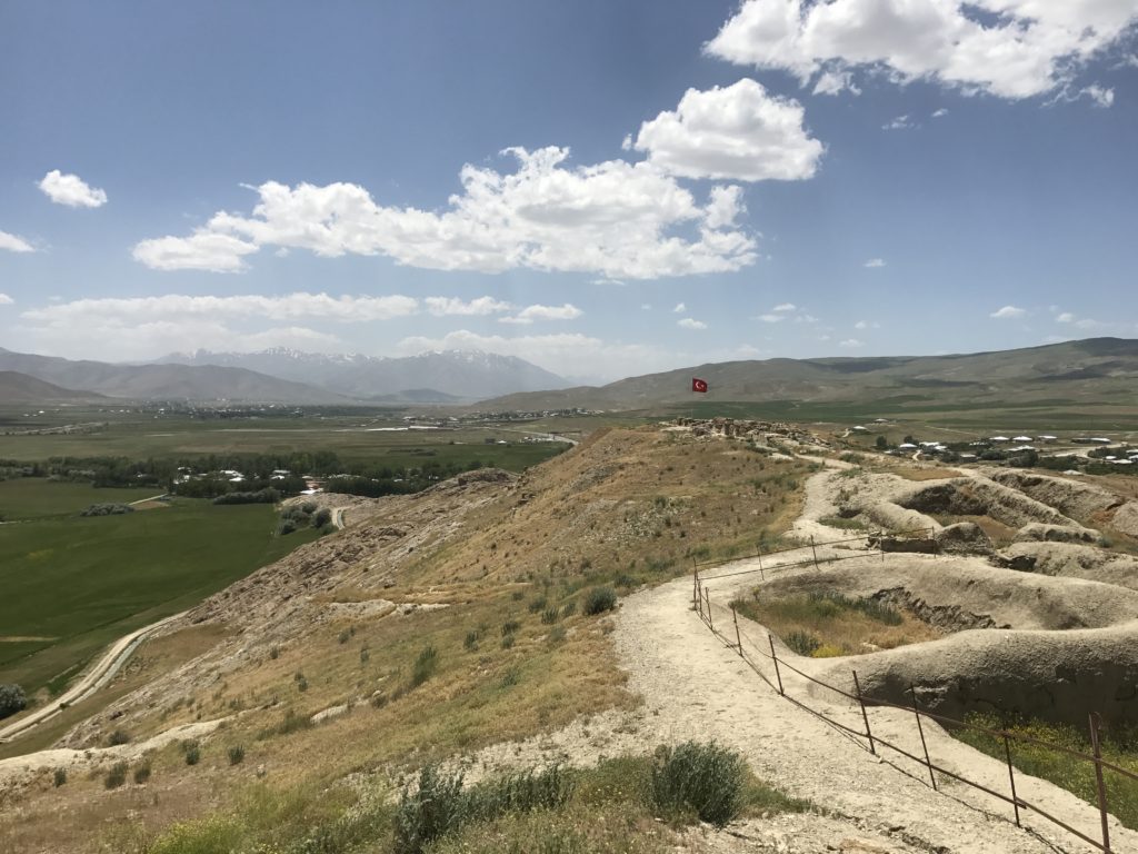
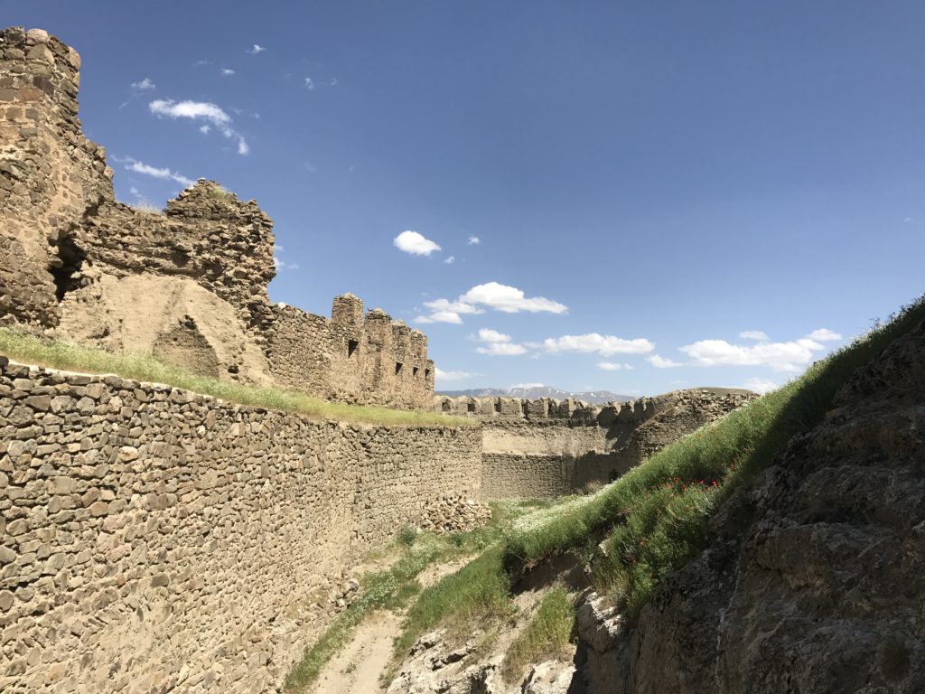
After returning to the dock, I drove east to Cavusteppe, a forbidding mountain ridge fortified in the ninth and eighth centuries BC by the kingdom of Urartu. The scanty remains within the citadel were less impressive than the cyclopean walls – built of massive stones joined without mortar – and the sweeping views of the umber valleys below.
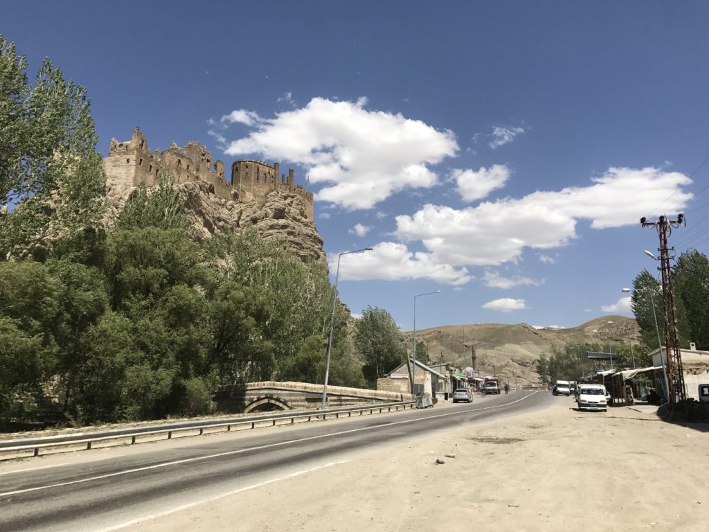
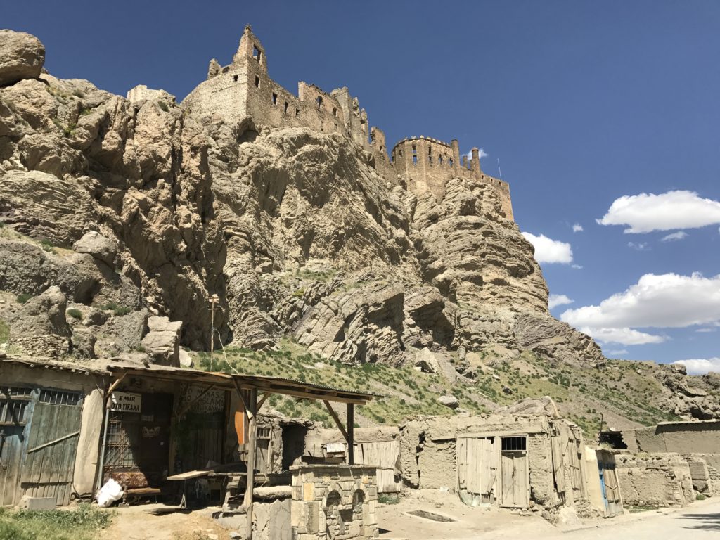
Further east, I found Hosap Castle, dramatically overlooking a landscape of barren hills. As I walked up, scattering a large herd of sheep, a man scurried from one of the ramshackle houses below and seated himself in the guard booth. He had some trouble finding the tickets. It appeared that here, as so often on this trip, I was the first visitor in a long time.
I was waved into yet another military checkpoint on the way out of Hosap. As usual, the soldiers had no idea how to deal with an American tourist – I briefly was worried that the commanding officer, who seemed unsure whether or not my visa was valid, was going to detain me.
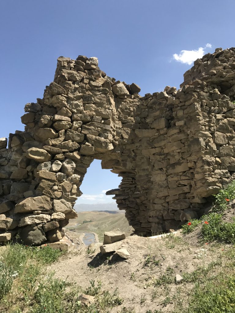
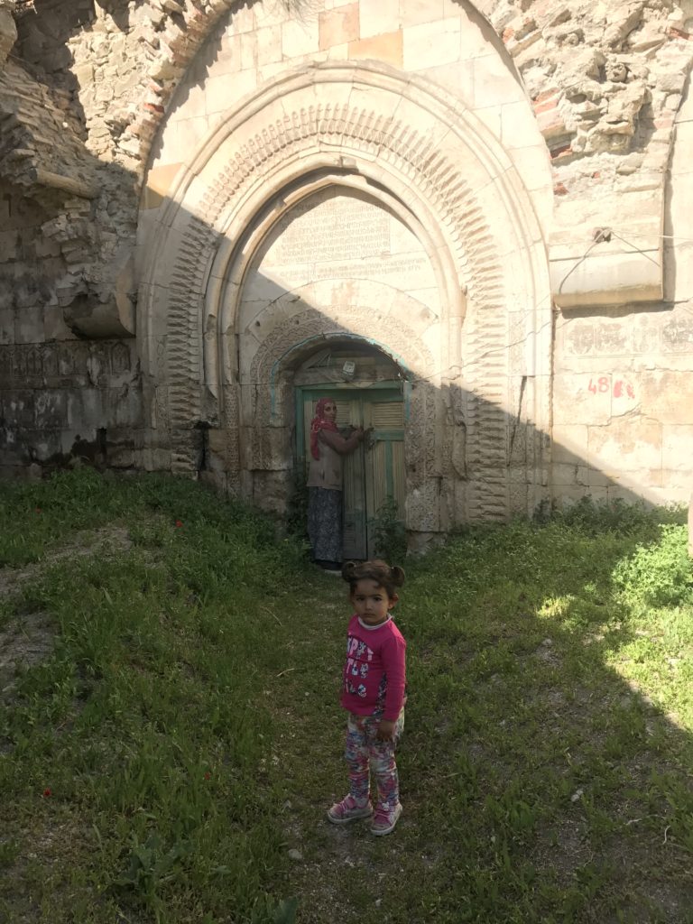
The dirt track up to my next destination, the little Kurdish village of Yedi Kilise, was also guarded. As I pulled into town, I found the road blocked by a two year old girl with folded arms. We faced each other down for a full minute, until her mother came running out of a nearby house and picked her up. This woman, fortunately, had the keys to the ruined monastery I had come to see, and led me there, daughter in tow. Virtually all of the frescoes inside were gone, but sunlight spilling through the shattered domes lent a sense of grandeur to the interior. As I walked from chapel to chapel, trying to take pictures in the semi-darkness, the little girl – fascinated by this strange creature with torn pants and a floppy hat – followed from a cautious distance. Nice to have an admirer…
6-11
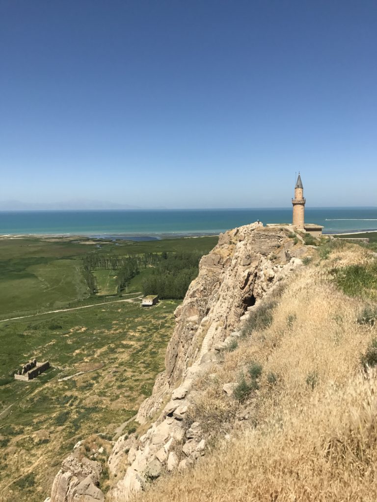
After checking out of my hotel, I detoured over to the Van Castle on the west edge of town. The pre-Ottoman remains were unimpressive, but the view over the sparkling lake and hazy mountains was almost worth the long climb up. My next detour, to another ancient fortress on the shore of Lake Van, was stopped short of its goal by tire-swallowing mud on the access road. This proved to be only the first of the day’s frustrations.
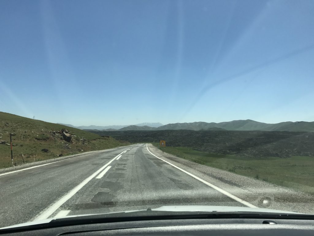
I had heard rumors that a surge in Kurdish insurgent activity had closed the highway to Dogubeyazit. But no one at my hotel could confirm this – not least because I probably bungled the question in Turkish – and there were no signs warning of a closure. As I proceeded north, I began to notice a worrying lack of oncoming traffic. But there were no signs, and so I pressed on. The highway climbed steadily toward the Dogubeyazit pass, twisting between barren slopes of black rock. High on a ridge to the east, a string of watch posts marked the Iranian border.
Finally, only 15 miles from my destination, I found a series of barricades partially blocking the road. A few hundred meters beyond these, two men in fatigues were standing on the shoulder. Rolling down the window, I asked in Turkish whether the highway was closed. One of the men, a rifle leaning against his hip, mumbled in the affirmative.
It was only after I had made my way back through the barricades that I realized the men I had just spoken with weren’t Turkish soldiers. Unlike the smartly-dressed troops who man the highway checkpoints, neither was wearing a full set of fatigues – one had camouflage pants, the other a threadbare camo jacket. Nor was there any military vehicle in evidence that could have brought them there. The two men may have been out hunting, or serving on some sort of local militia. I can’t imagine members of the PKK would be running around in broad daylight, especially on a highway being watched by the military. But there is a real, if remote, possibility that I managed to ask directions from Kurdish rebels.
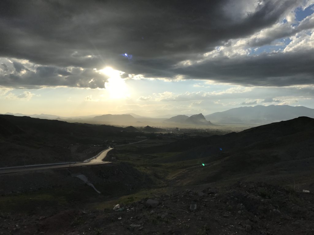
I now had to make a 150 mile detour. Among many other unseemly places, this brought me back through Tutak, the village where I was stranded two days before. The last 70 miles of highway were in remarkably bad shape, with foot-deep potholes and visibly rutted asphalt. It was evening by the time I reached Dogubeyazit. As usual, my hotel proved elusive; and the always exhausting process of negotiating an unfamiliar Turkish city was made particularly distressing by spikes designed to enforce one-way traffic.
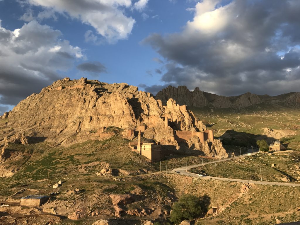
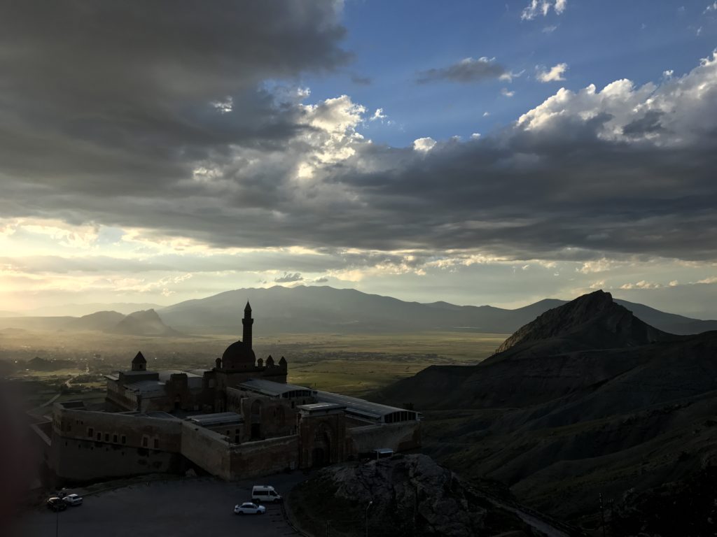
When I finally found my hotel, I paused long enough only to ask directions to the one thing I wanted to see in Dogubeyazit: the Ishak Pasha Saray, an eighteenth-century palace perched on a crag overlooking the city. I reached the palace just before sunset. Climbing up the adjacent ridge, I found a number of local families, ready to break their Ramadan fast, setting up picnics. The scent of roasting chestnuts filled the air. And below, toward the palace, a herd of goats was meandering through one of the most arresting landscapes I have ever seen. I stood transfixed as coppery light streamed over the domes of the palace and shimmered down the surrounding cliffs, draining to shadow through the broken plains below.