Yellowstone National Park
6/12 – 6/16/16
6-12
There are few things I hate more than a soggy tent. Quite aside from the discomfort of being woken by a sodden sleeping bag or droplets falling on my face, a wet tent dramatically extends my setup time, since I have to string up a clothesline and wait for rainfly, fabric, and tarp to air dry. My tent was soaked this morning. I took it down and hung it up – and then felt the first drops of another rainstorm.
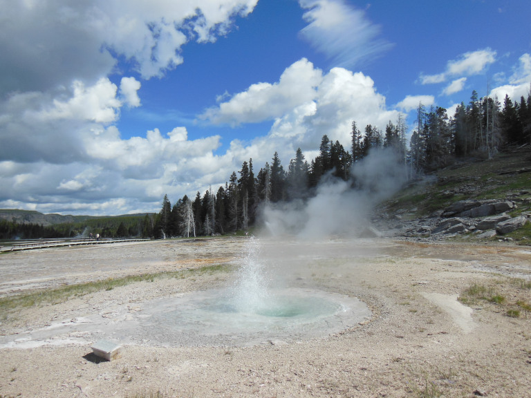
It rained all the way to my campsite in Yellowstone, a steady drizzle seeping from clouds so low that they seemed to scrape the skeletal lodgepole pines along the road. Since there was little point setting up camp in such weather, I made an hour-long stop at the West Thumb Geyser Basin. This small zone of geothermal activity, poised on the shore of Yellowstone Lake, is much smaller than the Upper or Norris basins. It offers, however, a fair sampler of the geological oddities for which Yellowstone is famous: rainbow-colored hot springs, bubbling mudpots, gleaming geyser cones.
The weather was still wretched – mid forties with a steady drizzle – but I enjoyed getting reacquainted with the geothermal features of Yellowstone, and took dozens of rain-flecked photos. I especially liked Fisherman Cone, a dormant geyser in three feet of water that anglers once used to cook their catches.
Driving farther north, I pulled into the Mud Volcano basin, another small zone of geothermal activity. Here the highlights include a gorgeous turquoise pond acidic enough to dissolve human skin; and the Dragon’s Mouth, a furiously boiling hot spring that sends forth great clouds of steam and a stygian roar.
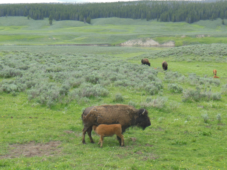
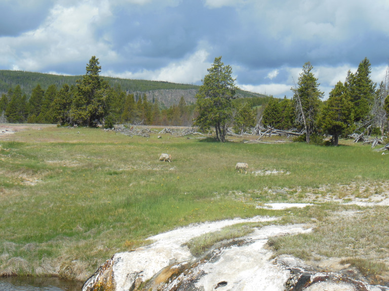
My progress across Hayden Valley was, predictably, slowed by wildlife on and around the highway. A massive herd of bison crossed the road just in front of me. Most buffalo were mangy with half-shed winter fur. Others were trailed by newborn calves; I was particularly impressed by a calf that managed to nurse from its mother while she was walking.
I did some necessary shopping in Canyon Village before retracing my outward journey from Bridge Bay. Along the way, I stopped to photograph the Lower Falls of the Yellowstone River, an undertaking that entailed elbowing my way through an immense herd of Chinese package tourists.
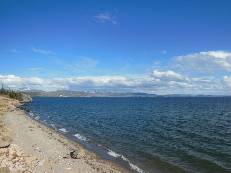
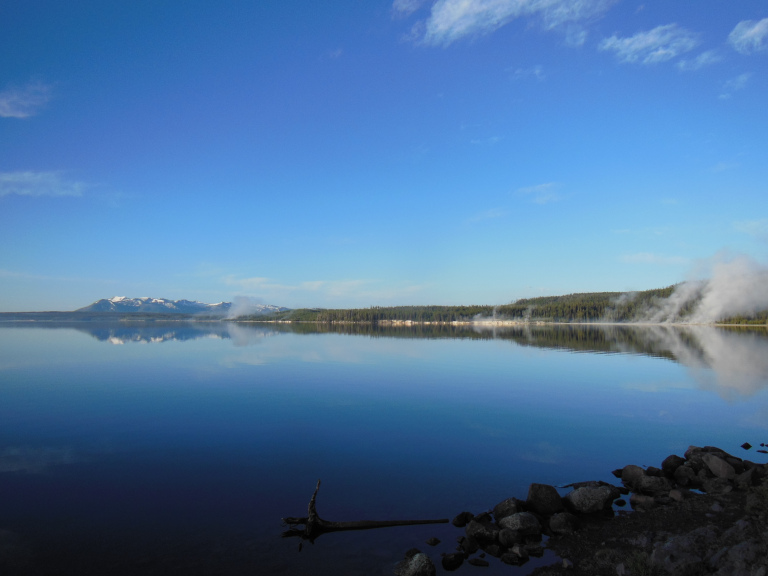
Near the end of my drive, I turned past Fishing Bridge (no fishing allowed) and stopped at the trailhead for a two-mile hike along the shore of Yellowstone Lake. This proved a pleasant surprise. All along the south and east shores of the lake, snowcapped mountains gleamed in the sunset. The view from Storm Point was especially evocative. Something about that shoreline woke in me a desire to explore – to scale those proud peaks, to walk through those virgin woods, to do the sort of thing that would end up with me starving in the wilderness somewhere. It was a curiously exhilarating feeling.
My exhilaration faded quickly on returning to my campsite. I have a knack for attracting undesirable neighbors, and today’s batch did not disappoint. Behind me, in a single large tent, was an Israeli family with four children under the age of six. When I pulled up, the father was screaming at one of his children in Hebrew and smacking him furiously. To the left of my site was a glowering biker, who sat unsmiling at his bench, chain smoking and watching me. To the right were the floodlights of the bathroom. Ah, wilderness.
6-13
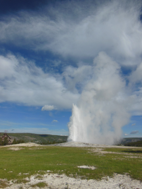
In time-honored fashion, I decided to begin my first full day in Yellowstone with Old Faithful. Having neglected to check the geyser predictions last night, I nearly missed the eruption. Wedging myself into a line of old ladies with ipads, I waited impatiently for fifteen minutes. After a few false starts (each attended by frantic fumbling for cameras among the assembled onlookers), the geyser finally did its thing. The eruption was, I feel compelled to note, five minutes late. Somewhere in the subterranean plumbing of Old Faithful, standards are slipping.
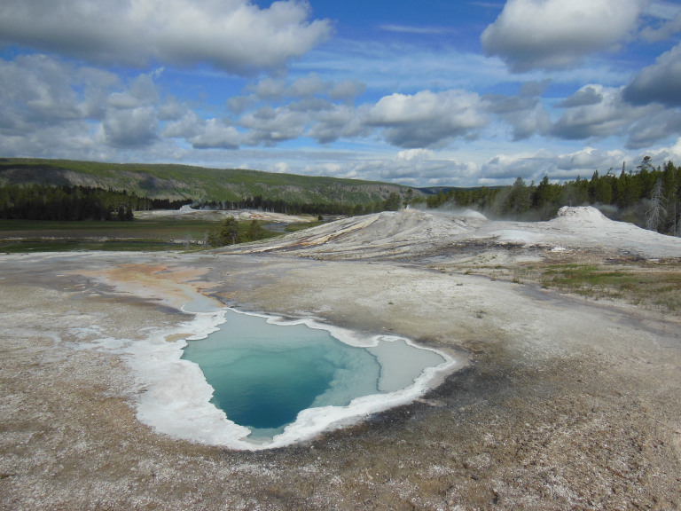
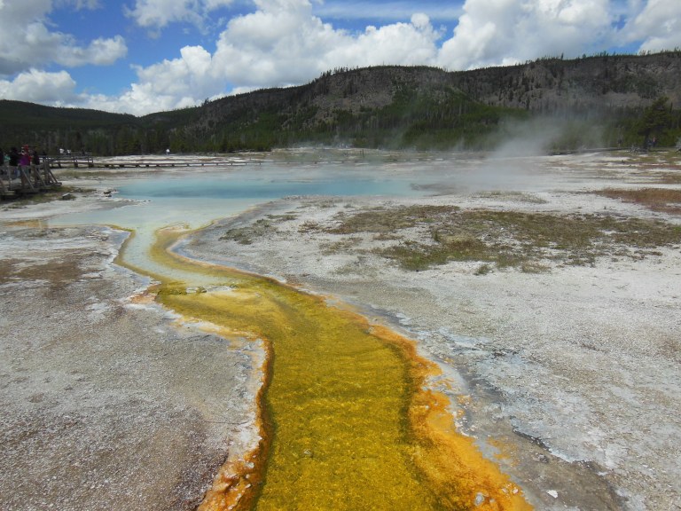
After the eruption, I joined a ranger-led walking tour of Geyser Hill, the portion of the Upper Geyser Basin adjacent to Old Faithful and the visitor center. The tour was informative, but it was hard not to get distracted by the otherworldly sights and smells of the seething landscape. Geysers spouted, pools steamed, and fumaroles hissed. Boiling springs showed a profounder blue to the cloud-scattered sky. Superheated water smoked in channels brilliant with thermophile bacteria. The stench of sulfur hung heavy in the steaming air.
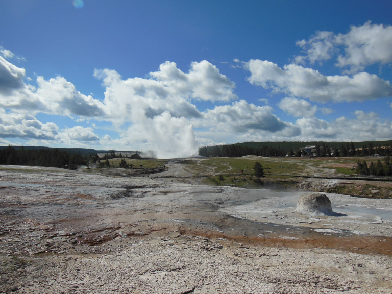
I watched Old Faithful erupt again from a distance, and then meandered along the Firehole River through the rest of the Upper Basin. To my intense disappointment, I just missed an eruption of Grand Geyser, an infrequent performer even taller than Old Faithful. In partial compensation, I was able to watch the aftermath of the eruption, in which several small geysers around the smoking crater performed in unison.
Farther along the boardwalk, I was startled by the sound of howling from a nearby thicket. A few moments later, two large coyotes came into view on the opposite bank of the river. Apparently unfazed by my presence, they boldly walked up to the head of the bridge on which I stood. I backed up about twenty feet; and they trotted across, turning off into the brush no more than fifteen feet from where I stood. Wildlife really does have right of way here.
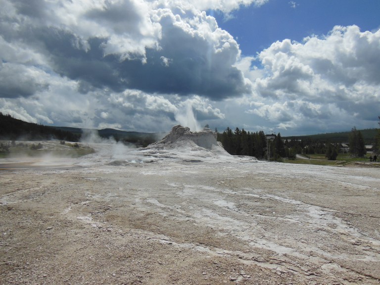
I rounded out my tour of the Upper Basin by walking past the (unfortunately silent) cones of another dozen geysers. I was most impressed by the massive sinter cones of Grotto and Castle Geysers, built up by millennia of eruptions.
The two small geyser basins west of Old Faithful were remarkable chiefly for their spectacular superheated pools, which glowed brilliantly in the intermittent sunlight.
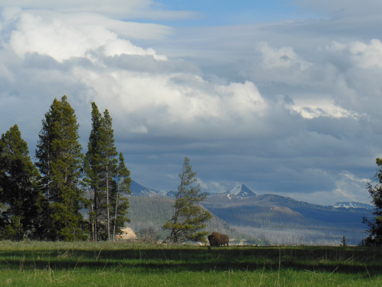
Passing by the overcrowded Midway and Lower Geyser Basins, I drove to the trailhead for a relatively long (10 mile) hike to Fairy Falls. After snapping a few photos of the large herd of bison grazing near the trailhead, I set out along a gravel roadbed lined with burned trees. This devastated forest lined the trail for five miles, gaunt and blackened snags looming over dense stands of ten- to fifteen-foot saplings.
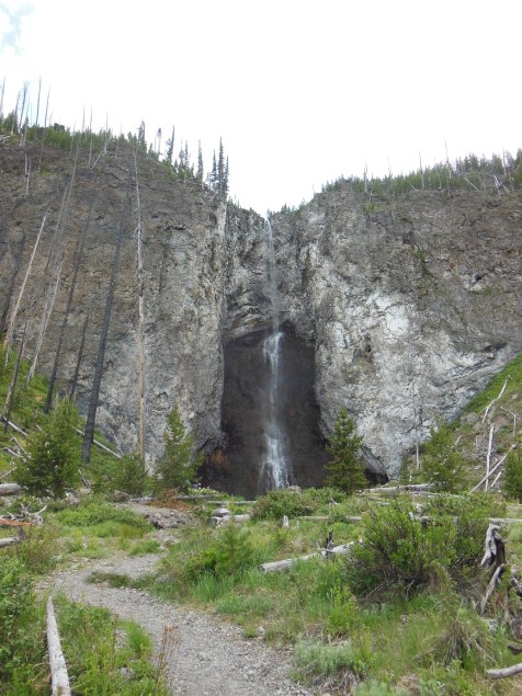
The sky was cloudy by the time I reached Fairy Falls, a thread of white water drawn over a black cliff. A few hundred yards from the falls, I saw the pitchy clouds of a thunderstorm racing over the cliff. By the time I extricated my raingear and pack cover from my daypack, the first fat drops had begun to spatter on the dust. Drizzle turned to torrent as I ran down the path, looking for any kind of shelter. Settling on a dense thicket of pine saplings, I stood atop a tangle of charred trunks, watching blinding curtains of rain and sheeting hail sweep over the adjacent meadow.
The saplings kept off the worst of the storm, and I emerged relatively unscathed twenty minutes later. Dark clouds to the south promised more rain, but I exploited the fleeting sunshine to walk toward the massive cloud of steam that rose near my thicket. As I padded along a runoff stream, smoking and saffron, I realized that I –alone, relatively noiseless, invisible in the steam –was violating virtually every guideline for avoiding bears when hiking. The steam thickened until I could hardly see the trail in front of me. I began to whistle nervously. The air was heavy, expectant – and then, no more than twenty feet away, a tremendous roar shattered the still.
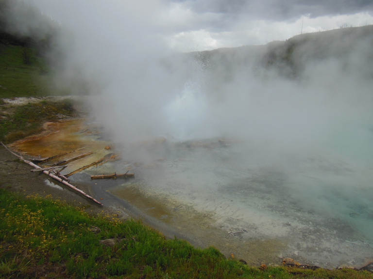
It wasn’t a bear. The geyser behind the cloud of steam had erupted, sending thousands of gallons of water crashing into the superheated pool around the vent. When I rounded the pool for a better look, I could see it still spouting, sending twenty-foot jets in every direction. A small thermal basin bubbled and hissed around me. I relaxed slightly – and then, while peering into a sputtering paint pot, felt the first drops of the second thunderstorm.
I didn’t bother to take shelter this time. Trusting in my raingear and pack cover, I trudged for an hour through gray drizzle and gray forest, pausing only to cow any nearby bears with periodic clapping. The sun came out after a few miles, shining with a determination that scorched my face and neck. Sodden and sunburnt, I finally came to the end of the trail – only to find it blocked by hundreds of bison.
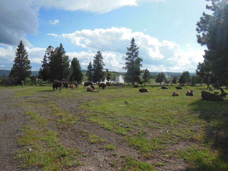
There was no way around the herd, which was spread for hundreds of yards on both sides of the path. None of the animals seemed particularly aggressive, but a few bulls were already eying me with what seemed a blend of indifference and distaste. I waited a few minutes for the animals actually grazing on the trail to move aside, steeled myself with a deep breath, and walked quickly but steadily through the middle of the herd. Calves bleated; cows looked up in mild surprise; bulls watched me narrowly – but I managed to avoid being gored or trampled.
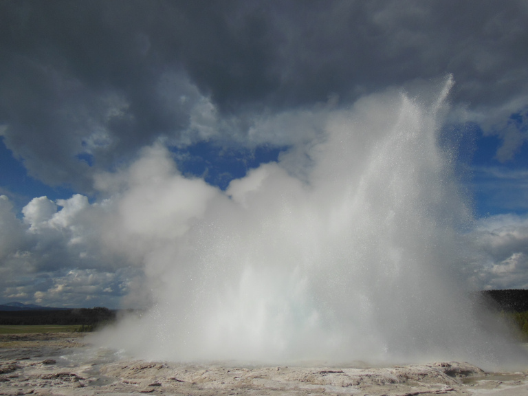
It was now nearly sunset, and the parking lots at the Lower and Midway Geyser basins were finally starting to empty. While strolling the boardwalk in the Lower basin, I was lucky enough to catch an eruption of Fountain Geyser. For twenty minutes, the geyser sent up massive bursts of water, up to forty feet high and twenty wide, that seemed to hang forever in the evening light, water droplets caught in ephemeral constellations.
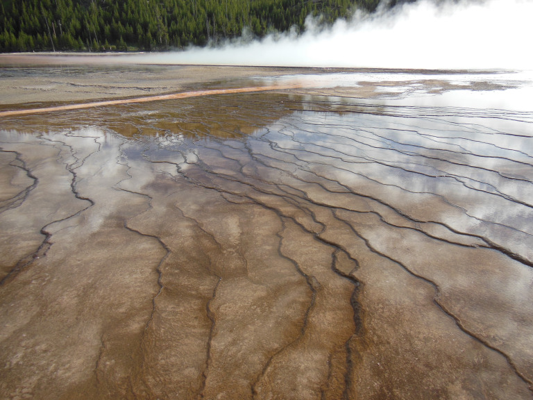
Midway geyser basin, by contrast, was a disappointment, since the stiff wind whipped steam off the Grand Prismatic Spring in a direction that obscured it from the boardwalks.
6-14
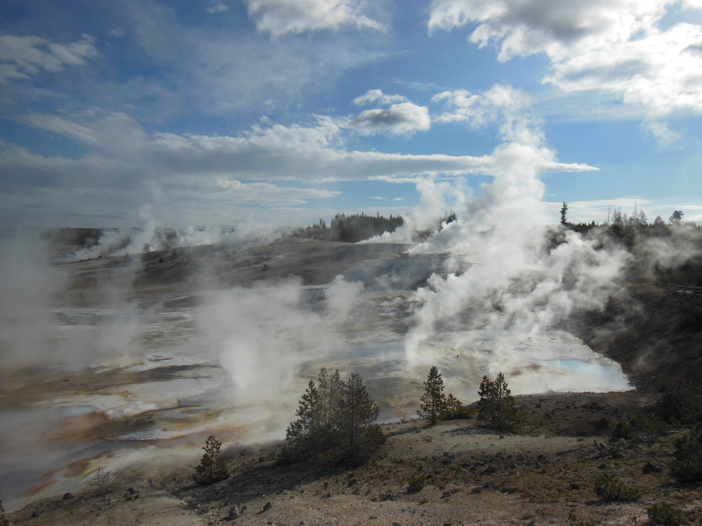
Norris Geyser Basin is the hottest and most volatile place in Yellowstone. Drumming over the sagging boardwalks, I could almost feel the magma of the caldera pushing upward, sending tendrils of fire through burning earth and sublimating water.
The highlight of Norris is the Porcelain Basin, a plain of fissured sinter where fumaroles roar and geysers spit. One of the few larger geysers here, the misleadingly-named Constant Geyser, erupted as I walked by. Since the eruption lasted all of ten seconds, however, my only memento of the occasion is an unfocused picture of my left boot, taken in the course of frantic efforts to focus my camera.
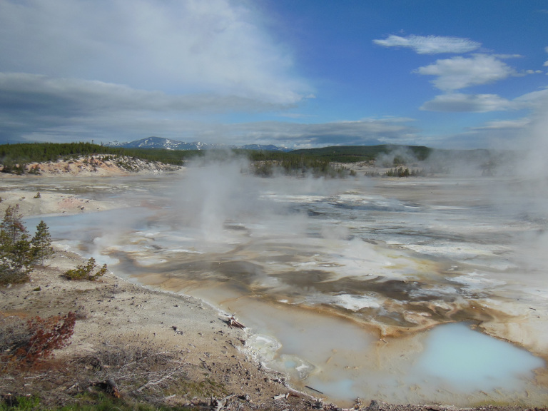
In Norris’ Back Basin, the highlight is Steamboat Geyser, the tallest active geyser on Earth. “Active,” however, is a relative term: the last eruption was two years ago. During my visit, the mighty crater was sputtering ineffectually, like a hero in senility.
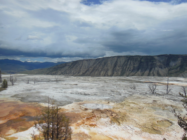
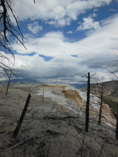
I drove on to Mammoth Hot Springs, where, after jockeying furiously for a parking spot, I was forced to remain in my car for a half-hour by a series of thunderstorms. Once the weather cleared, however, I spent an hour wandering among the famous travertine terraces. Like coral reefs, the terraces build on the bones of their ancestors, spilling and swelling brilliant streams over the chalky channels of past years.
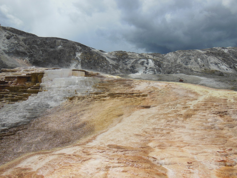
In places, whole forests have been swallowed, half-fossilized trees obtruding from inexorable stone.
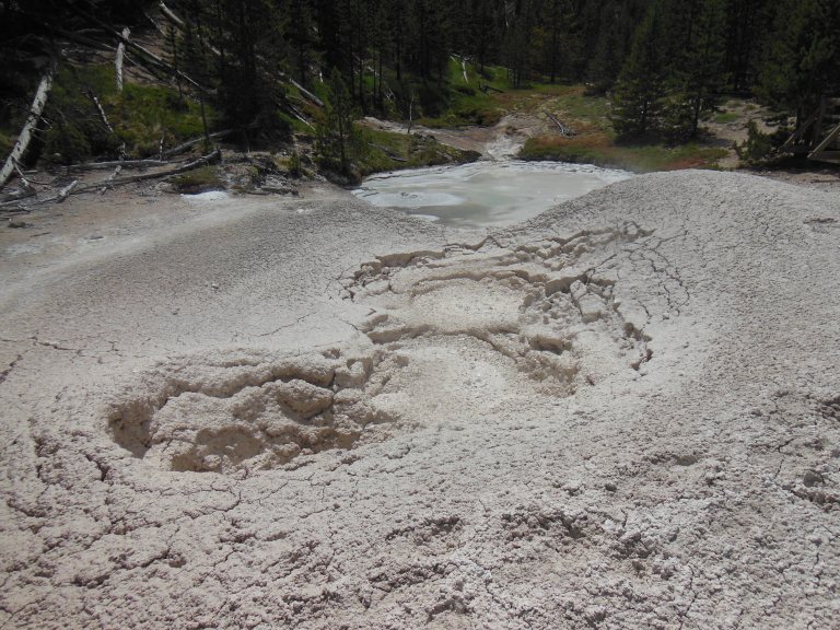
I turned south again, pausing to hike up to the Artist Paint Pots, where I managed to get lavishly spattered by boiling mud.
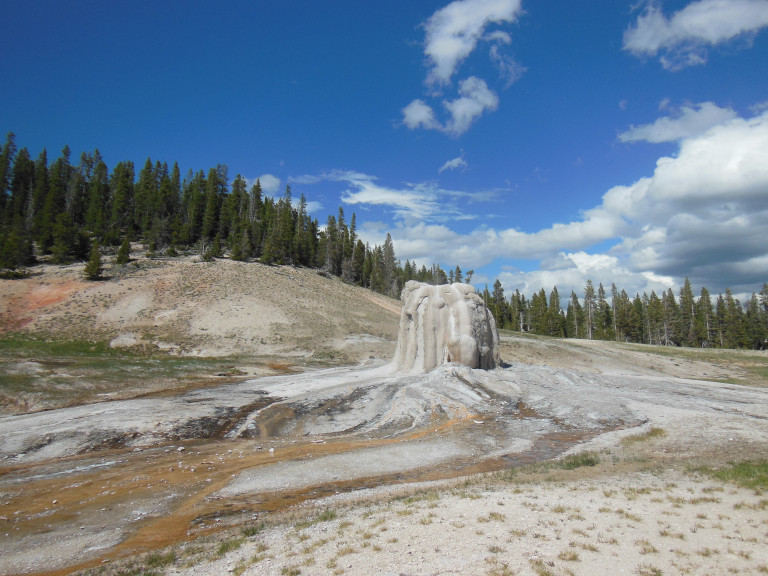
My last endeavor of the day was a hike to Lone Star Geyser, located in an isolated thermal basin five miles from Old Faithful. The five-mile walk, which paralleled the rushing Firehole River, was enjoyable. The massive cone of the geyser itself, alone before a backdrop of pines, was evocative enough. The fact that I managed to just miss an eruption, however, was frustrating. Mentally grafting a dramatic plume onto the gently smoking cone, I took a therapeutic round of pictures, sighed just once, and trudged back to the path.
6-15
It was an unpleasant night. Repeatedly wakened by storms, I watched the fabric of my tent belly under onslaughts of hail and sleet, and felt on my face the light spray of rain driven under the fly. Hour after hour the rain continued, dripping from sodden pine trees to sodden earth.
Around 7:30, with the temperature still in the mid-thirties, I drove out toward Mount Washburn, which I planned to make my primary hike of the day. The weather, unfortunately, refused to cooperate. It rained harder and harder as I drove north, the temperature falling toward the freezing mark. Finally, as I was approaching Dunraven Pass, I rounded a corner to find thickly-falling snow – and a ranger pulling a gate across the road. I asked him when the road would reopen. As sleet rattled on my windshield, he shrugged: “it’s snowing pretty hard up there…try the afternoon.”
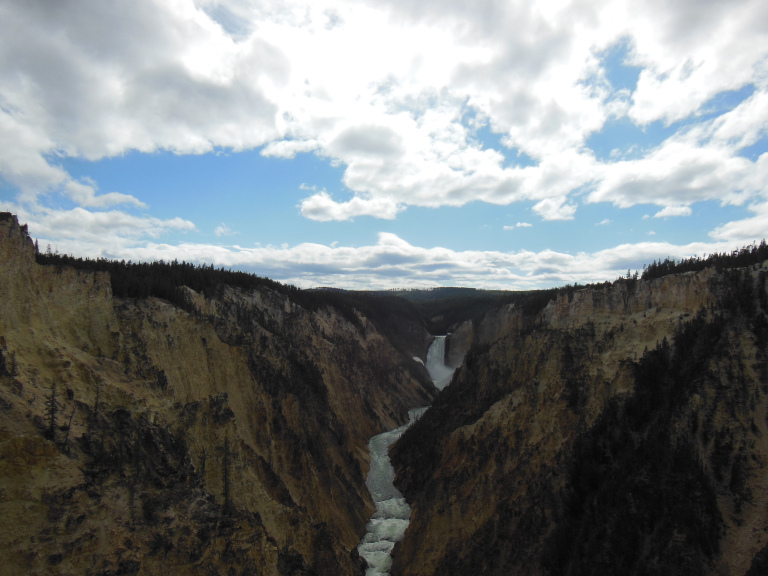
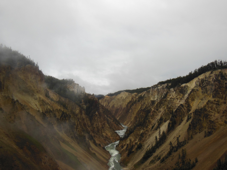
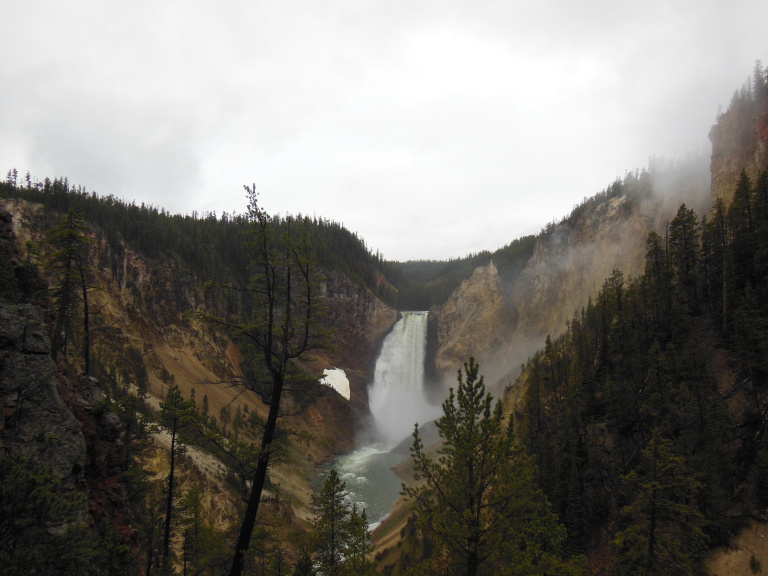
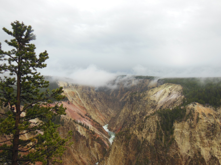
I ventured out into stinging sleet to attempt Uncle Tom’s Trail – a network of footpaths and boardwalks that passes just in front of the Lower Falls of the Yellowstone River. Unfortunately, this trail was also closed, icy spray from the falls having made it impassable. Stymied again, I hiked a series of overlook trails on the north and south winds. Though not as deep as some of the canyons I have seen this trip, the Grand Canyon of the Yellowstone is among the most colorful, the stone of its walls brilliantly dyed by the mineral effusions of hot springs. The light was poor – it was still raining – but the dragging dark clouds and billowing mist were evocative, if not photogenic.
The road to Mount Washburn was still closed when I finished the canyon trails. Having nothing better to do, I showered for the first time in four days. With my usual knack for attracting undesirable company, the stalls on either side of me were occupied by Russian brothers, who talked over my partition and spat huge gobbets of phlegm into the drains by my feet. They were replaced by a pack of bros: “hey bro, snag that shower” “sure thing bro” “you got some of that sweet shampoo?” “damn straight” “nice, bro”. Etc.
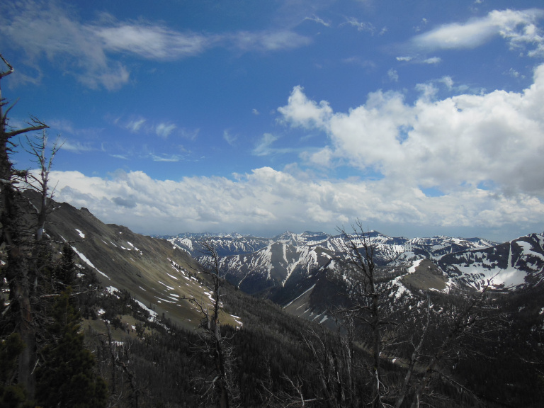
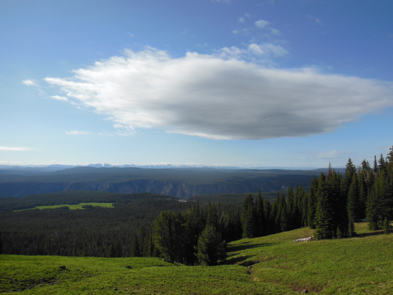
I had a leisurely lunch in a soggy grove near the shower building, stewing up some of my ramen as a sort of low-cost treat. I tried the road one last time, was informed that it wouldn’t open until 6 or so, and decided to defer Washburn until tomorrow. With the whole afternoon before me, I decided to hike up Avalanche Peak, a 10,500 ft. mountain on the east edge of the park. This is one of the most remote parts of Yellowstone, where lines of snowy peaks overlook vast tracts of burned-over forest.
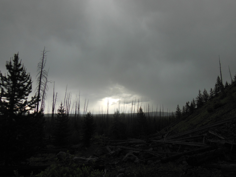
Parking at the trailhead, I could see the summit some 2500 feet above me, flecked with the morning’s snow. The path, slick with mud and melting snow, charged straight up the mountainside. Having no choice but to follow, I trudged up at a deliberate pace, eyes on my feet. When I ventured to look up, I was struck by the desolation of my surroundings. Every tree in the lodgepole pine forest on either side of the path was dead, killed a decade ago by bark beetles. Unlike fire, which stimulates new growth, invasive species like the bark beetle do nothing more or less than kill. There was something post-apocalyptic about this dead gray forest, something reminiscent of hanged men left to rot on a gibbet. A more practical problem was the dead trees’ penchant for falling across the path. At least two dozen lay across the first section of the trail, each an obstacle to be clambered over or shimmied beneath.
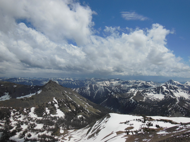
As I gradually climbed through the dead forest, awesome mountain views began to materialize beyond a sea of broken branches. Once I passed the tree line, the panorama opened in all its splendor. South and east, seemingly endless lines of snowy peaks gleamed against a backdrop of back clouds. Ahead, to the west, Yellowstone Lake glimmered.
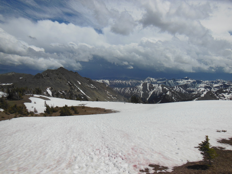
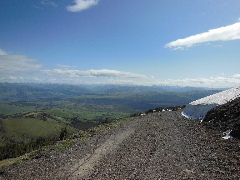
Forcing my eyes back to the trail, I clambered over a half-mile of loose snow, and finally emerged on the windswept summit. For thirty or forty miles in every direction, lakes, woods, and peaks wove patterns beneath ranks of swiftly-moving clouds. The Tetons glimmered far to the southwest. South and east, a storm was raging over the mountains, obscuring the more distant peaks with curtains of rain and snow. Lightning flickered in the storm’s heart, too distant for thunder. The only sound was that of the wind, whistling over the glacier-sharpened ridge. Cloud shadows sweeping over me, I sat on a boulder, watching the storm. The visual drama was extravagant – like something from the imagination of an especially intemperate Romantic painter. I was entranced.
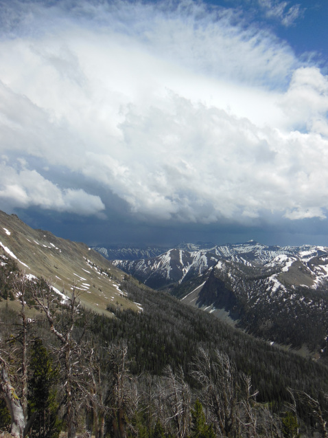
Clambering back down, I watched with alarm as the storm suddenly changed direction. Thunder began to roll over the valley, and a rising wind moaned through the scabrous branches of the rotting forest. Just as I became convinced that I was going to get another soaking, however, the wind shifted again, and the storm retreated. I slipped my way back down to the trailhead, and performed the daily ritual of changing my wet hiking boots for sandals.
6-16
Today was forecasted to be sunny, with an afternoon high in the low sixties. Emboldened by this palmy prospect, I began my hike up Mount Washburn this morning wearing only a t-shirt and two light sweatshirts (and, in the interests of propriety, pants). This outfit served me well for the first half of the hike, as I gradually climbed an old roadbed with spectacular views over the Grand Canyon of the Yellowstone.
A little below the tree line, however, I rounded a corner and ran into a tempest. A gale-force wind, strong enough to make me stagger, was howling over the barren peak. Once I caught my hat, my biggest problem was the cold. The air temperature was (barely) above freezing, but the wind made it feel much colder, stiffening my gloveless fingers until I could no longer work my camera.
Cursing myself for leaving my heavy gloves in the car, I tried to keep my mind off the discomfort by focusing on the spectacular views. Mount Washburn is often described as the best overlook in Yellowstone, with prospects extending as much as fifty miles in every direction. Yellowstone Lake, twenty miles away, gleamed beyond the yellow-red gash of the Grand Canyon of the Yellowstone; pine forests filled the valleys and swept over the tormented hills of the caldera; and snowcapped mountains crowded every horizon.
After a few minutes in the warming hut on the summit, I beat a hasty retreat, hands firmly in pockets. Driving further north through thickening traffic, I made my way to the idyllic Lamar Valley, famous as the home of Yellowstone’s wolf packs. Fortunately, I was spared any close encounters of the lupine kind on my hike along Specimen Ridge, a prominence along the canyon of the Yellowstone River.
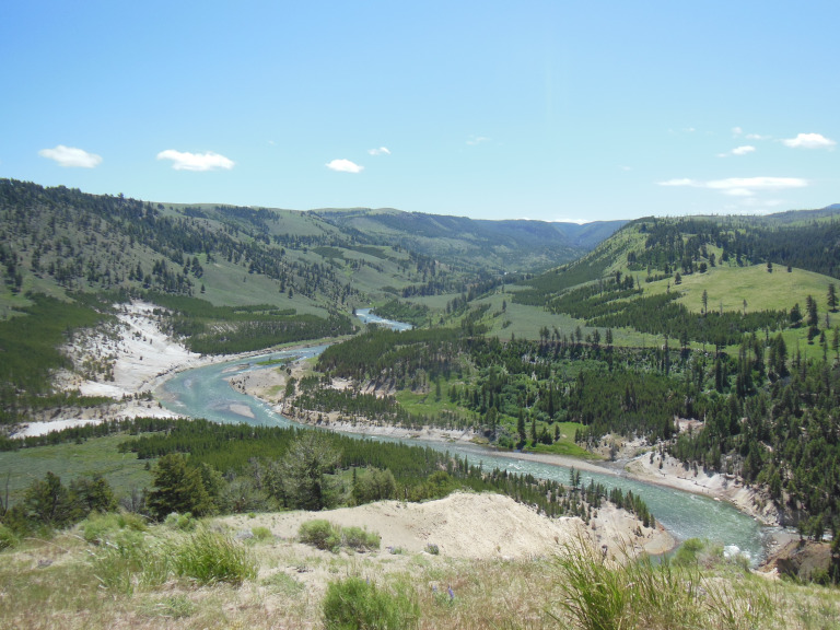
I hiked four miles through a meadow of sagebrush and tall grass. To the east rose the snowy Beartooth Mountains. West was the canyon of the Yellowstone, cut alternately through basalt lava flows and thermally-altered sedimentary rock. On the riverbank three hundred feet below, a few fumaroles sent up plumes of smoke, winging the wind with sulfur. It was the sort of unambitious walk that I seldom allow myself, and I enjoyed it accordingly.
Besides the momentary diversion of a grizzly bear digging roots a few yards from the highway, the ride back to my campsite was uneventful. Eschewing the filthy machines and screaming children of the campground laundry, I snuck my clothes into the vastly superior facilities of the Yellowstone Lake Lodge. I write this entry on the porch of that fine building, looking toward the whitecap-furrowed lake. Snowy mountains glow on the shore in the late afternoon sun, and a chill wind sighs in the pines. I will miss the austere beauty of this place – but am not looking forward to a fifth frosty night in my tent.