Denver, Co – Moran, WY
6/6 -6/11/16
6-6
This morning, I fulfilled a long-cherished ambition to visit one of the two main US mints. Although I lack the time (and money) to collect seriously, I have been interested in numismatics since grade school. When I realized that I would be passing through Denver, accordingly, I was careful to reserve a mint tour. Parking downtown was a hassle; but the mint tour itself was fascinating. The production rooms and machines were much smaller than I had expected – little different from the floor of any moderate-sized industrial operation. These nondescript machines, however, produce about half of all the coins circulating in the United States – roughly 26 million a day. I watched as thousand of silver blanks were tipped into one of the stamping machines, and converted, at a rate of 8 per second, into quarters.
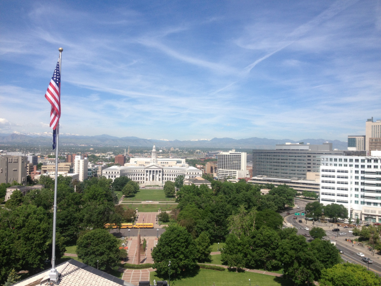
The mint tour ended a little before 9, and I spent the next couple hours walking around downtown Denver. Drawn by the grandiose golden dome, I walked into the Colorado state capitol building. On impulse, I joined a free guided tour of the building, led by a nervous teenage intern. The docent was informative enough; but I was most impressed by the self-guided tour of the cupola, which afforded spectacular views of downtown Denver and the mountains beyond.
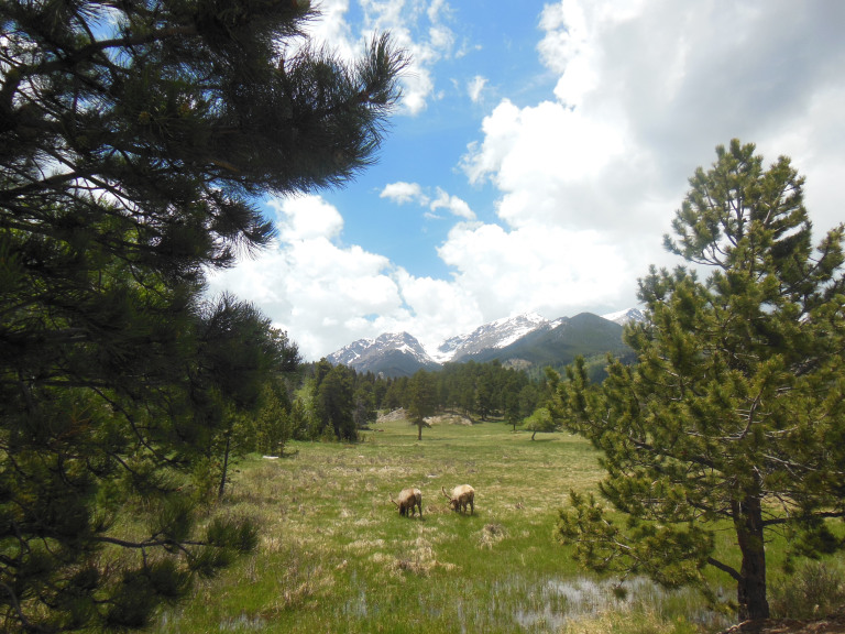
Leaving Denver before noon, I drove up a series of busy roads to the tourist circus of Estes Park. Stopping only to stock up at a Safeway, I headed straight into Rocky Mountain National Park. The drive to my campground was considerably complicated by wildlife. A dithering trio of bighorn sheep caused a massive traffic jam, as did a herd of elk grazing by the roadside.
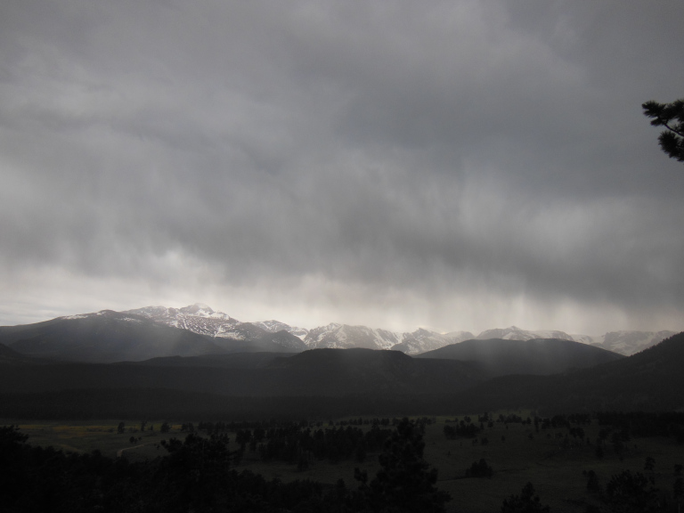
I pulled into my campsite just ahead of a massive thunderstorm, and got the rainfly over my tent only a few minutes before the monsoon began. Initially a light drizzle, the rain swiftly intensified into a full-scale deluge, mingled with marble-sized hail. Eating lunch in my car, I watched as sheets of rain and hail battered my tent and swept over the windshield. I decided to head straight for my hike, with the hope that the storm would have abated or moved on by the time I arrived. The gamble paid off – shortly after I pulled into the Bear Lake trail head, the clouds parted, and the dripping spruces began to smoke in the afternoon sun.
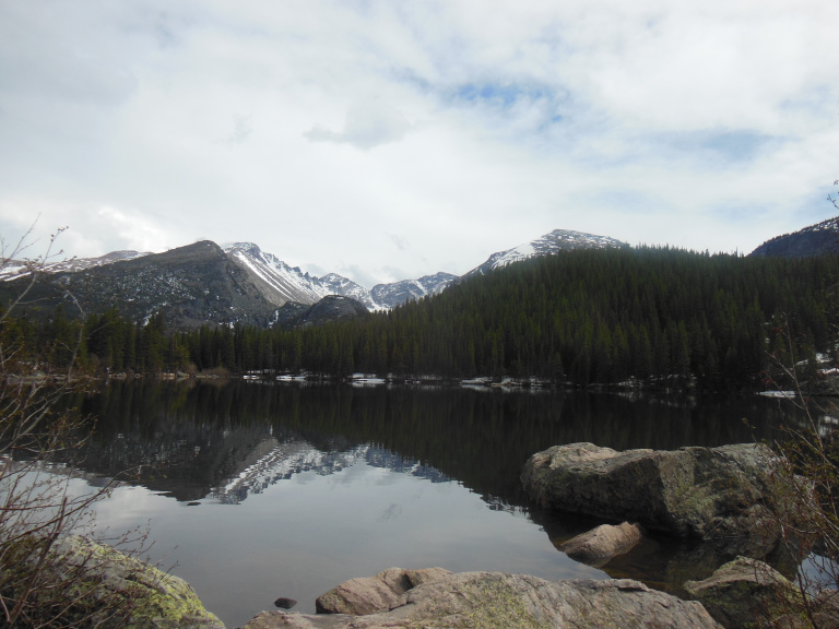
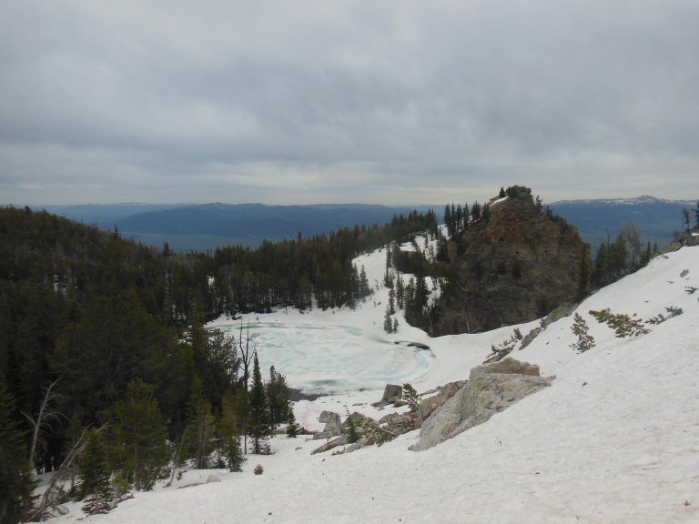
The Bear Lake area, normally the busiest in the entire park, was almost deserted after the storm. I strolled around Bear Lake itself, a small mountain pond still lined with snow, before beginning the longer hike up to Emerald Lake.
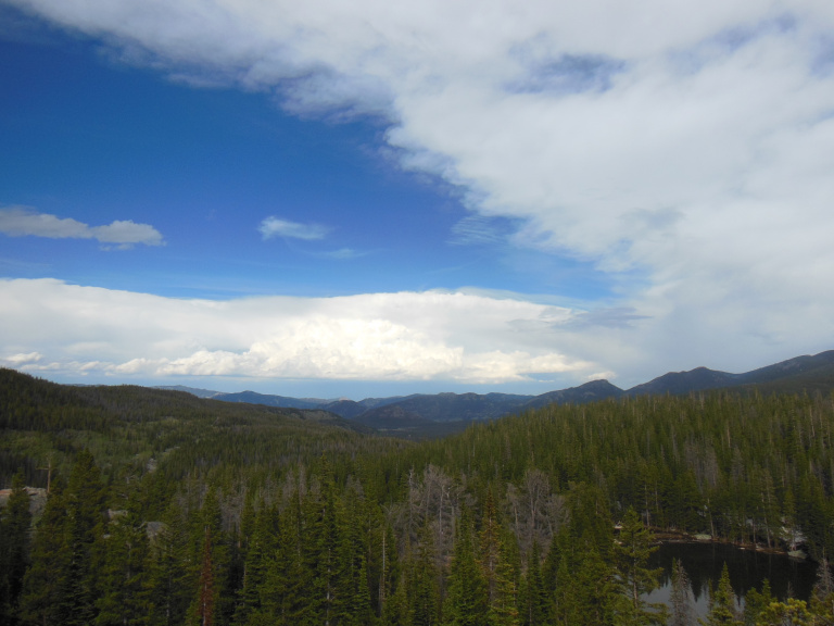
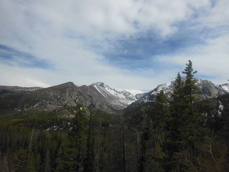
The first overlook provided a stunning view of the surrounding landscape. The massive peak, snowfields gleaming in the late afternoon sun, that rose to my right was mirrored on my left by the equally massive thunderhead of the retreating storm. Beneath peak and cloud rolled an endless panorama of spruce forest and scattered ponds.
I was surrounded by the sounds of the spring melt. A mountain stream, swollen with runoff, roared alongside the trail, dewing the trees with spray. Smaller rivulets trickled in counterpoint from snowbanks along the beaten path; and beneath all the voices of running water ran the half-heard basso continuo of sinking snow and breaking ice.
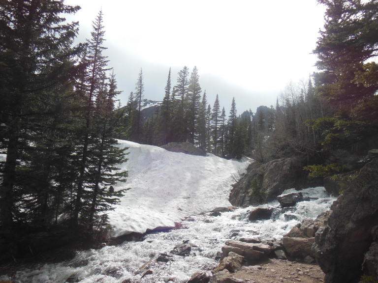
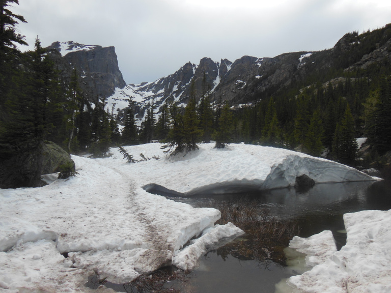
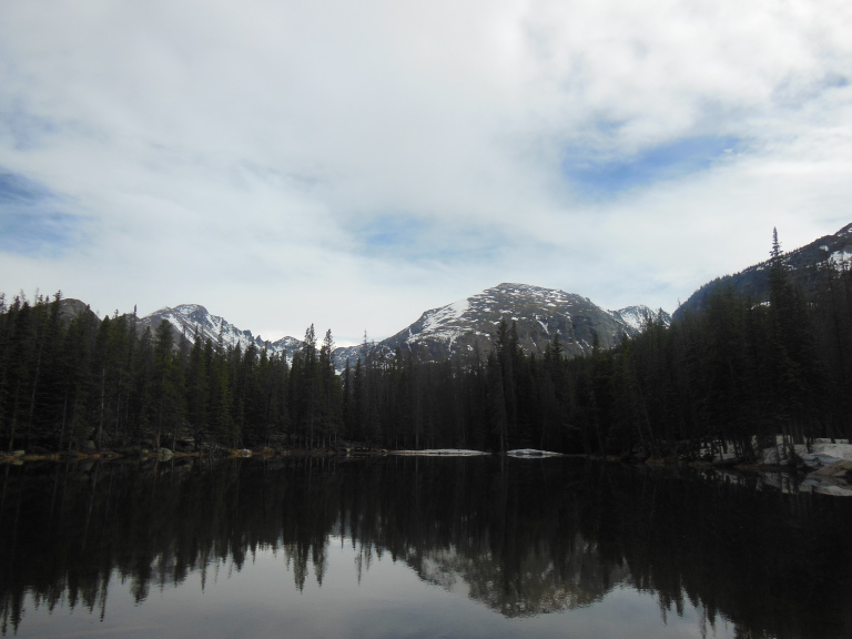
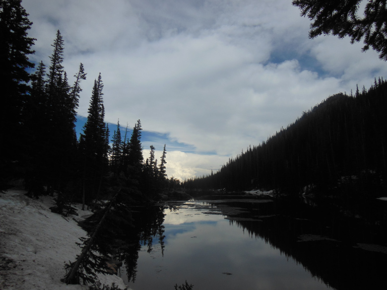
The sounds of the melt began to subside as I climbed higher, reaching a tarn ringed by towering snowdrifts and scattered with the last of winter’s ice.
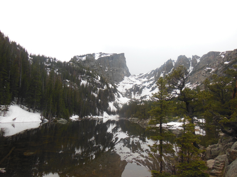
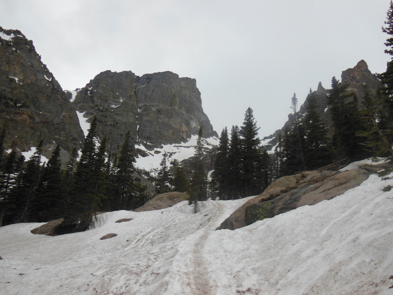
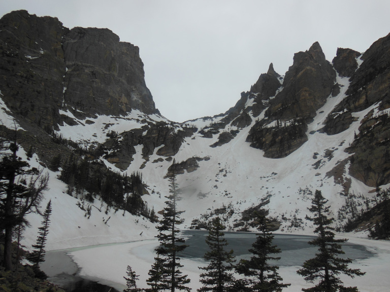
The trail was now completely covered in a thick blanket of snow, firm but icy. The gym shoes I had heedlessly worn were soon soaked and slipping. Progress was downright treacherous by the time I reached Emerald Lake, which was still locked in ice.
The return trip proved even harder than the ascent. My sodden gym shoes could find no purchase on the ice, and I kept losing my footing and falling backward. Eventually, I realized that I could turn my lack of traction into an advantage. Sitting back on my heels, I skied down the trail on my shoes, steadying myself as needed with my hands. My best run exceeded 200 yards.
Over the trees, I could see the anvil top of another incoming thunderstorm. On reaching my car, I had time only to change my shoes before the storm struck. Fresh waves of rain and hail drummed and clattered on my windshield as I drove back toward my campsite. The sight of the storm as it rolled over the mountains was awesome. Lightning flickered among the peaks, their silhouettes wrapped in curtains of snow. As I drove past a meadow populated with several dozen sodden elk, a nearby lightning strike made the herd stampede – fortunately, not in the direction of the road.
6-7
This morning, I decided to drive the famous Trail Ridge road, one of the world’s highest continuously paved highways. Beginning at an elevation of 9000 feet, the road mounts by a prodigious series of switchbacks to the ridgeline of the surrounding peaks, staying above 11,000 feet for more than ten miles, and topping out at 12,183 feet. Due to drifting snow, the road is only opened for the season on Memorial Day, and is occasionally closed by blizzards even in midsummer. The skies were mercifully clear as I made my ascent, rising through the scrawny spruces of the subalpine zone to tundra – a barren landscape of boulders and snowfields.
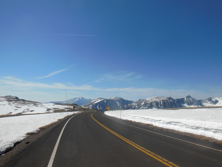
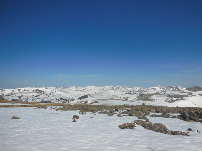
At every turn, broader vistas opened over a seemingly endless succession of mountain peaks. Far below, spruces darkened a snowy valley. Whenever I left my car to take pictures, a wind winged with ice reddened my face and stung my eyes. I managed, however, to walk the “tundra communities” trail, a mile long track over rock and icy snow that afforded staggering views of the mountains and road.
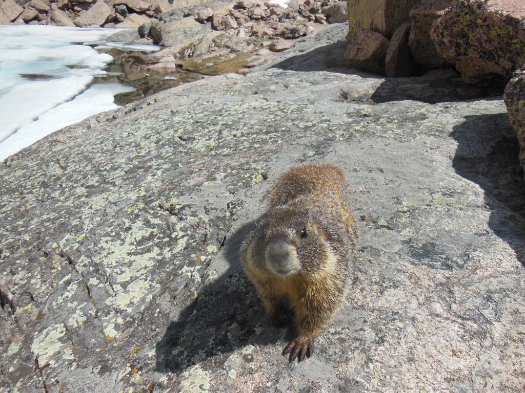
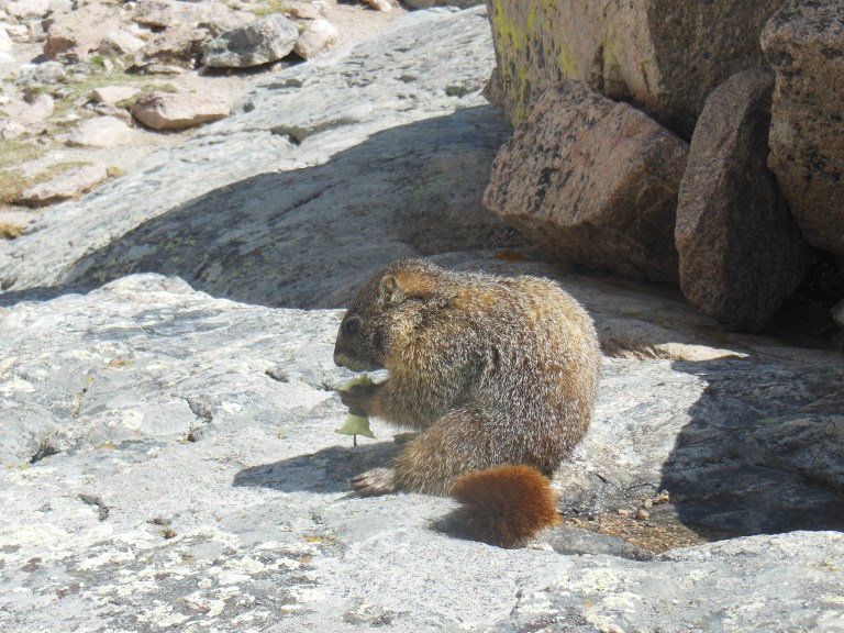
As I walked, I startled a marmot who was sunning himself on the rocks. Over this howling wilderness of ice and stone, where men wither from hypothermia, the marmot is undisputed lord and master. A morbidly obese ground squirrel of pendant jowls and weighing eye, the marmot waddles where bears fear to tread. His corpulence defies the chill – one particularly plump specimen watched indifferently from a rock as I shivered in the biting wind. It must be nice to have an evolutionary strategy that relies on gaining weight and doing nothing.
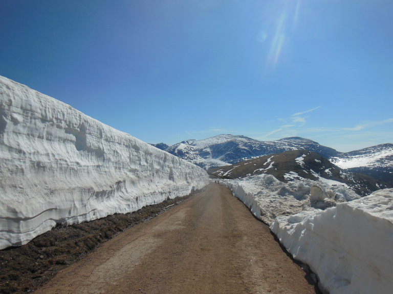
Near the road’s high point, at the Alpine Visitor Center, I walked for a half mile or so along the old Trail Ridge Road, presently closed (though not, for some reason, to foot traffic) on account of avalanche danger. Snow was piled twenty feet high along the road, weeping in the mid-morning sun. I found myself walking very softly.
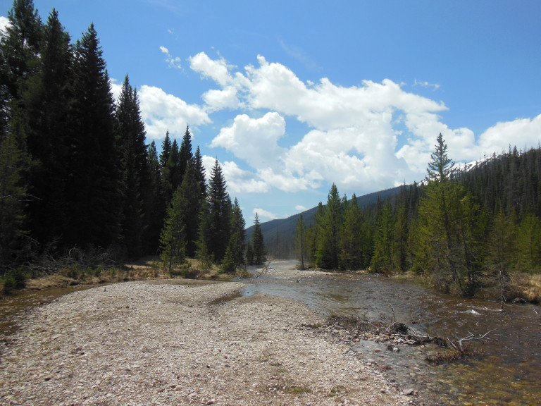
Cresting the Continental Divide, I descended into the spruce forests on the west side of the mountains, and parked at the trail head for my main hike of the day. The Colorado River has its headwaters in Rocky Mountain, and flows as a rapid mountain stream toward greater things in the southwest. My trail paralleled the trail of the nascent river for nearly four miles, ending in a sunlit mountain clearing at the site of the gold mining town of Lulu. The town was completely gone; but the scenery along the rushing Colorado was gorgeous. I walked through the midst of a mountain spring: the aspens were silver-green with their first leaves, and flowers sprouted in the shadow of melting snow drifts. Although winter seemed to reign still on the icy peaks of the mountains on both sides, the meltwater streams rushing down to join the Colorado showed that Spring was at work on every altitude. I enjoyed a pleasant lunch on a boulder beside the Colorado, enjoying the sun.
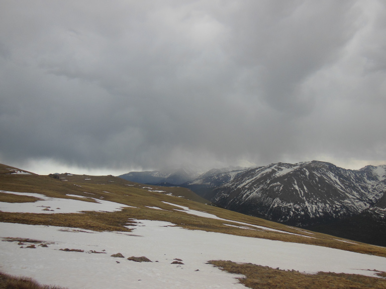
The light soon faded, however, with the advent of the usual afternoon thunderstorm. I managed to avoid the rain on the trail, but drove into the storm as I crested the Trail Ridge Road. Once again, I was treated to the breathtaking spectacle of a thunderstorm in the mountains, peaks alternately vivid against and shrouded by dragging dark clouds.
6-8
After discovering that the trail for my first choice hike had been wiped out by a landslide, I decided on the Chasm Lake Trail, an eight mile trek with a 2500 foot elevation gain. The lower three miles of the Chasm Lake path are identical with the first half of the fabled Longs Peak trail, the route to the top of one of Colorado’s most famous fourteeners. Not foolish enough to attempt the ascent, I settled for the next best thing – most of the work and none of the glory.
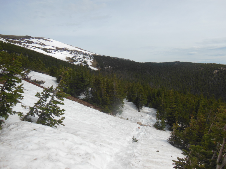
In late summer and fall, when it is mostly free of snow, the Chasm Lake trail is fairly popular. In early June, it is the preserve of those determined or ignorant enough to slog through hundreds of yards of deep and softening snow. After the first mile, the trail was completely buried. For what felt like an hour, I scrambled over half-frozen drifts in the shadow of a dense spruce forest. It was hard to believe that it was June.
As I labored through drifts, the stunted spruces of subalpine forest gave way to the dwarf trees and lichens of tundra. There was less snow here, but the trail was steeper, climbing relentlessly upward toward the distant mass of Longs Peak.
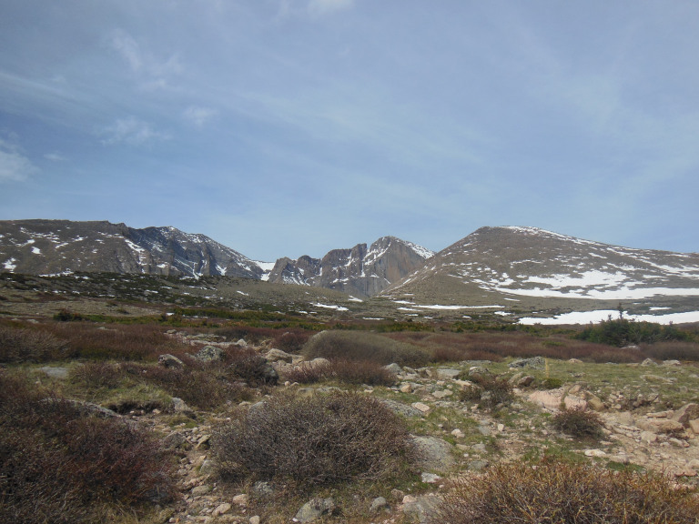
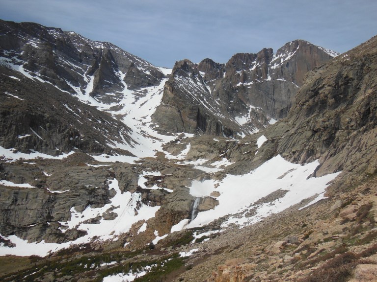
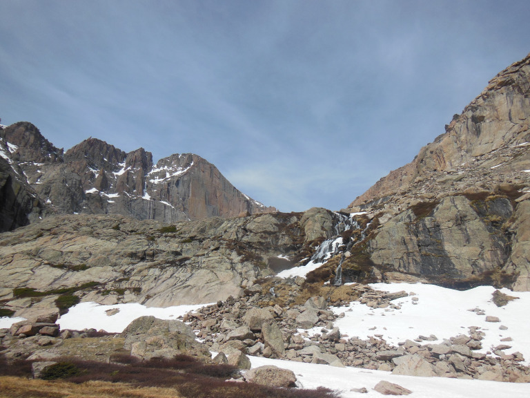
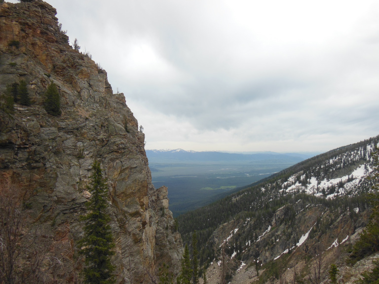
At long last, the trail leveled off along the wall of a beautiful alpine valley. Longs Peak filled the background, flanked on either side by sweeping gray cliffs. At the valley head, some three thousand feet below the summit, a roaring waterfall leapt through eroded fields of snow.
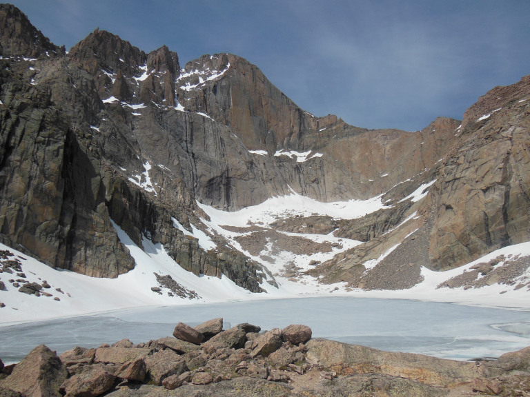
Inching through a steep snowfield and crossing over the waterfall, I trudged up a steep slope of loose snow and clambered over a rocky ledge to reach Chasm Lake. Still completely frozen, its blue ice ringed by towering granite peaks and mounded snow, the lake seemed untouched by spring. The sun, however, was warm; and I sat on a boulder by the lakeshore to eat my lunch.
Sitting back on the warm granite, I listened to the wind whistling over the peaks, to the slow but inexorable music of the melt, to the creaking of the ice. I thought I was alone. But then, at the very instant I took the first bite of my sandwich, an immensely fat marmot poked his head over a nearby boulder. Scurrying over to my perch, he stood on his haunches, head bobbing back and forth. Then he scampered into a hole beneath an adjacent pile of stones, reappearing a moment later directly behind me. He inched closer until, to my astonishment, he was actually nosing my elbow. When I finally had pity and tossed him an apple core, the carnage was appalling –seeds, stem, and flesh were devoured with grim efficiency and expert speed. I found myself grateful that marmots are not carnivorous.
The way back down was tedious, as the way back down always is. I slipped and slid on the icy snow, soaking my shoes and exhausting my knees. In what was becoming something of a ritual, I collapsed into my car on reaching the parking lot, wearily unlaced my hiking boots, and slipped on sandals. Another day, another snowy hike.
6-9
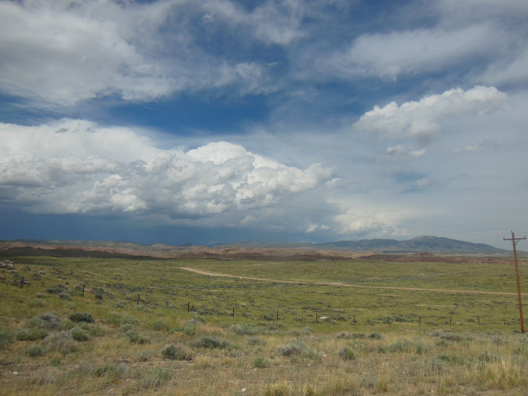
I don’t know how truckers do it. I had to drive across northern Colorado and Wyoming today – a 550 mile journey that construction delays made into a ten-hour ordeal. Part of the problem was topographical. Hour after hour, I sped through the changeless green immensity of the high plains – a rolling landscape of knee-high grass, interrupted only by lines of trees along distant rivers and the occasional unassuming limestone bluff.
So there was little to look at; my ipod was malfunctioning; and the radio offered nothing but static and cattle reports. Besides the occasional diversion afforded by high-speed passing maneuvers, I had nothing to do. I swiftly descended into that special brand of madness that is the province of the long-distance driver. I tried to be productive – to plan the next day’s hike, to work out the argument of a long-shelved article, etc. – but this, as always, was a fleeting charade. I sank into a numb reverie, the world assuming the simplicity of a necessary journey to an arbitrary goal. The landscape I was hurtling through at 90 Mph took on the frozen quality of a painted backdrop, passing cars and drivers reduced to props and puppets on an infinite stage. There is a point at which all thought collapses inward; at which all introspection sinks into morbidity, and impressions slick over the consciousness like rain on marble. That point is somewhere west of Casper, Wyoming.
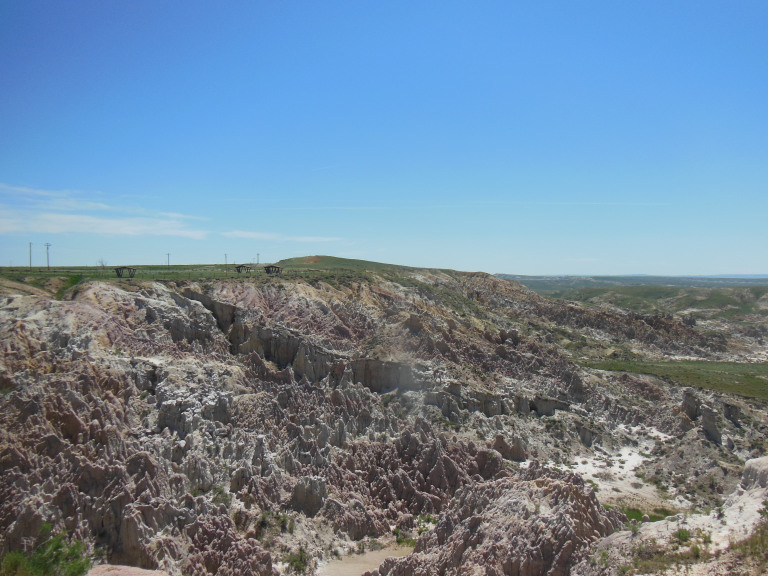
Around the time a line of mountains began to gnaw at the western horizon, I pulled off the highway to view Hell’s Half-Acre, a wildly eroded badland characterized by jagged pinnacles of multicolored stone. Since the Wyoming Department of Transportation, in its infinite wisdom, had closed the only picnic area for a hundred miles, I made my customary peanut butter sandwich in the parking lot and ate lunch on the road, watching as the line of mountains and the massed clouds of a thunderstorm rose over the plain with maddening deliberation.
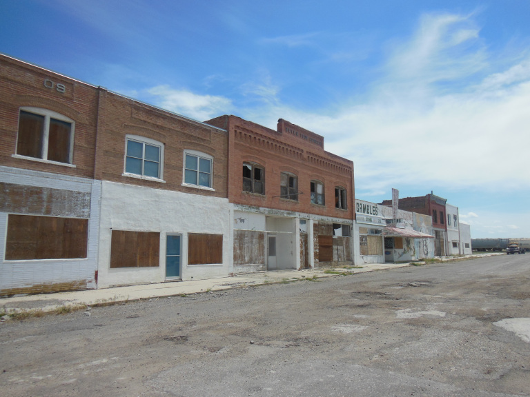
After being stopped for a half-hour by roadwork, I pulled into the next town to stretch my legs. Shoshoni, Wyoming may not be the most desolate town in this empty state, but it is not for want of trying. All but one of the fifteen-odd buildings on Main Street was abandoned and windowless. A gutted truck rusted by the curb. An uncoupled line of freight cars sat idle at the end of the street. Where the railroad tracks met the horizon, the distant mountains and rising thunderstorm shimmered in the early afternoon heat.
Onward and westward, the mountains and clouds rising steadily at the end of cracked two-lane highways. The clouds spread over the peaks, the snowfields gleaming through veils of rain. I entered a region of badlands, dissected hills heeling heavenward into the storm. The sky cleared again as the road bumped over the Continental Divide, meandered through a snowy spruce forest, and finally came into view of the Tetons, hazy and unreal in the west.
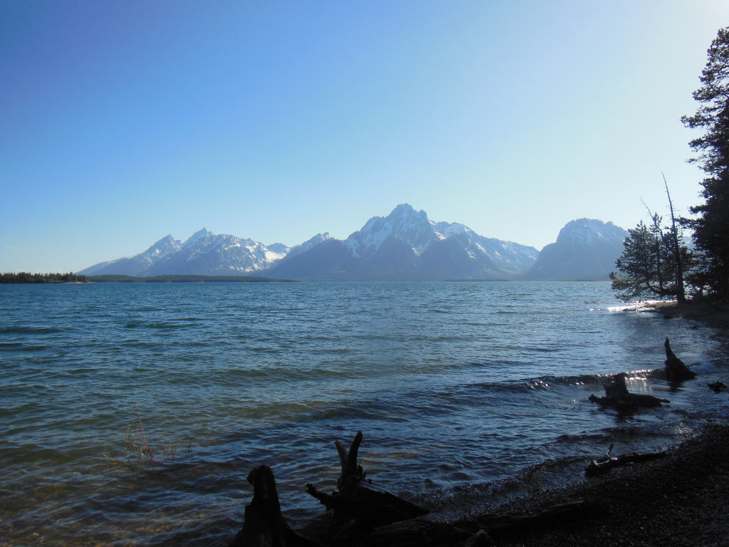
I pulled off at one of the first overlooks in Grand Teton National Park to get a better view of the famous peaks. The Tetons rise dramatically from the Snake Valley, sculpted, ice-crowned, and ridiculously picturesque. They famously owe their name (“the breasts”) to the French fur traders who saw in them gigantic mementos of the (presumably well-endowed) ladies they left at home. I didn’t see the resemblance, but maybe I just haven’t been alone in the wilderness long enough. After setting up my tent, I took a two-mile hike along Jackson Lake, taking a series of thoroughly inadequate photos of the stunning peaks.
6-10
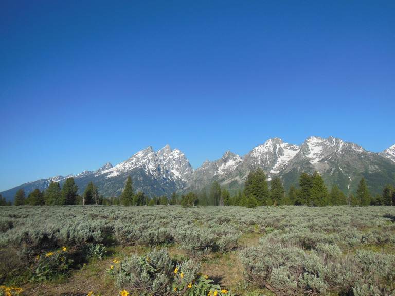
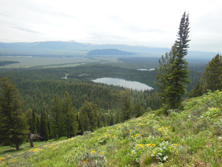
A single long hike kept me occupied for most of the day, and exhausted for the rest of it. Starting shortly after sunrise, I drove south toward Jenny Lake, stopping at a series of overlooks to admire the Tetons. The sky was clear, the peaks rose and crystal in the early morning light. It was the sort of scenery that makes one itch for a good hike – and so I committed myself to a trek of nearly twenty miles, which would rise almost three thousand feet to a remote mountain lake.
The beginning was easy enough. Parking on the north side of Jenny Lake, I walked two more or less level miles to the west shore, where the lake laps at the roots of the mountains.
Here, between two towering peaks, Cascade Canyon cuts a half-mile deep gash through the heart of the Teton Range. From Inspiration Point – a lookout a few hundred feet above Jenny Lake – I could see the first four or five miles of the canyon: sheer talus slopes, alternately black with stands of spruce and white with patches of snow, laced with the gleaming tendrils of meltwater streams.
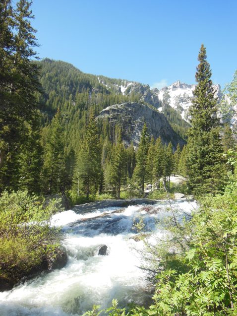
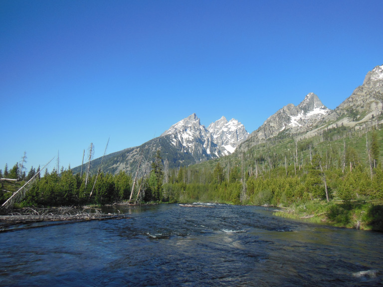
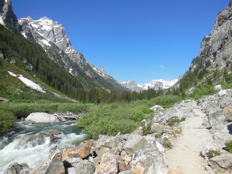
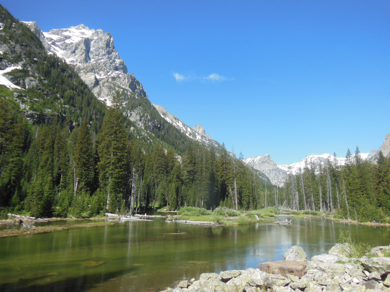
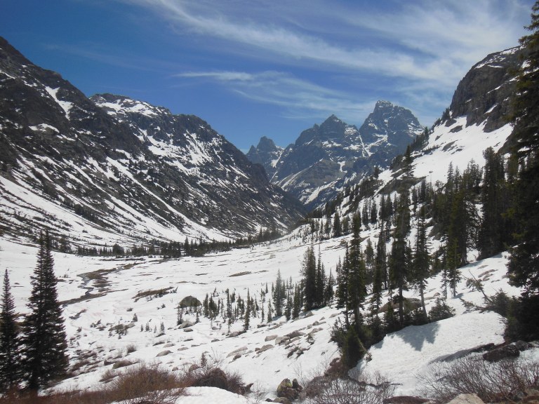
The views were even more impressive as I hiked farther up the canyon. Down from the sky-piercing pinnacles of the Tetons, poised almost directly overhead, meltwater cascades roared and smoked over two thousand feet of gleaming granite, rushing headlong to join the braided channels of a mountain river. The trail paralleled the river for four miles, gradually climbing with the valley floor. Through stands of spruce and sunny mountain meadows, my steps were constantly accompanied, as so often in the past days, by the many voices of the spring melt.
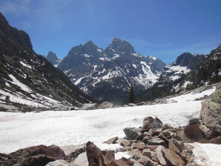
The path turned up toward Lake Solitude, and climbed more than 2000 feet in less than three miles. I walked now in a high mountain valley. Behind me, where the valley joined Cascade Canyon, the towering summit of Grand Teton closed the horizon. Ahead, the snow-draped valley walls sloped up to a cirque (glacier-carved bowl), against a backdrop of distant peaks.
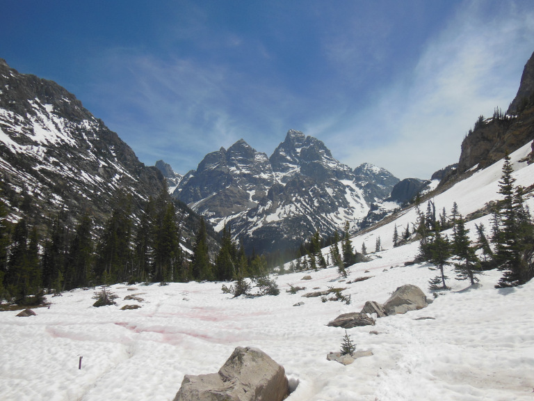
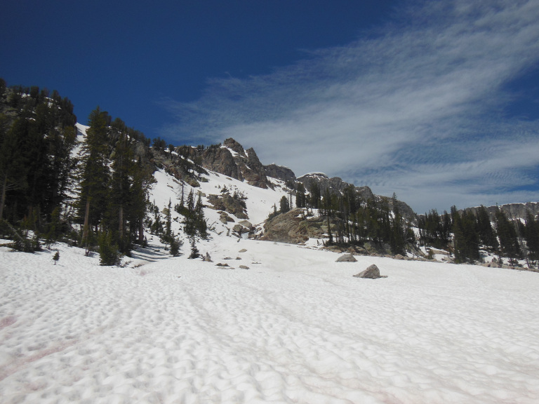
After the first few hundred yards, the trail was buried in deep snow, which was rapidly softening in the midday sun. All along the valley walls, the snow was sculpted into regular patterns of “cups” – shallow depressions formed by gradual irregular melting. Since these look rather like footprints, this sometimes had the disconcerting effect of making the trail seem to cover the entire valley.
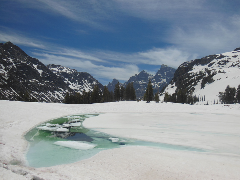
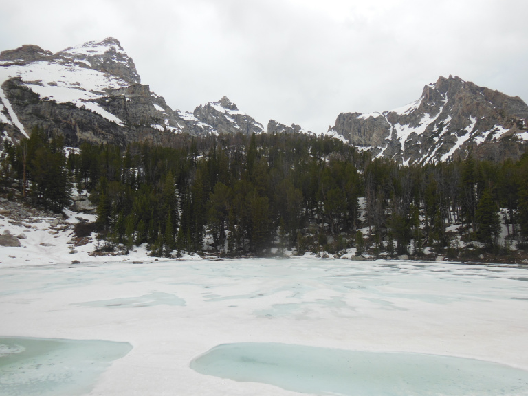
I finally staggered up to Lake Solitude. The lake was just beginning to thaw, turquoise water showing through arctic green ice in a few places along the shore. The granite cliffs behind were draped in heavy snow, brilliant against the cloudless sky.
What goes up must come slipping and scrambling down. The return hike, bereft of any goal but finishing, always feels longer than the outward leg, even when it trends downhill. Three miles over snow and seven over rock brought me at last to my car, where I collapsed into the driver’s seat. It was a real effort to remove my soggy hiking boots and put on sandals.
6-12
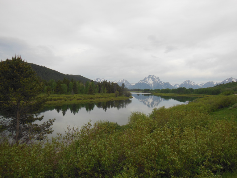
In a repeat of yesterday’s performance, today featured a grueling hike to a frozen mountain lake. I woke early again, and visited another series of overlooks on my way down to the trailhead. I was particularly impressed by the view from the Horseshoe Bend of the Snake River, where the Tetons were reflected perfectly in the still water.
Today’s hike to Amphitheater Lake was shorter than yesterday’s to Lake Solitude, but even steeper – ten miles, with a 3000 foot vertical climb. Four of the five miles on the outward leg consisted of steep switchbacks, which zig-zagged relentlessly up a rocky slope. If not as stunning as yesterday’s, the views were striking. The Tetons were only just visible above the spruces for most of the climb, but the endless switchbacks afforded an impressive panorama of the valley, framed by nodding wildflowers.
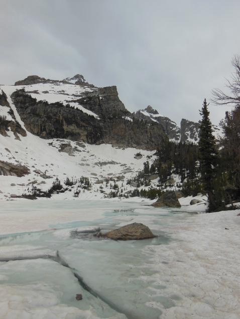
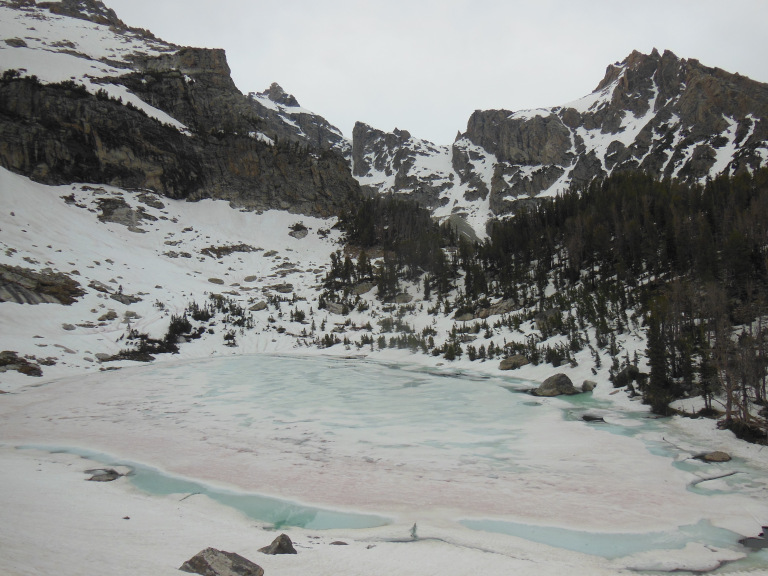
The last mile and a half of the trail were covered in hard-packed snow. The path finally levelled off into a high mountain valley blanketed with deep drifts. Two frozen tarns nestled among the spruces and granite cliffs. The lower, Surprise Lake, was just beginning to thaw, turquoise water welling up around boulders by the shore.
The upper tarn, Amphitheater Lake, showed only a few cracks in its pale green ice, framed by the shoulders of Grand Teton.
To get a better view, I scrambled up two hundred feet of snowy slope. Balanced on a protruding boulder, I took a series of photos of the two lakes and the gigantic mountains, stark against a rack of dark clouds.
The way back, as always, was something of an ordeal. My hiking boots are drying again in my backseat; and my knees ache as I write this at a formica table in the Colter Bay Laundromat.