Las Vegas, NV – Denver, CO
6/1 – 6/5/16
6-1
On this first day of meteorological summer, I woke to another heavy frost. Having little success in drying my tent (it was still too cold for the frost to melt), I threw it crackling into a plastic bag and sped off toward a warmer clime.
Losing elevation as I drove northeast, I passed before the Vermillion Cliffs, gleaming in the early morning sun; rolled through Colorado City, whose rambling houses bespoke polygamist families; and finally entered a region of true desert, spotted with Joshua trees and sagebrush. As I crossed the Nevada border, the distant red cliffs decayed into mournful ranges of burnt hills; the sagebrush dwindled to scabrous patches; and thickening ranks of pylons converged along the highway, marching toward Las Vegas. The city itself appeared as I crested a hill on I-15, casinos gleaming amid the smog and shimmer of valley-spanning sprawl.
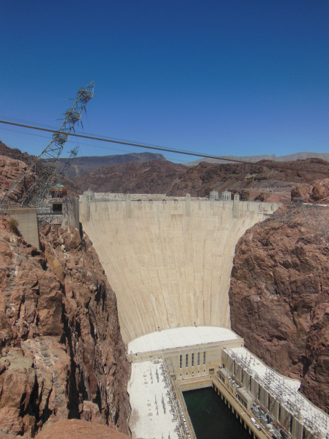
Before plunging into Vegas, however, I decided to check out Hoover Dam. The temperature was well over 100 by the time I reached the shore of Lake Mead – a full 80 degrees warmer, in fact, than it had been at my campsite four hours earlier. Donning my floppy sunhat, I braved the heat to buy a ticket for a tour of the power plant beneath the dam. This proved to be $15 well spent. An elevator brought us 500 feet down the dam face to the two generator rooms. Both of these cathedral-like buildings holds nine generators, each capable of supplying power to 70,000 households. As I held the metal railing on the observation balcony, I could feel the faint thrumming of water surging through the penstocks below, and half-fancied that I could sense the awesome surge of power through the pylons above.

The tour ended with a ride back up to the top of the dam. In the hammering sun outside, I admired the graceful flaring lines of the dam face and the Art Deco flourishes of the intake towers. Seldom have form and function been melded so successfully. My camera overheated, and I had to wait long minutes on the blistering overlook before finally getting a shot of the full dam face, wreathed with pylons and humming transformers.
And then, into Vegas. After negotiating the madhouse traffic of the Strip, I pulled into my hotel lot with more than a little relief that I had managed to avoid killing any pedestrians. The car thermometer registered 108, but there were still crowds out on the sidewalks, siphoning through casinos and shops with blithe disregard for the blistering heat. More cautious, I waited until 6 before venturing from my hotel room.
I find it difficult to marshal my impressions of the next six hours into a coherent opinion. By personality and training, I am abstemious and rather cheap – primed and programmed, in other words, to hate Vegas and everything it stands for. As I walked through the cavernous casinos and associated shopping complexes, however, I was too awed to disapprove. At first, it was all too easy to criticize the casinos as processing plants for baser impulses, or to condemn the hordes of my fellow visitors, faceless behind flashing sunglasses, as agents and victims of mindless consumption. But soon this righteous indignation gave way to grudging respect, and finally to fascination.
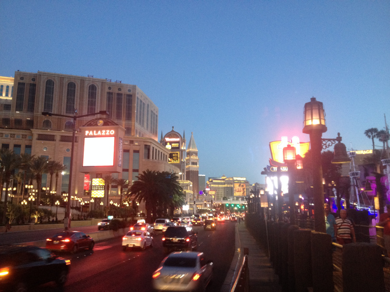
The Vegas Strip is nothing more or less than the world’s most efficient pleasure machine. Awesomely complex and infinitely subtle, designed to tease, tickle, and tantalize the every impulse of a vast range of audiences, it has the synesthesiatic magic that converts onlooker into consumer. The music in the loudspeakers, the dazzling décor of the casinos, the pimps on the street corners, the whole atmosphere of fantasy and play insidiously urges you to feel good, take it easy, and spend freely. The men who own and design the casinos are past masters of capitalism – that is, of psychology. As I walked through the colossal mall beneath the Venetian and Palazzo casinos, designed to recreate the streets of Venice, canals and all, I was struck in turn by the ridiculousness, by the beauty, and by the efficacy of my surroundings. Sometimes, naked ostentation really is the best marketing.
My own Vegas indulgence was limited to food. Around 7, I sauntered into the dinner buffet at TI, which I had heard described as a good mid-range option. Once inside, I am sorry to report that I gorged myself shamelessly: ribs, Italian sausage, sushi, slushies. I paid for my indulgence over the next three hours, the cocktail in my stomach soured by a long walk and the sweltering heat.
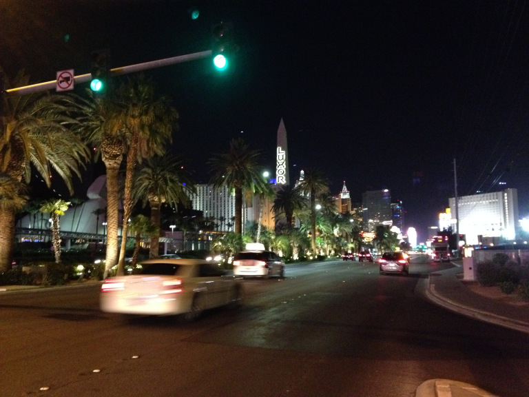
After ducking in and out of the more famous casinos – I especially liked Caesar’s Palace and New York, New York – I decided to walk to the south end of the Strip to see the famous Welcome to Las Vegas sign. I did not realize how long the walk would take me. From my hotel on the north end of the Strip, it was at least three miles one way, most of which involved painstakingly navigating busy streets and crowded pedestrian walkways. By the time I did understand, I had already gone too far to turn around. It took nearly two hours to reach the sign. It was a long trek for a stifling desert night; but the last segment, past the dark runways of the McCarran Airport and the sort of motel where one brings the more utilitarian class of prostitute, was almost relaxing. These few minutes, when the cicadas in the palm trees were louder than the midnight traffic, and the electric madness of the Strip shimmered silently in the middle distance, were the highlight of my walk. Then I reached the sign, took the obligatory photo, turned, and wandered back into the riot and lights.
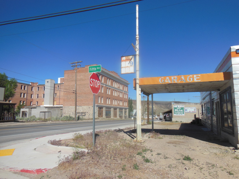
6-2
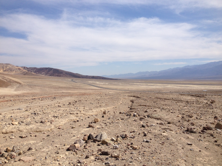
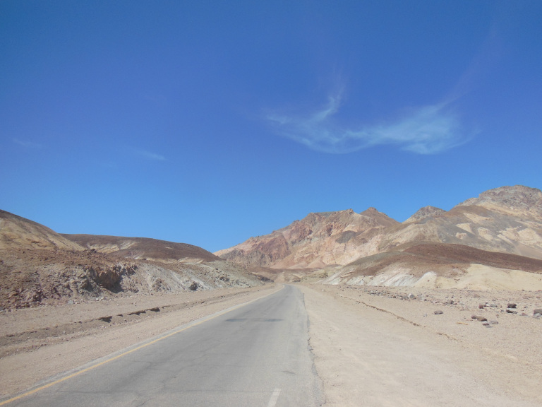
As I was leaving Vegas early this morning, I refueled at a gas station with a marquee advertising LOOSE SLOTS. Only in Nevada. As I drove west, the landscape contrived to become even more desolate than the trackless desert around Vegas. After crossing a range of hazy treeless hills, I entered a plain punctuated by Joshua trees and clumps of sagebrush. Past the straggling desert town of Pahrump, even these plants vanished. On either side of the pitted asphalt, a barren plain of reddish rock ran to a horizon torn by jagged black hills. I was approaching Death Valley.
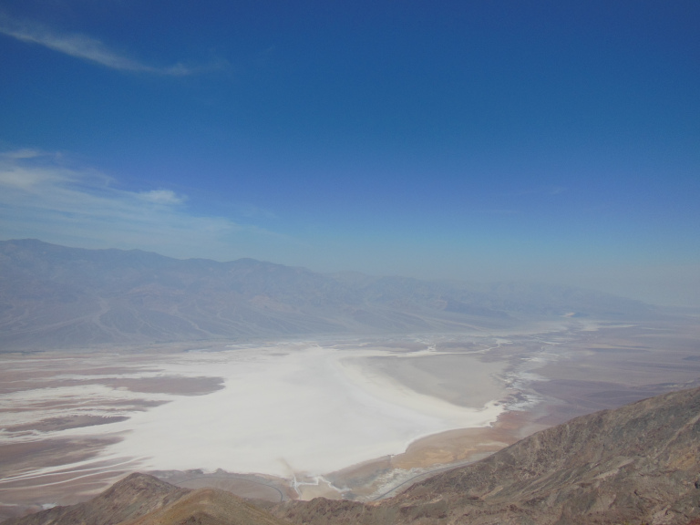
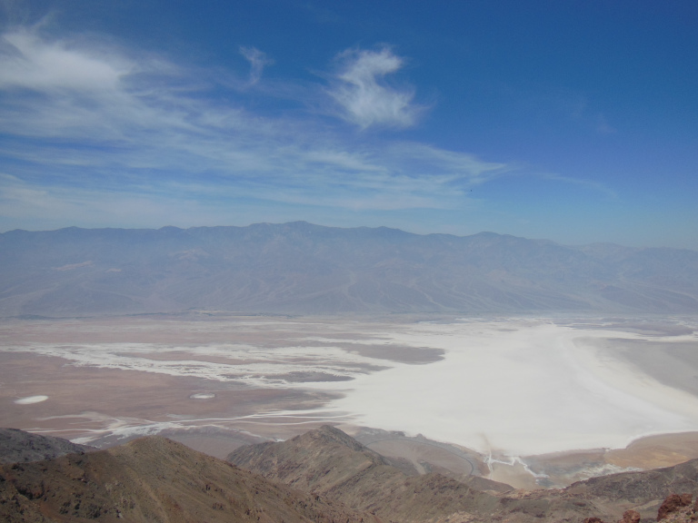
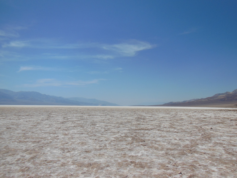
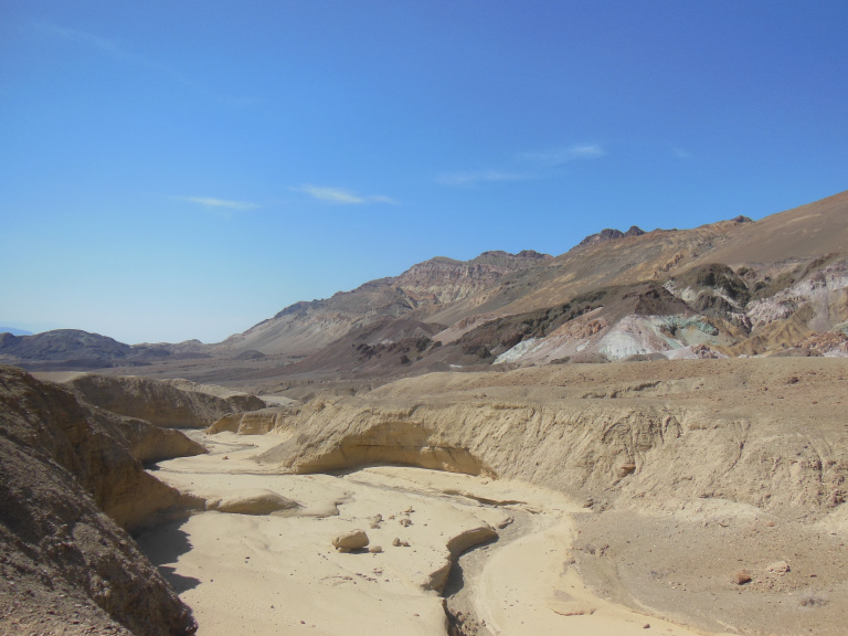
Around 10 AM, just as the car thermometer topped 100, I entered the national park itself. Never able to resist a photo op, I turned onto the skittering little road that leads up to Dante’s View, an overlook poised 6000 feet above the valley. Hiking over the baking rocks to a good viewpoint, I beheld a scene of splendid desolation. The sky shimmered like the air over an uncapped gas can – lethal, and ready to burn. Through the haze of the building heat, the whole of Death Valley was visible, a 100-mile depression between two jagged mountain ranges. The mountains were cinder black; but the valley floor was the color of burnt flesh, pocked with dully gleaming alkali flats. Never have I seen a landscape so determinedly desolate.
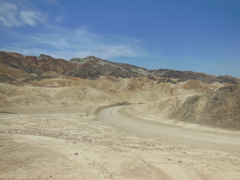
As I drove down to the valley floor for a closer look, the temperature climbed to 110 – despite the fact that it was not yet 11. As I approached sea level, weirdly contorted outcroppings, strata perpendicular to the sky, began to emerge from the haze. A narrow gravel track, built for the twenty mule teams that hauled borax out of the valley a century ago, leads through the midst of these badlands. I followed the track in my protesting Camry, kicking up clouds of alkali dust that reddened the almighty sun.
Merging back onto the main highway, I made my way down to the park headquarters at Furnace Creek, where I asked a stolid ranger where I could hike. He looked me up and down. “Don’t hike today. Gonna be 120 in the shade.” “Can I hike in the evening?” “It’ll still be 110.” “How about at night?” “Still over 100.” “Would the mountains be cooler?” “Not much.” “Well what can I do?” “Stay in your car and drink.”
In confirmation of the ranger’s words, the temperature rose steadily as I drove down the valley, rising to 122 as I neared the so-called Devil’s Golf Course, a flat coated with minerals precipitated from the water that rushes down from the mountains in rare winter rainstorms. The deposits of gypsum and calcite thus formed rime the ground like coral reefs bleached and killed by annihilating heat. These formations, twisting off toward the molten horizon, radiated heat as I tore my shoes on them. The photos I managed to take before my camera overheated, however, were worth the trouble.
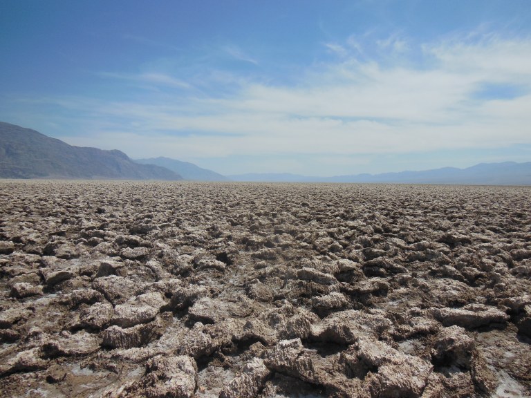
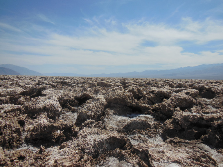
The temperature held at 122 as I drove to Badwater point, the lowest point in North America (283 ft. below sea level). I walked about a half-mile out onto the blinding salt flats, trying to get a good photo of the valley center. A superheated wind was blowing, whipping up dust devils and stealing the moisture from my lips and eyes. I began to fancy that it was a living and malignant thing – something desperate to lap my sweat and the blood from the cuts on my legs. Walking a mile in these conditions, I realized, lay just about at the boundaries of human – or at least my –endurance. I restricted myself to shorter walks thereafter.
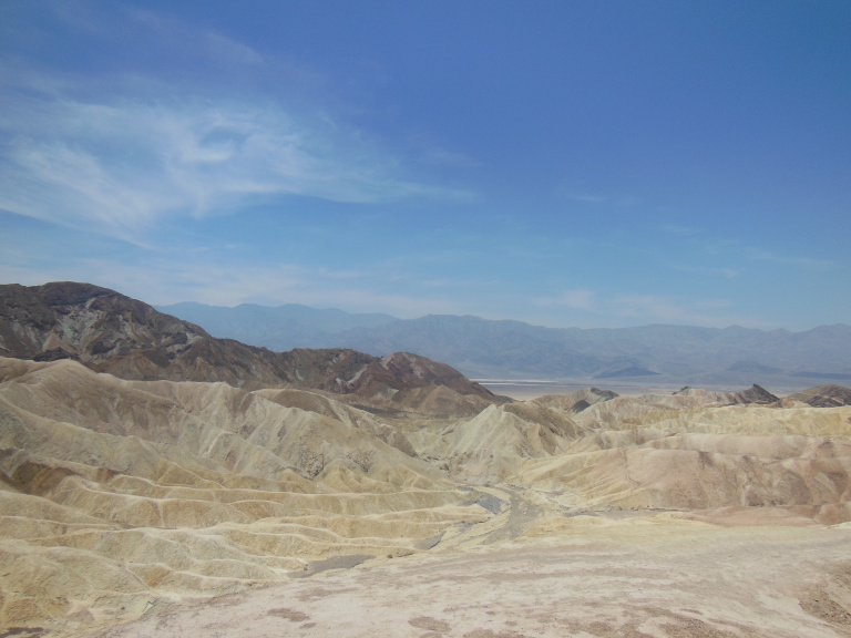
I spent a much more pleasant half-hour along the scenic drive that runs through the western edge of Death Valley’s badlands, leaving my car to examine more closely the splendid mineral-stained hills at Artist’s Point.
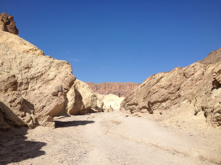
I attempted another short hike in the Golden Canyon, famous for its use as a setting in the first Star Wars movie. Like the nearby badlands, this was a surreal landscape of tilted and gloriously colored rock formations, endlessly photogenic in the late afternoon light. My camera, however, promptly overheated and shut down, followed soon after by my iphone. The flesh was willing, but the circuitry was weak.
I finished my tour of Death Valley with the large field of sand dunes near Stovepipe Wells, which shone against the dull basalt of the Panamint Mountains. Here again, I was restricted to a few pictures and a short walk by malfunctioning electronics.
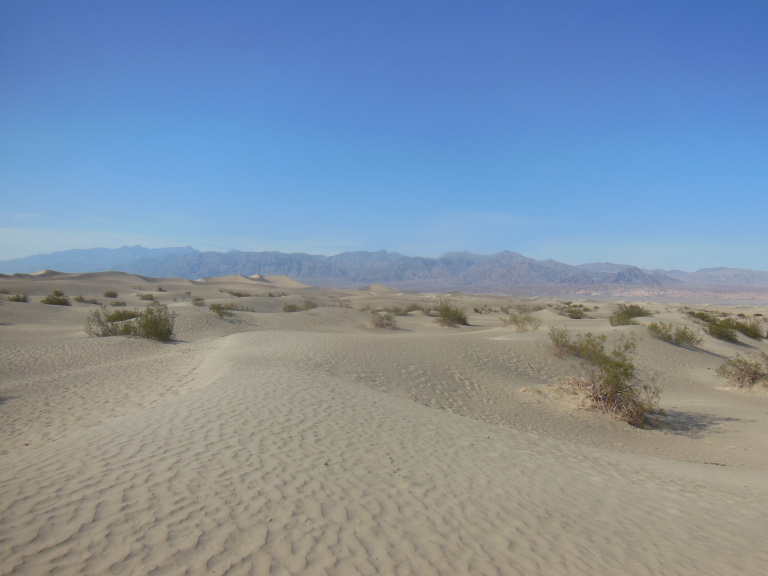
The temperature at the dunes was a relatively brisk 118. As I drove out of the valley, my car thermometer registered a temperature below 110 for the first time in eight hours. I parked briefly on the valley lip and looked back down. Hundred foot dust devils were rolling majestically over the sand dunes, adding grit to the heat haze that made the black mountains shimmer and melt.
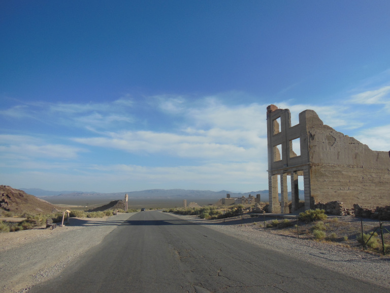
By the time I reached the ghost town of Rhyolite, the temperature had cooled to a refreshing 100. The gaunt brick skeletons of hotels and banks cast long shadows in the rosy stillness of evening. Sagebrush rustled in an unfelt breeze. The endless black line of the highway cut through tan desert in the distance, running toward the shimmering peaks of the Panamint Range.
Beatty, NV, the struggling mining town where I had decided to spend the night, was not much livelier than Rhyolite. Half the storefronts seemed to be shuttered, and I was the only customer in the dusty Mexican restaurant on Main Street. It must be said, however, that my motel was pleasant enough, despite being a time capsule from 1970. The owners were kind enough to turn on the lights for me in the little concrete pool behind the parking lot. With the temperature still in the 90s at 10 PM, I floated there for long minutes, looking up at the low-hanging stars.
6-3
Central Nevada is empty in a way that shames even the Great Plains. As I left Beatty, I passed a sign reminding drivers that the next gas station was 97 miles away. That station, incidentally, was closed.
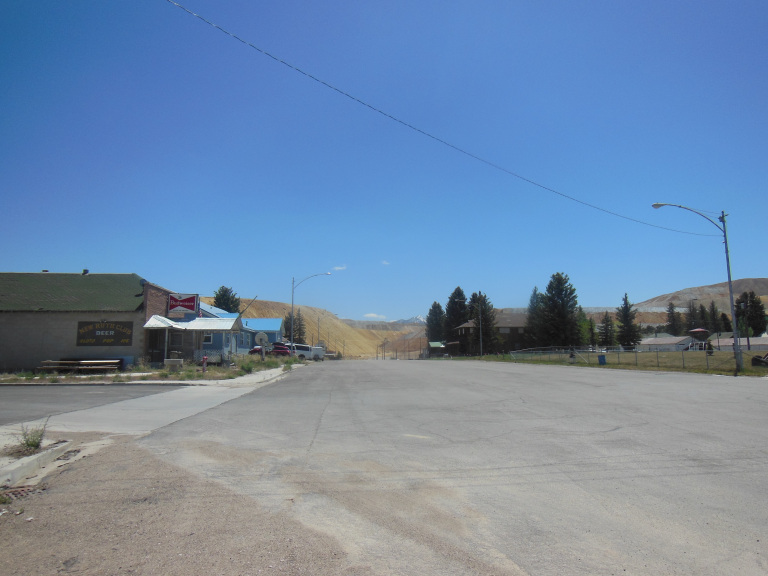
The few towns in this howling wilderness live and die with their mines. At the moment, all seem to be dying. Goldfield, the first town I passed through, is a representative example. Every other storefront on Main St. was boarded up. I parked in the shadow of an abandoned three-story hotel, and walked up and down the main streets. The century-old courthouse, a jail with barred windows appended to the back, was still in use and good repair; but the grand old high school on the street just behind was collapsing. The silent headframe of the mine on a nearby hill told the whole story: the gold was played out, and the people had no reason to stay. On the ragged outskirts of towns like this, where empty mobile homes straggled over gray hills, the desert began again – an endless landscape of dry sagebrush, punctuated by eroding buttes. It was the towns, curiously, that seemed the loneliest parts of this landscape.
For 80 miles, I drove up the Big Smoky Valley, a desolate plain bounded on the east and west by lines of snowcapped peaks. At the north end, I turned onto US 50, famous as the “loneliest road in America.” It lived up to this reputation. In 250 miles, I passed through a grand total of three towns, only two of which were large enough to have gas stations. The landscape varied relatively little: low hills, drab with sagebrush, rolling toward remote mountains. Through it all the road ran endlessly, vanishing before and behind in the haze of incomprehensibly distant horizons.
The smallest of the three towns through which the road passed was New Ruth, crouched beneath the orange tailing heaps of the colossal copper mine that swallowed old Ruth. I stopped to take a few photos of the main street, aligned with the mine entrance and a snowcapped mountain range.
Ely, far and away the largest town in east-central Nevada, sprawled nearby. Though reasonably prosperous-looking, it had the fossilized look of so many places along US-50. The main street, with its specialty shops and brick hotels, cannot have changed much since the 50s, when the decision was made to route I-80 through northern Nevada and the cross-country traffic dried up.
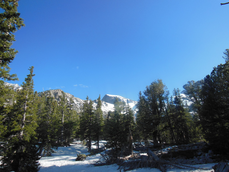
At long last, I reached Great Basin National Park. One of the least visited national parks in the country, for the simple reason that it is located approximately in the middle of nowhere, Great Basin sprawls over the spruce-covered foothills of Wheeler Peak (elev. 13,064). After the usual ignoble jockeying, I secured a site beside a babbling meltwater stream. My pleasure in the location was blunted, however, by the gravel tent pad, which bent all of my stakes.
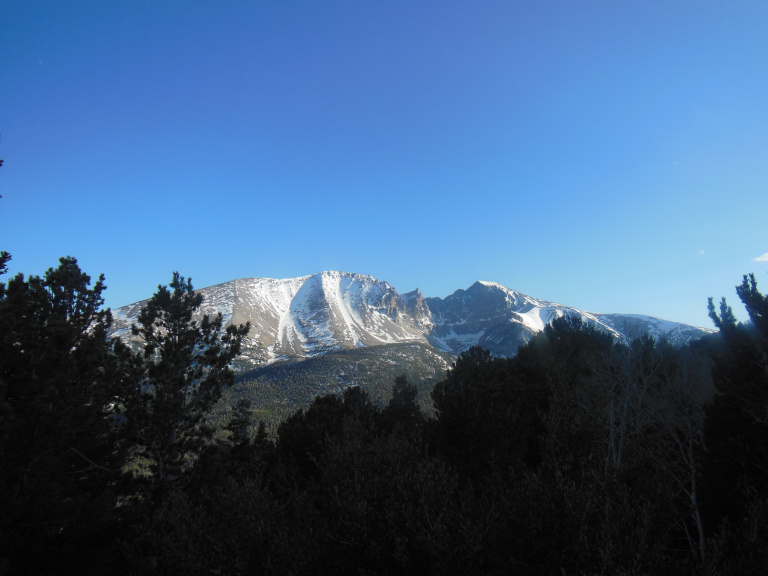
It was now mid-afternoon. Deciding that a medium-length hike was in order, I leafed through my guidebook and settled on the Bristlecone Trail. Assiduous readers will recall my fascination with the Bristlecone Pine. Great Basin hosts a whole grove of these homely immortals, and I was determined to see it. I had not reckoned, however, with the snow. At 7000 feet, where the access road began, the temperature was in mid-eighties; trees were in full leaf, the grass knee-high. At 9000 feet, it was nearly twenty degrees cooler; the aspens were naked, and snow lingered on shadowed slopes. A thousand feet higher, at trailhead, the ground was completely blanketed with snow, drifted in places to depth of six feet.
A prudent man would have shrugged, taken a few pictures, and turned around. But I had come to see Bristlecone Pines; and I was not about to let a few miles of deep snow stand in the way. I could see that a few intrepid or foolhardy souls had walked over the drifts in the direction of the trail. If they had done it, so could I. At first, the going was relatively easy. The thaw was in full spate, and meltwater streams were chuckling between the drifts, leaving patches of exposed grass.
After a few hundred yards, however, the bare spots disappeared. Since the trail was buried, I had only the footsteps of my predecessors (there were four or five sets of prints, all probably made in the previous couple weeks) to guide me. This track was clear enough – but the snow had softened since it was made. I kept punching through the icy crust, sinking knee- or waist-deep in grainy snow. I found a dead sapling that would serve as a walking stick – and promptly snapped it when I plunged into a five-foot drift.
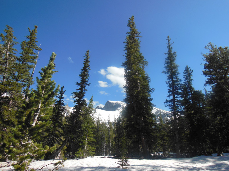
I worked gradually uphill, emerging finally in a meadow of brown grass that was mercifully free of snow. Wheeler Peak, gleaming in the late afternoon sun, filled the eastern horizon. Distracted by this view, I lost the trail. For fifteen panicky minutes, I floundered through drifts, looking for the telltale depression of the track. After finding it, I promised myself that I would head straight back to the parking lot. I promptly abandoned this pledge when I found the half-buried trail sign pointing to the bristlecone grove .7 miles away. The line of footsteps was clear enough, but the snowpack had decayed terminally since the last hiker passed. At almost every step, I sank to my thighs. Once, in a drift, I managed to plunge to my armpits. The effort was excruciating – but I had not come this far to turn back before seeing the trees.
After nearly 40 minutes of pushing through drifts, I reached the edge of the Bristlecone grove. Exhausted and soaked to the chest, I took a few pictures of the gnarled trees (which didn’t come out), and then plunged back toward the parking lot.
When I finally reached my car, I pulled off my soaked boots and socks. Alone with the sound of trickling meltwater, I began to change my pants – and, as if on cue, three cars pulled into the lot. I retreated into the car just in time to avoid adding indecent exposure to the evening’s sins.
6-4
Morning found me back on the endless empty asphalt of US 50, whipping through the abomination of desolation at 80 Mph. For nearly a hundred miles after leaving Great Basin, the landscape consisted of the familiar sagebrush-covered valleys and distant snowy peaks. A certain degree of variety began to appear in the foreground past the Utah border: shimmering salt flats, long hills of short dead grass, hazy ranges of eroded hills.
Turning onto US 6 (like 50, a segment of the old Lincoln Highway), I rolled into half-deserted mining town of Eureka, UT. I stopped there primarily to check out three ghost towns in the vicinity. Two were disappointments, for the simple reason that they were no longer ghost towns: lured by the high price of gold, small bands of miners had returned to work over the spoil heaps left by their predecessors. The third, Dividend, was more rewarding.
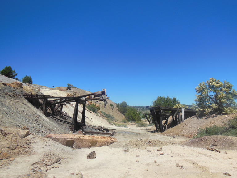
Following a narrow road with sweeping views of the mountains, I passed a series of abandoned mine workings. I pulled off the road near the largest of these, the former Tintic Mine #2. Although most of the buildings had collapsed into their foundations, the old mining equipment was still in place, rusting before a glorious backdrop of snowcapped peaks.
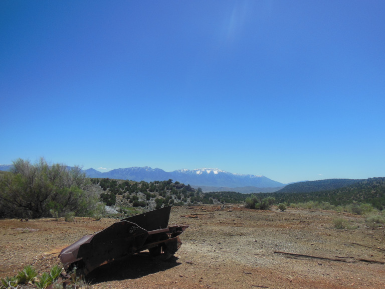
The shaft was still open. Picking up a pebble, I threw it down the hole, and counted four long seconds before it clattered on the bottom. If I recall my high school physics, this means that the shaft was really freaking deep. Giving the abyss a wide berth, I explored the crumbling works, eyes peeled for minerals in the spoil heaps. To my surprise, I actually found some nice pieces of rose quartz and a fingernail-sized lump of what I fondly imagined to be malachite.
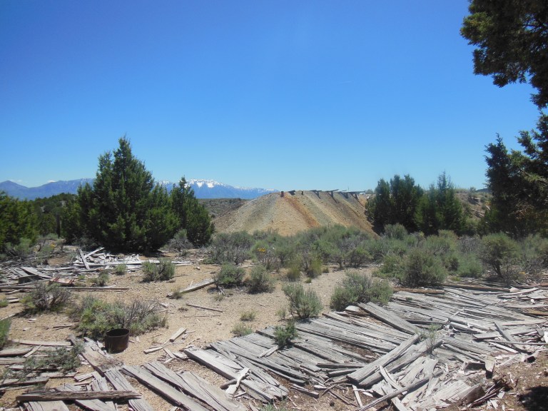
The town of Dividend, once spread over the hill below the mine, has almost completely vanished. Besides a few sagebrush-covered foundations, the chief remains were – as in the ruins of an ancient city – ephemera in the dirt: glinting bits of beer bottles, half a telegraph transponder, the crumbling leather last of a woman’s shoe. From an erosion ravine, I plucked a fragment of a fine china plate, which I fancied may have belonged to the town hotel. Conscientious for once, I left the artifact where I found it, glittering among the windblown sagebrush.
Onward and eastward, past mountains and lush green valleys, through the barren hills of central Utah’s coal country, into a desolate landscape of sagebrush and pale stone buttes. Finally leaving US-6, I pulled onto I-70, set my cruise to 88, and watched the familiar landscape of the Colorado Plateau blur by to the south. As I passed, I was treated to a last glimpse of the red buttes around Moab. The La Sale Mountains passed in review, snowy peaks crowned by purpling thunderheads. I crossed into Colorado; and finally, exiting the interstate, drove a winding road along the cottonwood-lined Colorado River.
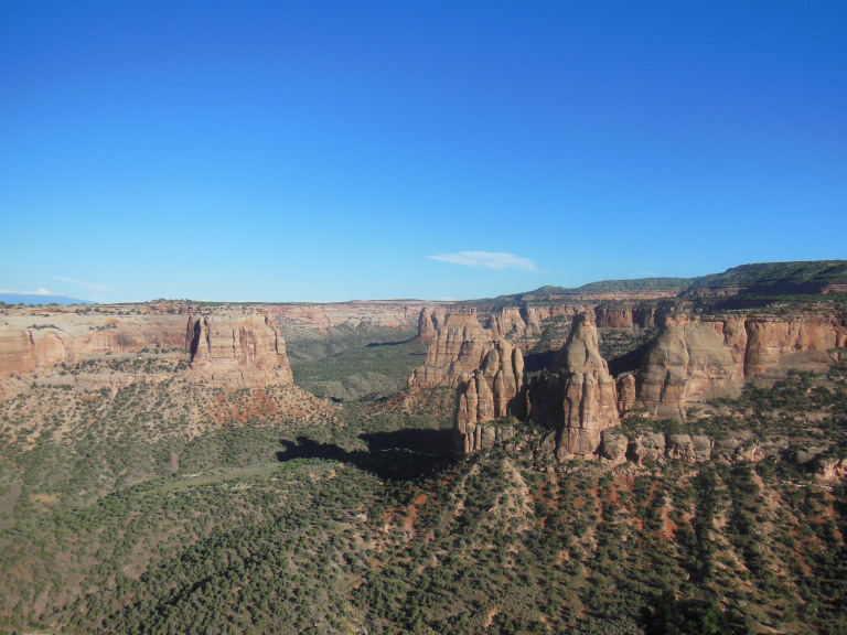
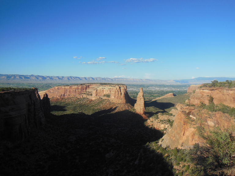
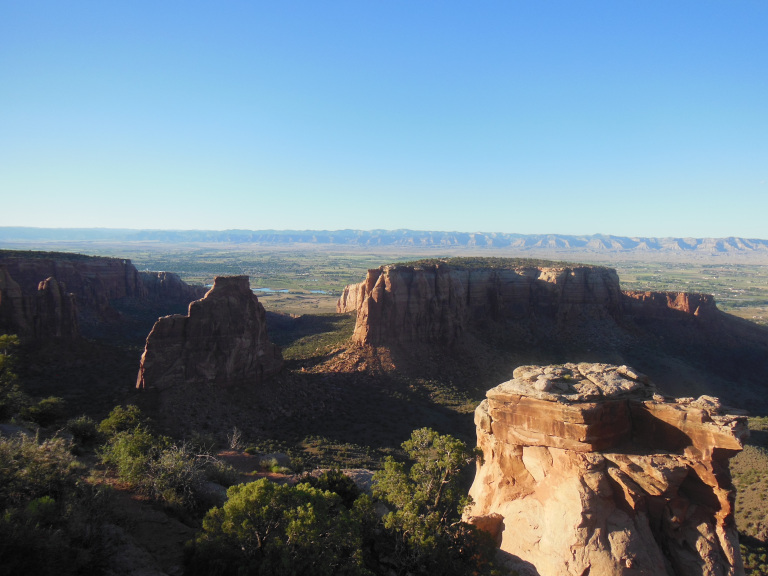
I closed the evening with a few hours at the Colorado National Monument, a series of fantastically eroded canyons in a red mesa overlooking the eponymous river. The views along the rim road and the few short trails I sampled were very fine – rosy dreamscapes overlooking the Grand Valley and a distant range of seamed hills. After Bryce and the Grand Canyon, however, I’m afraid that I’ve become rather jaded. Another glorious sunset quickening the infinite palate of lambent stone? Seen it.
6-5
Driving east from Grand Junction this morning, I was treated to a reprise of my first glimpse of the Rockies three weeks ago, as long ranges of brown hills were suddenly crowned by a blue line of snowcapped peaks. The distant mountains soon receded again, however, behind scrubby hills, leaving me little to gawk at until I reached Black Canyon of the Gunnison National Park.
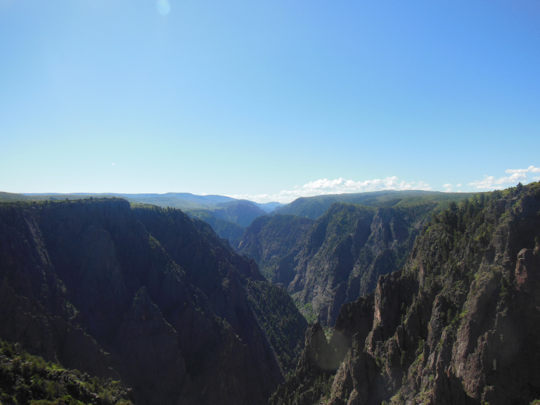
After weeks in canyon country, I have become something of a connoisseur of gigantic chasms; and the Black Canyon, in my learned opinion, is a real humdinger. It cleaves through Precambrian basalt, magma spilled and hardened in the dim eons when life was single-celled and unambitious. Unlike the softer sedimentary formations of the Colorado Plateau, this rock splinters and shatters as it erodes, giving the cliff faces the appearance of a sheer fortress wall studded with spikes.
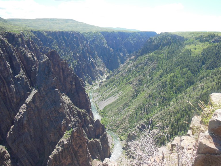
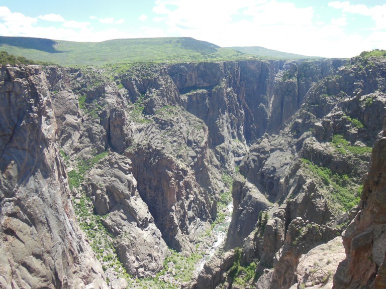
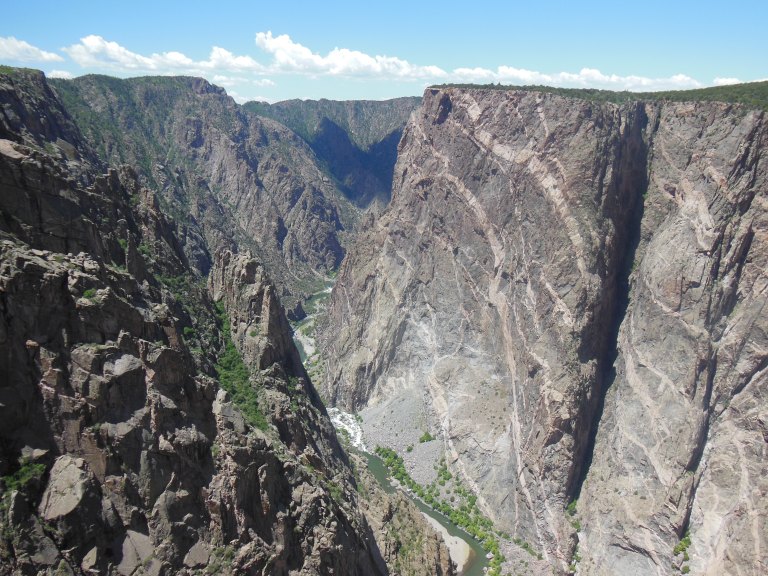
There is something forbidding about the Black Canyon, a beauty quieter and more somber than the Kodachrome riot of red rock country. Each overlook afforded a dramatic new vista of the narrow black chasm, hacked through a green plateau. The most impressive of all was the Painted Wall – a 3000 foot face of Precambrian rock, marbled with billion year-old magma intrusions.
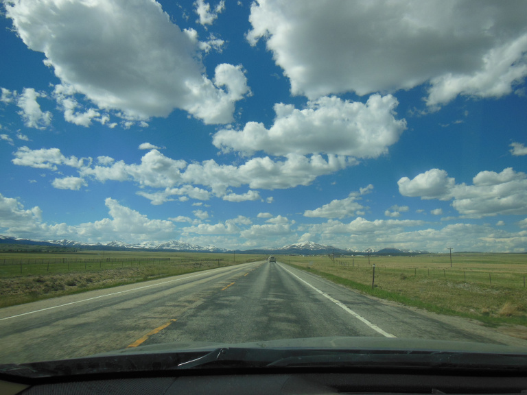
After a few short hikes and many pullouts, I returned to the interminable line of US 50. The scenery became more dramatic as the road vaulted into the mountains, peaking at the snowy Monarch Pass (elev. 11, 312). Finally leaving 50, I followed the long winding Hwy 285 through a series of broad winter-brown valleys bounded by sky-filling peaks.
One image in particular sticks in mind: a vacant ranch house, paint and windows long gone, in a field of tall brown grass. A motionless black cow stands sentry in the front yard; and the mountains go on forever behind. This scene, glimpsed through the car window at 80 Mph, summarized the landscapes of the past four days. I did not stop for a picture.