Escalante, UT – Demotte, AZ
5/27 -5/31/16
5-27
Today began and ended in profound frustration, but featured at least one moment of pure exhilaration. The morning’s troubles stemmed from the fact that, when planning my trip a few months ago, I completely forgot about Memorial Day. Realizing my mistake, I decided to leave Bryce as early as possible to ensure a campsite at Zion on Friday morning. Breaking camp in the half-light just before dawn was an ordeal. My tent was still stiff with frost, and the tarp soaked and swollen from yesterday’s thunderstorm; shoving both into garbage bags with numb hands, I threw my gear into the trunk and sped southwest.
Along the way, as is my custom, I tuned into the local stations, and was treated to “country in the morning with Big D and Bubba”. Shortly after this show faded to static, I passed the entrance gate for Zion National Park. Racing through the striated sandstone hills east of Zion Canyon, I whipped into the campground a little before 8 – and found myself at the end of a 50 car line. I had badly underestimated how many people would take Friday off for the holiday weekend. Desperate, I began calling campgrounds. The only place that had even overflow camping spaces available was the Ponderosa Ranch Resort, located in a remote juniper forest about 10 miles from Zion’s eastern gate. The staff were friendly enough; but the site I was assigned gave new meaning to the adjective “unimproved.” The access track (“road” is too generous a word) was a sea of rocks and dust; and the site, though pleasantly shaded by junipers, was about a quarter mile from the bathroom. Resigned to my fate, I rigged up a clothesline, hung up my sodden tent, and raced back into Zion.
Although it was still before noon on a Friday, crowding in the park had reached crisis proportions. I had to park in the town of Springdale, nearly a mile from the western gate. Jogging back to the park entrance, I joined a long line of people waiting for the shuttles that carry visitors into Zion Valley itself. As a girl in front of me informed her parents – “this is worse than Disneyland!” Once I finally got on a shuttle, I went directly to the trailhead for Zion’s most infamous hike: Angels Landing.
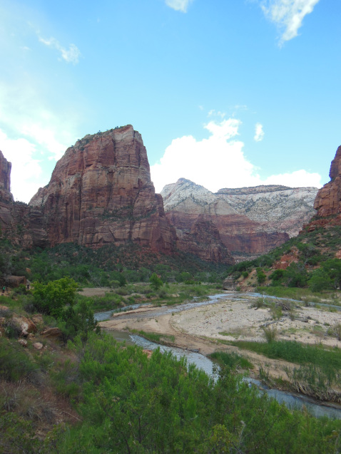
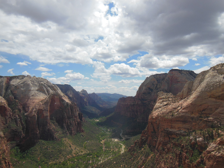
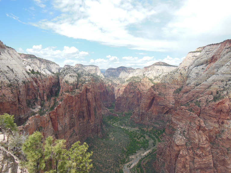
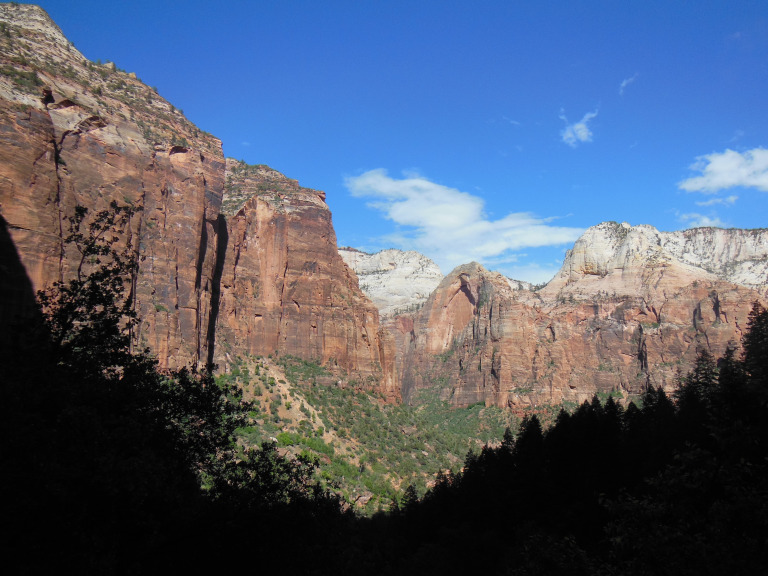
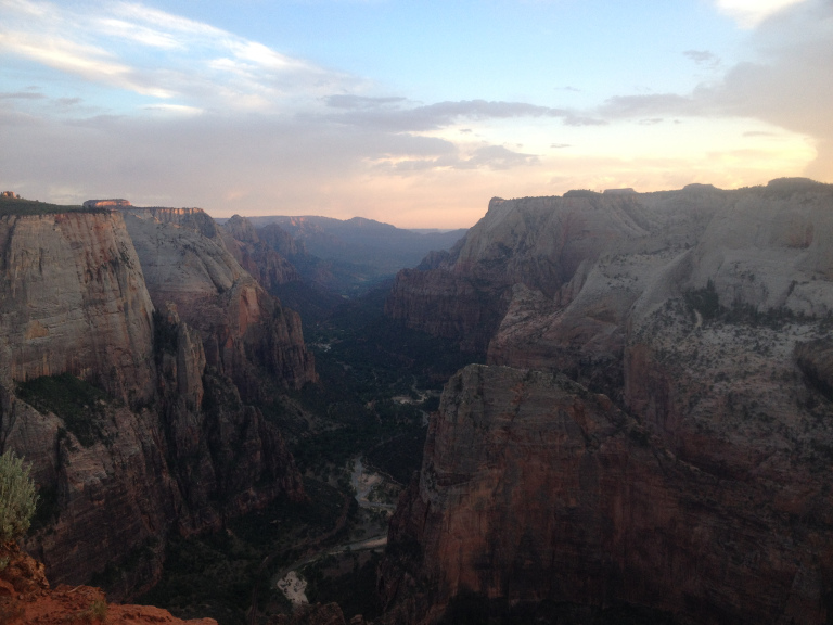
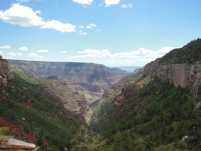
As I walked to the trailhead, I had my first chance to properly admire the Zion Valley, a deep canyon reminiscent of Yosemite. Cliffs of pale and rosy sandstone rose sheer 2000 feet above the valley floor, where the little Virgin River meandered and murmured over its stony bed. A sudden cloudburst soaked me as I began the climb, followed by a sweltering sun just as I began the switchbacks. As I labored up the steep section known as Walter’s Wiggles, my resolve was spurred by the blatantly unfit people waddling, shuffling, and wheezing down. Angels Landing has a way of drawing not only experienced hikers who know what they’re getting into, but also crowds of people who know that the trail is famous without quite realizing how difficult it will be. Many of those I passed were clearly not even regular walkers, let alone hikers equipped for a serious climb. Most turn back before the dangerous part of the trail; but those who persist clog an already hazardous route for everybody else. The last half-mile of the Angels Landing trail follows a razor-sharp ridge of slick sandstone to a pinnacle poised over Zion Valley. The trail is seldom more than a foot or two wide, and frequently runs beside unfenced drops of nearly 2000 feet, with a hold chain as the only safeguard. To make matters worse, another cloudburst was approaching, driving gale force winds and a whipping drizzle over the rock.
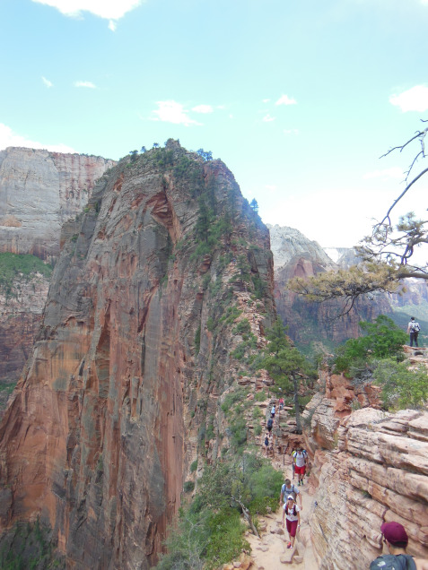
The climb, the crowds, and the wind made the hike up extremely unpleasant. But the views from the top, illuminated by a passing moment of sunshine, were spectacular. North and south, the green stripe of the Zion Valley ran beneath my feet, bounded by the gleaming white and gold sandstone of cliffs. The dark clouds of the rainstorm, passing just to the side of the summit, accentuated the colors of the scene. After fighting my way through the crowds to the base, I walked down to the Virgin River and looked incredulously through the drizzle at the looming ridge I had just climbed. As after hiking up the Half Dome at Yosemite, I couldn’t help thinking: that was fun, but never again.
After Angels Landing, the short trail up the Upper Emerald Pool was underwhelming – though I suppose almost any hike would have seemed anticlimactic. It did, however, provide some splendid views of the half-mile high wall of Zion Canyon, brilliant in evening sun.
I slogged back to the parking lot to find my car booted. Apparently, it was a pay lot – I drove in through the exit and missed the sign. Calling the number on the sign posted to my window, I couldn’t get ahold of the tow operator. As I sat wondering how I could possibly get back to my campground that night, the operator called back. When he finally showed up, he was not impressed with my explanation of why I didn’t have a parking stub, and levied the full fine of $100. This did not make my evening.
Livid as I drove back toward my campsite, I played Bach’s Mass in B Minor to relax. In this ruminative mood, I added a Bighorn Sheep to the list of animals I have nearly run down with my car this trip. Fortunately, the sheep stayed on a concrete parapet just over the road, surveying the world with a philosophic indifference I did my best to imitate.
5-28
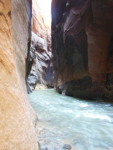
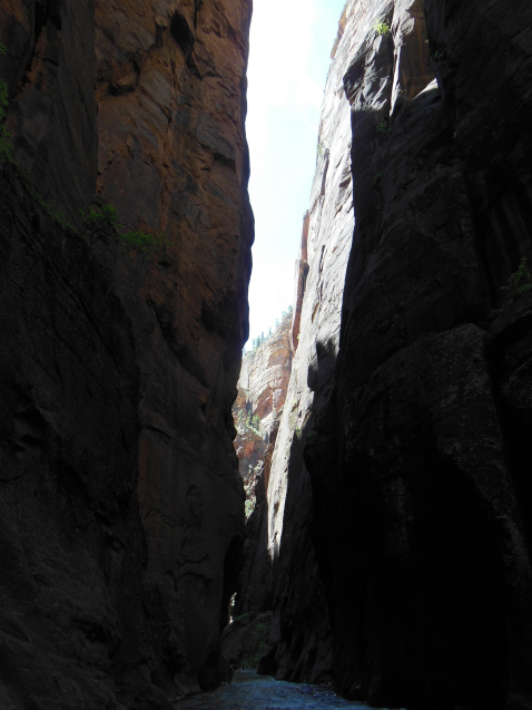
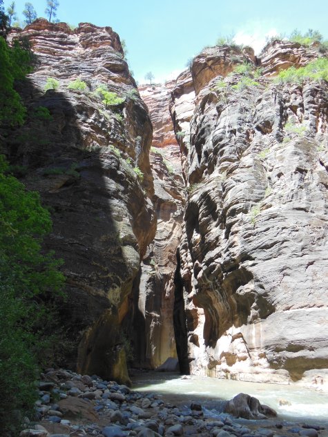
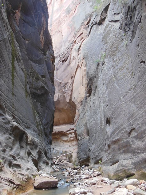
As it gently meanders through the Zion Valley, the Virgin River, chuckling on its bed of pebbles, seems an innocuous little stream. Beyond the valley head, however, where the canyon walls contract into a chasm little more than twenty feet wide, this charming brook is revealed as a powerful mountain stream. This stretch of the Virgin River, whipped to froth between beetling cliffs, is known as the narrows. With Angels Landing, the walk up the Narrows is one of Zion’s iconic hikes. Again with Angels Landing, it is also one of Zion’s most dangerous. Even in high summer, when the flow is often less than a third of what it was today, navigating the slippery river bed and insistent currents of the Narrows requires considerable caution. The higher waters of Spring are correspondingly more hazardous. When I checked a few days ago, the Narrows were closed by high water. They reopened yesterday when the water flow fell below 150 cubic feet/second for the first time in weeks. Since the river was still flowing at 140 cf/s during my hike, however, it was sometimes all I could do to stagger forward into the current.
As usual, I was up before dawn, racing through Zion to reach the outfitter in Springdale by the crack of 7. Hiking the Narrows requires special equipment – gripped water shoes, waders, and a hiking stick – and I wanted to get my set before the hordes showed up. I was right to hurry; there was already a line outside the outfitter at 6:45, and the stock of equipment was dwindling fast by the time I left. Waddling over to the shuttles, I made the 45 minute ride out to the mouth of the narrows, and then walked the pleasant mile-long riverside trail to my point of entry. The first hundred yards introduced me to both the gorgeous scenery and the hazards I would experience for the rest of my hike.
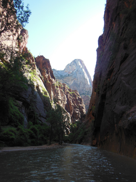
Virtually alone – I was at the head of the first wave of morning hikers –I trudged upstream in twilight of the canyon interior. Only after an hour did the first streaks of sunlight begin to find their way down slot canyons, dappling the surface of the river and revealing intricate patterns in the sandstone walls. I hiked perhaps three miles upstream, until my progress was stopped by a six-foot hole between two huge boulders.
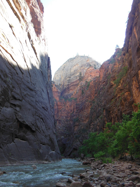
On the way back, I took more time to appreciate the visual drama of the two thousand foot canyon walls, high enough to blot out the noon sun over parts of the river. In places, these walls had been polished so smooth by the rushing stream that they shone like finished marble. Spring-fed nooks and crannies, by contrast, bulged with mosses and bristled with clumps of ferns.
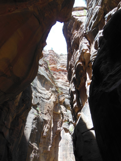
About a mile from the trail’s end, I stopped to explore Orderville Canyon, a slot canyon even narrower than the main channel, graced with a series of picturesque waterfalls.
I spent nearly eight hours in the Narrows. By the time I emerged, the mid-afternoon crowds were out in full force. Squelching at every stop, I had to force my way back to the shuttle, and then sit through an hour of traffic on my way back to the campsite.
5-29
I intended to leave Zion this morning, deciding to stay only after a series of increasingly desperate phone calls revealed that no campsites were available for a hundred miles in every direction. Defeated, I reluctantly extended my tenure at the Ponderosa by one night. I was determined not to go into the Zion Valley on this crowning day of the Memorial Day Weekend, and resolved to find a moderate-length hike east or west of the crowded park center.
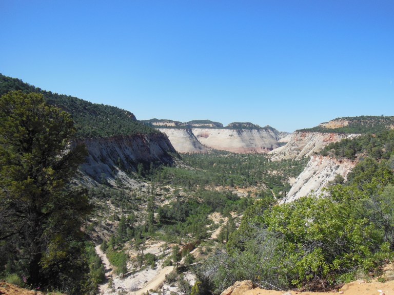
In the end, I settled for the East Rim Trail, which joined the highway just inside the park’s east gate. I walked a little more than eight miles. Since this side of the trail is used primarily by long-distance backpackers, I had little company, passing only a few hikers in the course of entire morning. The lack of people only partially compensated for the lack of dramatic scenery. With the exception of a few panoramas over side canyons of striated sandstone, the trail passed primarily through forests of spruce and juniper, parts of which had been blackened by a recent fire. The only real moment of excitement came two miles in, when I nearly stepped on a large snake sunning itself on the trail.
Passing the two-mile line of cars that had formed at the east gate with an air of schadenfreude, I returned to my campsite for a quiet afternoon, which I used to catch up on this journal.
After making my dinner this evening (hot dogs and chili), I decided to visit Observation Point, a remote overlook on the east side of Zion. The man at reception assured me that the hike was three miles. Blithely assuming that he meant three miles round-trip, I bumped over a rutted dirt road to the trailhead. There, I discovered that the hike was 3.3 miles one way. I had 45 minutes until sunset. Left with no alternative, I ran. About halfway to the overlook, I realized that I had forgotten my camera, and would have to rely on my phone’s camera. Grabbing this from my pack, I sprinted the last half-mile, arriving just as the sun merged with the horizon. Zion Valley lay crimsoned before me.
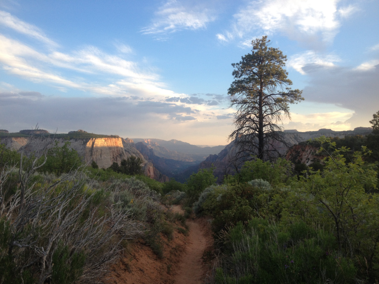
About a half-mile ahead and a thousand feet below, I could see the last ant-sized hikers climbing down from Angels Landing. Beyond, the cliffs of the valley wall, tops splashed with a narrow band of vermillion, stretched toward the distant lights of the visitor center. The Narrows, already dark, sliced off into the plateau on the other side of the overlook. Then the sun set, the vista turned blue and hazy, and I switched on my flashlight for the long walk back to my car.
5-30
I left Ponderosa early, shaking thorns from my tent and tarp. The ride to the north rim of the Grand Canyon was largely uneventful. After a long stretch of juniper-covered hills, I crossed into Arizona at Fredonia. Passing a gas station with a roadside sign advertising LOTTO GUNS AMMO BEER (a winning combination), I entered a scrubby desert. An overlook nearby provided a spectacular view of the landscape I had just left: three lines of cliffs – the buttery crags of Bryce, the paler hills of Zion, and the crimson buttes of the Vermillion Cliffs National Monument – rose like a colossal staircase mounting to the north. I was entering the southernmost and oldest part of the Colorado Plateau. But not the lowest – the landscape rose into a region of leafless aspens and winter-brown grass, where the air retained a hint of frost.
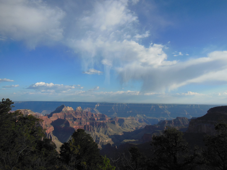
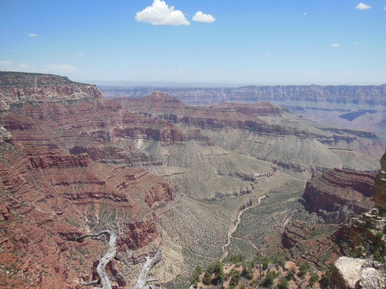
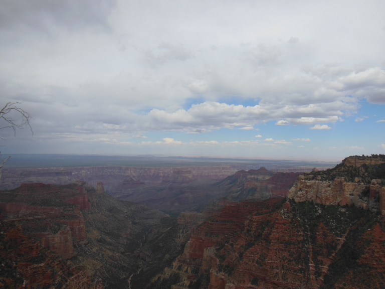
I reserved one of the last spots at the Demotte Campground, about five miles north of the park entrance. Driving into the gate, I was stopped by a herd of rangy-looking buffalo. They passed at a leisurely pace, picking at grass by the roadside and leading a half-dozen clumsy calves. A motorcycle pack jammed the gate; and then, finally, I was in. I drove straight to the visitor center, and walked out to Bright Angel Point, where the canyon itself first became visible. I have seen the Grand Canyon before, and have spent the past two weeks in a landscape molded by the same erosional forces. But I was still astonished by that first look. The scale, already almost incomprehensible, was made even harder to grasp by the hazy air, and by a series of cloudburst drifting across the southern rim. My general impressions are perhaps best epitomized by the biker who walked up beside me, took off his sunglasses, whistled, and said: “holy shit.”
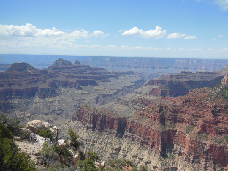
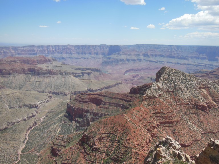
After the obligatory promenade up Bright Angel Trail, snapping innumerable ill-composed photos, I drove out to the overlooks east of the visitor center, which afforded spectacular vistas of the canyon, dappled with clouds. On the eastern horizon, darkened with rain, the Painted Desert shone dully. I especially liked the view from Cape Royal, from which the green stream of the Colorado was just visible among the buttes and crags it had carved.
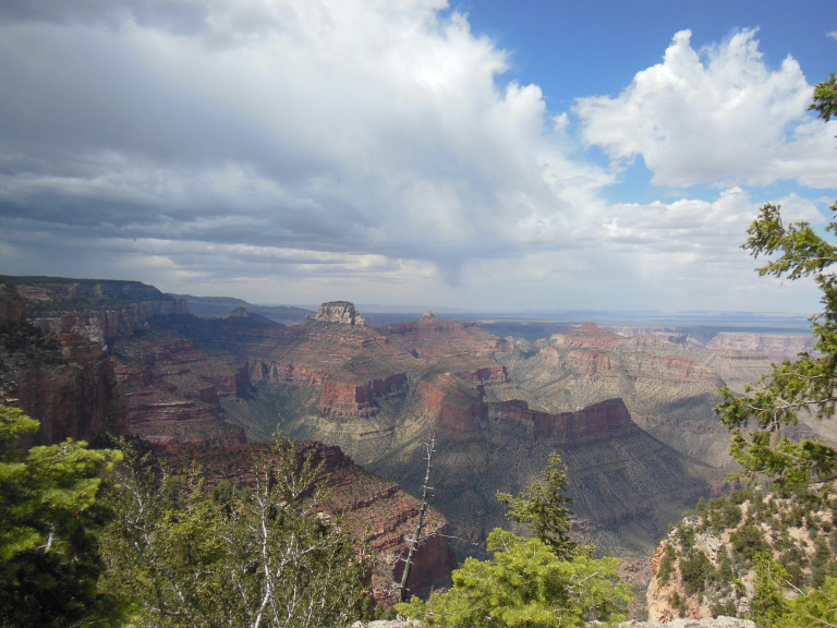
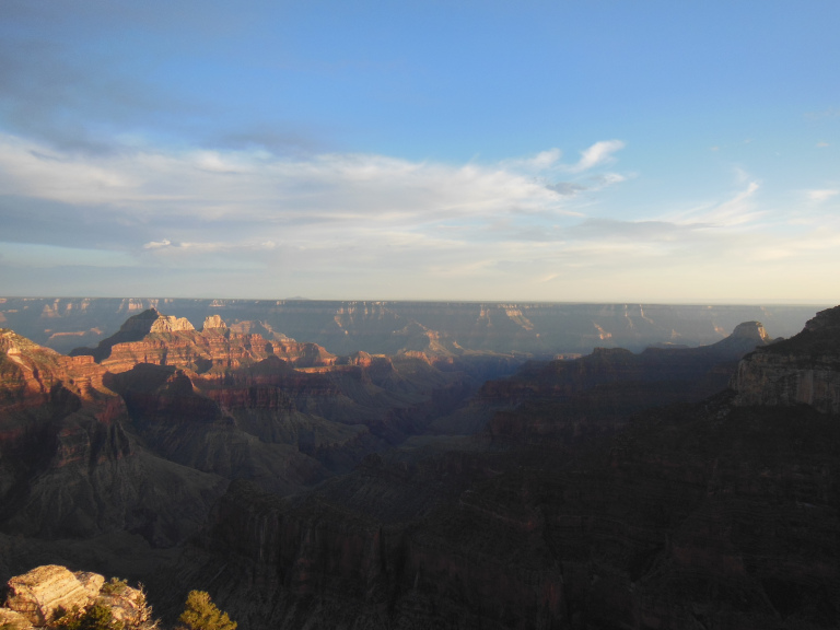
I did a number of short hikes, and then retired to the General Store to catch up on this journal. Emerging at the hour of sunset, I walked out again to Bright Angel Point. The spectacle, predictably, was awesome. I provide a few inadequate pictures in lieu of a still more inadequate description.
On the way to my campsite, I added a buffalo to the growing list of western animals I have nearly pulverized with my car. Arriving well after dark, I set up my lantern and cooked dinner under a ceiling of twinkling stars. It would have been gorgeous if it hadn’t been so cold.
5-31
Up just before dawn, I emerged into a landscape whitened by heavy frost. The car thermometer registered 24 degrees as I pulled into the lot for the North Kaibab Trail, the only path on the North Rim that descends into the canyon. The temperature warmed quickly as I descended, as did I, sweating slightly with the effort of keeping walking a steady slope down for more than five miles. Since the path is confined to two side canyons, the scenery consists less in sweeping panoramic vistas than in the humbler drama of trailside geology. One by one, the rock formations of the Grand Canyon walls – Kaibab Limestone, Supai Sandstone, Bright Angel Shale, etc. – pass in review, submitting themselves to this amateur geologist’s close inspection. As I descended and the sun rose higher, the formations rose in sparkling detail above me, three thousand feet and a hundred million years deep.
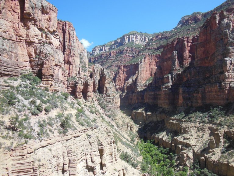
I stopped for a leisurely lunch at the idyllic Roaring Springs, where a waterfall joins a rushing stream amid thick groves of oak and maple. I went perhaps a half-mile further to take some pictures of Bright Angel Canyon, and then began the weary slog back up – six miles and nearly 3500 feet. I was careful, stopping frequently and sipping plenty of water; and, by putting in my headphones and maintaining a steady pace, was able to make the climb in a reasonably comfortable three and a half hours. I felt pretty good on top – so good, in fact, that I decided to take another hike. I was about a mile into this when I felt my legs growing rubbery. Turning around, I drove to the General Store, where I promptly fell asleep at my table. I woke twenty minutes later in a small puddle of drool. The price of glory, I suppose.
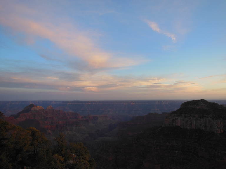
About an hour before sunset, I returned to Bright Angel Point for a last viewing of the canyon. Predictably, it did not disappoint, gleaming with hues of crimson made surreal by the evening haze. I lingered for nearly a half hour on a ledge overlooking this spectacle, the finale and culmination of my two weeks in red rock country. On to fresh woods and deserts new…