9/22 – 9/24/20
9-22
I headed back down the McCarthy road and followed a foggy highway to the Chugach Mountains. Still sore from two days of relentless elevation gain, I decided to settle for a short jaunt up the ridge overlooking Worthington Glacier.
The glacier appeared with a flourish, shimmering through a rent in the fog. On reaching the trailhead, I discovered that the trail was closed. But since there was nobody around to enforce this, I ducked under the caution tape and headed up. The trail was steep but short – in fact, several hundred yards shorter than it was supposed to be, since a landslide had carried away its upper end (whence the closure, I guess). I took my pictures, and wallowed back downslope.
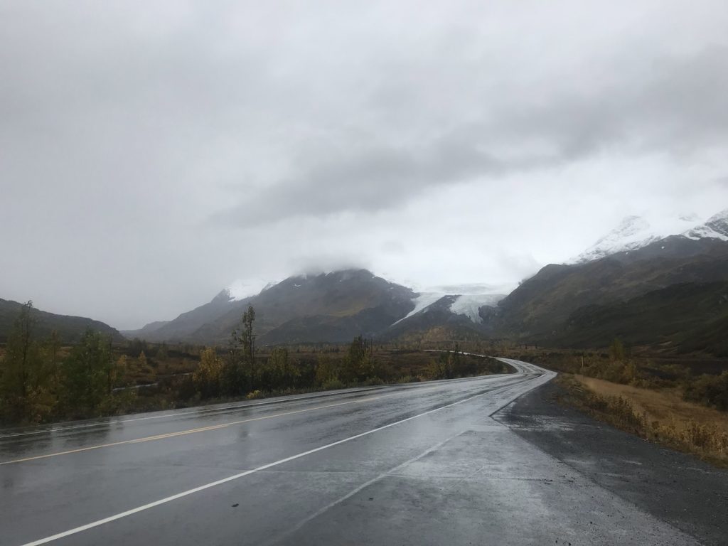
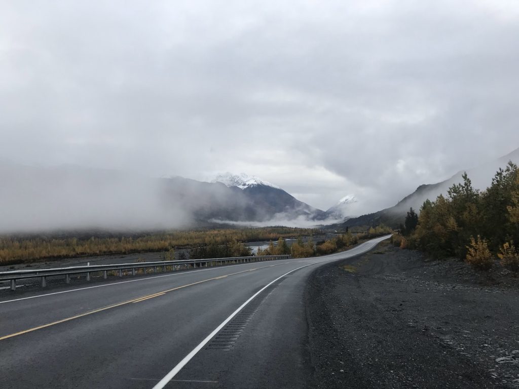
Driving between lines of fifteen-foot plow markers (this part of Alaska receives hundreds of inches of snow each winter), I twisted with the highway past bounding waterfalls and rain-slicked cliffs. A few miles from the road’s end, I followed a cratered gravel track to the site of Old Valdez, devastated by the Good Friday Earthquake of 1964. On the other side of the rain-shrouded bay, lights glowed in the terminal of the Trans-Alaska Pipeline. A tanker rode at anchor just offshore.
Valdez itself felt nearly as deserted. Both the campground in which I had planned to park and the restaurant at which I had hoped to gorge myself were closed for the season. Making the best of the circumstances, I went to a gas station and paid for the most refreshing shower I can remember. I restocked my canned goods at the local supermarket. Then, cleansed and provisioned, I strolled through the drizzle to Mike’s Palace Ristorante. Taking my ease in a booth (I was the only customer), I plowed through a plate of shrimp scampi, bowl of clam chowder, and basket of warm breadsticks. Through a window behind the deserted bar, rain darkened the Chugach Mountains. When I had finished my banquet, I drove back past the cliffs and waterfalls and snow poles, and pulled into a campground ringed by bleary peaks. Rain tapped all night on the Subaru’s roof.
9-23
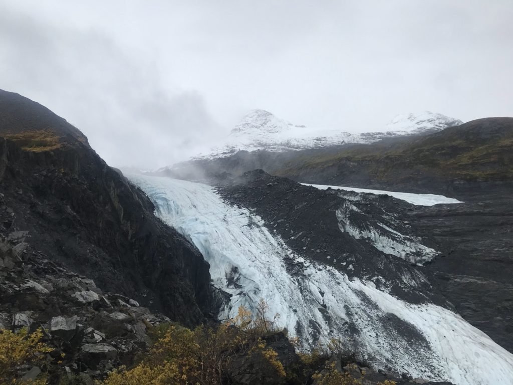
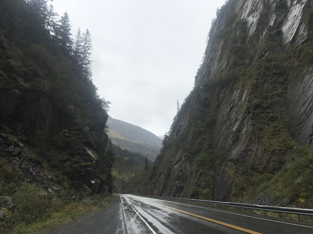
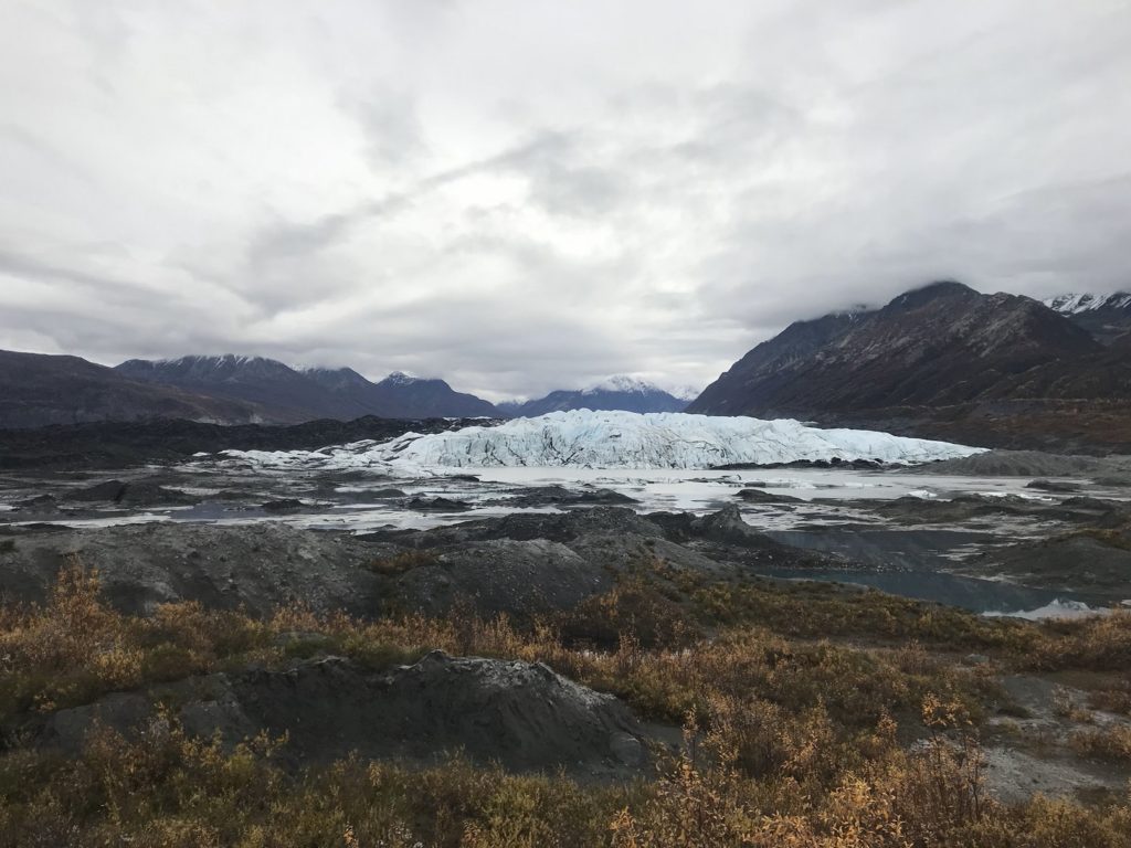
As I drove back north, stately fleets of clouds sailed up and down the peaks overlooking the highway. I was treated to a fleeting final view of the Wrangell Mountains, haloed by fog, before turning into the Chugach Range. The road plunged dramatically through the peaks – as every Alaskan highway seems to do sooner or later – and past the marbled flanks of a huge glacier. Stopping at a wayside with a view of the ice, I discovered that this particular glacier was (a) privately owned and (b) the centerpiece of something called Glacier Park. Naturally, I had to investigate.
The glacier, it turned out, was Matanuska Glacier, a 30-mile river of ice that can visited for the low, low price of $30. After forking over this ambitious fee and signing a waiver that exempted the owners if I managed to fall into a crevasse, I drove out to the glacier face. Like most Alaskan glaciers, Matanuska is retreating – a half-mile or so in the past fifty years. The newly-exposed land at its terminus is a wasteland of mudflats, punctuated here and there by meltwater pools and mounds created by huge blocks of buried ice.
Following the “trail” (a line of orange cones), I passed from mud to mud-covered ice to ice. Although the temperature was in the forties, the surface of the glacier was slick with meltwater, which could be heard trickling away through the hidden cracks and channels. I was fascinated to see that every rock and pebble had melted a tiny hole into the ice, and distractedly followed the valleys and deltas of the miniature streams that carried water down to the silty lake at the glacier’s foot.
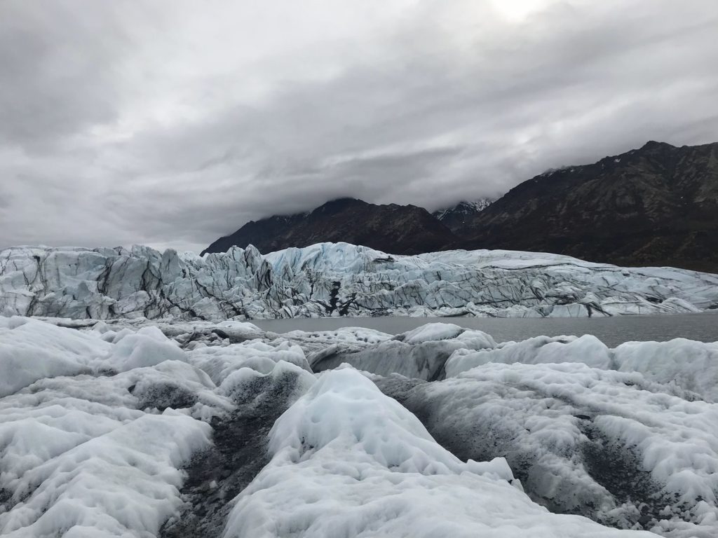
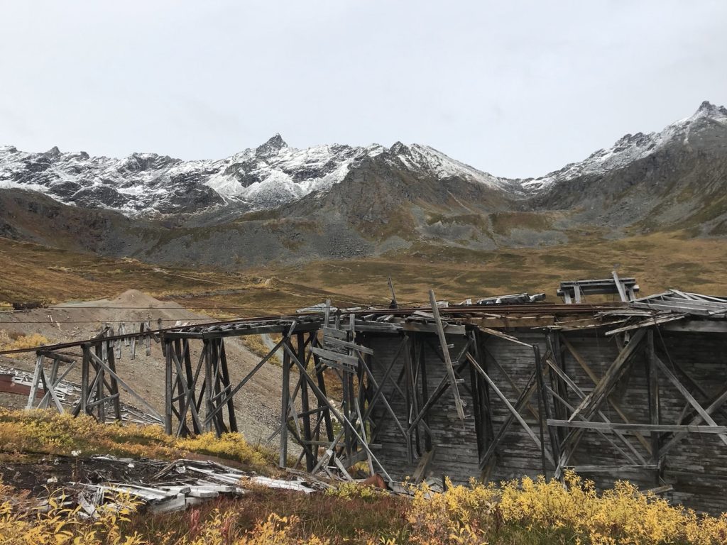
After the requisite photos of the dramatically fissured ice of the glacier’s face, I continued west. As I did, the landscape mimicked other corners of the country – forested valleys out of New England, wheat fields from the Midwest, the mountain streams of Colorado – before becoming Alaskan again in the snow-dusted Talkeetna Mountains. Here, because I can never resist broken buildings, I visited the remains of Independence Mine, a gold mine abandoned shortly after the Second World War. The site was a little too managed for my tastes (the main buildings had been restored), but I was able to take a few evocative pictures.
9-24
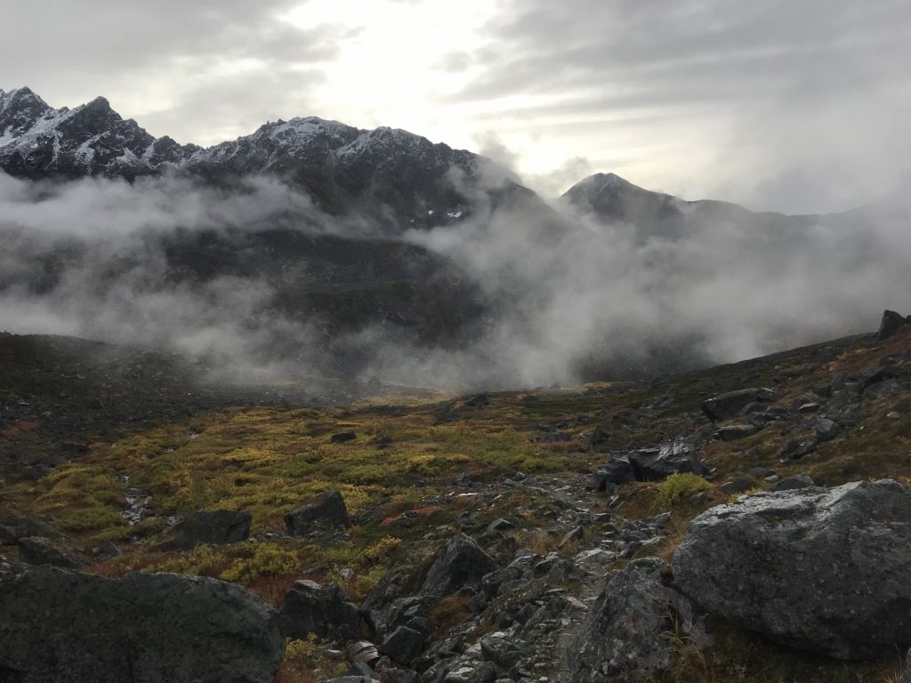
It rained today – but it was a gentle, manageable sort of rain, the sort that suits a crisp fall morning. I hiked up a gorgeous mountain valley in the heart of the Talkeetnas, drizzle pattering on my rain gear and pocking puddles in the trail. Glacial banks of fog swept over ridges and filled high valleys, sending down tongues that melted as they reached downslope.
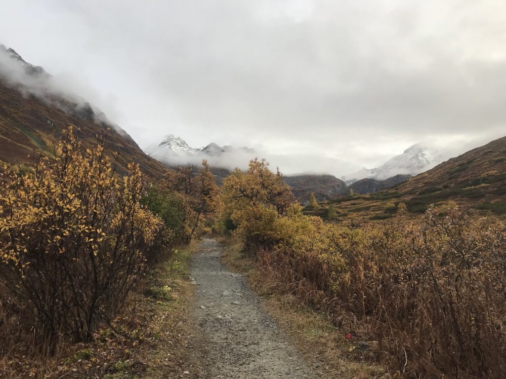
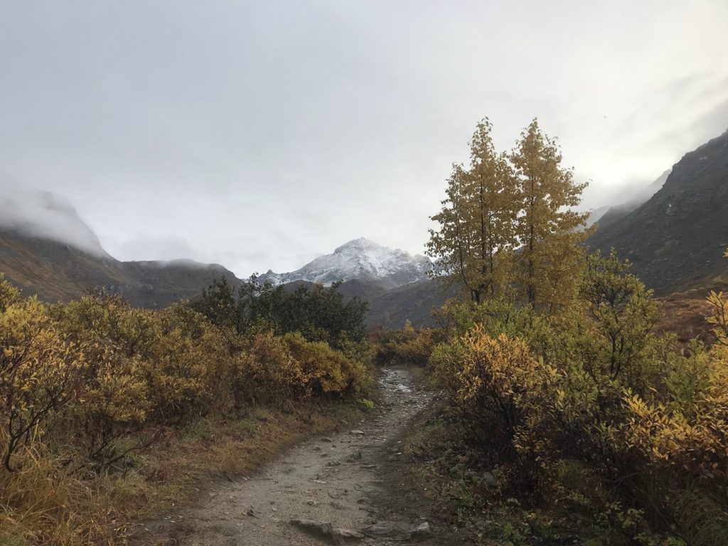
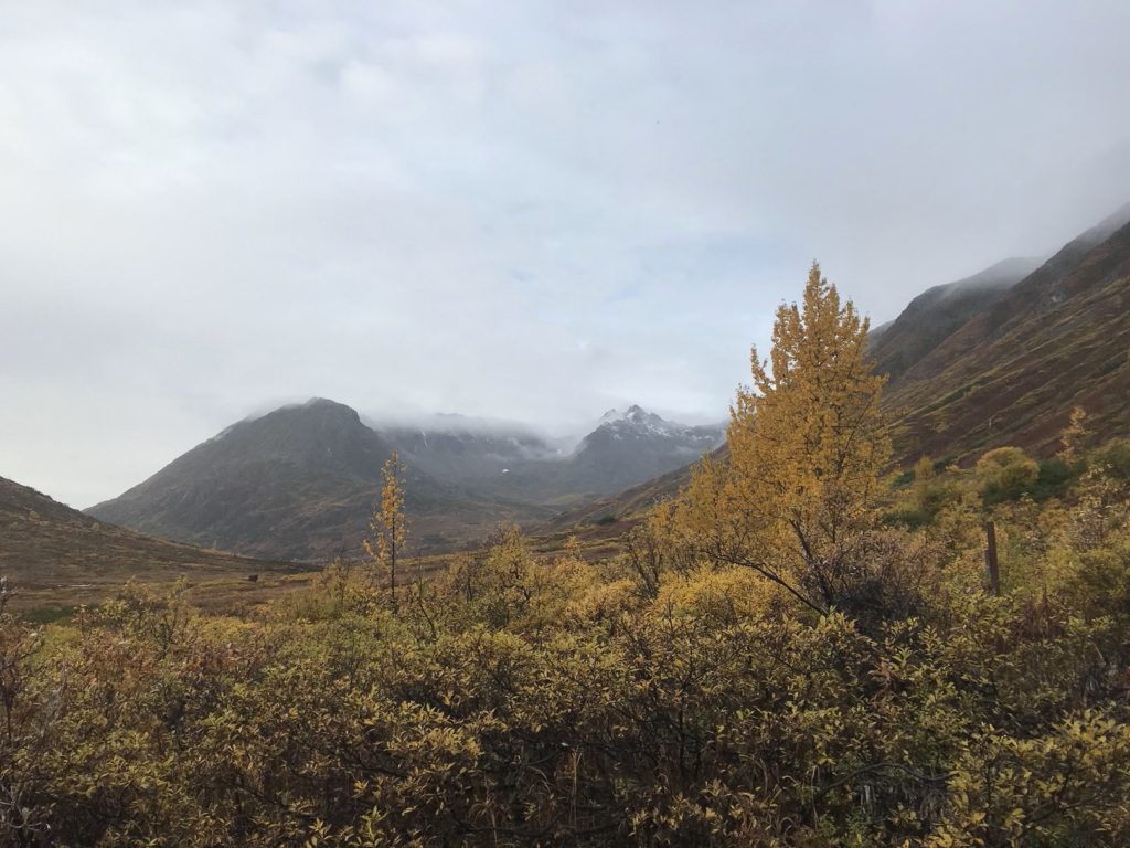
Into one of those valleys, brimming with pearly fog, the trail turned. The climb was steep and muddy; but at the top, I had a box seat to the clouds’ slow progress through the valley.
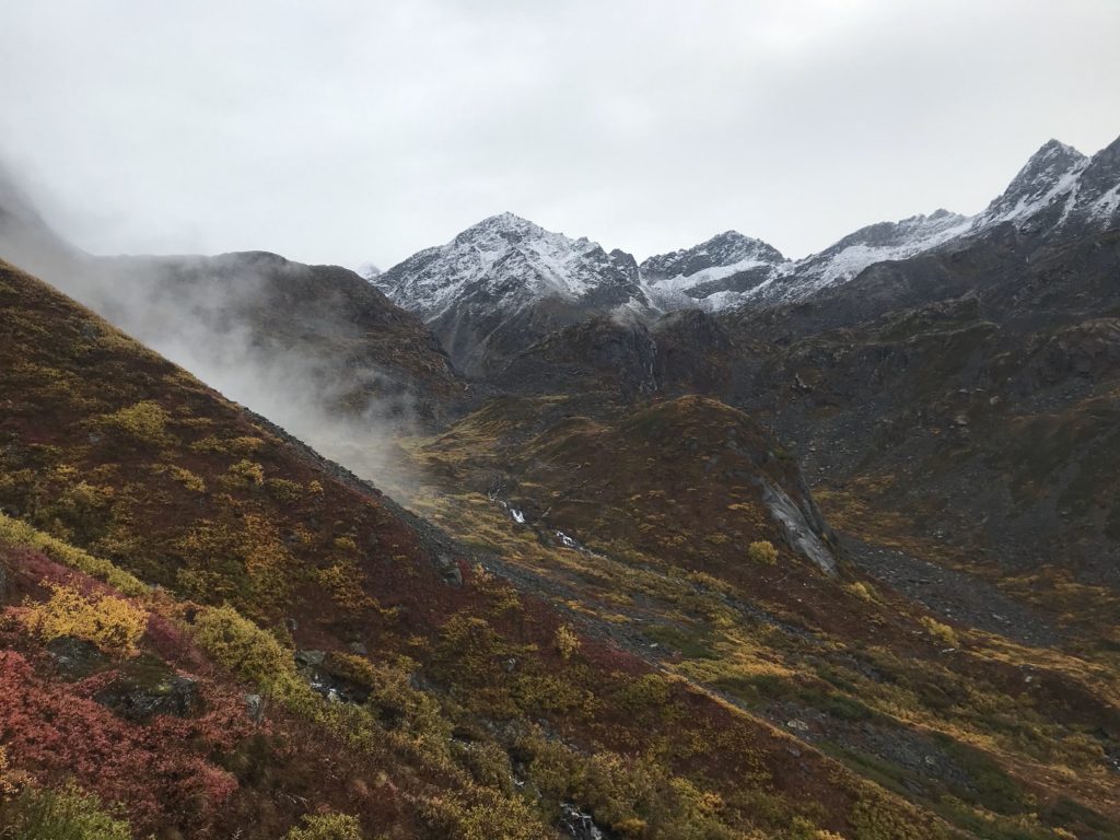
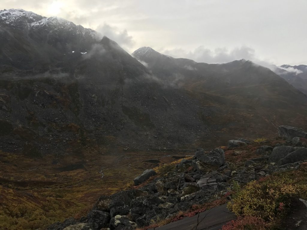
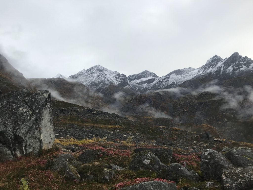
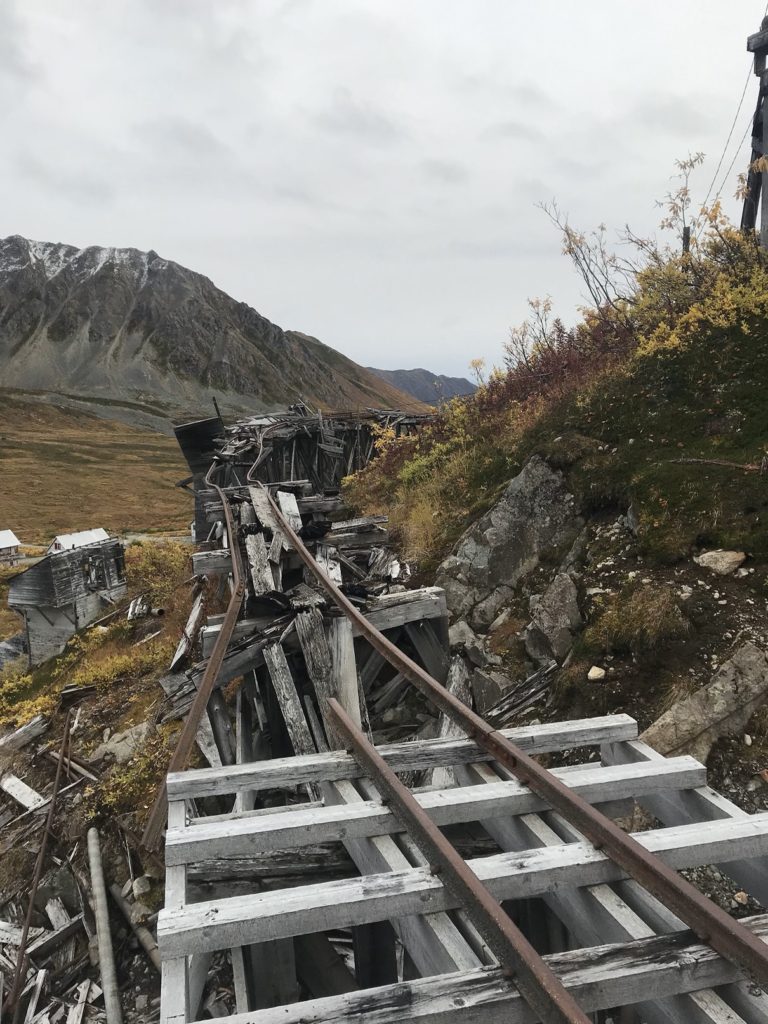
The high valley into which I had climbed, momentarily clear, housed long-abandoned Snowbird Mine. I was more interested, however, in what lay above and beyond the ruins: a dramatic mountain pass, and a secluded glacier. Reaching these landmarks involved a new challenge: four inches of fresh snow. The snow was beautiful, picking out every detail of the landscape. But it also hid the trail. Staggering and stumbling over buried rocks, guessing where the path was, I groped my way up to the head of the pass.
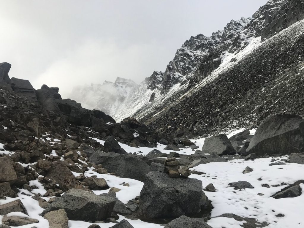
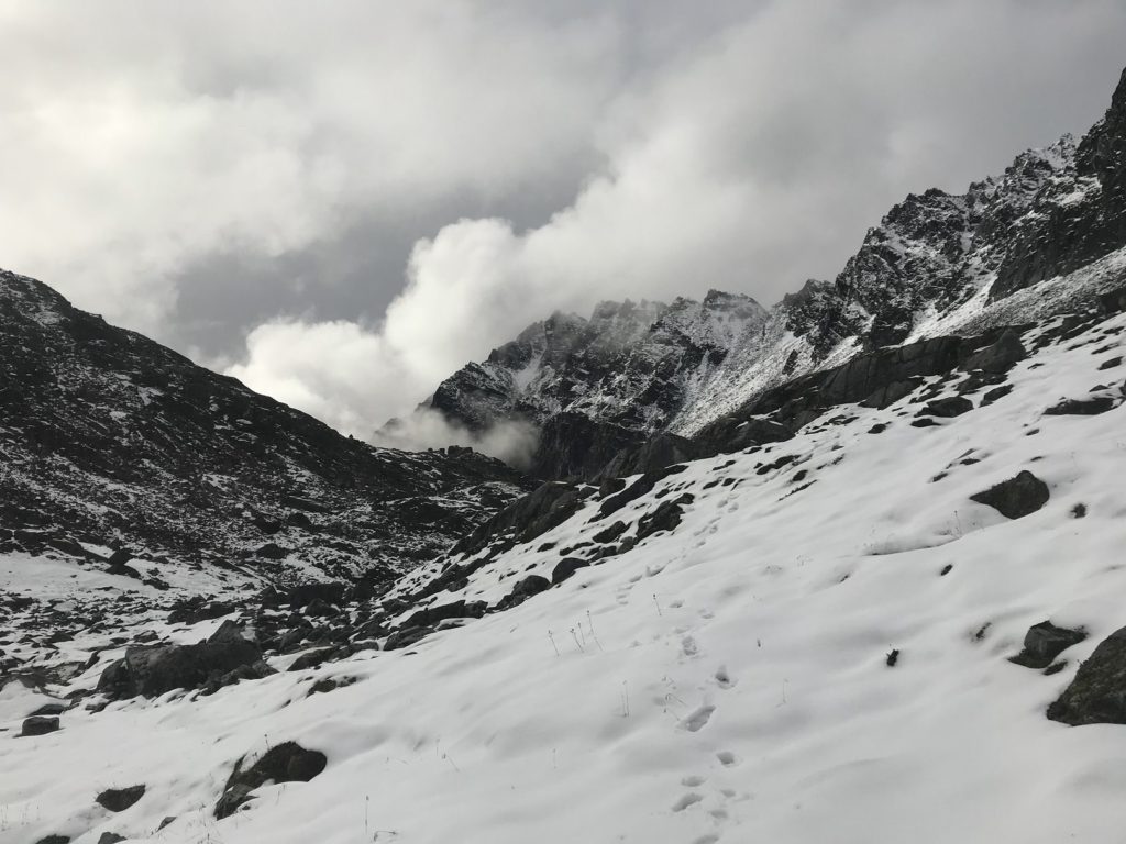
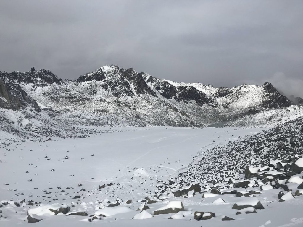
Sunlight greeted me on the far side. A break had opened in the clouds, making the snow shimmer. Below stretched Snowbird Glacier, a freshly-frozen lake at its foot. Brushing a boulder clean, I ate my lunch. Just as I was finishing, fresh clouds funneled through the pass, and a light snow began to fall.
The rainy hike back down was less enchanting.