9/19 – 9/21/20
9-19
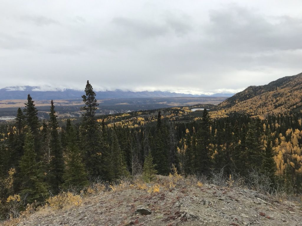
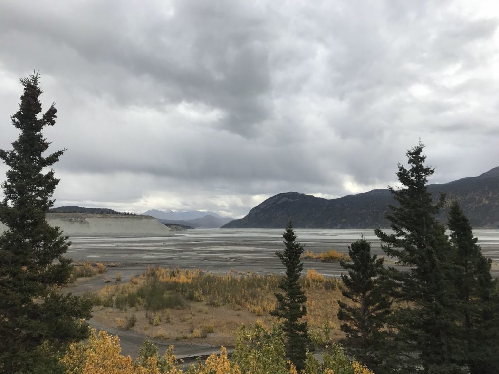
The Wrangell Mountains shone in the distance this morning, gauzily curtained by falling snow. Still shining, they hovered in the background as I rattled back down the Nabesna road, refilled my water bottles at the Park headquarters complex, and made my way to the turnout for the Liberty Falls trail, a pleasant little hike just outside the park. The views from the top of the trail were worth the stiff climb up. The Copper River coursed below, foaming over the debris of its summer floods. Beyond were endless woods, spruce spangled aspen gold. In the background, the mountains shone.
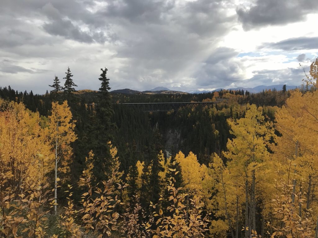
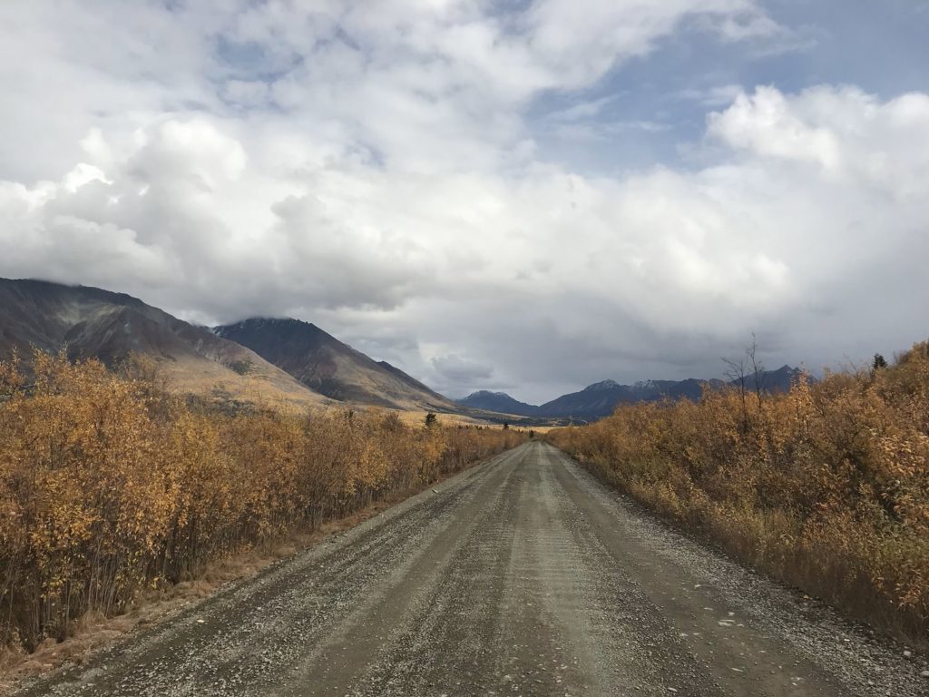
At the hamlet of Chitina, I started up the infamous McCarthy Road, the southern route into Wrangell-St. Elias National Park. The road owes its reputation to the rusty spikes that stud its gravel, a legacy of its origins as a railroad bed. In the first decade of the twentieth century, after fabulously wealthy copper deposits were discovered in a remote valley of the Wrangell Mountains, eastern investors pumped millions of dollars into the construction of the Copper River and Northwestern (“Can’t Run and Never Will”) Railroad, designed to carry ore from the new mines to a coastal harbor. The railroad, laid over glaciers and along the treacherous Copper River, was one of the great engineering feats of the early twentieth century. But once the ore was exhausted, it was abandoned. Although most of its bed was allowed to revert to wilderness, the sixty miles between Chitina and Kennecott – the site of the copper mines – was converted to a road. The road builders, however, did such a slapdash job that much of the railroad was left in place beneath a thin layer of gravel. Tires have suffered ever since.
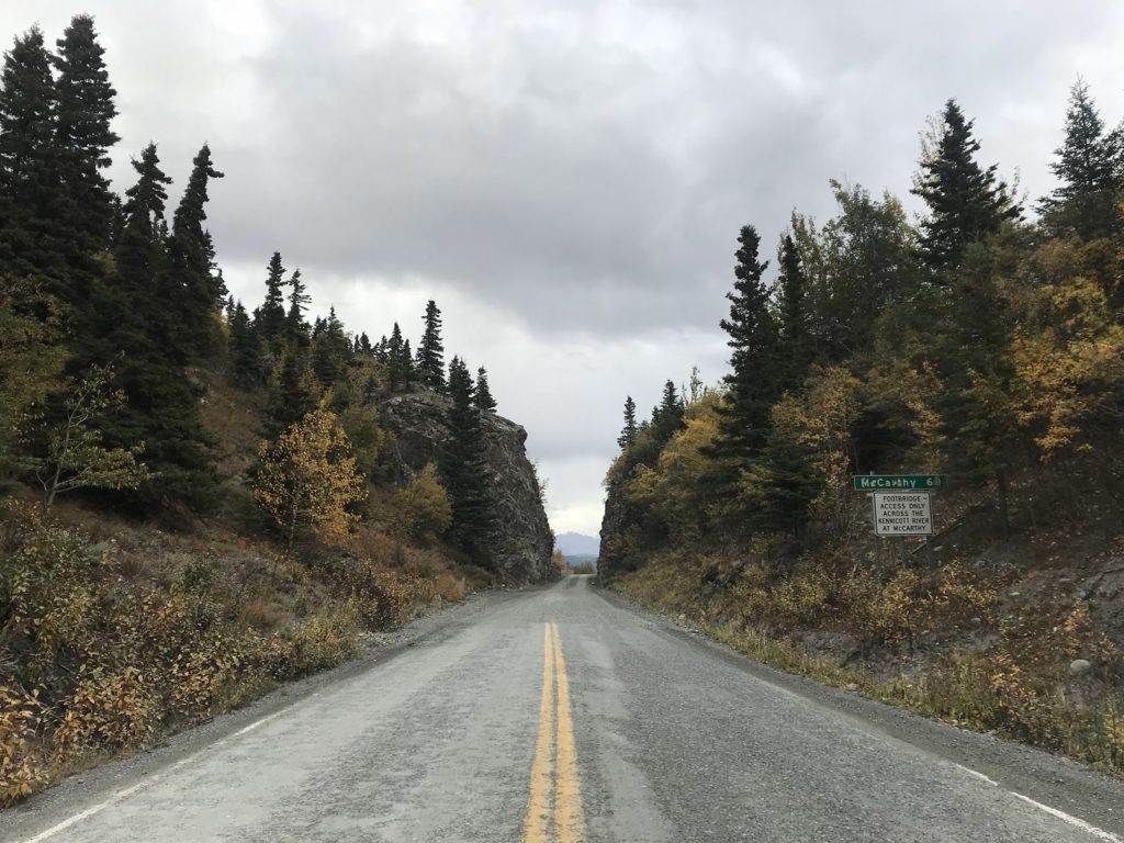
Anxious to avoid another flat, I drove in the middle of the road (there were no other cars), seldom breaking 30 mph. It took me well over two hours to reach the road’s end at McCarthy. Fortunately, there was plenty to distract me along the way: looming peaks, rushing rivers, the rickety trestles of the old railroad. The weather was fickle – sun, then rain, then sun again – and alternating bursts of light and drizzle swept the gilded woods and snow-seamed mountains.
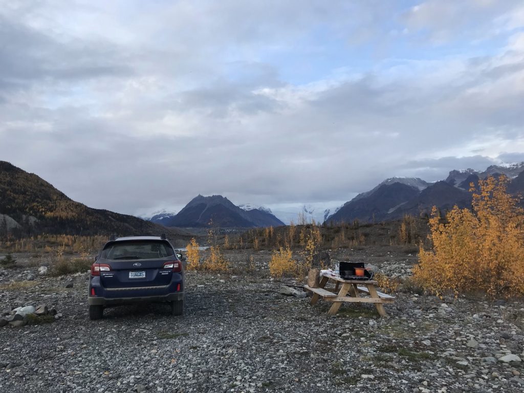
Parking in the gravel lot that serves as the town’s off-season campground, I walked into McCarthy. In summer, McCarthy – originally a cluster of bars and brothels catering to the copper miners of neighboring Kennecott – is a bustling little tourist center. In late September, I discovered, the town is virtually empty. I had hoped to rent a mountain bike for the next few days. But after asking a quarter of McCarthy’s population (seven people), I discovered that none were available. Dispirited, I returned to my campsite, which was swept by the cold wind pouring from a massive glacier just to the east.
9-20
The McCarthy Road ends a half-mile from the town of McCarthy. The abandoned mill town of Kennecott, trailhead for all local hikes, is four and a half miles past McCarthy. In summer, a shuttle van runs the five miles from the end of the McCarthy Road to Kennecott. In last September…it doesn’t. I caught the final van of the season this morning (the driver told me that he was still in town only because his cabin’s water line had frozen, and he was trying to fix it before leaving for the winter).
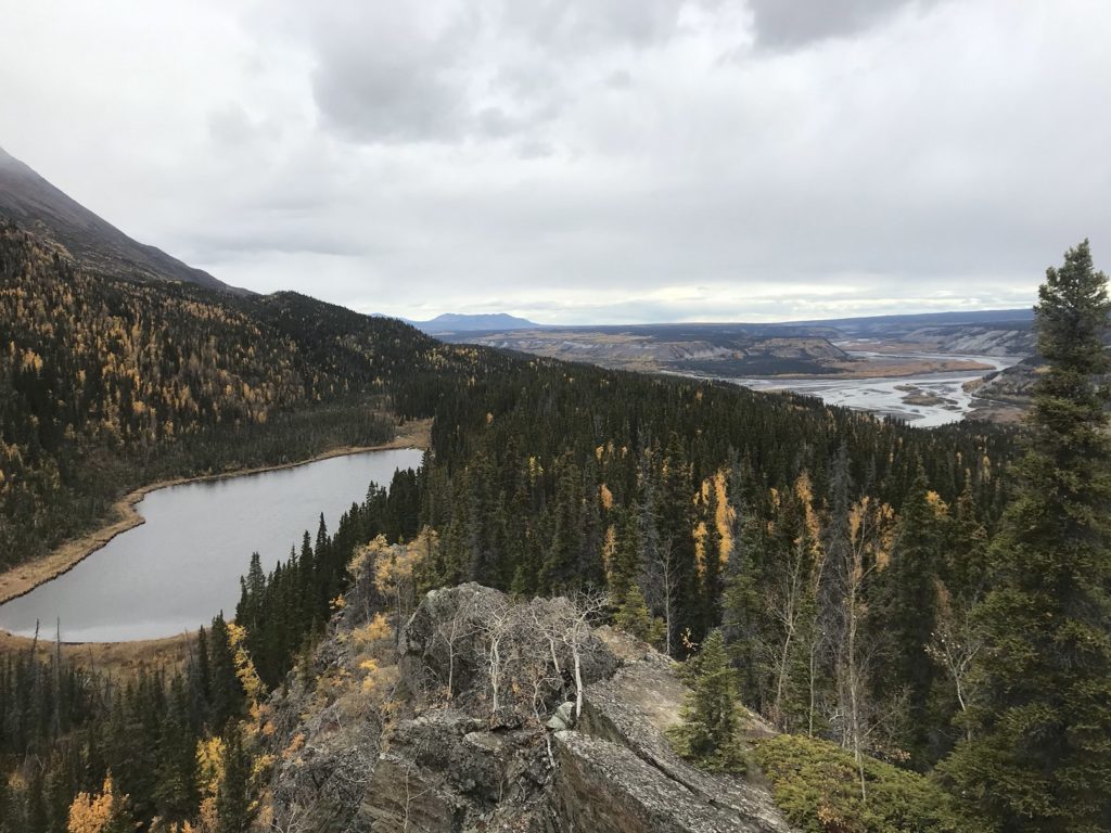
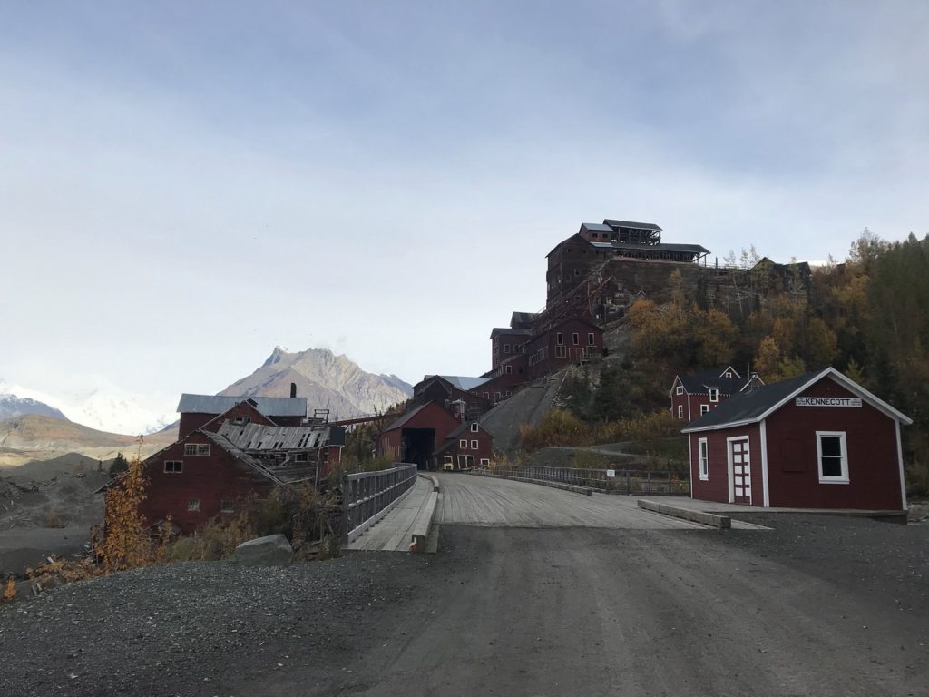
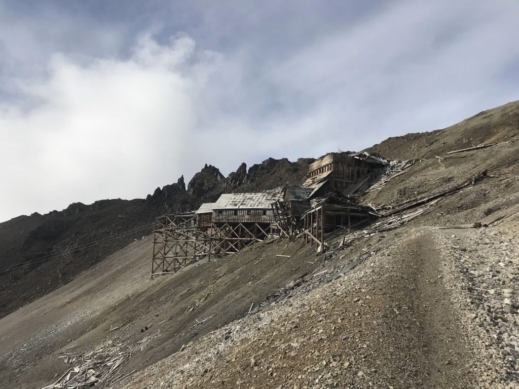
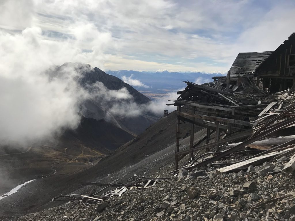
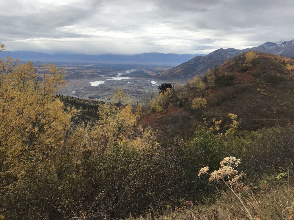
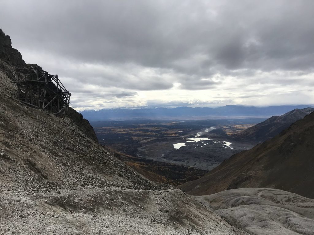
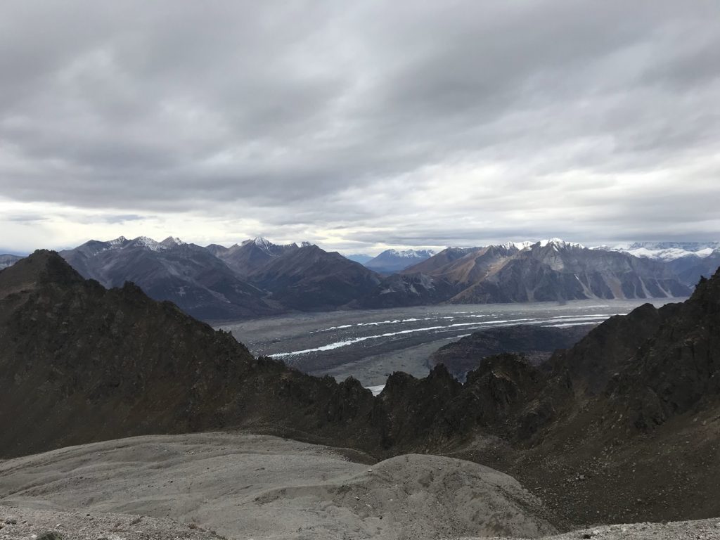
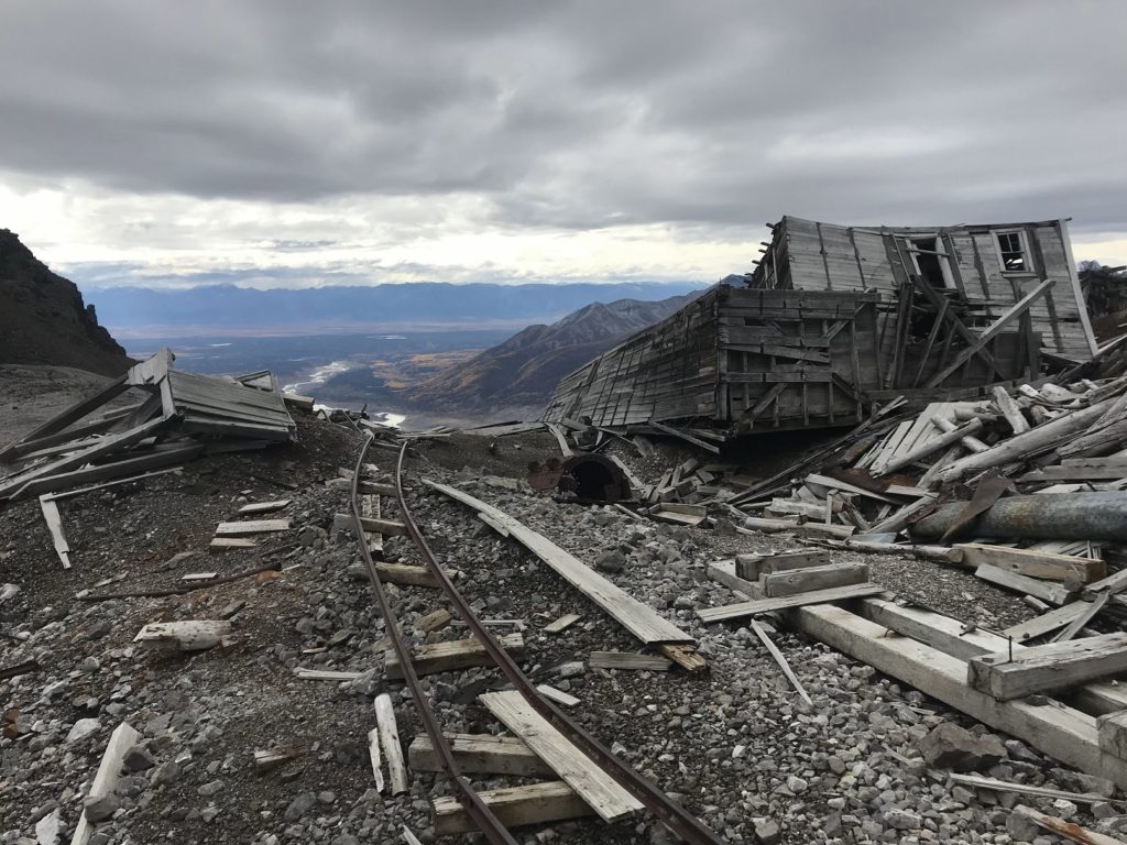
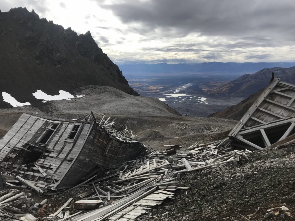
The shuttle dropped me and a few visitors from Anchorage at Kennecott. As mentioned earlier, Kennecott was the center of the colossal copper mining operation served by the CR&NW railroad. Between 1911 and 1938, hundreds of millions of dollars of copper ore were carried on trams from the mountaintop mines to the concentration mill in Kennecott, where the ore was refined and readied for shipment to the lower forty-eight. Although its gears and engines stopped more than 80 years ago, the concentration mill still stands, an astonishing 14-story matchbook pile. Kennecott’s other buildings range in condition from pristine to ruinous. The dramatic setting contributes to the rather surreal effect. Just below the town is the rubble-covered ice of Kennecott Glacier. Above are the skeletal remains of the tramways, snaking up barren slopes to mines among the mountain peaks.
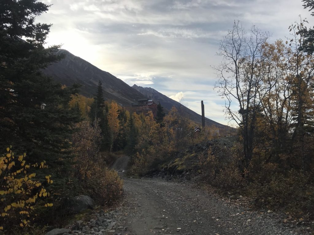
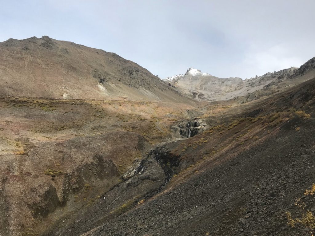
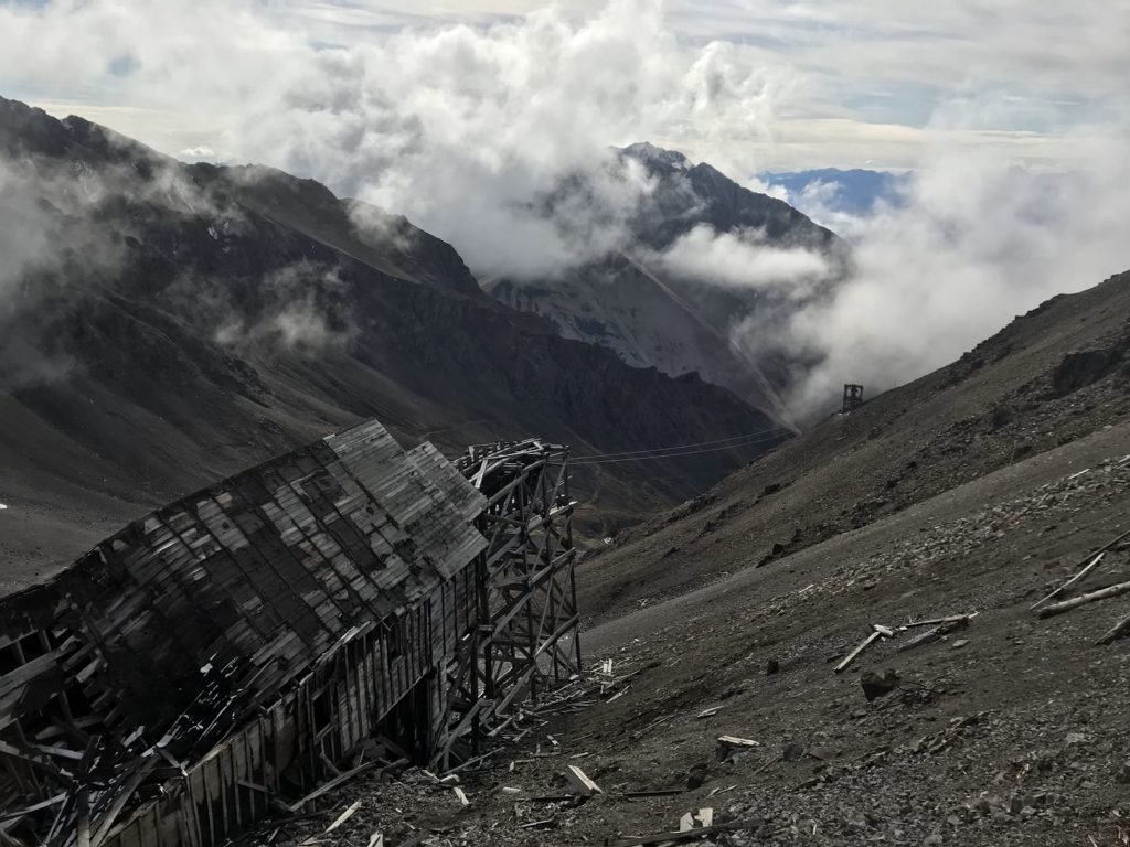
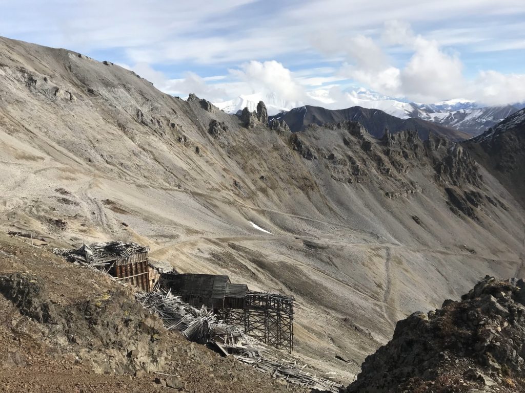
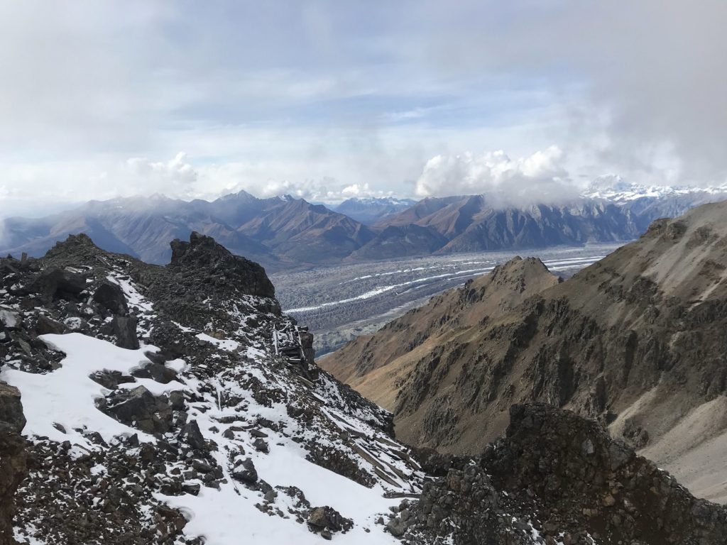
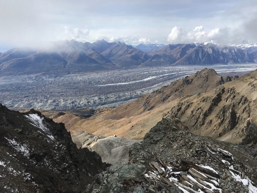
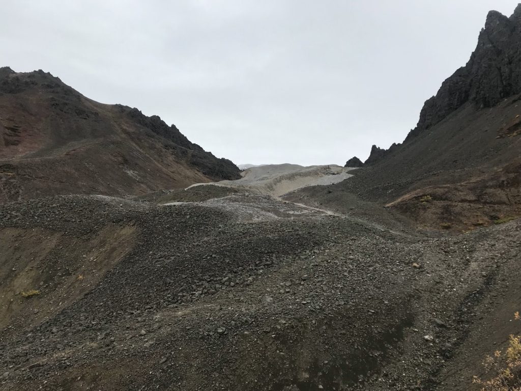
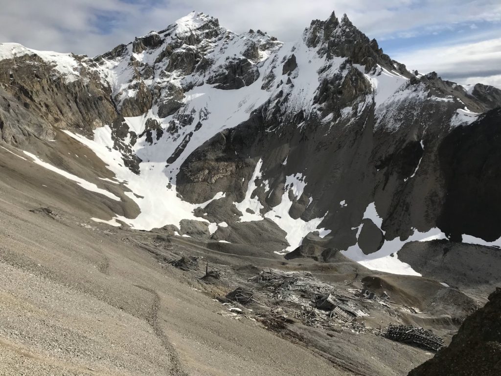
Four mines, linked by some 70 miles of tunnels, fed the concentration mill. Two mines can still be visited, and I was determined to see both. My first target was Bonanza Mine, five miles north of, and 3,500 feet above, Kennecott. The initial four miles were an uninspiring climb, enlivened only by increasingly expansive views of the glacier below. But the final mile was magical. The first sign that I was getting close to the mine was a rickety wooden tram tower. Beyond it was a steep valley bisected by a rushing stream. At the head of the valley, where clouds brushed the jagged mountain rim, I could just make out the ruins of the mine.
At first, the trail paralleled the stream, climbing steeply and steadily past shattered engines and splintered timbers. Once the trail left the brook, I was struck by how quiet it was. For the first time in days, there was no wind. The only sounds were the tapping of my hiking sticks, the rattle of distant rockslides – and, of course, my own panting. Up and up the trail climbed, following the old mine road. Here and there among the snow-streaked rubble, I began to notice rocks flecked with the emerald and cobalt of malachite copper ore.
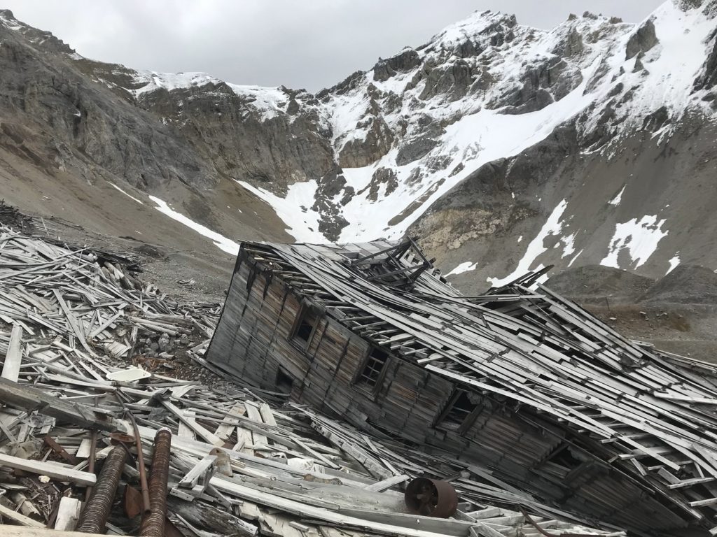
Bonanza Mine originally boasted a bunkhouse, a tramway station, and a half-dozen outbuildings. With the partial exception of the bunkhouse, all are now in a state of collapse. (So are most of the tunnels that led down into the copper deposits, though I managed to find one that was still open, its walls coated in ice.) Boots rasping over debris, I climbed to a rocky slope overlooking the bunkhouse, and spent a contented lunch watching wisps of cloud stream up the valley and over the ruins.
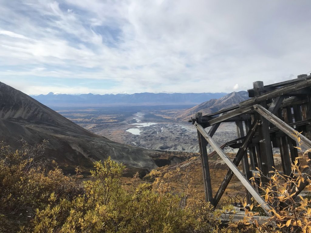
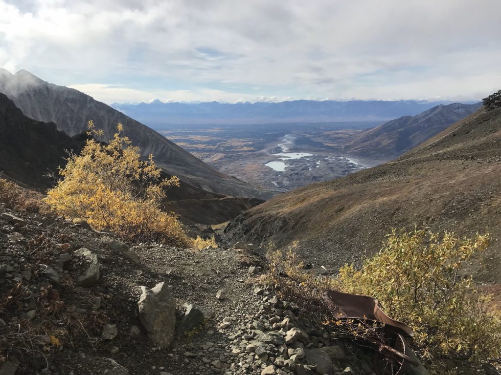
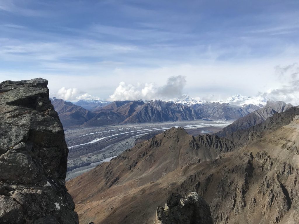
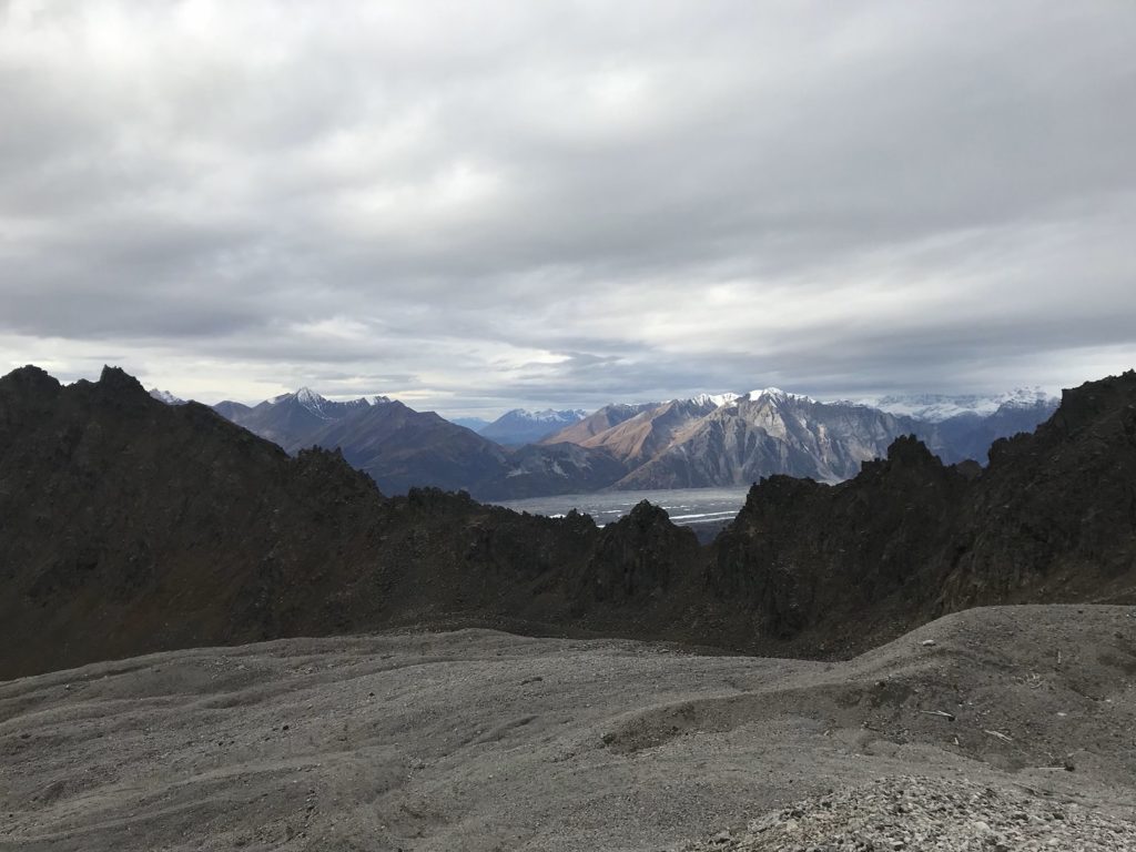
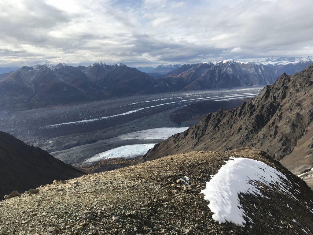
When I had finished my sandwich, I hiked up to the mountain crest overlooking the ruins. The views from the top were astonishing. On one side of the ridge, beyond the valley rim, ranks of snowy peaks marched to the horizon. On the other side, a deep ravine, dusted with fresh snow, descended to the majesty of Kennecott Glacier.
I must have stood on that ridge for a half-hour, watching clouds sweep over and through the valleys. The solitude, the absolute stillness, the parade of clouds – all combined to create one of those rare moments of genuine awe.
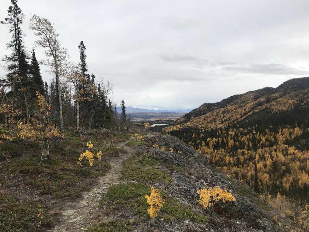
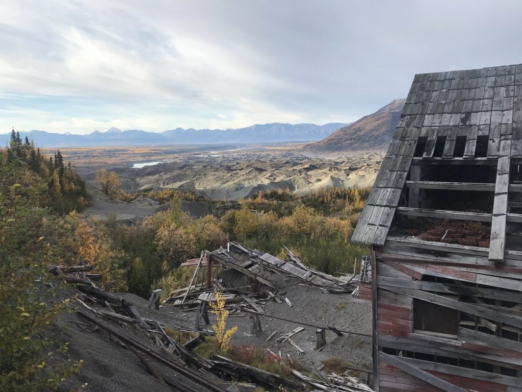
But at last, I had to come back down the sunny and debris-strewn valley. As I did, I decided – inspired by my ridgetop reverie – to take a closer look at Kennecott Glacier before heading back to camp. So, ignoring sore feet and a sinking sun, I turned onto the trail that parallels the glacier’s side.
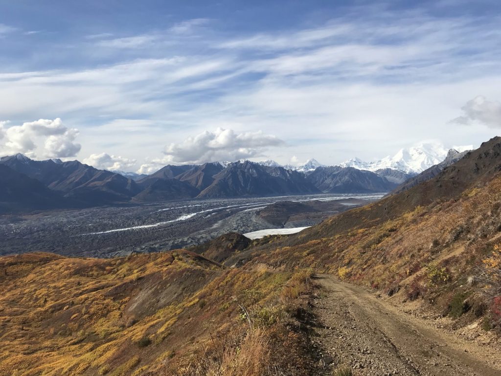
For the first mile or so, the surface of the glacier, darkened by colossal drifts of rubble, looked like a range of barren hills. Farther up the valley, gleaming Root Glacier merged with its stony cousin, creating a millennial traffic jam of boulder heaps and icy ridges.
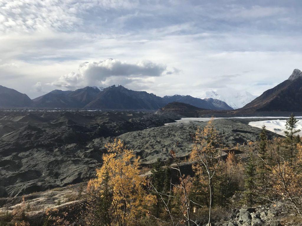
I walked to the glacier’s edge and listened to the slow music of creaks and groans, counterpointed by the tinkling of meltwater. Then, satisfied, I turned back toward Kennecott. The few other visitors had left hours before, and there were no cars in sight. So I walked the five miles back to camp. Clouds hazed the sun, and a chilly breeze rattled the aspens. It was cold, and I was very tired. But I couldn’t have asked for a better day of hiking.
9-21
As I started the long walk back to Kennecott this morning, I had the (partial) good luck to hitch a two-mile ride with the owner of a local lodge. As we drove, I asked what the winter population of McCarthy was. “According to the last census, 28.” He paused, then added, “But they missed some people.”
After walking the last three miles and taking a closer look at the buildings of Kennecott, I followed a muddy path along the opposite side of the ridge I had climbed the previous day. This time, my goal was Jumbo Mine, another of the four that fed copper ore to the great concentration mill. Jumbo Mine is even more remote than Bonanza, and the condition of the trail reflected this. The first few miles were almost swallowed by undergrowth. Besides the general inconvenience of bushwhacking, I found myself becoming anxious about animal encounters – particularly after noticing rich deposits of moose and bear scat on the trail. So I sang and shouted and generally made a fool of myself until the path climbed at last into open tundra.
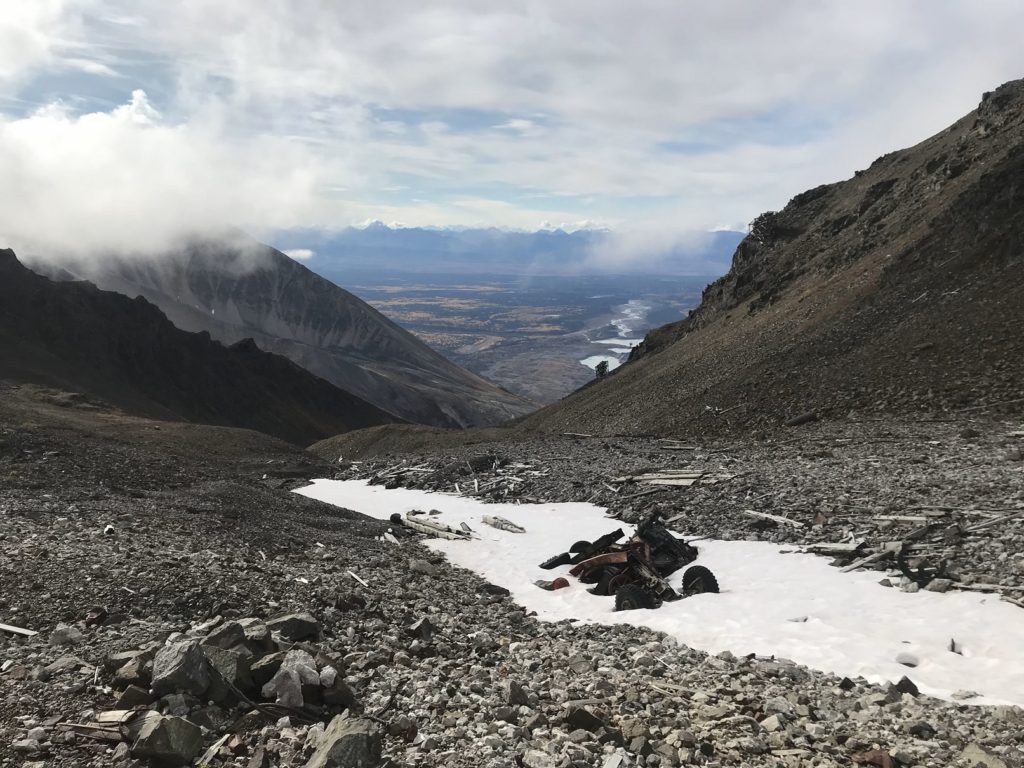
The irritations of clinging scrub were then replaced by the agonies of loose rock. The last two miles of the trail climbed a relentless series of scree slopes, where every step sent rocks skittering downhill. Thanks to the unstable terrain and lingering fatigue, I was soon exhausted. The last half-mile, which featured a climb of about 1,500 feet, nearly did me in. Taking quick breaks every hundred paces, I willed myself uphill, following the rusty cables of the ore tramway.
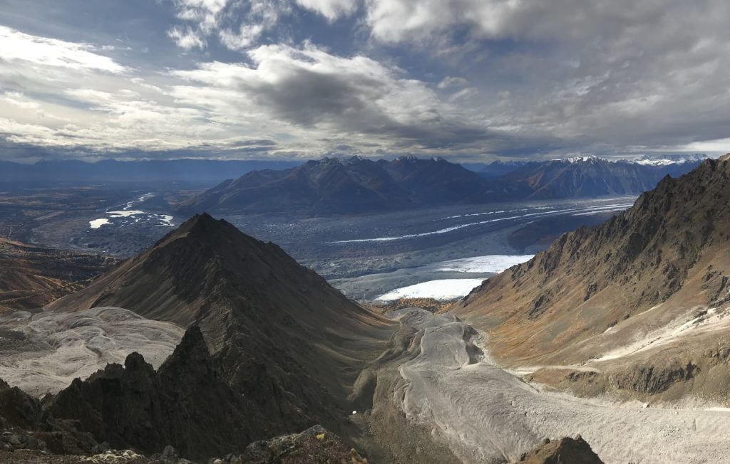
As I climbed, an awesome panorama of glacier and peak opened behind me.
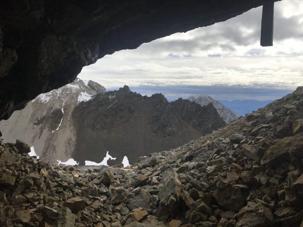
The view ahead, however, consisted of endless sliding rock, with the skeleton of the final tram stark against the clouds on top. When I began to see streaks of green and cobalt in the rock, I knew I was finally getting close. At last, staggering past the struts of the tower, I found myself in the snow-dusted valley that held the remains of Jumbo Mine.
Eighty winters had pounded most of the mine buildings into heaps of splintered wood. Here and there, a yawing wall protruded from the rubble. The rails of a narrow-gauge railway dipped and wove through the ruins, corkscrewing into nothingness over vanished bridges.
Making a bench from a mine timber and two rocks, I ate lunch among the wreckage. Then I climbed a few hundred feet up a steep scree slope to the crest of the snowy ridge behind the ruins. Along the way, I passed an open mine shaft, its walls shimmering with veins of malachite.
The view from the ridgetop was awesome: a world of ice and rock, offset by the brilliance of new snow.
When it was time to go, I surfed down the first scree slope, fell, brushed myself off, and began the calf-wrenching descent back to the trailhead. Six miles later, footsore but content, I reemerged in Kennecott. About two miles into the walk back to McCarthy, I heard a vehicle approaching and stuck out my thumb. The car – an old Subaru with a cracked windshield – came to a screeching halt. A large dog regarded me from the passenger seat. The driver shooed the dog into the backseat and invited me in. As we started down the road, the dog (an overgrown six month-old puppy named Chica) began to lick the back of my head. At length, for reasons best known to herself, she decided to climb over the seat and into my lap. She only managed to get about halfway across before getting stuck, rear legs kicking ineffectually, with her chest and front paws draped over my body. Never a dull moment on this trip…