5/17 – 5/19/21
5-17
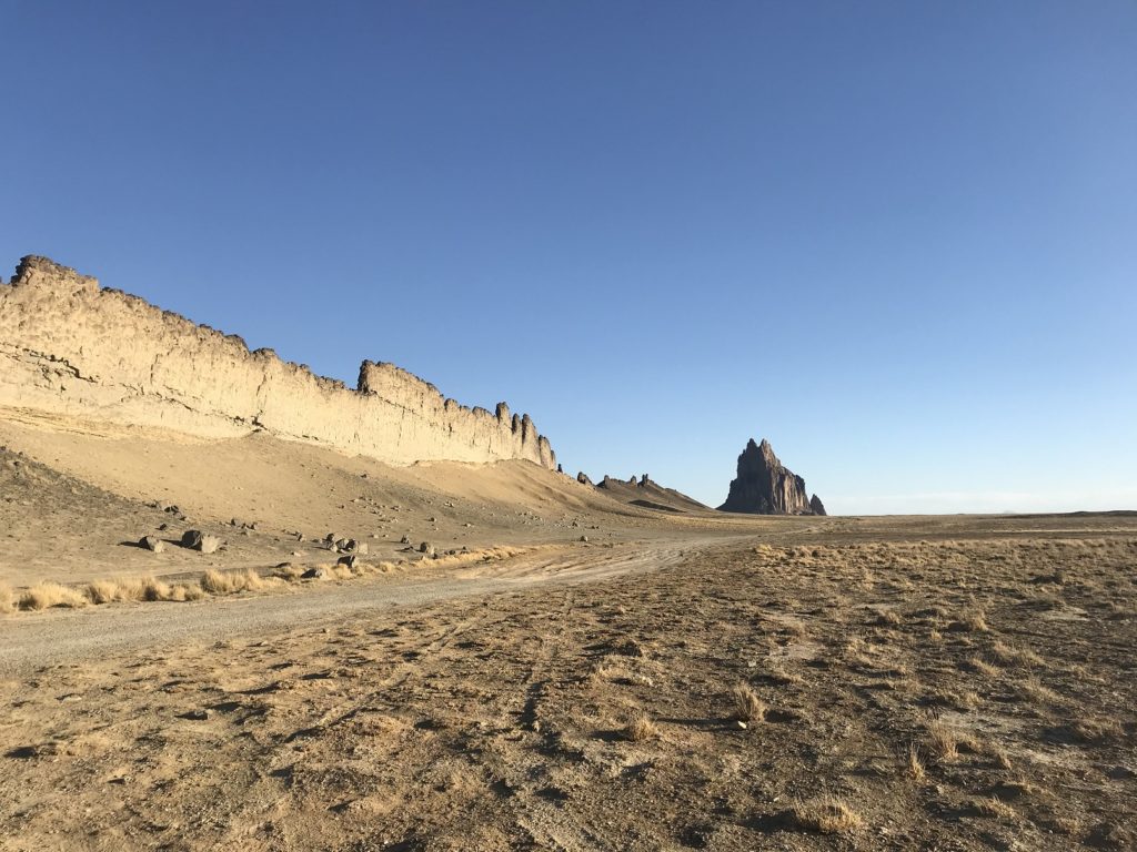
I left last night’s campsite at dawn, pausing only to watch the sun rise over the New Mexico badlands. Detouring across the massive Navajo Reservation, I stopped for a few pictures near the base of the Shiprock, a cathedral-like spire of volcanic rock.
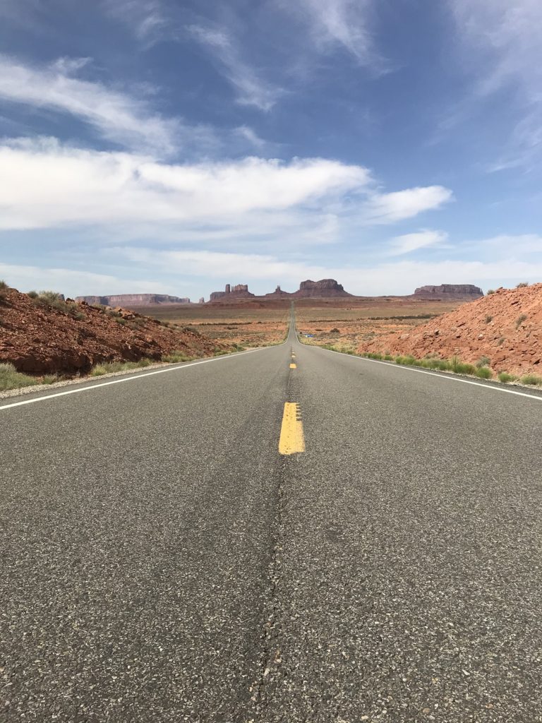
The next stop was Monument Valley. Although I had visited before, familiarity had not bred contempt. I re-took my old pictures at a series of scenic turn-outs. And on the hill leading south into the valley – that long stretch of road featured in so many movies – I got out and took the iconic shot.
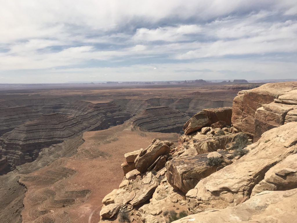
Finally, as I had promised myself I would, I turned down the long sandy road to Muley’s Point, the best viewpoint in the southwest. It was just as I remembered it – a narrow peninsula of stone, poised above a riot of canyons and mesas. I ate lunch on a bench-shaped ledge, enveloped by the view.
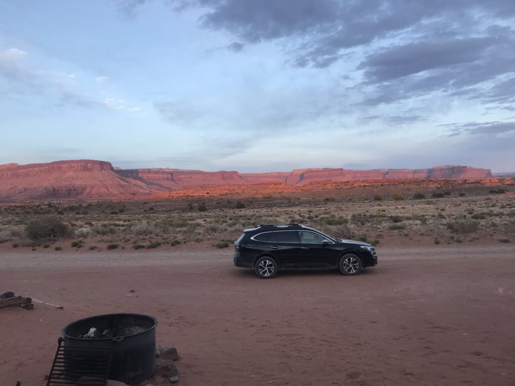
At the end of a long drive, I discovered that the only campground in the Needles District of Canyonlands National Park was full. Backtracking twelve miles, I found a site at a BLM campground called Hamburger Rock (after a hunk of sandstone that looks, at least if you’ve been out on the trails all day, a little like a gigantic hamburger) before racing back to the park for a few short hikes.
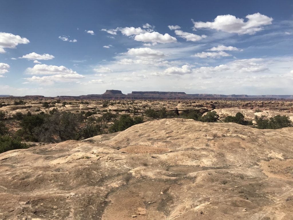
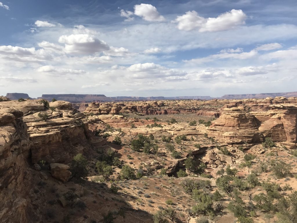
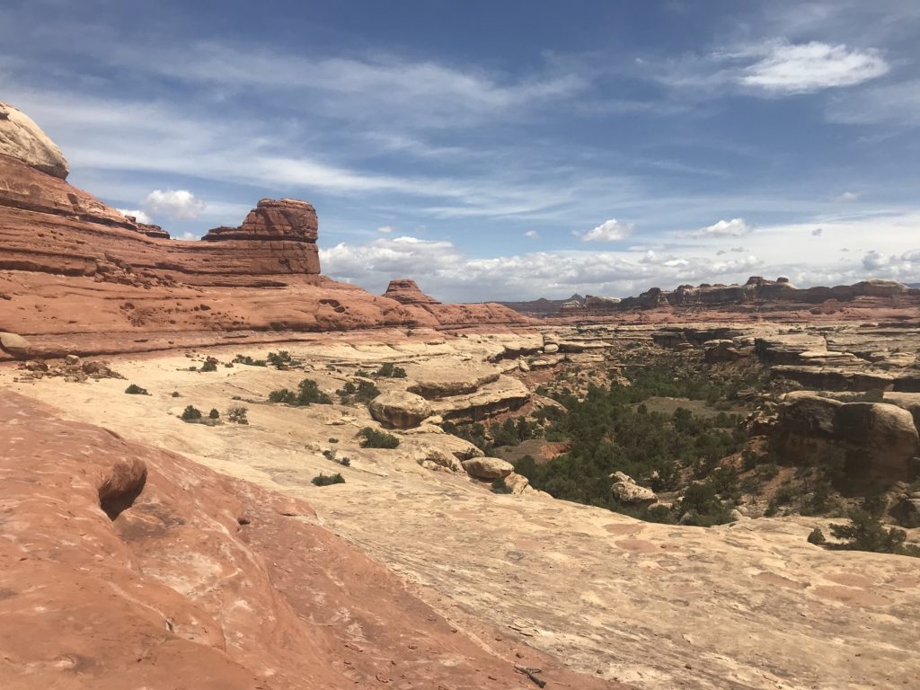
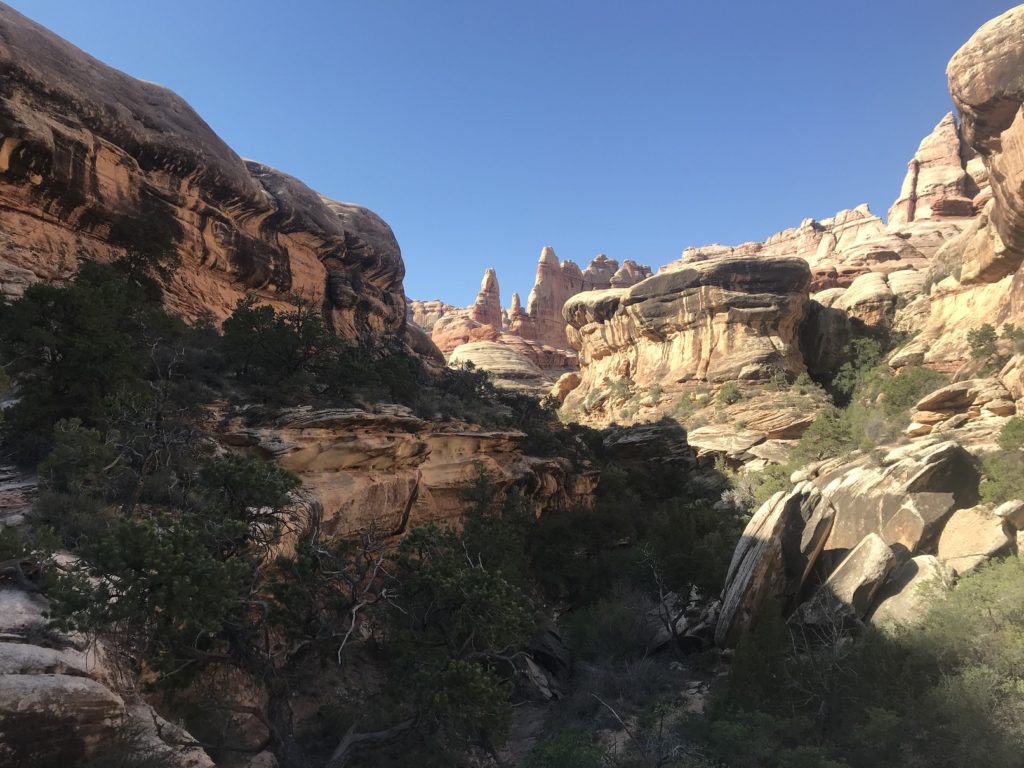
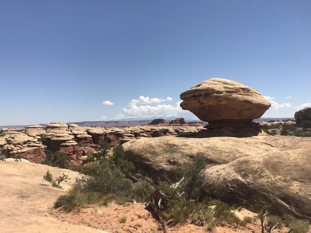
Canyonlands, as the name suggests, has a lot of canyons. But the most interesting features of the park are the sandstone formations around those canyons, which populate an otherworldly landscape unlike anything else on the Colorado Plateau.
Back at Hamburger Rock, I made dinner (soup and ramen tonight – very swanky), brought out my computer, and began to write this entry on a bench. As the sun set, the whole line of cliffs that peers down on my campsite began to glow. I stopped typing and watched, unable to look away, until the glow faded and the moon began to shine overhead.
5-18
There are perks to being the day’s first hiker: an open trail, that magical early morning light, a vague feeling of accomplishment. But there are also pitfalls. Particularly during long hikes, I tend to go into autopilot – walking and walking while my mind drifts far from my feet. Normally, this is not a problem, since most trails in national parks are more or less impossible to lose entirely. Most, but not all.
This morning, probably because my mind was elsewhere, I walked right past an important marker, and up what I thought was the trail. It wasn’t. It looked convincing enough – blazed straight and clear through the desert. But as I crawled down steep ledges and up an endless rockslide, I gradually realized that the trail had been created by desert bighorn sheep, not people. It took me a half-hour to get back to the real trail. When I found the turn I had missed, I cursed myself thoroughly, kicked a few rocks off the nearest cliff, and set out at a trot.
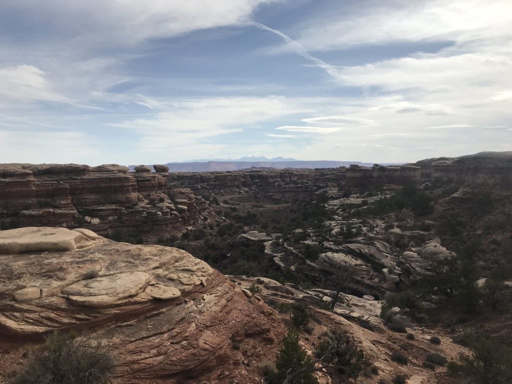
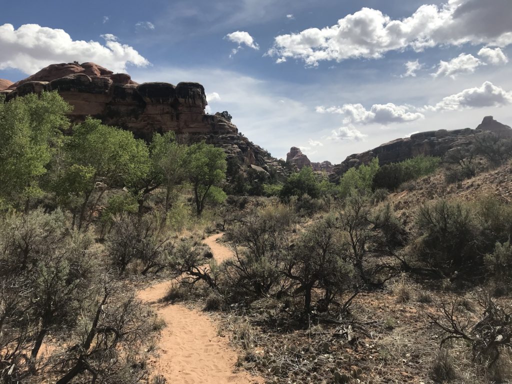
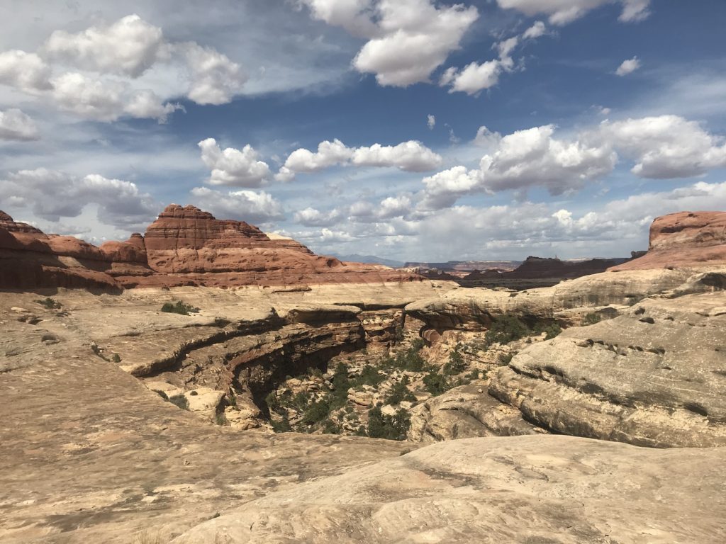
I had decided to cram two long hikes into the day. The first one – now starting an hour later than planned – was a little over 10 miles long. It wove in and out of canyons and between pinnacles, rising occasionally to high points with views of the distant mountains.
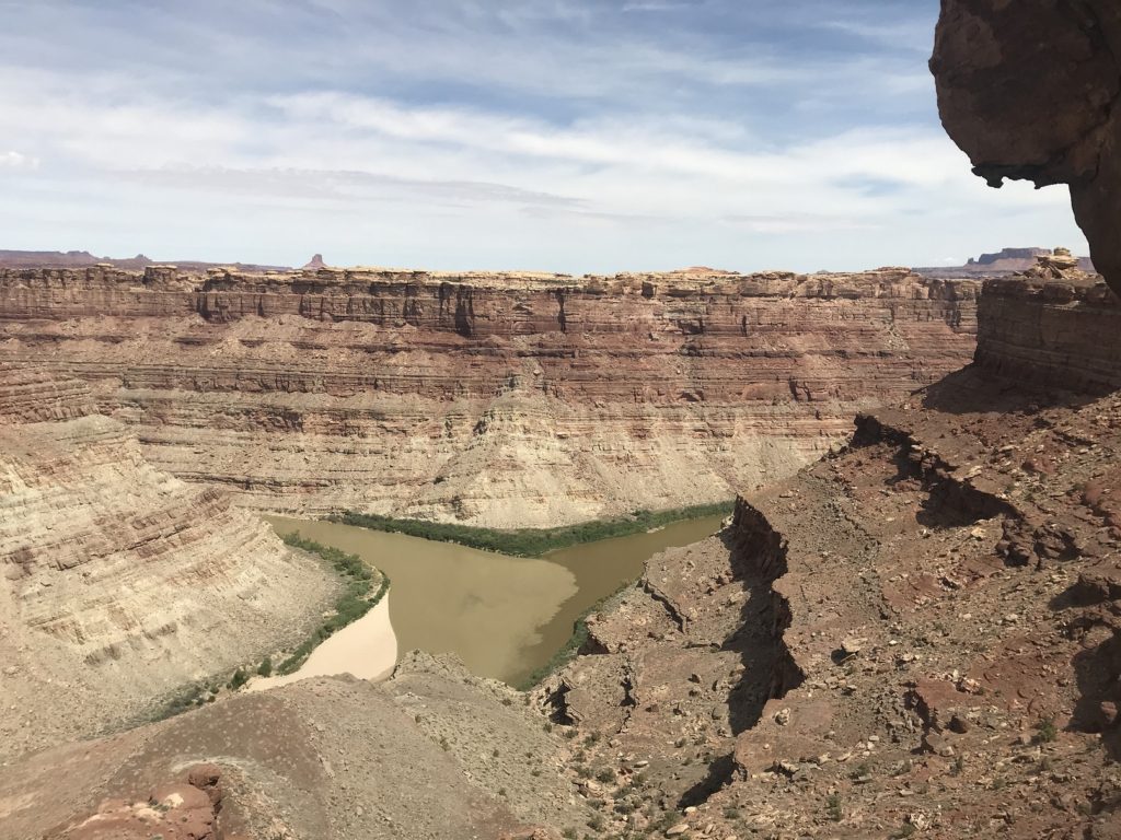
The highlight was the overlook at trail’s end, poised a thousand feet above the confluence of the Green and Colorado Rivers. I ate my lunch in the shadow of boulder at the cliff’s edge, wondering idly how my inflatable kayak would handle the Colorado River.
At the end of the long and unshaded return hike, I staggered back to my car, guzzled a liter of water, and drove to the trailhead for the Lost Canyon Loop. The trail was long – almost ten miles – and hard, with scrambling required in several places. But it almost immediately became one of my favorite hikes. The scenery was magnificent – walls and towers of glowing stone, receding toward the mountains.
The floor of Lost Canyon, watered by springs, was shaded by dense groves of cottonwoods. The shade was welcome. The knee-wrenching sand beneath it was not.
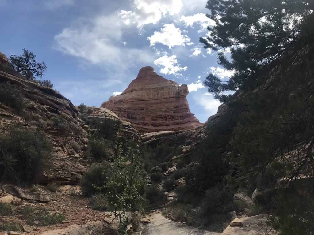
Near its end, the trail dropped into a narrow canyon dominated by a castle-shaped butte. The view from the head of the canyon was jaw-dropping, taking in a seemingly endless panorama of sandstone formations. Far to the east, the peaks of the La Sal Mountains gleamed in the afternoon light.
5-19
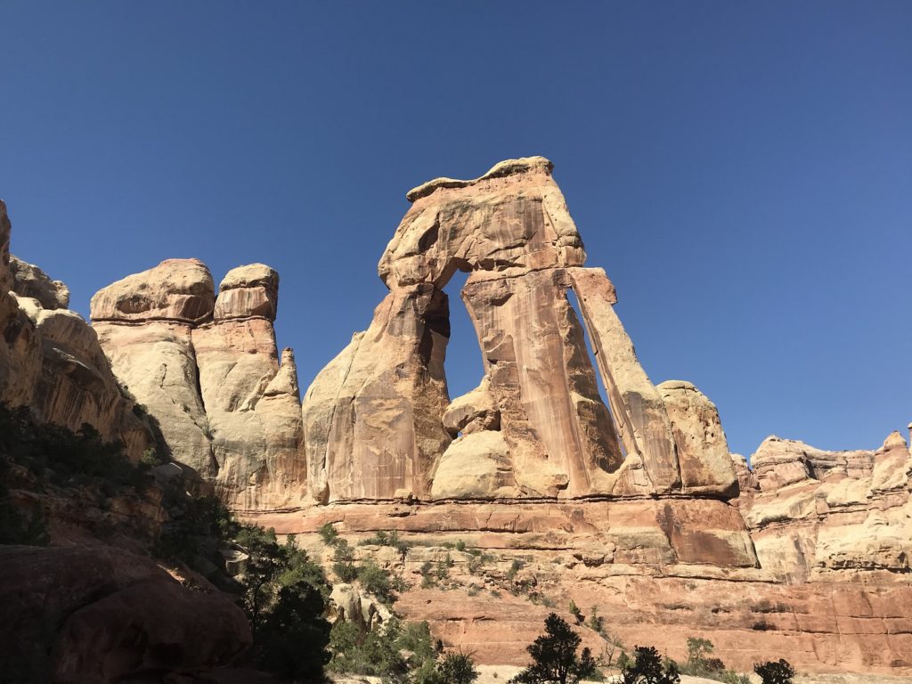
Since I had only a half day, and since my legs were still aching from yesterday, I had planned only a single hike: an 11-mile jaunt to a sandstone formation known as Druid Arch. The canyon floors down which the trail ran were shady and cool, and filled with the sharp aroma of creosote.
A long scramble brought me up to Druid Arch itself, a towering monolith well over 100 feet tall. I took my pictures, admired the view of the canyon below, and started back down the trail.
By the trailhead, I paused for a last look at the La Sal Mountains hovering over that red wilderness. Then I returned to my car, and left the park.
After stopping in Blading for the ice cream I had been fantasizing about for two days, I followed a lonely road through sagebrush-covered desert to Hovenweep National Monument. Like Mesa Verde (not far to the southeast), the park protects ruins built by Ancestral Puebloans. I had planned to do a short hike; but since my left knee had other ideas, I had to be content with a short hobble to the nearest overlook.