5/22 – 5/23/21
5-22
Just as dawn began to glimmer on the mountains, I pulled my frost-speckled car out of the campground and onto the interstate. For nearly fifty miles, the highway bucked and rolled and dove between the peaks of the Front Range before falling, steeply and suddenly, into the Denver suburbs. Then, seemingly all at once, I was back on the Great Plains.
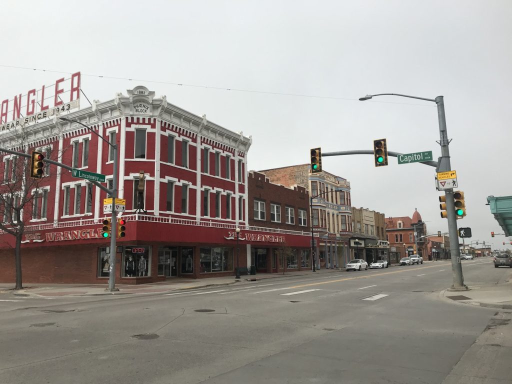
The weather was cold and foggy as I rolled into southeastern Wyoming. On an impulse, I stopped to explore downtown Cheyenne. Although I can’t imagine that the pace of life is ever especially hectic there, it was dead quiet when I arrived. A few blocks from the state capitol, while stopped at a red light, I watched a jackrabbit lope lazily across the street. I half-expected a tumbleweed to follow.
Onward, then, onto the foggy prairie. I followed a series of indistinguishable two-lane highways, each with line of telephone poles on one side, each receding forever into rolling gray-green hills. Here and there, sandstone pinnacles erupted from grass.
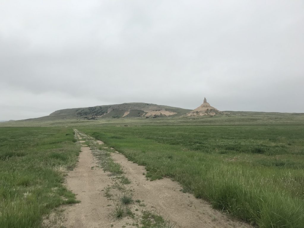
One of those pinnacles was my next destination. As a child of the 90’s, I squandered many an afternoon playing the old Oregon Trail PC game, and couldn’t resist an opportunity to see Chimney Rock. I wouldn’t call it majestic – the rock has weathered over the past century and a half, and is now marooned in a cow pasture – but it was certainly memorable.
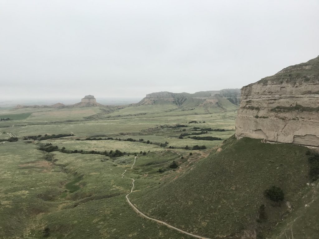
A short drive brought me to Scottsbluff, metropolis of the Nebraska Panhandle. After lunch at local institution Taco Town (“we’re tac-o the town”), I headed a few miles west to Scotts Bluff proper – the crumbling mesa, eight hundred feet tall, for which the city is named. Tired of sitting in my car, I decided to hike up the bluff. Though the weather was still cold and drizzly, it was refreshing to walk, crickets singing in the grass, as the prairie spread endlessly beneath my feet.
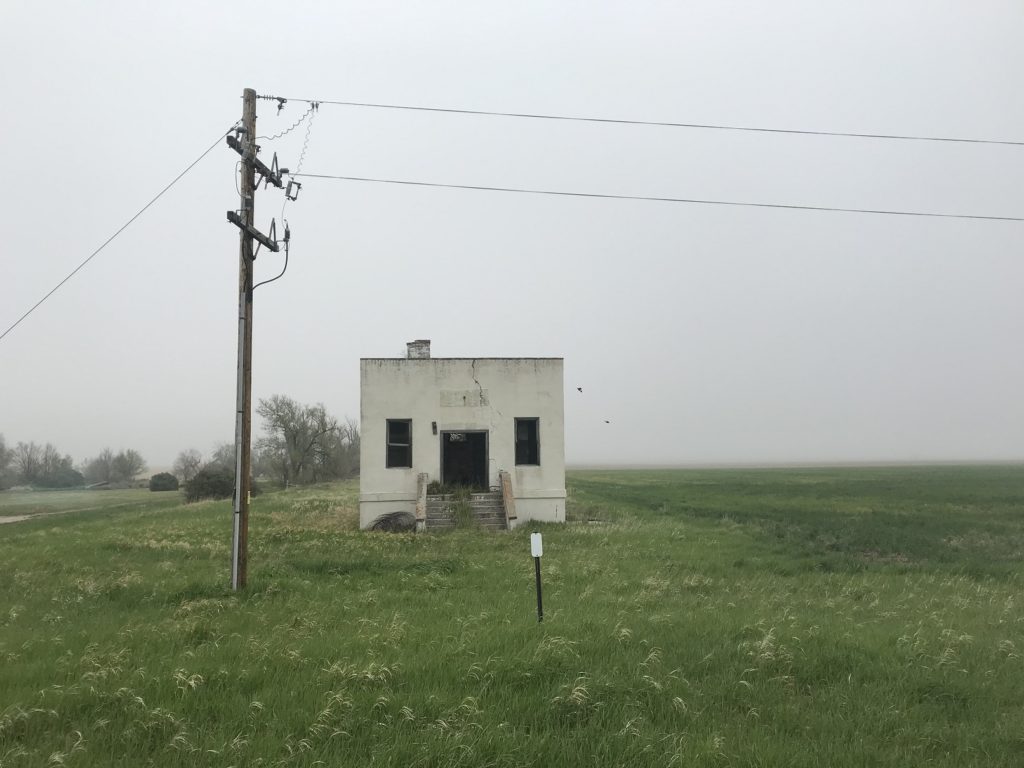
After my hike, I headed north through the empty heart of the Nebraskan Panhandle. Half the buildings along the highway seemed to be abandoned and crumbling.
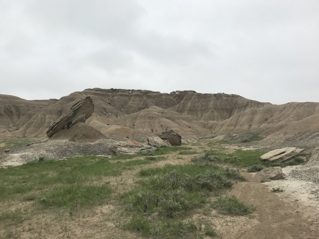
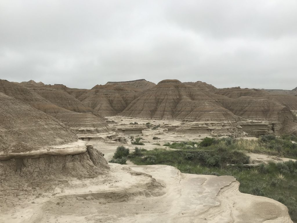
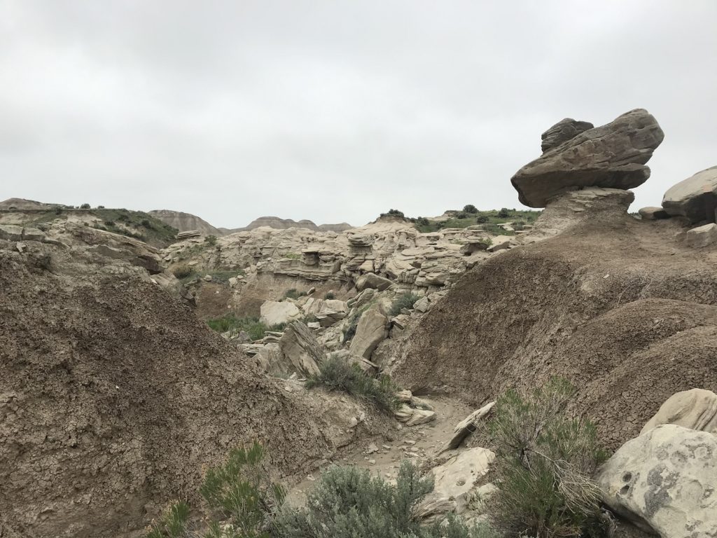
Everybody knows about the badlands of South Dakota. Connoisseurs may be familiar with badlands of North Dakota’s Theodore Roosevelt National Park. But how many have visited Toadstool Geologic Park – the other, other badlands of the Great Plains? I don’t know, but now I am now in that number. The park, in the extreme northwest corner of Nebraska, stands at the end of a rutted 12-mile dirt road. Emerging into the wind and drizzle, I found myself in a wildly eroded landscape reminiscent of the South Dakota badlands fifty miles or so away. I shuffled around a mile-long interpretive loop. Then, my pictures taken, I walked gingerly back to my car.
 5-23
5-23
Having spent the night at the cheapest motel in Chadron, Nebraska, I hit the road at dawn. For something like 600 miles – all across Nebraska and well into Iowa – I followed US-20, one of the old pre-Interstate cross-country highways. The first 150 miles or so were picturesque, with streamers of fog clinging to rolling hills on either side of the road. The towns among those hills were tiny – many had populations of 100 or fewer – and almost invariably dying, their grain elevators collapsing and front streets shuttered.
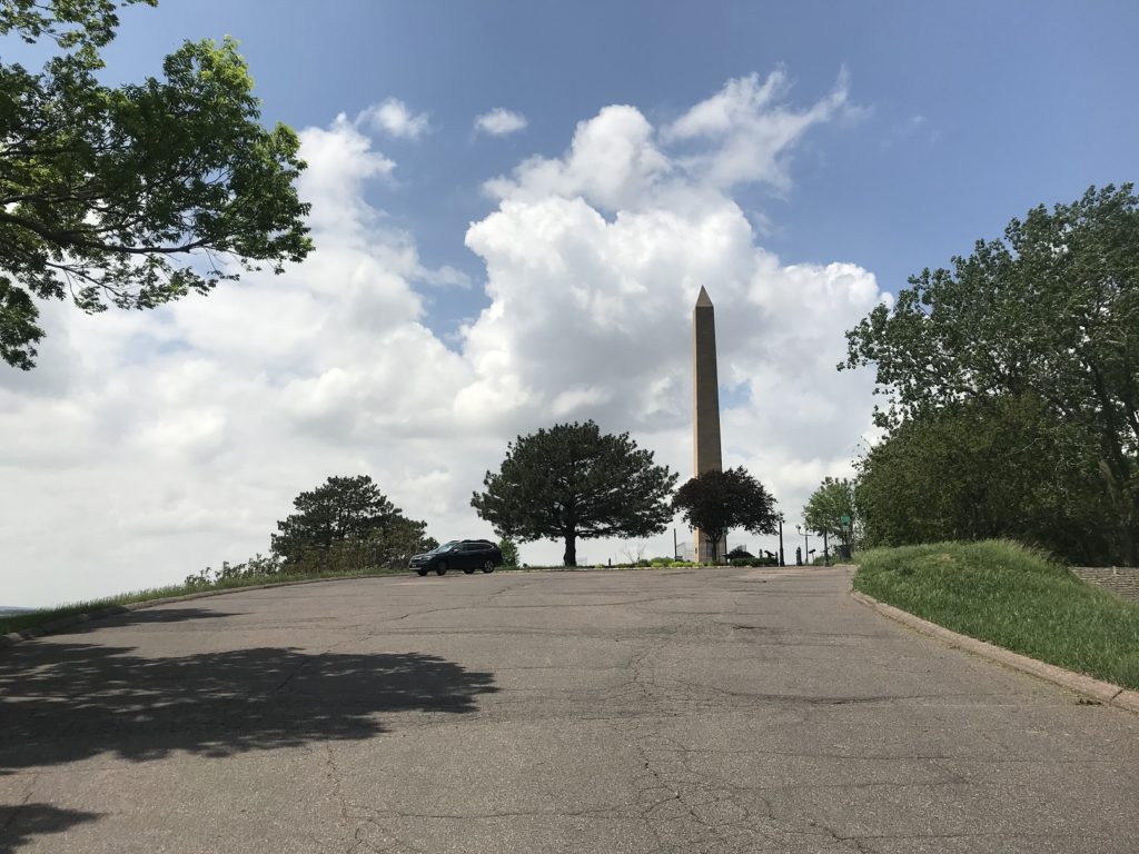
Once I cleared the Sand Hills – long ranges of dunes covered in short grass – and entered central Nebraska, the landscape became more monotonous. It continued to be uninspiring all the way to the Missouri River, where I crossed into Iowa at Sioux City. There, I stopped to see the Sergeant Floyd Monument, a tall obelisk in a lonely park that marks the grave of the only man who died during the Lewis and Clark Expedition.
After lunch at a Sioux City drive-through, I plunged onward through Iowa, where my drive was enlivened by a line of severe thunderstorms. By the time I emerged from the downpour, the moon was glowing in the evening sky. I arrived home a little after 10. Stepping from the car – now liberally plastered with bugs – I took a deep breath of humid summer air. Then I opened the trunk, and started unpacking.